It is very clear that New Zealand geologists have suffered ‘silo effect’ in their misreading of the Christchurch earthquake series. They failed to read a very obvious sequence of earthquakes, from a much larger ground movement process, as a single source and single “main shock” concern initially, and thus proved incapable of preventing loss of life and community confidence when they could have preserved both.
The corporate-influenced scientists’ recent advice has just been proven seriously incorrect. From geonet.org.nz/canterbury-quakes/aftershocks page (“Observed” figures updated to 18 June by me, although GNS Science has revised and deleted this earlier projection since June 13th) asking for accountability:
“1 month forecast, May 19 – Jun 18
Expected range of aftershocks of magnitude 4.0-4.9 | Expected average | Observed to date
1 – 10 | 5 |” 20
“Expected range of aftershocks of magnitude 5.0 and above | Expected average | Observed to date
0 – 2 | <1 |” 4
Note: the new 13June2011 ‘aftershocks’ will continue to inflate these ‘unforeseen’ high results.
But finally we are getting useful advice from GNS, after the above projection and early-June media presentations by them turned out to be so embarrassing.[1] This can be understood one of two ways:
Either GNS geological methodology was seriously flawed (for dealing with central Canterbury’s unique seismic risk), or they knew a lot more than they were telling us previously (in a paternalistic policy of withholding ‘scary’ information, that they have now dropped, perhaps).
– Neither of these reasons are acceptable to the New Zealand public, for keeping us and our visitors safe, in the face of significant natural hazard. EQC has similarly proven woefully unprepared.
– Wake up to Zealandia's Chatham Rise “straight line” great fault awakening: the line-up of the Greendale Fault, through 22 February’s 6.3 and 13 June’s 5.6 and 6.3, straight out towards the Chatham Islands – and probably escalating seismic activity[2] – is looking incontrovertible:
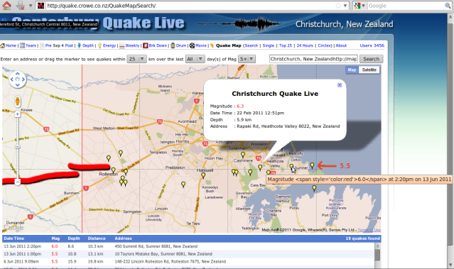
http://quake.crowe.co.nz/QuakeMap/Search/ magnitude 5 and up - Christchurch - revised to 6.3, 5.6, 6.3
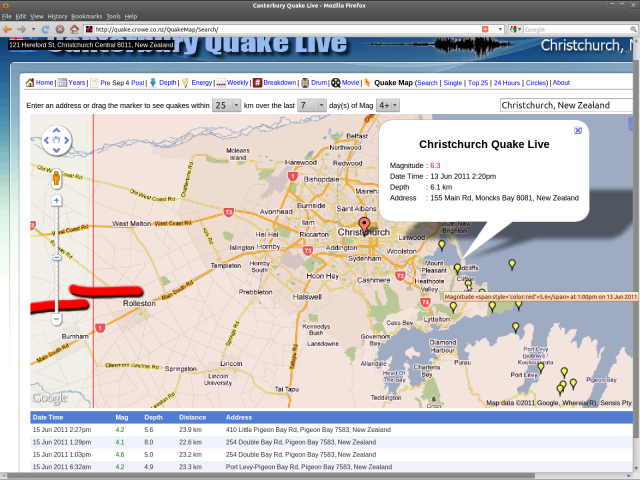
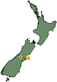
The finished 13June2011 earthquake location record:
Further (amateur) analysis detail is here: infohelp.co.nz/quake2
[1] More mis-informative, ‘authoritative’ downplaying of our current geological events, from late May: Big earthquake risk put at 23 per cent “during the next year” and ‘only 6% chance of it being near Christchurch’ ?! [2] (already! – so with the forecast likelihood of an even bigger shock now raised to “30%”, that is even surer) Press 31May11; Quake experts to speak 2Jun11; New faultlines found “Region has a low fault risk in the long term”; Little change to risk of big quake – expert 3Jun11; New faults fail to dull optimism 4Jun11; until:
Monday’s quakes reveal new fault “Another fault several kilometres south of the Port Hills fault is now believed responsible for yesterday’s major aftershocks. GNS Science seismologists said the newly confirmed fault had already generated a number of quakes since the deadly February 22 event. Dr Bill Fry said the dominant energy in Monday’s magnitude 5.7 and 6.3 aftershocks had been horizontal compared with vertical in February’s 6.3 quake. This meant they were felt differently. Unfortunately for Cantabrians, rather than reduce the statistical probability of another big quake, yesterday’s violent shakes will, for a time, increase the risk of another large aftershock of similar magnitude. However, GNS Science hazard modeller Dr Matt Gerstenberger said that elevated level of risk would not last long. It was also important to realise the risk estimates, and any other aftershock forecasts, were only computer models based on average quake sequences and not derived from any physical evidence, he said. Only two weeks ago, Christchurch city councillor Sue Wells released aftershock forecast information given to councillors. The calculations from GNS Science warned of a 23 per cent probability of a quake of magnitude 6.0 to 6.9 hitting the Canterbury aftershock zone within the next 12 months. GNS Science said the risk of an aftershock of that size occurring under or close to Christchurch was much lower – around 6 per cent. Yesterday’s largest earthquakes were located close to the coast and slightly south of the eastern tip of the Port Hills fault, which generated the magnitude-6.3 quake on February 22. Given their similar positions, scientists say the 1pm earthquake is believed to be a foreshock of the second quake..” 14Jun11
Conclusions: New-old fault larger? ~ #kaiapoi #chch having asked Will it be this June? ~ #eqnz re Big One.
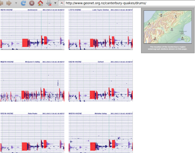
Note too how 13June2011’s aftershocks are – unless the seismometers are calibrated differently – more strongly felt towards the Southern Alps:
Combine this with the Murchison, Hanmer, Haast and Milford Sound earthquakes of the past week (mid-to-high 4s) and we must now START WATCHING THE ALPINE FAULT INTENTLY …
Zealandia is the ancient and unique Pacific Plate landmass (mostly submerged) that, in stalling the Australian Plate, built up the Southern Alps. It’s massive might has only just started to reveal itself.
Regarding an Alpine ~8.0 earthquake, YOU HAVE BEEN WARNED.
Zealandia Continent map Wikipedia; NIWA bathymetry and news.
Believable? – ‘No movement imminent on the Alpine fault soon’ What lies beneath? The Press 18Sep10
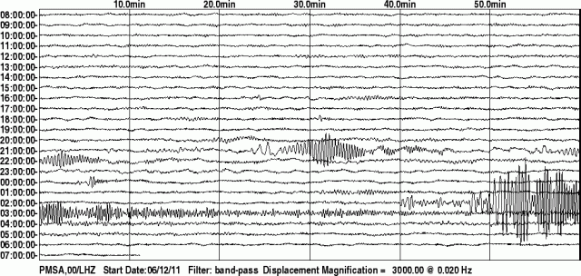
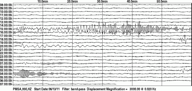
But most noteworthy of all today perhaps, the view from the other side of Antarctica, at Palmer Station:
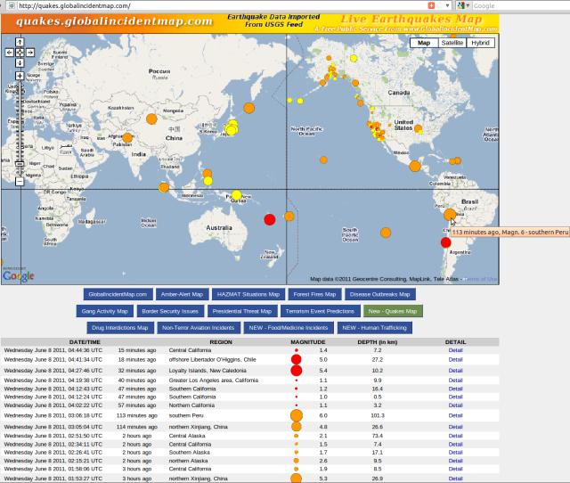
The big disturbance shown is our Christchurch 6.3. Above that and much smaller is the – much nearer to Palmer Station – South Shetlands Islands 4.9 of 0.02am UTC. At top and magnitude ~5+ is… something not recorded anywhere else (on quakes.globalincidentmap.com that is). This must be another Antarctic earthquake, that needs closer examination. Check the graph of dramatic other recent Antarctic perturbation on #Earth vs #Capitalism #volcano #disaster post, again from Palmer Station.
Let us observe with consideration that the faulting ‘cracks’ in the ‘eggshell’ Earth are converging south upon Antarctica.
~ Kia ora
14Jun11 update:
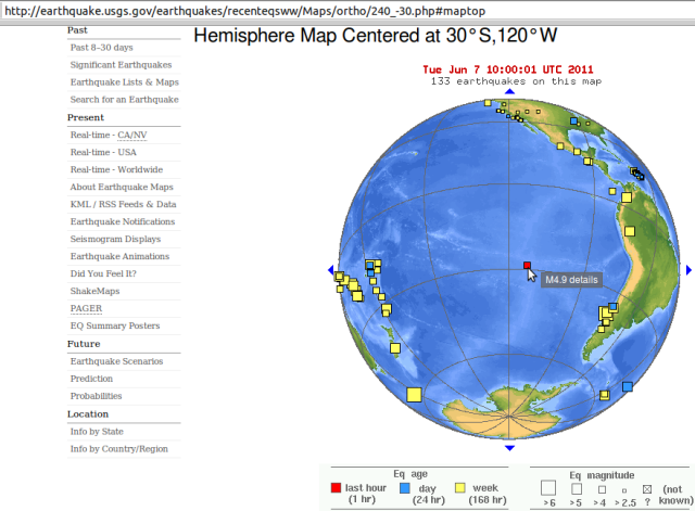
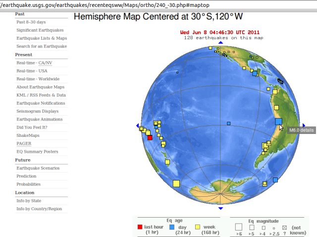
Australian Plate and South Pacific still very lively:
Geonet “recent quakes” is all Christchurch – but with a Lake Heron, Methven area magnitude 4.8 punching the Chatham Rise “straight line” fault sequence straight into the Alps.
a. Here is Palmer Station again, showing the Indonesia 6.4 quake.
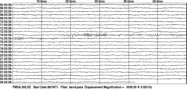
b. Then, another ‘undocumented’ Antarctic earthquake from Palmer Station seismometer of 15 June, #2 below.
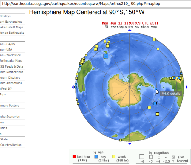
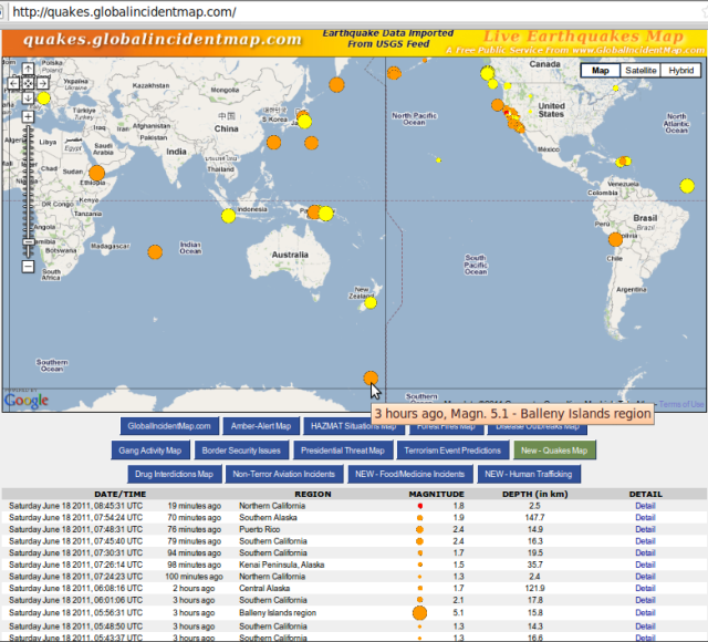
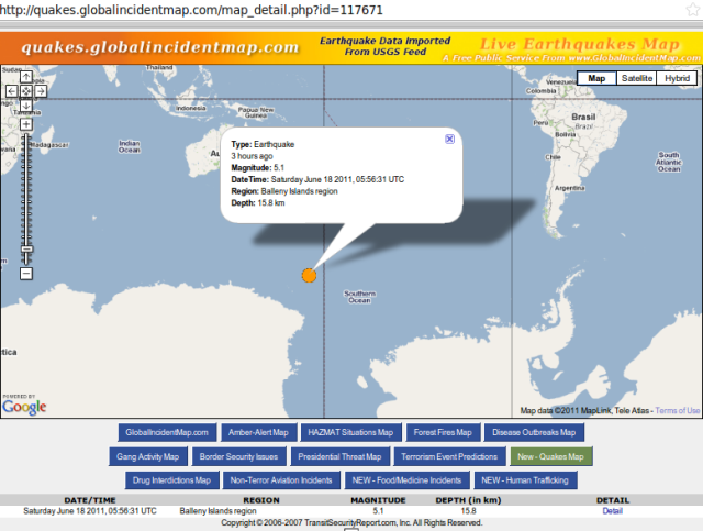
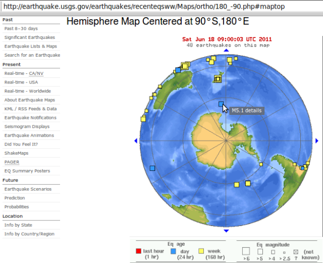
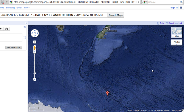
c. 18Jun11 update: As predicted yet again, almost, at 5:56pm NZST, a near-Antarctic earthquake.
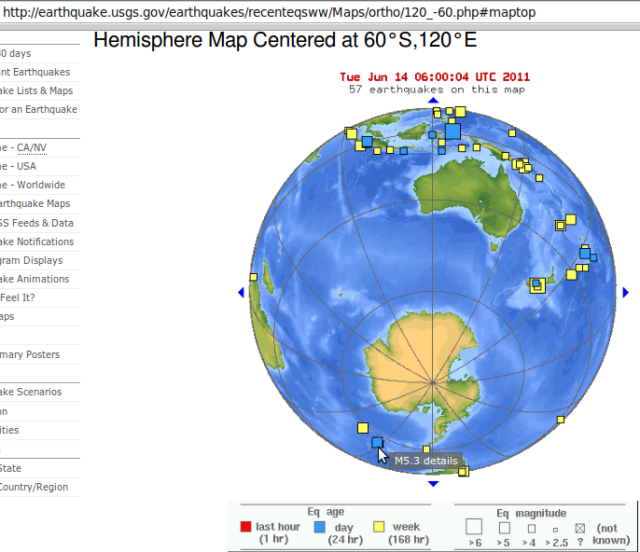
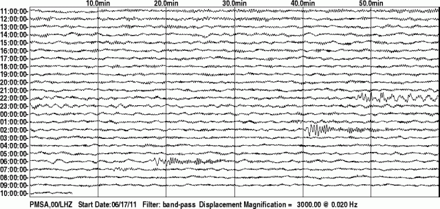
c-4. Penultimately, the Bellaney Islands magnitude 5.1 as seen in record from the other side of Antarctica, Palmer Station 180611, after two other quakes – unknown and local. N.B. the Bellaney Islands are stratovolcanoes on facebook. Source: Google Map via USGS record. My facebook comment:
Hi. Have been tracking Canterbury-NZ quake context, following flow south and expecting Antarctic volcanics to soon feature. Then 5.56pm Sat, here it begins: Balleny Islands region http://www.nzgeographic.co.nz/articles.php?ID=194 + my notes: (current page) ..am seeing scenario where Chch quakes stay large and keep breaking east, until final ‘straw’ (camel’s back) that allows Alpine Fault to slip (the major damage source). Zealandia rules our seismic lives, from below the waves and the city.. (Zealandia is the heavy brake that can break)



That was an excellently written essay, thank you so much.