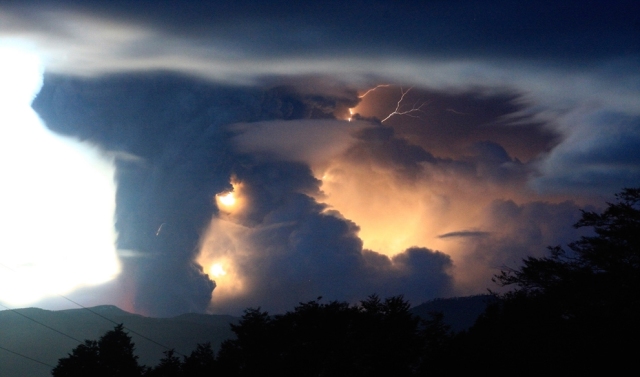
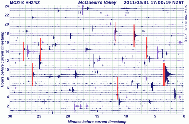
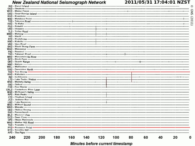
In the southern hemisphere, we are well into another week of heightened seismic activity; or so it seems from the many medium-sized (5+) earthquakes occurring here. There is an eerie subsurface resonance on two sides of the South Pole, with the recent Chilean volcanic eruption probably venting some displaced energy from March 11th’s Sendai 9.0, and definite ripples on the south-western Pacific. “The last eruption of Puyehue volcano was in 1960 following a 9.5 earthquake. An eruption began at Puyehue-Cordón Caulle Volcano on 24th May 1960. The eruption was probably precipitated by the great earthquake in Chile (magnitude 9.5) which occurred on 22nd May 1960. The eruption consisted of an explosive subplinian phase and the formation of a mushroom-like column 8 km high.” Current visual reference: Chile’s Puyehue Volcano Erupts.
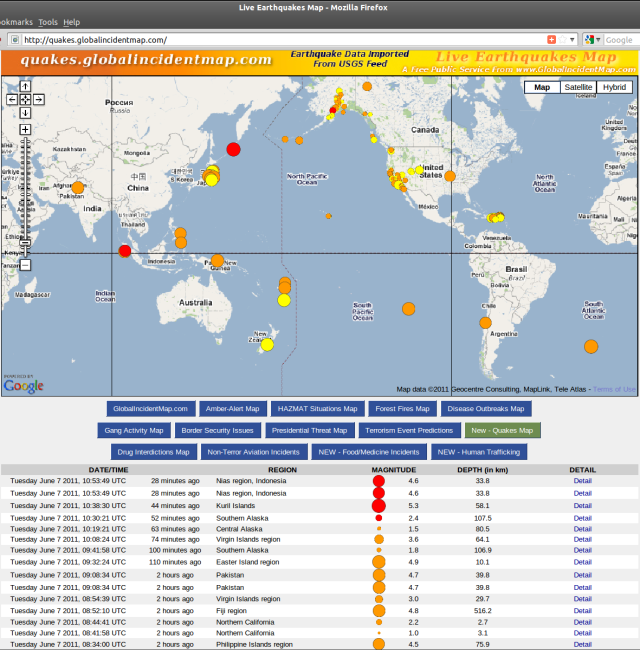
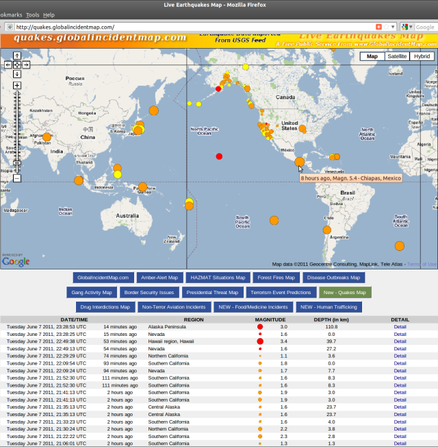
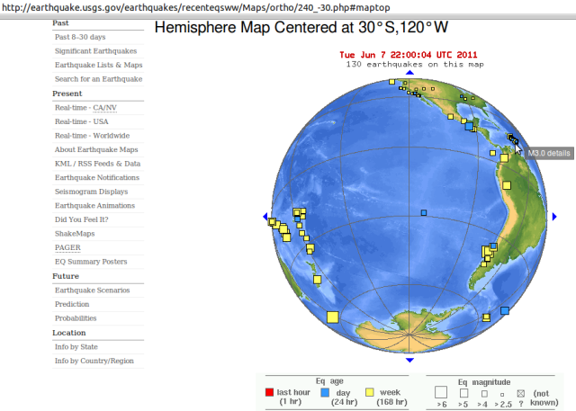
Don’t believe it? – Check the sources: usgs.gov/earthquakes/recenteqsww & quakes.globalincidentmap.com.
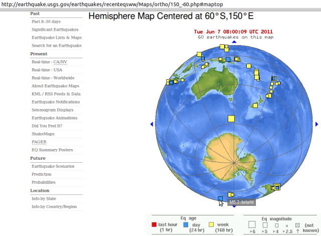
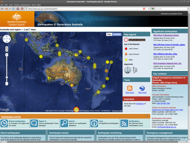
After some Sandwich Islands earthquakes, the southern Mid-Atlantic Ridge has just had a 5.3. This zone presents a mirror echo of southern Australia and New Zealand quakes of late, the biggest a 6.3 (a 6.5 on the Australian scale):
Source: Earthquakes@Geoscience Australia ga.gov.au/earthquakes
“Read ’em and weep”, sayeth Ruaumoko below.
~ Kia ora
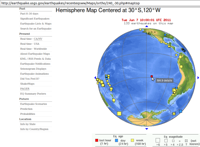
Update: And now Easter Island has chimed in, with a magnitude 4.9:
It won’t be anthropogenic global warming that ends human evolution, directly; it will be the toxic atmosphere spewed up by the new age of volcanism that global warming unleashes, alongside emmissions pollution and climate change.
The Earth has been there before, and this is the flipside of global warming – the natural switch for rapid cooling, by global ash-cloud coverage. Next comes The Snowball Earth “when the whole planet appears to have [been] gripped by colossal ice ages” (geology.About.com /controversies) after drastic reduction of oxygen-dependent life, like mammals especially livestock and us.
The plant kingdom can then recover the environmental balance that we previously enjoyed. (Ref. Lovelock and “Gaia” theory).
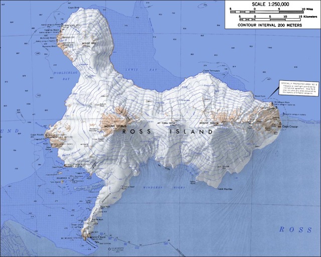
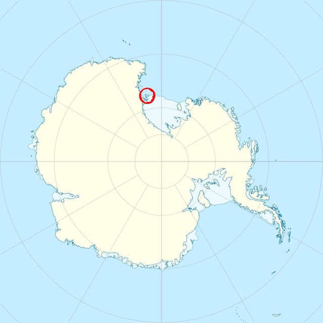
Here is a consequent forecast/prediction/prophecy that you can bank on: Mount Erebus and its neighbours will erupt increasingly: “The glacier-covered volcano was erupting when first sighted by Captain James Ross in 1841. Continuous lava-lake activity with minor explosions, punctuated by occasional larger strombolian explosions that eject bombs onto the crater rim, has been documented since 1972, but has probably been occurring for much of the volcano’s recent history” Global Volcanism Program
List of volcanoes in Antarctica Wikipedia: Mount Erebus “is part of the Pacific Ring of Fire, which includes over 160 active volcanoes”
Mount Erebus Volcano Observatory MEVO erebus.nmt.edu Live seismometers etc Science+++
Mount Erebus – Antarctic Volcano antarcticconnection.com Science+++
Antarctica Casey Geoscience Australia seismometer + Palmer Station US National Science Foundation seismometer USGS
Surprise! There’s an active volcano under Antarctic ice wattsupwiththat.com January 2008
Under-Ice Volcano Eruption Spewed Ash Over Antarctica “more than 2,000 years ago” news.NationalGeographic.com January 2008
Buried Volcano Discovered in Antarctica “Under the frozen continent’s western-most ice sheet, the volcano erupted about 2,300 years ago yet remains active.. Brooding giant. Although ice buried the unnamed volcano, molten rock is still churning below.. discovery might explain the speeding up of historically slow-moving glaciers in the region.. hidden volcano doesn’t explain widespread thinning of Antarctic glaciers.. ‘This wider change most probably has its origin in warming ocean waters,’.. which most scientists attribute to global warming resulting from human activity, such as the use of fossil fuels..” LiveScience.com January 2008
Scientists Find Active Volcano in Antarctica “For Antarctica, ‘This is the first time we have seen a volcano beneath the ice sheet punch a hole through the ice sheet,’.. Heat from a volcano could still be melting ice and contributing to the thinning and speeding up of the Pine Island Glacier, which passes nearby, but Dr. Vaughan doubted that it could be affecting other glaciers in West Antarctica, which have also thinned in recent years. Most glaciologists.. say that warmer ocean water is the primary cause. Volcanically, Antarctica is a fairly quiet place. But sometime around 325 B.C., the researchers said, a hidden and still active volcano erupted, puncturing several hundred yards of ice above it” NYTimes.com January 2008
Underwater Antarctic volcano found “Research ship documents apparently fresh lava flow ..no previous scientific record of active volcanoes in the region where the new peak was discovered. The volcano is located on the continental shelf, in the vicinity of a deep trough carved out by glaciers passing across the seafloor” msnbc.msn.com Science updated May 2004
Antarctic volcano not melting ice “..Erebus was erupting when members of Capt. James Ross’ 1841 expedition became the first humans to see it. In fact, the eruption at that time was the largest ever seen. Ross named the volcano for his ship, the Erebus. He named another Ross Island volcano Mt. Terror after his other ship. To the ancient Greeks, Erebus was the dark region beneath the earth that spirits had to pass through to get to the realm of Hades below..” USAtoday.com/weather/antarc January 2001 + NOVA program, “Warnings from the Ice” PBS radio April 1998
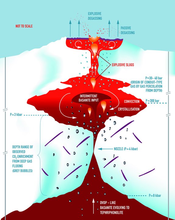
Antarctica Erupts! “On Mount Erebus, the churning magma is exposed at the top of the volcano, in a roiling 1,700-degree Fahrenheit lake perhaps miles deep.. it had recently broken a two-year quiet spell. Mount Erebus had started acting up in early 2005, and when scientists arrived it was erupting several times a day, each time ejecting 50 or so lava bombs” SmithsonianMag.com/science-nature December 2006
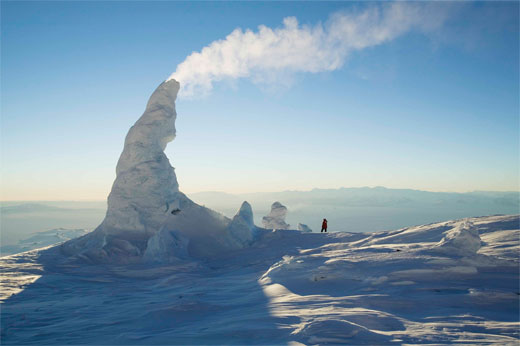
“Antarctica Erupts! Seemingly dreamed up by Dr. Seuss, Mount Erebus’ improbable ice towers form around steaming vents, growing up to 60 feet before collapsing” – Photos: Smithsonian
Extra: Today’s bigger quakes brought further sign of change.. ..Five Injured in 5.3-Magnitude Earthquake in China’s Xinjiang “A specialist with Xinjiang’s earthquake administration said further earthquakes in the region are unlikely.’Quakes over 5-magnitude have rarely been reported in Toksun County over the past 70 years. Citizens do not need to worry'”
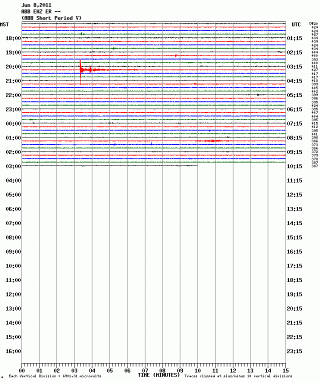
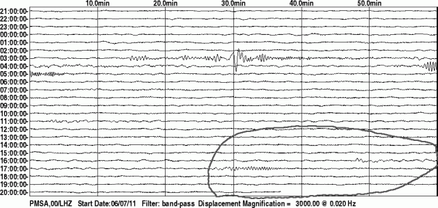
Magnitude 6.0 earthquake Southern Peru depth 101.3 km 03:06:18 UTC Wednesday 8th June 2011 – it took about 10 minutes to reach Palmer Station seismometer in Antarctica..
and 12 minutes to reach Erebus MEVO Station seismometer Abbot Peak on the other side Antarctica..
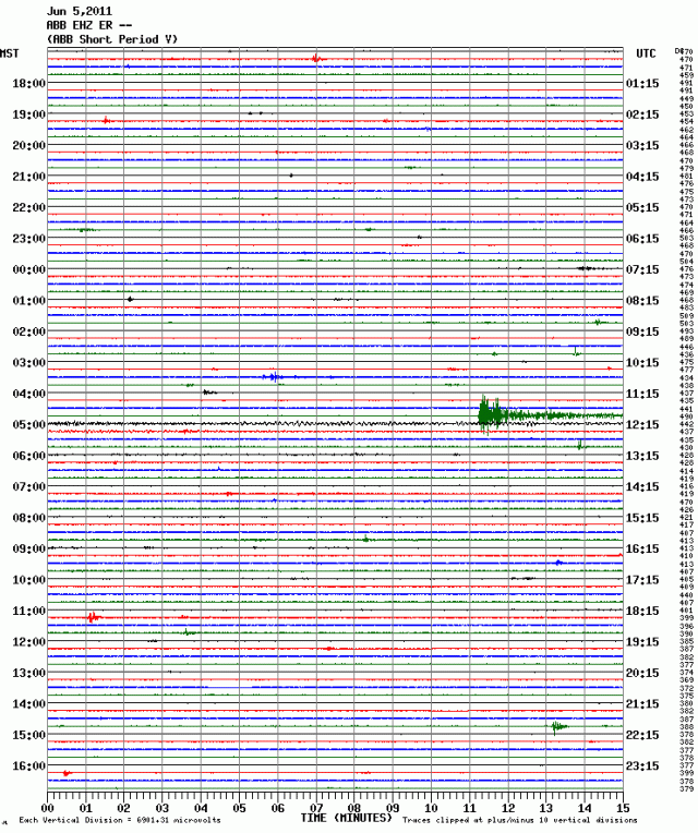
For comparison, here is Abbot Peak’s record of the 5 June 2011 Macquarie Island magnitude 6.3 quake:
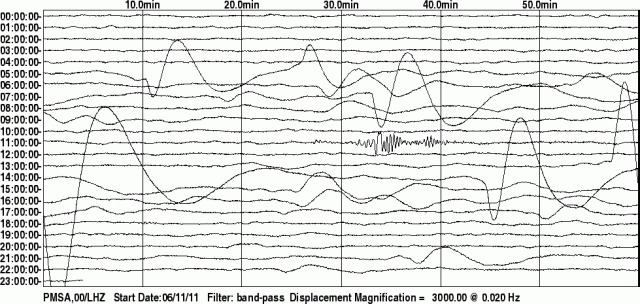
Palmer Station 12 hours later: small local seismicity that does not show up, or relate to any remote event, on the global record. i.e. keep watching Antarctic seismometers to better read Antarctica.
Of course, as with diurnal peaks and troughs of seismic activity, there are seasonal flows and ebbs of earthquakes too – all due to planetary warming (then cooling, in cycles). So we should not expect the heightened Antarctic volcanism until next summer, January to March 2012. Make your bets now. …
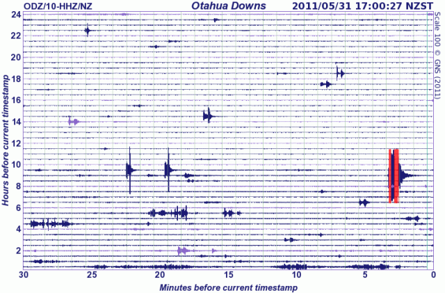
12Jun2011 – Unless?!?:
These notes continue on new page Earth vs Capitalism …

