Category: Tarawera


My recent blog posts have traced the progression of Pacific Rim plate-boundary subduction movements, from north to south, from Alaska to Antarctica, with New Zealand in between – Zealandia continent being the least mobile, thickest piece of Pacific Plate crust on Earth, and therefore the last Pacific mass to move: an enormous distinction, that governs our edgy tectonic and seismic life. Viz 5.7 south-west Tonga Trench ridge quake shakes NZ 26 June and Next ChristChurch 6+ quake 4 July, Taupo’s deep plate shift today shows how far the south has already moved. Are we building significant momentum now, that can soon “unzip” the Southern Alps fault, as is due?

Magnitude 6.5, Tuesday, July 5 2011 at 3:36 pm (NZST), 30 km west of Taupo:

Taupo magnitude 6.5 - GNS Science 050711

Taupo magnitude 6.5 - GNS Science 050711

Note, there was very clear indication this moderately big deep-quake event was coming via Hikurangi Trough:
Magnitude 3.9, Monday, June 27 2011 at 10:00 am (NZST), 30 km east of Castlepoint geonet
Magnitude 3.9, Sunday, July 3 2011 at 8:02 pm (NZST), 50 km east of Castlepoint geonet
Magnitude 4.4, Monday, July 4 2011 at 4:06 am (NZST), 60 km south-east of Porangahau geonet
Magnitude 5.0, Monday, July 4 2011 at 8:36 pm (NZST), 60 km south-east of Porangahau geonet
Magnitude 4.2, Monday, July 4 2011 at 10:02 pm (NZST), 60 km south-east of Porangahau geonet
Magnitude 3.9, Tuesday, July 5 2011 at 7:37 am (NZST), 20 km south-east of Arthur’s Pass geonet
Magnitude 2.6, Tuesday, July 5 2011 at 08:21 am (NZST), near 11626 W Coast Rd Arthur’s Pass: Crowe.co.nz
Magnitude 4.6 – NEAR THE SOUTHEAST COAST OF AUSTRALIA 2011 July 05 01:32:13 UTC Victoria: USGS

Taupo magnitude 6.5 quake - GNS Science GoogleMap 050711

Taupo magnitude 6.5 quake - GNS Science GoogleMap 050711


More attention is now required, to Taupo volcano in particular: “The Taupo volcano last erupted over 1,800 years ago… first began to erupt over 300,000 years ago. It is very large and has many vents, most of which are now under Lake Taupo. Geological studies of Taupo show that the volcano makes up only the northern half of the lake and a small surrounding area but there have been numerous eruptions from different sites within this large volcano… The Taupo eruption was the most violent eruption in the world in the last 5,000 years… [and] took place from a line of vents near the eastern side of the modern lake” – GNS Science.

Media coverage has been quick to echo the GNS Science view, that this 150km-deep quake was in no way unusual or connected to Christchurch events: ‘We typically have maybe two, three events at that depth of around magnitude five, magnitude six a year – it is normal New Zealand process’. Quakes all part of regular activity – scientist “GNS scientist Brad Scott explains the link between seismic and volcanic activity following yesterday’s Taupo quake” TV1 Breakfast 6July2011 Ref. tectonic earthquake on subducting slab, plate boundary process, not a 15-20km deep volcanic process.
Jul 6 2011 – Taupo Earthquake: Questions and Answers – GNS Science.

Knowing approximately when big quakes are coming is of no consequence to the international scientific community, by current study discipline, except in Japan. Is that acceptable, or simply what we must expect?

5July2011 @6pm ONE News “..for Wellingtonians and for Christchurch residents, they’re just brushing it off as another small shake'” Quake shakes central NZ “A 6.5 magnitude earthquake which struck the central North Island has been felt across much of New Zealand, but there have been no reports of damage.. Geonet said it would be unlikely that it caused any damage because it was so deep. Aftershocks were also unlikely.. Jason Pye, also from Wellington, said it was the strongest quake he’s felt in many years. ‘Bit of a jolt then shaking got worse for about 4 seconds then slowly stopped, everything was shaking but nothing fell of shelves etc.'” 05July2011 + Quake jolts Melbourne “A magnitude 4.4 earthquake, with its epicentre near Korumburra in Victoria’s east, has been felt more than 100 kilometres away in Melbourne.. Geosciences Australia reported the depth at 2km.. Hundreds of small aftershocks followed a similar earthquake in 2009. A number of tremors measuring between 1.8 and 4.6 originated near Korumburra in March and May 2009, with the largest on March 18 felt as far away as Bacchus Marsh, 50km west of Melbourne” ONE News

North Islanders rattled by 6.5 magnitude quake “The six and a half magnitude earthquake centred just west of Taupo yesterday caused no damage, but has shaken the nerves of many North Islanders. (2′48″)” RadioNZ Morning Report 6July2011

Volcanic Taupo - GNS 310511

Volcanic Taupo - GNS 310511

May 31 2011 – Earthquake swarm under Lake Taupo “From late evening on Saturday 28 May until early Monday 30 May, a small swarm of earthquakes occurred in the southern part of Lake Taupo between Kuratau and Motuoapa. Twenty-seven earthquakes were recorded and they were all located at shallow depths (< 10 km). The largest earthquake had a magnitude of 2.4, but they were mostly between magnitudes 1.7 and 2.2. Small swarms like this often occur within the central part of New Zealand and are likely to be associated with occasional movement on small faults in the southern part of the lake. We believe they are due to the normal extensional processes (stretching and thinning of crust) that occur in the Taupo Volcanic Zone. There is no evidence that the earthquakes are related to a change of volcanic activity" geonet.org.nz

Rumblings at Ruapehu spark alert for planes “Increased rumblings under Mt Ruapehu and a warmer-than-usual crater lake have led authorities to raise alert levels for planes flying over the area. A volcanic eruption is not imminent – the alert level remains at one out of five – but volcanologists say there are subtle signs of unrest under Ruapehu, which last erupted in 2007.. eruptions can occur with little or no warning” NZ Herald 6Apr2011

Facebook comment: “Government has a strong command-and-control civil defence approach, to prevent panic of either NZ or overseas investors, that makes us populace really sacrificial lambs ~0~ ”

Deep quakes last 60 days - GNS Waikato 060711
Source: Geonet.org.nz Waikato 60 days of Recent Deep Earthquakes 6Jul2011. Update:

Hikurangi Trough continues to move:
Magnitude 4.0, Wednesday, July 6 2011 at 8:21 am (NZST), 40 km south-east of Porangahau

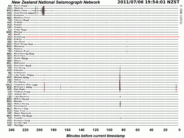
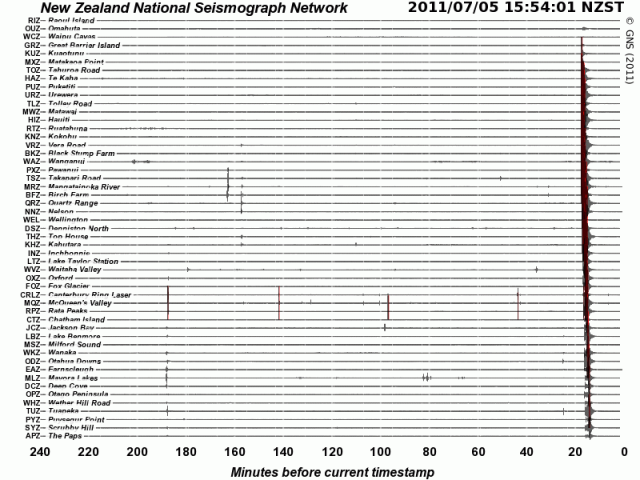
A Northland-Canterbury shake here?:

NZ seismometer drums - GNS 060711

NZ seismometer drums - GNS 060711

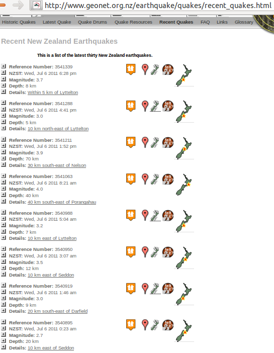
Major quake-lines appear to be asserting themselves and coming to life – SW-NE x 2 = Alpine Fault onto Wairau and Awatere fault areas; SE-NW x 1 = spine of the fish, Te Ika a Maui – all at oblique angles to the Greendale Fault:

GNS recent quakes - 060711a

GNS recent quakes - 060711a


GNS recent quakes - 060711b

GNS recent quakes - 060711b

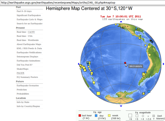
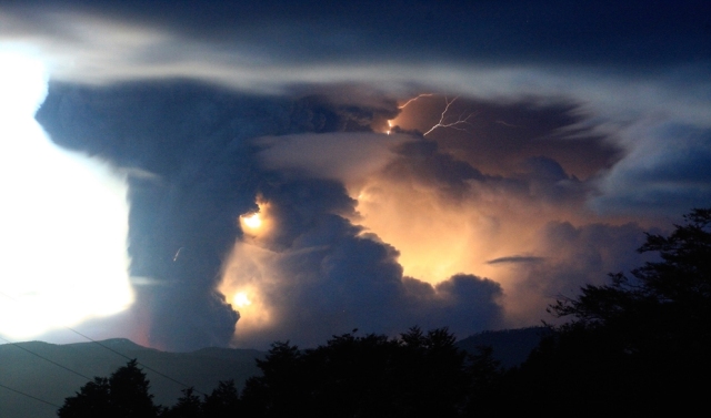
In the southern hemisphere, we are well into another week of heightened seismic activity; or so it seems from the many medium-sized (5+) earthquakes occurring here. There is an eerie subsurface resonance on two sides of the South Pole, with the recent Chilean volcanic eruption probably venting some displaced energy from March 11th’s Sendai 9.0, and definite ripples on the south-western Pacific. “The last eruption of Puyehue volcano was in 1960 following a 9.5 earthquake. An eruption began at Puyehue-Cordón Caulle Volcano on 24th May 1960. The eruption was probably precipitated by the great earthquake in Chile (magnitude 9.5) which occurred on 22nd May 1960. The eruption consisted of an explosive subplinian phase and the formation of a mushroom-like column 8 km high.” Current visual reference: Chile’s Puyehue Volcano Erupts.

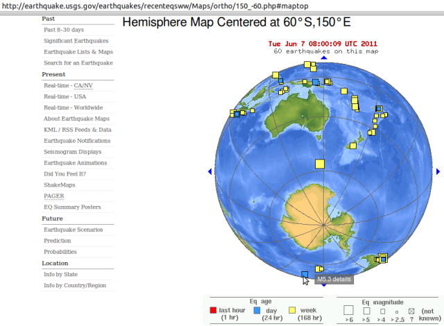
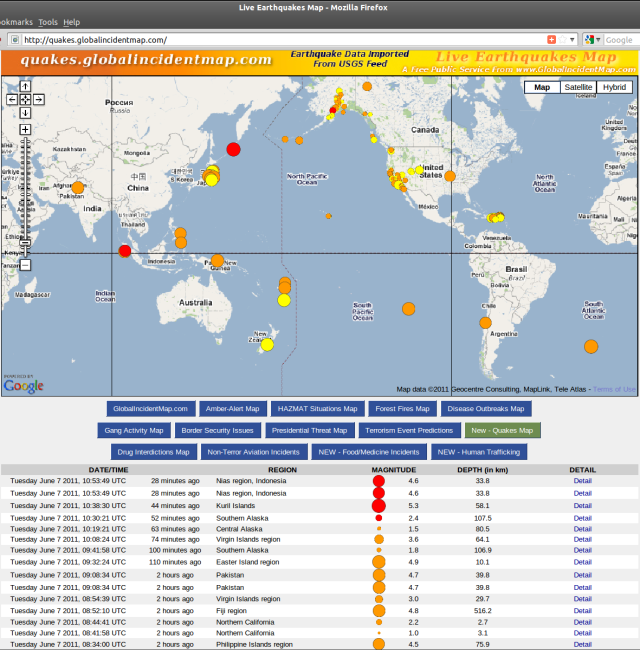
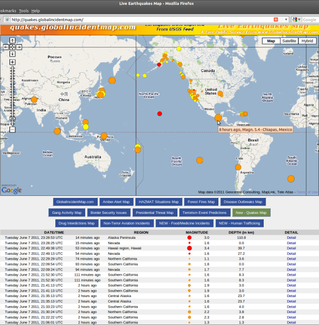
Don’t believe it? – Check the sources: usgs.gov/earthquakes/recenteqsww & quakes.globalincidentmap.com.

Southern Mid-Atlantic Ridge 5.3 USGS 070611

Southern Mid-Atlantic Ridge 5.3 USGS 070611

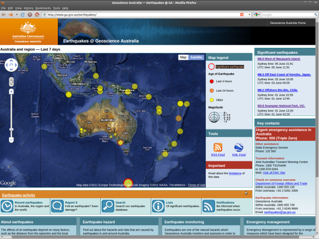
After some Sandwich Islands earthquakes, the southern Mid-Atlantic Ridge has just had a 5.3. This zone presents a mirror echo of southern Australia and New Zealand quakes of late, the biggest a 6.3 (a 6.5 on the Australian scale):

Earthquakes@Geoscience Australia - Macquarie Island 6.5 050611

Earthquakes@Geoscience Australia - Macquarie Island 6.5 050611

Source: Earthquakes@Geoscience Australia ga.gov.au/earthquakes

“Read ’em and weep”, sayeth Ruaumoko below.

~ Kia ora

Update: And now Easter Island has chimed in, with a magnitude 4.9:

Easter Island 4.9 USGS 070611

Easter Island 4.9 USGS 070611

Puyehue - Reuters 050611

Mount Puyehue in Chile erupts - first time since 1960 - Reuters 050611

Puyehue Volcano in Chile : Real life Mordor Egyptian Chronicles

Mid-Atlantic Ridge 5.3 - quakes.globalincidentmap.com 070611

Mid-Atlantic Ridge 5.3 and Easter Island 4.9 - quakes.globalincidentmap.com 070611

~ Now there’s a very scary line-up indeed – the Earth is peeling like an orange? …

It won’t be anthropogenic global warming that ends human evolution, directly; it will be the toxic atmosphere spewed up by the new age of volcanism that global warming unleashes, alongside emmissions pollution and climate change.

The Earth has been there before, and this is the flipside of global warming – the natural switch for rapid cooling, by global ash-cloud coverage. Next comes The Snowball Earth “when the whole planet appears to have [been] gripped by colossal ice ages” (geology.About.com /controversies) after drastic reduction of oxygen-dependent life, like mammals especially livestock and us.

The plant kingdom can then recover the environmental balance that we previously enjoyed. (Ref. Lovelock and “Gaia” theory).

Here is a consequent forecast/prediction/prophecy that you can bank on: Mount Erebus and its neighbours will erupt increasingly: “The glacier-covered volcano was erupting when first sighted by Captain James Ross in 1841. Continuous lava-lake activity with minor explosions, punctuated by occasional larger strombolian explosions that eject bombs onto the crater rim, has been documented since 1972, but has probably been occurring for much of the volcano’s recent history” Global Volcanism Program

List of volcanoes in Antarctica Wikipedia: Mount Erebus “is part of the Pacific Ring of Fire, which includes over 160 active volcanoes”
Mount Erebus Volcano Observatory MEVO erebus.nmt.edu Live seismometers etc Science+++
Mount Erebus – Antarctic Volcano antarcticconnection.com Science+++
Antarctica Casey Geoscience Australia seismometer + Palmer Station US National Science Foundation seismometer USGS

Surprise! There’s an active volcano under Antarctic ice wattsupwiththat.com January 2008
Under-Ice Volcano Eruption Spewed Ash Over Antarctica “more than 2,000 years ago” news.NationalGeographic.com January 2008
Buried Volcano Discovered in Antarctica “Under the frozen continent’s western-most ice sheet, the volcano erupted about 2,300 years ago yet remains active.. Brooding giant. Although ice buried the unnamed volcano, molten rock is still churning below.. discovery might explain the speeding up of historically slow-moving glaciers in the region.. hidden volcano doesn’t explain widespread thinning of Antarctic glaciers.. ‘This wider change most probably has its origin in warming ocean waters,’.. which most scientists attribute to global warming resulting from human activity, such as the use of fossil fuels..” LiveScience.com January 2008
Scientists Find Active Volcano in Antarctica “For Antarctica, ‘This is the first time we have seen a volcano beneath the ice sheet punch a hole through the ice sheet,’.. Heat from a volcano could still be melting ice and contributing to the thinning and speeding up of the Pine Island Glacier, which passes nearby, but Dr. Vaughan doubted that it could be affecting other glaciers in West Antarctica, which have also thinned in recent years. Most glaciologists.. say that warmer ocean water is the primary cause. Volcanically, Antarctica is a fairly quiet place. But sometime around 325 B.C., the researchers said, a hidden and still active volcano erupted, puncturing several hundred yards of ice above it” NYTimes.com January 2008
Underwater Antarctic volcano found “Research ship documents apparently fresh lava flow ..no previous scientific record of active volcanoes in the region where the new peak was discovered. The volcano is located on the continental shelf, in the vicinity of a deep trough carved out by glaciers passing across the seafloor” msnbc.msn.com Science updated May 2004
Antarctic volcano not melting ice “..Erebus was erupting when members of Capt. James Ross’ 1841 expedition became the first humans to see it. In fact, the eruption at that time was the largest ever seen. Ross named the volcano for his ship, the Erebus. He named another Ross Island volcano Mt. Terror after his other ship. To the ancient Greeks, Erebus was the dark region beneath the earth that spirits had to pass through to get to the realm of Hades below..” USAtoday.com/weather/antarc January 2001 + NOVA program, “Warnings from the Ice” PBS radio April 1998

Antarctica Erupts! “On Mount Erebus, the churning magma is exposed at the top of the volcano, in a roiling 1,700-degree Fahrenheit lake perhaps miles deep.. it had recently broken a two-year quiet spell. Mount Erebus had started acting up in early 2005, and when scientists arrived it was erupting several times a day, each time ejecting 50 or so lava bombs” SmithsonianMag.com/science-nature December 2006

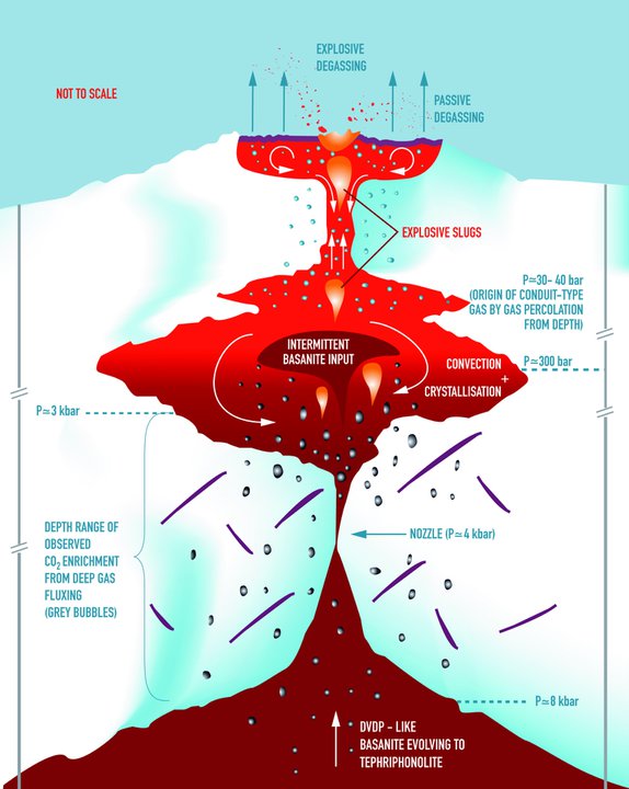
Mount Erebus Volcano Observatory diagram - CO2 degassing

Mount Erebus Volcano Observatory diagram - CO2 degassing


Smithsonian - volcano steam

Smithsonian - volcano steam

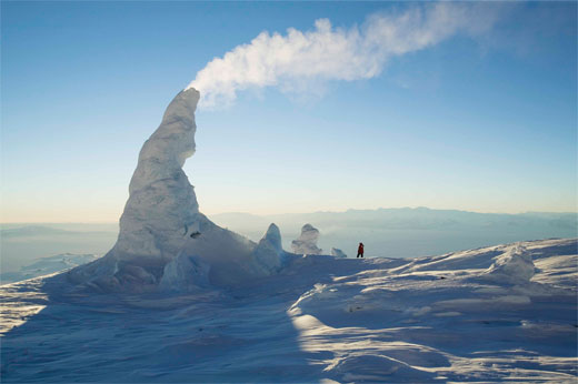
“Antarctica Erupts! Seemingly dreamed up by Dr. Seuss, Mount Erebus’ improbable ice towers form around steaming vents, growing up to 60 feet before collapsing” – Photos: Smithsonian

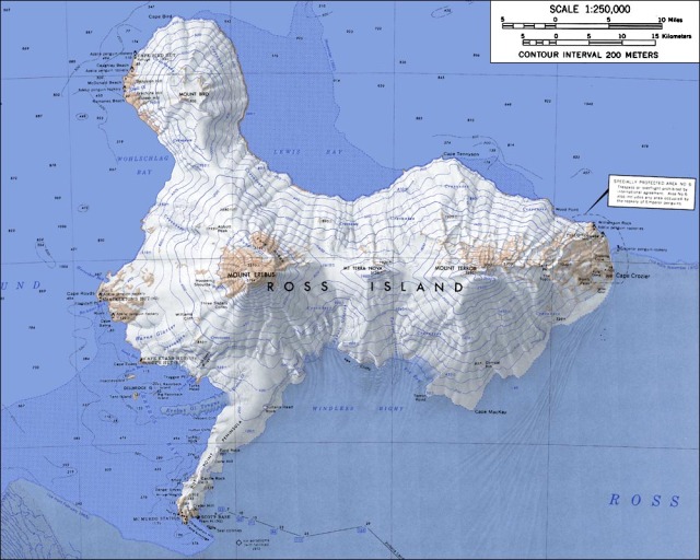
Ross Island Map - Wikipedia Mount Erebus

Ross Island Map - Wikipedia Mount Erebus

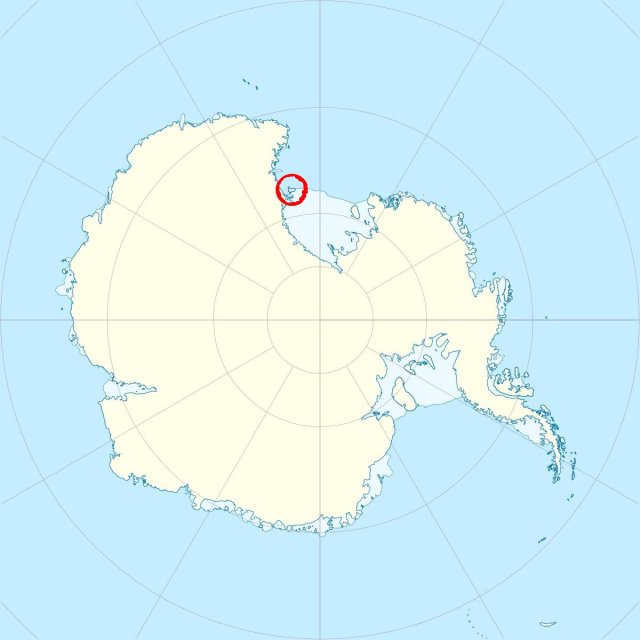
Antarctica location map - Wikipedia Mount Erebus

Antarctica location map - Wikipedia Mount Erebus

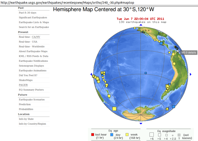
Another peel of the orange? - Chiapas 5.4 & Hawaii 3.4 080611

Another peel of the orange? - Chiapas 5.4 & Hawaii 3.4 080611

Chiapas alignment through Easter Island to Macquarie Island

Chiapas alignment through Easter Island to Macquarie Island

Extra: Today’s bigger quakes brought further sign of change.. ..Five Injured in 5.3-Magnitude Earthquake in China’s Xinjiang “A specialist with Xinjiang’s earthquake administration said further earthquakes in the region are unlikely.’Quakes over 5-magnitude have rarely been reported in Toksun County over the past 70 years. Citizens do not need to worry'”

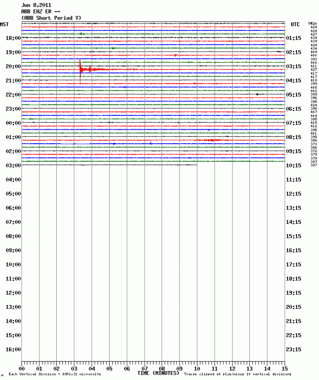
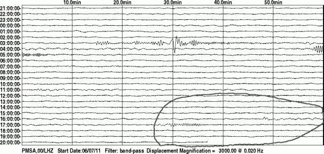
Magnitude 6.0 earthquake Southern Peru depth 101.3 km 03:06:18 UTC Wednesday 8th June 2011 – it took about 10 minutes to reach Palmer Station seismometer in Antarctica..

Peru 6.0 Palmer Station USGS 080611

Peru mag 6.0 Palmer Station USGS 080611


and 12 minutes to reach Erebus MEVO Station seismometer Abbot Peak on the other side Antarctica..
Erebus MEVO - Peru 6.0 20110608

Erebus MEVO - Peru 6.0 20110608


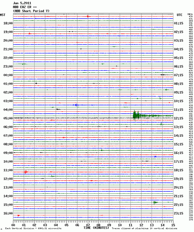
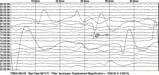
For comparison, here is Abbot Peak’s record of the 5 June 2011 Macquarie Island magnitude 6.3 quake:
Erebus - Macquarie Island 6.5 20110605

Erebus - Macquarie Island 6.5 20110605


Antarctic view - USGS 080611

Antarctic view - Peru 6.0 + Chile shocks / south-west Pacific - USGS 080611


Palmer Station Antarctica 080611

Palmer Station Antarctica 080611

Palmer Station 12 hours later: small local seismicity that does not show up, or relate to any remote event, on the global record. i.e. keep watching Antarctic seismometers to better read Antarctica.

Of course, as with diurnal peaks and troughs of seismic activity, there are seasonal flows and ebbs of earthquakes too – all due to planetary warming (then cooling, in cycles). So we should not expect the heightened Antarctic volcanism until next summer, January to March 2012. Make your bets now. …

12Jun2011 – Unless?!?:

Palmer Station Antarctica 1200611 - unusual movement?

Palmer Station Antarctica 1200611 - unusual movement?

These notes continue on new page Earth vs Capitalism