Category: Lake Taupo


GNS Science head office, like most New Zealand government, resides in Wellington region. There, existential angst competes heavily with Auckland for economic weight and centre of gravity. So Wellington treats the South Island as a private back yard – to be seen, not heard, exploited for all it is worth and insistently ignored and mis-spoken for. ‘It is all about us’, believes the capital, almost always. This hard-to-dislodge perspective explains constant nonsense from official sources over the 14-Nov-2016 magnitude-7.8 earthquake, particularly where it actually took place (and what it did). You would think GNS could not read a map or never travelled a secondary highway, to have located this earthquake as “Culverden”. They have a convention of approximating, to name larger centres that people may have heard of, only. This generalising is unhelpful. Locating the historically-large earthquake accurately is key to understanding it and its implications.

This was a “Wairau” earthquake, as the epicentre map shows – so why aren’t the authorities saying that? Why has this earthquake become about “Wellington” and “Kaikoura” exceptionally? Yes, people have sadly died or become most isolated in the latter town, and have our condolences and full support through that, with buildings lost at both places. But this is governance by spin: intentional confusion to deflect risk – to benefit who, we may ask? Tsunami alarm and quake interpretation questions abound – what is really happening? Where is it happening? Public discourse to be urgently joined. Lives depend on getting this very public knowledge correct.
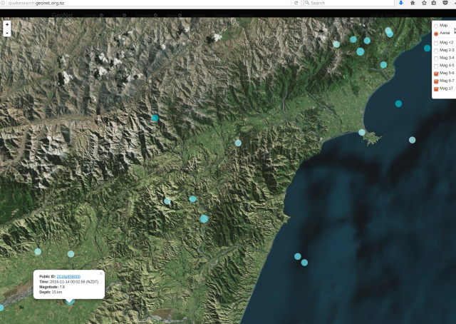
Canterbury magnitude 5 to 7.8 EQs 13-21 Nov2016

Canterbury magnitude 5 to 7.8 earthquake and aftershocks, 13-21 November 2016 – http://quakesearch.geonet.org.nz
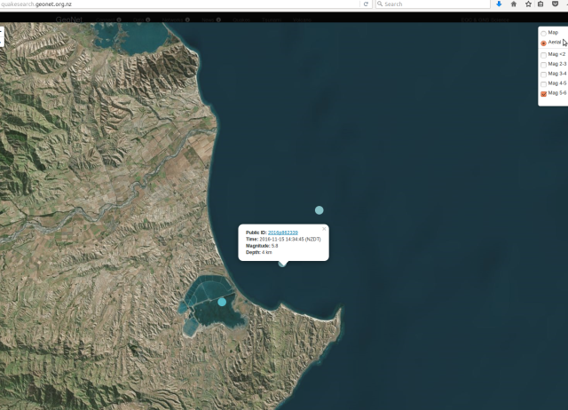
For comparison, Marlborough magnitude 5 to 6 earthquakes, 13-18 November 2016

For comparison, Marlborough magnitude 5 to 6 aftershocks, 13-21 November 2016 – much fewer and smaller
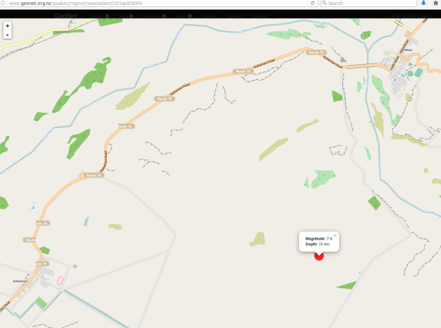
Canterbury 7.8-magnitude earthquake epicentre 141116

Canterbury 7.8-magnitude earthquake epicentre 14Nov2016 http://www.geonet.org.nz/quakes/region/newzealand/2016p858000

Journalists often muddy the water – Cheviot earthquake: Tracing the source of the 7.5 magnitude quake “It appeared to have been a complex earthquake, and scientists were looking into whether it ruptured two separate fault planes, or whether it could be considered just a single rupture. The epicentre of the quake was close to the Hope Fault. The Kaikoura area, where the Hope Fault went offshore, was strongly affected. Despite that, the pattern of events did not necessarily suggest a Hope Fault event, [GNS Science duty seismologist Dr Anna] Kaiser said. The Hope Fault was one of the major faults through Marlborough and North Canterbury that marked the boundary between the Pacific and Australian Plates. Those faults merged near Otira to form the Alpine Fault, which ran along the western edge of the Southern Alps. Looking back over hundreds of thousands of years, the Hope Fault was considered to have one of the highest slip rates among those faults. It was an important structure in accommodating plate movement in that part of the country, Kaiser said. ‘This earthquake occurred right along that line of very active deformation.’ The Marlborough fault system was a kind of transition zone between the Alpine Fault and the subduction interface between the tectonic plates under the North Island. ‘So far, it doesn’t look to be the Hope Fault, rather (and perhaps more concerning) it seems to have ruptured across the Hope Fault,’ USGS seismologist Professor Kevin Furlong said. ‘Most/many aftershocks extend to Cook Strait, implying that the rupture may have extended quite a bit to the north. One concern is whether this has involved any of the subduction plate boundary that starts up at Kaikoura and extends along the [east coast of the] North island. At a minimum, it may have changed the stress conditions on the main megathrust interface – we are exploring that possibility right now'” – deftly shifting the focus to Wellington.
http://www.stuff.co.nz/national/86416880/cheviot-earthquake-tracing-the-source-of-the-quake 14 November 2016
Research https://www.gns.cri.nz/Home/News-and-Events/Media-Releases/Rutherford-Award 11 November 2016

Naming the river floodplains involved is extremely important as these often follow fault lines, in north Canterbury and Marlborough especially – a crucial point for understanding the moving landscape: what is moving, why and when. The Wairau event aftershock trace mostly identifies the Hope Fault, joining directly as it does the massive offshore-Kaikoura Hikurangi Trough (to the Alpine Fault). It is ultimately movement in this huge connected structure that we see affecting land. Seismic force and aftershocks moving in the direction of Wellington should not be confused with the substantive event, but they have been, influential as they are.
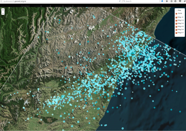
Canterbury aftershocks, 14-21 November 2016

Canterbury aftershocks, 14-21 November 2016 – http://quakesearch.geonet.org.nz/

Canterbury aftershocks, 14-21 November 2016

Canterbury aftershocks, 14-21 November 2016 – http://www.christchurchquakemap.co.nz/week
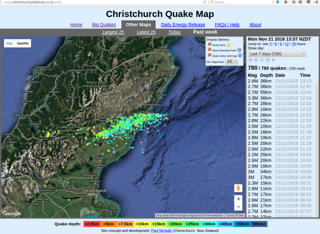
Canterbury aftershocks, 14-21 November 2016 - far view

Canterbury aftershocks, 14-21 November 2016 – http://www.christchurchquakemap.co.nz/week – far view

The zoom out illustrates two things: the offshore trench-fault that runs through land north of Kaikoura as the Hope Fault; that aftershocks are now reaching and accumulating stress along this at the Alpine Fault to the west.

GNS add to confusion – M7.8 Kaikoura quake the biggest since the Dusky Sound jolt in 2009 – 15/11/2016 “Named the Kaikoura earthquake, scientists are describing it as a complex rupture sequence that produced ground-shaking that lasted for about two minutes and was felt throughout the country. It was centered east of Hanmer Springs at a depth of 15km” https://www.gns.cri.nz/Home/News-and-Events/Media-Releases/M7.8-Kaikoura-quake 14 November 2016 – are they afraid of naming Waiau (and Hope)?

The focus is kept upon effects in the Wellington area – Seismologists record 2 metre shift south of Marlborough “The largest aftershocks were close to the Hope Fault, the line running across the centre of the map. The earth moved two metres to the north in Marlborough during Monday morning’s major earthquake, according to data from GNS Science.. the ground moved horizontally 2 metres to the north and vertically down a metre”
www.USGS.gov ground force map for 141116

http://www.USGS.gov ground force map for 141116

http://www.stuff.co.nz/national/nz-earthquake/86429681/seismologists-record-2-metre-shift-south-of-marlborough 14 November 2016 – local info presented may always be the best.

Sensational coverage becomes the fact: ‘Absolutely mind blowing’: Aerial photos ‘show seabed lift’ north of Kaikoura https://nz.news.yahoo.com/a/33218262/absolutely-mind-blowing-aerial-photos-show-seabed-lift-north-of-kaikoura/#page1 + Wellington Earthquake: If it struck at a different time, it could have been “much worse” http://www.stuff.co.nz/national/nz-earthquake/86453972/earthquake-if-it-struck-at-a-different-time-it-could-have-been-much-worse 15 November 2016

New Zealand’s Tectonic Dragon Awakens “beneath its verdant carpet, New Zealand is still under active construction. It occupies one of the most complex geologic venues on the globe, at the messy boundary of two tectonic plates.. violent, episodic upheavals that shake the seemingly tranquil hills” http://www.newyorker.com/tech/elements/new-zealands-tectonic-dragon-awakens 15 November 2016

Christchurch councils sends staff, resources to quake-hit Kaikoura https://ccc.govt.nz/the-council/newsline/show/1169 15 November 2016

GeoNet Kaikoura earthquake update: Magnitude revised http://info.geonet.org.nz/display/home/2016/11/16/Kaikoura+earthquake+update%3A+Magnitude+revised 16 November 2016 + ref. http://earthquake.usgs.gov/earthquakes/
M7.8 – 53km NNE of Amberley, New Zealand
2016-11-13 11:02:56 UTC 42.757°S 173.077°E 23.0 km depth
http://earthquake.usgs.gov/earthquakes/eventpage/us1000778i#executive +
Magnitude Mw 7.9
Region SOUTH ISLAND OF NEW ZEALAND
Date time 2016-11-13 11:02:58.4 UTC
Location 42.69 S ; 172.97 E
Depth 10 km
http://www.emsc-csem.org/Earthquake/earthquake.php?id=545040 7.9
http://www.emsc-csem.org/Earthquake/earthquake.php?id=545057 6.4
http://www.emsc-csem.org/Earthquake/earthquake.php?id=545073 6.1
http://www.emsc-csem.org/Earthquake/earthquake.php?id=545103 6.2
+ http://earthquake.usgs.gov/earthquakes/map/ (current)

While At quake’s epicentre, residents of Waiau watch helicopters destined for elsewhere “Waiau, population 280, is slowly returning to normality following the 7.8-magnitude earthquake that struck five kilometres away.. The town’s water supply has been restored but a separate feed to all rural properties was badly damaged and still broken. [Hamish] Dobbie said the council was working “really hard” to assist farmers who were running low on stock water. He hoped to have the water flowing in about a week. It has been a bitter pill to swallow for the community already struggling through a drought – a disaster within a disaster. Farmers near Waiau waved desperately at helicopters headed for Kaikoura, hoping they would stop.. It was hard not to feel forgotten as helicopters headed for Kaikoura, considering that Waiau was at the centre of it all. ‘I feel Waiau was a bit left out,” [Brenda] Smith said. ‘Even when it was first reported it was so many [kilometres] from Culverden, so many [kilometres] from Hanmer. I get it, we’re all hurting and Kaikoura is isolated … but yeah.'” http://www.stuff.co.nz/national/nz-earthquake/86594300/waiau-farmers-face-weeks-wait-for-water + Civil Defence overhaul ‘inevitable’ after tsunami warning confusion: Govt http://www.stuff.co.nz/national/86441740/civil-defence-overhaul-inevitable-after-tsunami-warning-confusion-govt + Mayor thanks those involved in evacuation effort https://ccc.govt.nz/the-council/newsline/show/1186 17 November 2016

Quake sparked more movements in Marlborough faults than first thought http://www.radionz.co.nz/news/national/318248/quake-sparked-more-movements-in-marlborough-faults-than-first-thought 17 November 2016

“Scientists know a tide gauge at Kaikoura rose 90cm during Monday’s magnitude-7.8 earthquake, but that’s one of the few pieces of detailed data so far about how much the level of the coastline has risen. There is also information about land movement from a network of continuous GPS stations run by GeoNet and Linz showing a rise of around a metre at Cape Campbell, at the southern end of Clifford Bay. Data from the stations also show Cape Campbell moved horizontally northeast by 2-3 metres. ..Many anecdotal reports suggest a two-metre rise at the coast, and there’s even one report of a reef rising six metres”
http://www.stuff.co.nz/national/86565581/finding-out-how-much-the-earth-moved-during-massive-earthquake 18 November 2016

Quake action formed Hanmer Springs but latest quake passed it by “The Hanmer Fault runs right through the township and is the noticeable rise you go up as you head north towards the pools. On the other side of the basin lies the Hope Fault, one of the major seismic features of the region which starts at the Alpine Fault near Inchbonnie on the West Coast and slices its way across North Canterbury before heading offshore just north of Kaikoura. It’s this eastern part of the Hope Fault that some scientists now believe could be at risk of rupturing if enough stress has been transferred on to it from Monday’s large quake.. GeoNet director Dr Ken Gledhill said the quake rupture took the path of least resistance northeastwards up the coast from close to Waiau where it began. ‘It’s kind of strange, it’s like the epicentre in this case is almost a meaningless concept.’ It’s where the action started but it must have started weakly and then slowly built up steam. So Hanmer just happened to be relatively close to where the epicentre, but not the real action, was. The real burst of energy that contributed to most of the magnitude was between Kaikoura and Cape Campbell. It raced up towards Cape Campbell and then it basically stopped.’ Fortunately, Cook Strait, with its offset faults, had acted like a barrier and halted the quake in its tracks, Gledhill said. It was the sudden deceleration which raised the coastal strip by up to 1 metre and shunted that part of the South Island 2m closer to Wellington, rather like a car braking sharply to a stop and the passengers being thrown suddenly up and forward. If you could create a big-enough map of the northern South Island and southern North Island you would be able to see how the islands have stretched, shrunk and otherwise changed shape since 12.02am on Monday. The quake moved Kaikoura about 1m further northeast and upwards 70 cm, and Hanmer Springs jumped east about 50 cm. Wellington and the Kapiti Coast are now 2 to 6cm further north, Christchurch and Banks Peninsula have shifted 2cm south and some parts of the West Coast are now 10cm closer to Canterbury than they were” http://www.stuff.co.nz/national/nz-earthquake/86554866/quake-action-formed-hanmer-springs-but-latest-quake-passed-it-by 18 November 2016

NIWA diverts ship to earthquake areas https://niwa.co.nz/news/niwa-diverts-ship-to-earthquake-areas 18 November 2016

CCC Coastal residents urged to have evacuation plan
https://ccc.govt.nz/the-council/newsline/show/1190

GNS Kaikoura shoreline movement, 14 Nov 2016

GNS Kaikoura shoreline movement, 14 Nov 2016

‘Startling’ rise of 5.5 metres in piece of coastline during Kaikoura earthquake confirms quake energy has spanned the Hope Fault – the Kekerengu Fault has just moved about 10 metres horizontally, or about half of its 20-25m known movement per 1,000 years. That much sudden, imminent movement is scarily awesome. Note the Hope Fault is near where shoreline rise has been the greatest, at 3-3.5 metres. http://www.stuff.co.nz/national/86703833/startling-rise-of-55-metres-in-piece-of-coastline-during-kaikoura-earthquake 21 November 2016

Greedy, short-sighted economic actors are multipliers of natural risk. Korean charter flights pulled post earthquake – “The tourism industry and government agencies were also deliberately calling it the ‘Kaikoura earthquake’ because referring to north Canterbury gave the impression that Christchurch had been affected, when it had not”
http://www.stuff.co.nz/business/86604299/korean-charter-flights-pulled-post-earthquake 18 November 2016

We must remember, and anticipate, the main event.

And the Wellington earthquake – in the South Island – origins.

This 7.8 was exactly where I forecast and warned of, as next in the Canterbury earthquake sequence we are – if lucky, or god will it – living through.

More information: https://www.gns.cri.nz/Home/Our-Science/Natural-Hazards/Recent-Events/Kaikoura-Earthquake

RadioNZ
There was never a risk of a tsunami, says seismologist “We are way over-playing the size and the role of tsunamis. And this is happening in a lot of other places too, because unfortunately we are in a period of science where, to get funding, you have to scare the hell out of the public.” http://www.radionz.co.nz/news/national/318338/there-was-never-a-risk-of-a-tsunami,-says-seismologist 18 November 2016
Stories from the quakes Insight http://www.radionz.co.nz/national/programmes/insight/audio/201824385/insight-earthquake-surviving-7-point-8 19 November 2016
GNS: Tsunami caught us by surprise http://www.radionz.co.nz/news/kaikoura-earthquake/318506/gns-tsunami-caught-us-by-surprise +
Govt to push for tsumani text message system http://www.radionz.co.nz/news/national/318473/govt-to-push-for-tsumani-text-message-system 20 November 2016
Civil Defence’s earthquake response to be reviewed http://www.radionz.co.nz/news/kaikoura-earthquake/318584/civil-defence’s-earthquake-response-to-be-reviewed +
Crayfish and pāua fisheries shut down on quake-hit coast http://www.radionz.co.nz/news/kaikoura-earthquake/318599/’high-and-dry,-and-now-unfortunately-rotting’ +
Quake-hit Kaikōura still isolated by road http://www.radionz.co.nz/news/kaikoura-earthquake/318538/quake-hit-kaikoura-still-isolated-by-road 21 November 2016
Minister criticises GeoNet’s funding call http://www.radionz.co.nz/news/kaikoura-earthquake/318618/minister-criticises-geonet’s-funding-call 22 November 2016

21 November 2016
Morning, Nine to Noon on http://www.radionz.co.nz News, Dr Kelvin Berryman for GNS Science discusses 14.11.2016 mag-7.8 quake fault research results and questions at variance from USGS findings (no link readily available)

This evening’s television illustrated the overwhelming interest we all have in our own local geological hazards: TV1 Seven Sharp asked ‘Is the capital in the right place?’ (lost link?); while TV3 Story looked at new research modelling of an Auckland tsunami.

22 November 2016
Scientists detect huge fault rupture offshore from Kaikoura
https://niwa.co.nz/news/scientists-detect-huge-fault-rupture-offshore-from-kaikoura
Huge fault rupture stretches 34km offshore from Kaikoura http://www.stuff.co.nz/sunday-star-times/latest-edition/latest-news/86752499/Huge-fault-rupture-stretches-34km-offshore-from-Kaikoura

The best clear explanation, through animations, of how the 7.8-magnitude earthquake propagated and exactly which faults where did move the earth, though again generalising the start as “near Culverden”:
Watching the M7.8 Kaikoura Quake Dominos Fall in Real Time

GNS M7.8 Kaikoura Quake Dominos video 2

GNS M7.8 Kaikoura Quake Dominos video 2

http://info.geonet.org.nz/display/quake/2016/11/23/Watching+the+M7.8+Kaikoura+Quake+Dominos+Fall+in+Real+Time

Tremors rattle Hawke’s Bay as ‘silent earthquake’ shunts East Coast after 7.8 quake http://www.stuff.co.nz/national/86715367/Tremors-rattle-Hawkes-Bay-as-silent-earthquake-shunts-East-Coast-after-7-8-quake

Magnitude-5.7 big aftershock that GNS generalises unhelpfully again as “Culverden” area, when it has badly affected Scargill township where a whole new quake sequence is located in their Hurunui River tributary valley. Far too vague! http://www.radionz.co.nz/news/national/318713/aftershock-damages-north-canterbury-homes
http://www.stuff.co.nz/national/86758316/Earthquake-Aftershocks-rumble-through-night-after-5-7-shake
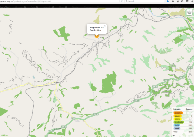
This is what preceded the Scargill mag-5.7, by 1 minute and 23 seconds, a local foreshock of 4.8:

GNS screenshot 2016-11-22 Scargill 4.8-magnitude foreshock aftershock

GNS screenshot 2016-11-22 Scargill 4.8-magnitude foreshock aftershock

http://www.geonet.org.nz/quakes/region/newzealand/2016p881666 83 seconds before
http://www.geonet.org.nz/quakes/region/newzealand/2016p881669 magnitude-5.7 Scargill quake

23 November 2016
The Future of New Zealand’s Coastlines
“The massive uplift after the 7.8 magnitude quake has changed Kaikoura’s coastline significantly. With a new reef forming as the land moved up, by as much as six metres along the fault plain. But do we know what the future of New Zealand’s coastline will look like? Just-published tectonic research gives some insight into what sea levels could be in the future. And the satellitle observations show parts of New Zealand, are sinking at faster rates than others, and will be subjected to higher levels of future sea level rise. Co-author of the research is Professor Tim Stern, of Victoria University’s School of Geography, Environment and Earth Sciences.” – RadioNZ Afternoons 231116

Prof Tim Stern research RadioNZ 231116

Prof Tim Stern research RadioNZ 231116

http://www.radionz.co.nz/national/programmes/afternoons/audio/201825015/the-future-of-new-zealand’s-coastlines

24 November 2016
Geonet ‘puzzled’ by aftershock sequence following the Kaikoura quake http://www.stuff.co.nz/national/86813422/geonet-puzzled-by-aftershock-sequence-following-the-kaikoura-quake
West Coast Civil Defence retracts ‘large aftershock’ warning http://www.newshub.co.nz/nznews/west-coast-warned-to-prepare-for-possible-massive-aftershock-2016112418
https://www.westlanddc.govt.nz/update-west-coast-civil-defence
http://www.wcrc.govt.nz/our-services/civil-defence-emergency-management/Pages/
Rotorua Museum closed over quake-damage concerns http://www.radionz.co.nz/news/kaikoura-earthquake/318833/rotorua-museum-closed-over-quake-damage-concerns

25 November 2016
West Coast Civil Defence aftershock warning ‘irresponsible’ – Mayor http://www.newshub.co.nz/nznews/west-coast-civil-defence-aftershock-warning-irresponsible—mayor-2016112510
Large aftershocks a possibility, but there are no ‘urgent warnings’ http://www.stuff.co.nz/national/nz-earthquake/86852615/large-aftershocks-a-possibility-but-there-are-no-urgent-warnings + Earthquake: Large aftershock urgent warning criticised “West Coast Civil Defence regional manager Chris Raine.. ‘an area in the Arthurs Pass just to the west of the divide is generating small earthquakes with several in the last few days that are being felt in Westland’.. [then CD chief] Stuart-Black said ‘Right from day one I’ve been saying that there is a likelihood that we would experience another large aftershock which could be as big as what we experienced just after midnight on 14th but could in fact be potentially larger’ http://www.stuff.co.nz/national/nz-earthquake/86863920/earthquake-large-aftershock-urgent-warning-criticised
So no news is good news? – http://www.civildefence.govt.nz/resources/declared-states-of-emergency/ – where are the official media releases from MCDEM? See https://www.facebook.com/NzGetThru/posts/1237250506334040 etc + https://www.facebook.com/CanterburyEM/
CCC – “The local state of emergency that has been in place in Canterbury for the past week has been extended until November 29” – https://ccc.govt.nz/the-council/newsline/show/1187 + “Self evacuate – don’t wait for the tsunami sirens – if it’s long or strong, get gone” – https://ccc.govt.nz/services/civil-defence/what-to-do-in-an-emergency/tsunami/evacuating/
GeoNet M7.8 Kaikoura Quake: Future Scenarios and Aftershock Forecasts Update 25 Nov 2016 15.00
“Scenario Three: Extremely unlikely (<1% within the next 30 days)
A much less likely scenario than the previous two scenarios is that recent earthquake activity will trigger an earthquake larger than the M7.8 mainshock. This includes the possibility for an earthquake of greater than M8.0, which could be on the 'plate interface' (where the Pacific Plate meets the Australian Plate). Although it is still very unlikely, the chances of this occurring have increased since before the M7.8 earthquake." http://info.geonet.org.nz/display/quake/2016/11/14/M7.8+Kaikoura+Quake%3A+Future+Scenarios+and+Aftershock+Forecasts + Stress and the earthquakes http://info.geonet.org.nz/pages/viewpage.action?pageId=20545958

26 November 2016
Central New Zealand shaken awake by magnitude 4.6 Cook Strait earthquake http://www.stuff.co.nz/national/86900233/Central-New-Zealand-shaken-awake-by-magnitude-4-6-earthquake
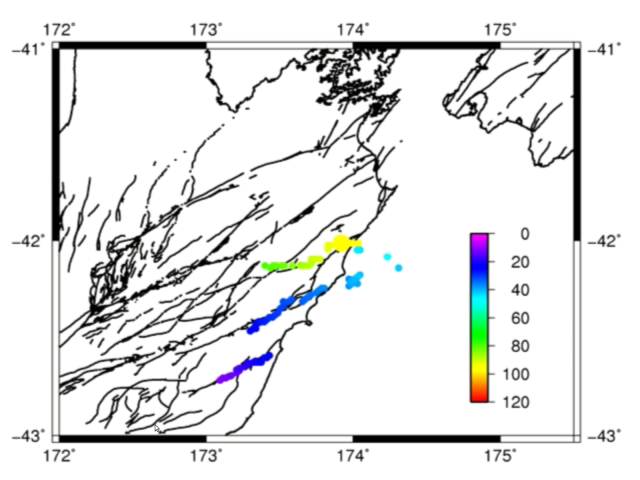
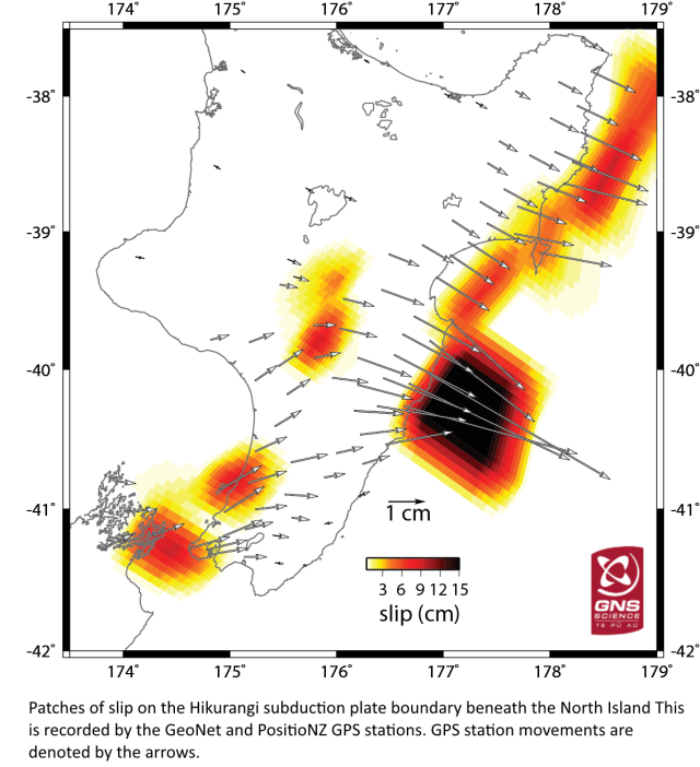
Updated: Gisborne and Hawke’s Bay slow-slip event now extends to include Kapiti and Manawatu regions following M7.8 Kaikoura Quake http://info.geonet.org.nz/display/quake/2016/11/21/Updated%3A+Gisborne+and+Hawke%27s+Bay+slow-slip+event+now+extends+to+include+Kapiti+and+Manawatu+regions+following+M7.8+Kaikoura+Quake

GNS slow-slip movements 26Nov2016

GNS slow-slip movements 26Nov2016

27 November 2016
‘Strong’ magnitude 4.8 quake rattles central New Zealand https://www.tvnz.co.nz/one-news/new-zealand/strong-magnitude-4-8-quake-rattles-central-new-zealand

28 November 2016
Three sharp earthquakes rattle central NZ, jolts continue overnight http://www.stuff.co.nz/national/nz-earthquake/86926530/Three-sharp-earthquakes-rattle-central-NZ-jolts-continue-overnight
Rotorua woken by 30m geyser eruption http://www.newshub.co.nz/nznews/rotorua-woken-by-30m-geyser-eruption-2016112810
‘The village is erupting!’ Water shot 30m into the air on Lake Rotorua, giving locals a fright https://www.tvnz.co.nz/one-news/new-zealand/village-erupting-water-shot-30m-into-air-lake-rotorua-giving-locals-fright
Rotorua geyser erupts like a shaken bottle of fizzy drink http://www.radionz.co.nz/news/national/319092/geyser-erupts-like-a-shaken-bottle-of-fizzy-drink + Geyser eruption sends water 30m into the air http://www.radionz.co.nz/national/programmes/checkpoint/audio/201825617/geyser-eruption-sends-water-30m-into-the-air
Geyser eruptions in Rotorua coincide with earthquake activity http://www.stuff.co.nz/national/86935777/Geyser-eruptions-in-Rotorua-coincide-with-earthquake-activity
Kaikoura quake could be behind ‘silent earthquakes’ http://www.radionz.co.nz/news/national/319093/kaikoura-quake-could-be-behind-‘silent-earthquakes&#8217;
Slow-slip earthquakes detected in Kapiti and Manawatu, joining Gisborne and Hawke’s Bay http://www.stuff.co.nz/national/86927682/Slow-slip-earthquakes-detected-in-Kapiti-and-Manawatu-joining-Gisborne-and-Hawkes-Bay
Watch: Incredible new images from space show how Kaikoura’s earth jolted apart https://www.tvnz.co.nz/one-news/new-zealand/watch-incredible-new-images-space-show-kaikouras-earth-jolted-apart?auto=5225981168001

29 November 2016
‘Unusual’ geothermal activity at Lake Rotorua – GNS
http://www.newshub.co.nz/nznews/unusual-geothermal-activity-at-lake-rotorua-2016112823
Are earthquakes and geyser eruptions related? ‘No, Taupo and Tarawera eruptions have a roughly 1,000 year return period, Auckland every 1-2,000 years..’
http://www.newshub.co.nz/tvshows/paulhenry/are-earthquakes-and-geyser-eruptions-related-2016112913
Scientists’ research trench slips nine metres in Kaikoura Earthquake http://www.stuff.co.nz/science/86972668/scientists-research-trench-slips-nine-metres-in-kaikoura-earthquake

30 November 2016
Another geyser erupts in Rotorua
http://www.newshub.co.nz/nznews/another-geyser-erupts-in-rotorua-2016113015
Weather might have caused second eruption in Rotorua http://www.radionz.co.nz/news/national/319291/weather-might-have-caused-second-eruption-in-rotorua

Become better prepared – https://happens.nz
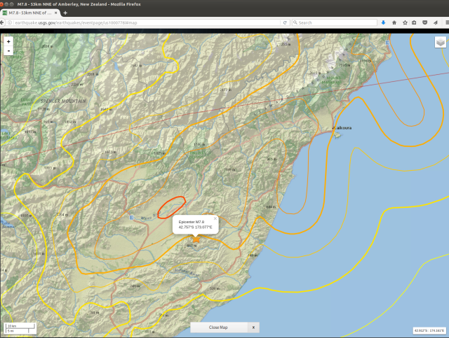
USGS 141116 mag-7.8 shakemap - Waiau

USGS 141116 mag-7.8 shakemap – Waiau – http://earthquake.usgs.gov/earthquakes/eventpage/us1000778i#map

This USGS shake-intensity map locates: a) the Pacific plate and Australian plate tectonic boundary; b) Wairau River as central to the mag-7.8 EQ fault action – confirmed (therefore USGS have this epicentre listed wrongly?)

Synchronicity with Alpine Fault movement is precise – “at least three past large earthquakes had occurred in the last 1250 years. These initial results confirmed that the Kekerengu Fault was capable of producing large earthquakes frequently (on average, about every 300 or 400 hundred years)” – how long delayed is the M7.8 Waiau flow-on effect, to an Alpine M8-9, being the only question. As in weeks, months, years or decades? … Further large stress input is not needed. – Kekerengu Fault has a Word to its Geologists http://info.geonet.org.nz/display/quake/2016/11/28/Kekerengu+Fault+has+a+Word+to+its+Geologists

1 December 2016
“Kēkerengū Fault.. in the last 1200 years.. this fault has ruptured three times – and now it’s the fourth time.. between 30 and 50 percent chance of having a great earthquake on the Alpine Fault in the next 50 years”
Fault unlocks new geological data
http://www.radionz.co.nz/news/national/319319/fault-unlocks-new-geological-data
Warnings sounded over NZ’s Transport resilience http://www.radionz.co.nz/national/programmes/ninetonoon/audio/201826002/warnings-sounded-over-nz’s-transport-resilience
Giant underwater landslide in the Kaikōura Canyon http://www.radionz.co.nz/national/programmes/ourchangingworld/audio/201825860/giant-underwater-landslide-in-the-kaik-ura-canyon
Slow slips could raise quake risk: GeoNet http://www.newshub.co.nz/nznews/slow-slips-could-raise-quake-risk-geonet-2016120117
“GNS volcanologist Brad Scott says the geyser was more likely due to weather than to seismic activity” Geyser erupts for second time in Lake Rotorua http://www.radionz.co.nz/national/programmes/morningreport/audio/201825984/geyser-erupts-for-secnd-time-in-lake-rotorua

2 December 2016
Lake Rotorua eruptions ‘not related’ to M7.8, say GNS.. despite its very long reach? :
Earthquake leaves Rotorua Museum closed ‘until further notice
http://www.newshub.co.nz/nznews/earthquake-leaves-rotorua-museum-closed-until-further-notice-2016120214

September 2015, one year ago: Rotorua geyser bursts into life after 35 years http://www.radionz.co.nz/national/programmes/checkpoint/audio/201769992/rotorua-geyser-bursts-into-life-after-35-years + in sequence before that:
Seismic studies shed light on natural disaster risk “the build-up to an eruption from Auckland’s volcanos would be more accelerated than those for volcanos elsewhere” http://www.radionz.co.nz/news/national/59423/seismic-studies-shed-light-on-natural-disaster-risk 13 October 2010 [then 4.9.2010, 22.2.2011 etc Canterbury quakes..]
New lakes formed by Mt Tongariro’s eruption http://www.radionz.co.nz/news/national/112694/new-lakes-formed-by-mt-tongariro’s-eruption 8 August 2012
New crater blasted on White Island http://www.radionz.co.nz/news/regional/302697/new-crater-blasted-on-white-island 30 April 2016
Mt Ruapehu still shaking http://www.radionz.co.nz/news/national/303667/mt-ruapehu-still-shaking 12 May 2016
Scientists prepare for Lake Taupo eruption http://www.radionz.co.nz/news/regional/305214/scientists-prepare-for-lake-taupo-eruption 30 May 2016
+ Preceding the 14.11.2016 mag-7.8 was Hydrothermal activity in Lake Rotorua “A collaboration between the New Zealand Defence Force and GNS Science has picked up hydrothermal activity in Lake Rotorua.. ‘This work is the first step in a series of surveys that we hope will ultimately determine how much heat is being discharged through the lake floor from an underlying magma source, with the results feeding into our long-term hazards assessment of the area.’ The six-week survey ends next week. It covered about 40 percent of the lake floor.” http://www.radionz.co.nz/news/national/317947/hydrothermal-activity-in-lake-rotorua 12 November 2016

4 December 2016
Kaikōura’s new coast shown by NASA photos http://www.radionz.co.nz/news/national/319560/kaikoura’s-new-coast-shown-by-nasa-photos

7 December 2016
Nine faults ruptured in Kaikoura quake “but the Hope Fault barely moved.. there could be three segments to the Hope Fault, which moved about 10cm at Half Moon Bay.. GNS was in the process of building a map of the faults” http://www.radionz.co.nz/news/national/319798/nine-faults-ruptured-in-kaikoura-quake
10 faults known to have ruptured in Kaikoura quake, more likely “The quake started with the rupture of the Humps Fault Zone, near Culverden, [Dr Nicola Litchfield, head of the GNS Science active landscapes department].. said. That seemed to have triggered the next fault along, which had triggered the next one and so on all the way to the Needles Fault – the offshore continuation of the Kekerengu Fault. ‘The movement in each of those [faults] was big enough it triggered the next to go in the same earthquake,’ she said. The faults that went must have been ready to go. The large Hope Fault hadn’t ruptured. “Basically it jumped over the Hope Fault and didn’t rupture that except for a tiny bit at the coast,” Litchfield said. ‘In this area there are a lot of faults. The thing is before this earthquake we didn’t think so many were going to rupture in one earthquake. I guess that’s the big surprise.’ It was unlikely the combination of faults in the Kaikoura earthquake would be repeated. The Kekerengu Fault went every 300-400 years. In contrast, it wasn’t known how often the faults at the south of the rupture zone went, but it was thought to be thousands, or tens of thousands of years between ruptures.”
http://www.stuff.co.nz/science/87292211/10-faults-known-to-have-ruptured-in-kaikoura-quake-more-likely

9 December 2016
Central NZ tsunami risk may be higher due to undiscovered offshore faults “GNS Science geophysicist Dr William Power said the 14 November tremor provided an ‘interesting puzzle’ in terms of where the tsunami was generated.. the tsunami might have reached 4 metres in some areas of the Kaikoura coast. However, the fact the quake struck close to low tide and that the land was uplifted at the same time reduced the extent of inundation. ‘A better understanding of the fault movements offshore in the Kaikoura earthquake will help us better evaluate the tsunami risks in central New Zealand.'”
http://www.stuff.co.nz/national/nz-earthquake/87301480/central-nz-tsunami-risk-may-be-higher-due-to-undiscovered-offshore-faults

15 December 2016
Restrictions on building along Alpine Fault in Franz Josef scrapped
http://www.stuff.co.nz/national/87604696/restrictions-on-building-along-alpine-fault-in-franz-josef-scrapped

16 December 2016
Scientists find evidence the Earth’s crust ripped apart to create a 7km deep abyss off Banda, Indonesia http://www.stuff.co.nz/science/87647721/scientists-find-evidence-the-earths-crust-ripped-apart-to-create-a-7km-deep-abyss

[post under edit – return to read more later – thanks for viewing]

M7.8 Kaikoura quake the biggest since the Dusky Sound jolt in 2009 – 15/11/2016
https://www.gns.cri.nz/Home/News-and-Events/Media-Releases/M7.8-Kaikoura-quake

Canterbury Earthquake Research Programme 2012-15 “In Budget 2011, Government made available to the Platform $12M GST ex for studies that addressed the impacts of the Canterbury earthquakes and lessons that could be applied to other centres” – So why stop there? …
https://www.naturalhazards.org.nz/NHRP/Publications/Establishment-Strategy/Canterbury-EQ-Programme

NZ moving to ‘period of more earthquakes’ 15 November 2016
http://www.radionz.co.nz/news/national/318095/nz-moving-to-‘period-of-more-earthquakes&#8217;

The Mountains Moved 00.02 14.11.2016
https://assets.stuff.co.nz/interactives/special-features/the-mountains-moved/index.html

Quake claims top $900m “New Zealand businesses have lodged more than $900 million in insurance claims since the Kaikōura earthquake”
http://www.radionz.co.nz/news/business/323574/quake-claims-top-$900m

Did November’s 7.8 shake create a ‘quake lake’ in the Tararuas? 20 March 2017
http://www.stuff.co.nz/environment/90608086/Did-Novembers-7-8-shake-create-a-quake-lake-in-the-Tararuas

Large earthquake risk remains high “15 percent likelihood of a magnitude 6.0 or higher earthquake striking New Zealand in the next month” 20 March 2017
http://www.radionz.co.nz/news/national/327036/large-earthquake-risk-remains-high

Quake-hit residents fear insurance woes 24 March 2017
http://www.radionz.co.nz/news/national/327322/quake-hit-residents-fear-insurance-woes

Major earthquake could split Wellington region into ‘seven islands’ 24 March 2017
http://www.stuff.co.nz/national/nz-earthquake/90790889/Major-earthquake-could-split-Wellington-region-into-seven-islands

Kaikoura earthquake moved the South Island, new research shows 24 March 2017
http://www.stuff.co.nz/science/90769048/kaikoura-earthquake-moved-the-south-island-new-research-shows

Kaikōura quake moved South Island 5 metres 24 March 2017
http://www.radionz.co.nz/news/national/327328/kaikoura-quake-moved-south-island-5-metres

Extreme heat detected beneath the Southern Alps “New Zealand scientists drilling into the Alpine Fault on the West Coast have found much higher temperatures than expected – which as well as being scientifically exciting could also be commercially very significant for New Zealand. They’ve drilled nearly 900 metres into the Alpine Fault at Whataroa – finding geothermal conditions comparable with Taupo, but there are no volcanoes in Westland. Kathryn Ryan talks to Victoria University’s John Townend” RNZ 18 May 2017
http://www.radionz.co.nz/national/programmes/ninetonoon/audio/201844259/extreme-heat-detected-beneath-the-southern-alps
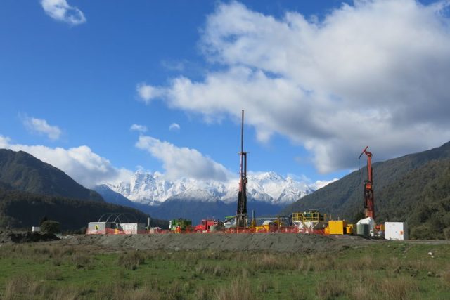
Whataroa Valley research site, Victoria University

Whataroa Valley research site at Alpine Fault – Victoria University supplied pic, May 2017


+ The sleeping dragon: Researchers find blazing heat beneath the Southern Alps The Press http://www.stuff.co.nz/environment/92669729/the-sleeping-dragon-researchers-find-blazing-heat-beneath-the-southern-alps

Noting a return of readers to my blog today, probably looking for New Zealand earthquake analysis, I will rattle this post off quickly, as a catch-up on a previously strong theme to my writing. Then I will take a good long walk to relax. As should we all.

Having accurately forecast, to within 50 minutes, a magnitude 4.7 Christchurch earthquake yesterday, what are my afterthoughts about this? Under-earth events continue for the country and are detailed here: #Masterton‬ mag 5.2 ‪#‎eqnz‬ this morning is not alone..”[1] (Read research at footnote link). The title is only more fitting, a month to the day since it was written, when there have been two 5.2 magnitude earthquakes, this new morning. (Ironically, says the Moon Man?)

Stunning, really. Awesome Earth!

But what is the big picture, if I am asked?

Well, it’s not good. Not for New Zealand, one of the newest land masses and nations on the planet – it is likely to have to start again. In our lifetime? It seems / I would say, perhaps yes. Because a 330-year Alpine Fault cycle is sitting at year 299, approximately.
The tectonic motion we have begun to experience as a constant factor of the post-colonial state has the capacity to practically destroy it. In my opinion. A catastrophe so large is built into this land, Aotearoa – Land of the Long White [volcanic] Cloud – that it will surely cripple us one day. Soon? Hard to say. Why? It looks like this:

Current south-east/central North Island quakes are signs that the Australian Plate it is on is moving, a little bit more. When it finally gets going properly it will be a huge leap south-east, and this will spread the central plateau / Kermadec Arc enough for the Taupo super-volcano to explode again. That will obliterate the central North Island and disable both Auckland and Wellington.

What will initiate this calamity, however, will be almost as bad for the South Island  – a magnitude 8+ slippage of the Alpine Fault, disabling Christchurch and the then-isolated West Coast. This (long-term) ‘regular’ event constitutes the letting-off of the not-quite slow-moving tectonic brake, that is the Southern Alps, that keeps this geological system ‘stable’. A relative term. Long calm will resettle again, after many many large and small aftershocks.

Will Otago-Southland be left standing to pull us through? Let us hope so.

There is no way we can recover from this imminent (in our lifetime?) surety without massive international support and massive sacrifice of sovereignty.

Let us prepare for that transitional step now. However we are best able to.

But it may be that the next magnitude 8+ Alpine Fault earthquake does not release Taupo super-volcano.[2]  Let us hope so. ‘Not yet please.’  We are not ready. …

Is the Taupo volcano on a 5, 6 or 7 Alpine Fault-slip cycle? Some decade on from now, all New Zealand will be discovering this, as-yet hidden fact, together. It will be our darkest hour. Human spirit will pull through.

Kia kaha. Kia ora. Waimarie.

[1] facebook.com/photo.php?fbid=10209826325001836&set=a.1294734535479.2045005.1443783772&type=3

[2] “1800 years ago Taupo volcano in New Zealand had the largest volcanic eruption in the world for the last 5000 years.” sott.net/article/249473-Is-The-Super-Volcano-Taupo-in-New-Zealand-Awakening and see wikipedia.org/wiki/Taupo_Volcano “The main pyroclastic flow devastated the surrounding area, climbing over 1500 metres (5000 ft) to overtop the nearby Kaimanawa Ranges and Mount Tongariro, and covering the land within 80 kilometres (50 mi) with ignimbrite from Rotorua to Waiouru. Only Ruapehu was high enough to divert the flow.”

“Possibility of further eruptions on White Island remains high” 10 May 2016 m.nzherald.co.nz/nz/news/article.cfm?c_id=1&objectid=11636672

“Mt Ruapehu still shaking” – top closed to public radionz.co.nz/news/national/303667/mt-ruapehu-still-shaking

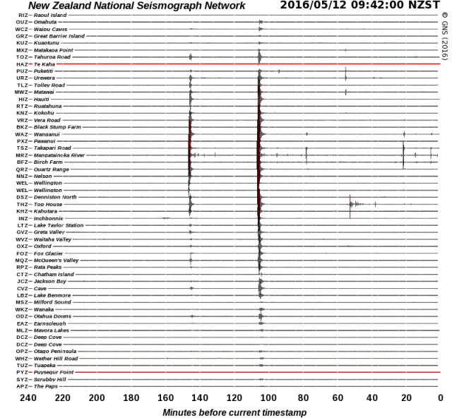
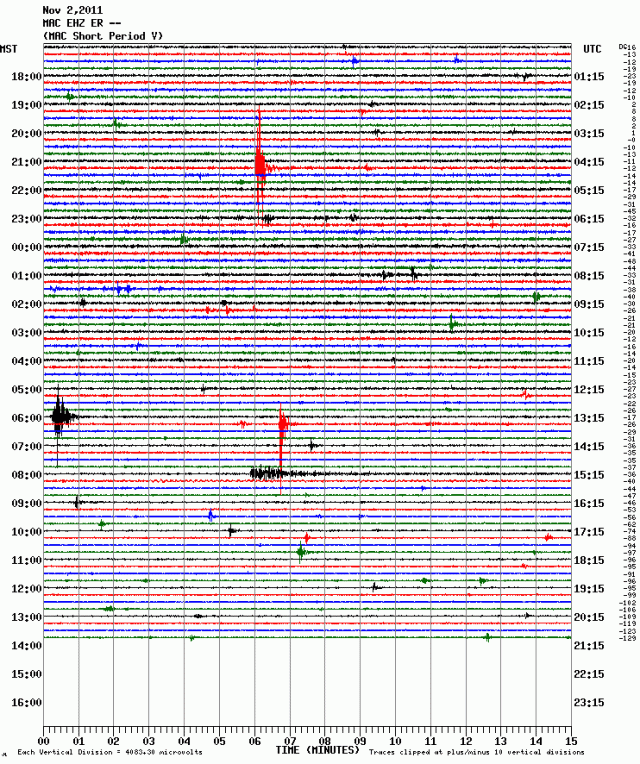
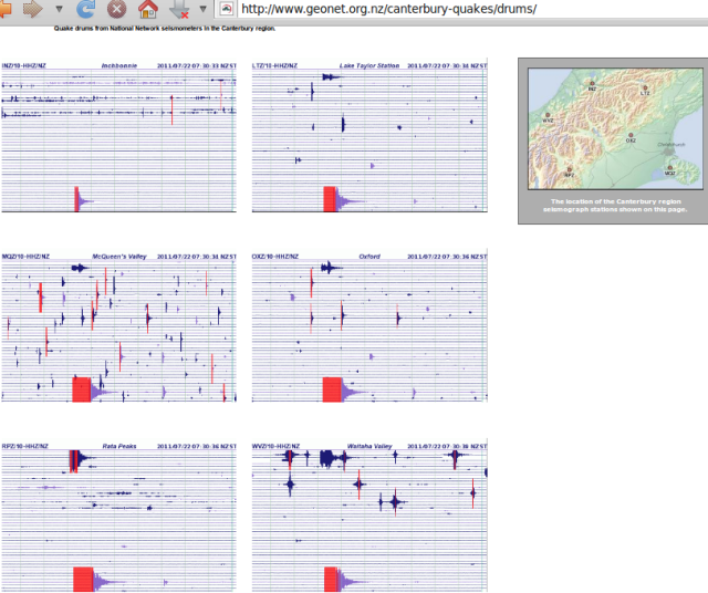
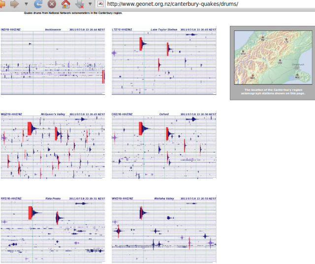
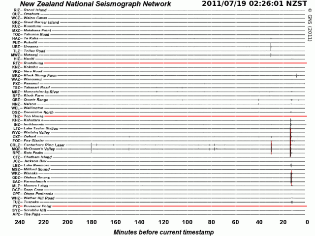
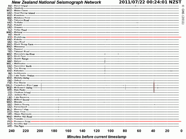
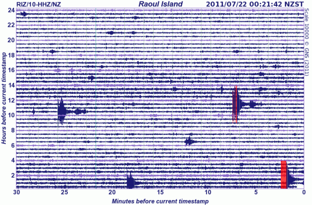
“Aggressive 4.7 Christchurch shake centred close to February 22, 2011 earthquake”  stuff.co.nz/national/79890087/earthquake-rattles-christchurch and five hours later a “‘Strong’ earthquake shakes lower North Island” stuff.co.nz/national/79892918/Strong-earthquake-shakes-lower-North-Island 12 May 2016 – graphic, GeoNet.org.nz/quakes/drums:

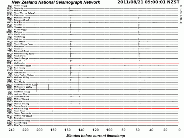
120516b-NSN-drums-Masterton4.7-5.2

Update 30/5/2016

Scientists prepare for Lake Taupo eruption

“A team of researchers is studying the volcano so better response plans can be put in place in case of a large eruption. The Earthquake Commission said damage from the last time the volcano erupted – almost 1800 years ago – would be large enough to destroy the central North Island…”
radionz.co.nz/news/regional/305214/scientists-prepare-for-lake-taupo-eruption

Understand that the Taupo Volcanic Zone, stretching from Mount Ruapehu to north of White Island, marks the southern pin of the broad Kermadec Arc and basin, a massive slow-spreading rift in the Earth that forever thins its crust. From this steady motion – eastwards, of the Australian Plate – re-eruption of Taupo Volcano is inevitable. It isn’t the centre of the North Island for no reason – it explains why the island is above water. https://en.wikipedia.org/wiki/Taupo_Volcanic_Zone

Subduction Zone diagram

Subduction Zone diagram

https://en.wikipedia.org/wiki/Lau_Basin + Graphic: https://en.wikipedia.org/wiki/Back-arc_basin

The 5th most explosive volcano event known to human scientific records:
Name: Whakamaru
Zone: Taupo Volcanic Zone
Location: New Zealand, North Island
Notes: Whakamaru Ignimbrite/Mount Curl Tephra
Years ago (approx.): 340,000
Ejecta bulk volume (approx.): 2,000 km³
https://en.wikipedia.org/wiki/Supervolcano#VEI_8

Later, “Earth’s most recent eruption reaching VEI-8, the highest level on the Volcanic Explosivity Index” https://en.wikipedia.org/wiki/Taupo_Volcanic_Zone

“The Ōruanui eruption (about 26,500 years ago) covered much of the central North Island with ignimbrite, up to 200 metres deep. Ash fallout was spread by the wind over the entire North Island, much of the South Island, and a large area east of New Zealand, including the Chatham Islands. About 1,200 cubic kilometres of pumice and ash were rapidly ejected. This caused a large area of land to collapse, forming the caldera basin now filled by Lake Taupō.”

…”Big bang – The Ōruanui eruption was so enormous that it is hard to visualise. In only a few days or weeks it ejected enough material to construct three Ruapehu-sized cones. After the eruption, the new lake gradually filled to a level 140 metres above the present lake. The lake broke out to the north, resulting in a huge flood. For several thousand years the Waikato River flowed northwards into the Hauraki Gulf, but it later changed its course to flow through the Hamilton lowlands to the Tasman sea.”

Then, …”Taupō eruption – The most recent major eruption of Taupō volcano took place in late summer–early autumn around 200 AD, from vents near Horomatangi Reefs (now submerged). The eruption produced a towering ash column, resulting in tephra-fall deposits over a wide area from Hamilton to Gisborne. The airfall deposits were much thicker to the east of Taupō because the eruption column was blown in that direction by strong westerly winds. The eruption column was followed by a devastating pyroclastic flow, blanketing a roughly circular area within 80 kilometres of Lake Taupō with ignimbrite, and destroying all life in its path. The ground-hugging pyroclastic flow appears to be one of the most powerful ever recorded, and was able to overtop Mt Tongariro and the Kaimanawa mountains, climbing 1,500 metres in a matter of minutes. The outlet of Lake Taupō was again blocked during the eruption, and the lake level rose to 34 metres above its present height, forming a widespread terrace. The lake eventually broke out in a huge flood whose effects can be traced for over 200 kilometres downstream, and include boulder beds and buried forests.”
http://www.teara.govt.nz/en/volcanoes/page-5

That is, the same most recent was, the ‘Hatepe eruption’: “considered New Zealand’s largest eruption during the last 20,000 years.. ejected some 120 km3 (29 cu mi).. of which 30 km3 (7.2 cu mi) was ejected in the space of a few minutes. This makes it one of the most violent eruptions [on Earth] in the last 5000 years.. Tsunami deposits of the same age have been found on the central New Zealand coast, evidence that the eruption caused local tsunamis” https://en.wikipedia.org/wiki/Hatepe_eruption

“Radiocarbon dating indicates an uneven spacing of Taupo’s eruptions, from decades to thousands of years apart. This makes it difficult to forecast when the next eruption will occur and how big it will be.” http://www.teara.govt.nz/en/volcanoes/page-5

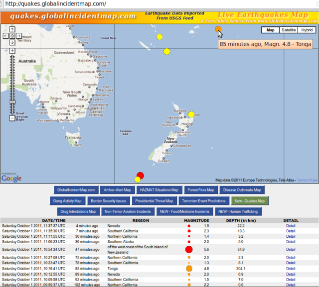
http://hisz.rsoe.hu/alertmap/index2.php#supv

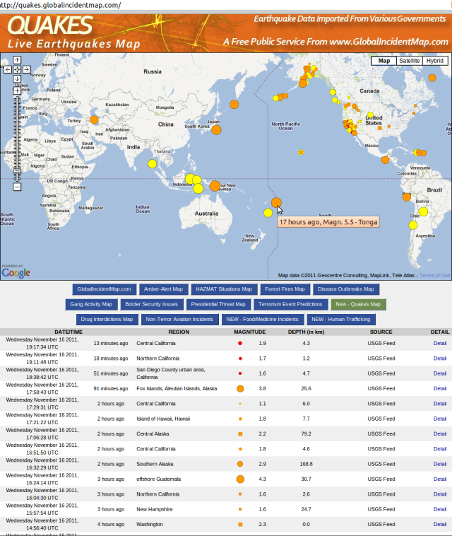
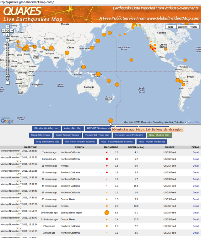
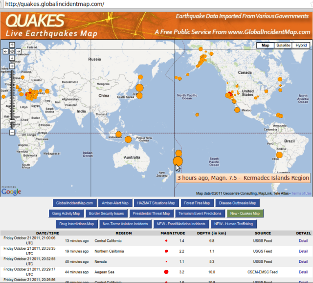
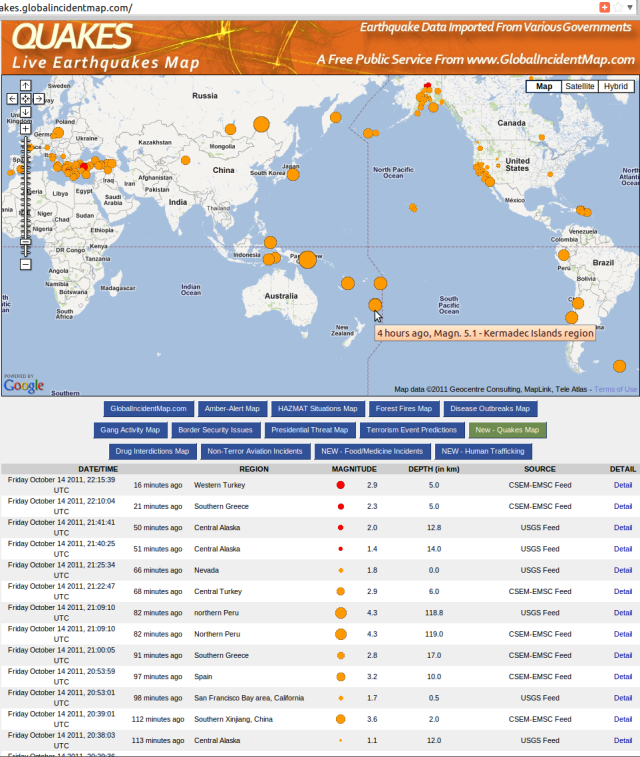
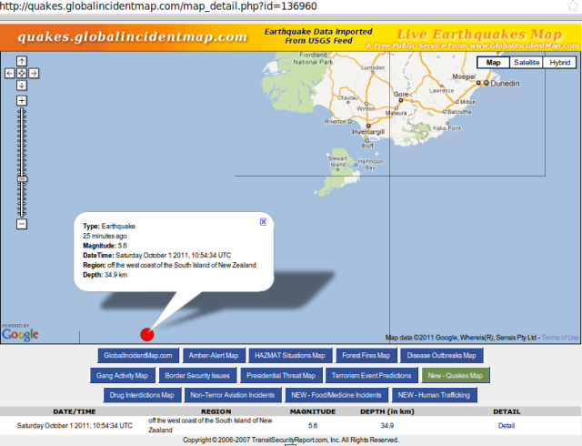
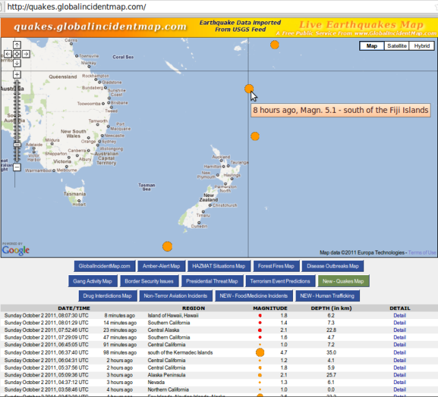
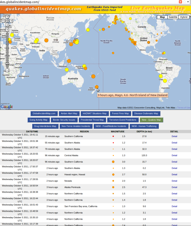
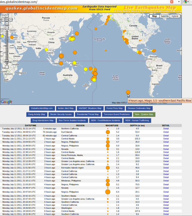
http://quakes.globalincidentmap.com

http://www.emsc-csem.org/Earthquake

Update 4/6/2016
“Magma chamber blamed for Bay of Plenty earthquake swarm.. study found the previously unrecognised magma body caused several thousand small earthquakes between 2004 and 2011.. expansion of the molten rock chamber approximately 9km below Matata has pushed up 400 square kilometres of land by 40cm.. something was accumulating at a depth of around 9.5 to 10km beneath the Earth’s surface.. The magma body could have been there for centuries or more.. The area was a ‘rift zone’ where over time the crust had been stretched and thinned – but it was not clear whether the crust was already thin, or the magma made it thin. ‘It is probably a thinner crust than the average you’d find elsewhere.. But what happens is as you stretch the crust and the hot rocks beneath come to a shallower depth, as they become shallower they get less pressure, which actually then enables them to melt and become magma. That magma, because it’s less buoyant than the surrounding rock, it then wants to percolate up through [into the crust]'”, RNZ – radionz.co.nz/news/national/305592/magma-buildup-blamed-for-quakes & Science Advances article, “results suggest that the continued growth of a large magmatic body may represent the birth of a new magma chamber on the margins of a back-arc rift system” – advances.sciencemag.org/content/2/6/e1600288.full
“A huge deposit of magma has been detected just 9km below a small North Island town – and scientists say it may be causing earthquakes. Matata is nestled between Tauranga and Opotiki, and new research using satellite image, GPS data and surveying has revealed the molten secret. The level of the town has been steadily rising over the last few years – up to 10mm per year of uplift, but it is now beginning to slow to about four-five millimetres per year. Scientists are confident there will not be an eruption in the near future, but say they will continue to monitor the magma field”, TV1 – tvnz.co.nz/one-news/new-zealand/huge-field-molten-magma-found-under-north-island-town
“Rising magma to blame for swarm of quakes”, TV3 – newshub.co.nz/nznews/rising-magma-to-blame-for-swarm-of-quakes-2016060400
“Volcano status and notifications come to the GeoNet app – With the flurry of volcano activity last month, we’re pleased to add some new features to the GeoNet app so you can keep an eye on them, too”, GNS 30May2016 –
info.geonet.org.nz/display/appdata/2016/05/30/Volcano+status+and+notifications+come+to+the+GeoNet+app

Update 17/6/2016

Lake Tarawera water warning, 10 Jan 2015 – “People are being warned not to drink water from Lake Tarawera or swim in it after locals noticed the water was discoloured. It was reported to the Bay of Plenty Regional Council yesterday by Hot Water Beach residents. The council says geothermal activity could be to blame for the water’s white, milky appearance. Samples have been taken to test for the presence of algal blooms. The results are not due back until next week.”
http://www.newshub.co.nz/nznews/lake-tarawera-water-warning-2015011012

Lake Tarawera tests positive for algae, 15 Jan 2015 – “Lake Tarawera has tested positive for potentially toxic blue-green algae, but a health warning will not be issued. The confirmation comes after samples were taken from the lake last week, as well as Te Rata Bay near Hot Water Beach. The lake is at ‘amber alert’, meaning the situation will continue to be monitored. ‘The blue-green algae identified are potentially toxic but the levels of algae are below health guidelines,’ says Bay of Plenty Regional Council science manager Rob Donald. ‘We recommend that people do not swim in the water if it is discoloured.’ Blue-green algae only recently arrived in New Zealand, but has already taken its place in lakes throughout the North Island. It causes water to appear green and cloudy, and sometimes green specks will be visible.”
http://www.newshub.co.nz/nznews/lake-tarawera-tests-positive-for-algae-2015011517

Mt Tarawera vent erupts after 35-year slumber, 17 Jun 2016 – “One of the geothermal vents in Mt Tarawera’s Raupo Pond Crater came alive for the first time in 35 years last month, according to GeoNet. The Mud Rift feature — a 6m-wide, 36m-long, 15m-deep vent formed in 1906 that has been lying dormant since 1981 — was activated sometime between May 17 and 20 this year. A blog on the GeoNet website suggests the eruption was a fleeting event, and involved fluids flooding into the vent and causing ‘stress and browning off’ of surrounding plants. It says the eruption was mainly steam-driven, and involved plenty of water, creating what has been likened to a ‘muddy geyser’.”
newshub.co.nz/nznews/mt-tarawera-vent-erupts-after-35-year-slumber-2016061716

Update 27/7/2016
It appears this blog post has been read and authorities are now responding:
stuff.co.nz/national/82524357/team-granted-funding-to-plan-response-for-alpine-fault-megaquake

– Noting that a Megaquake could hit central New Zealand, Stuff 19 May 2015, motivating research like Simulation of a Magnitude 8.4 Megathrust Quake in New Zealand, GNS Science youtube, 12 November 2015

Stuff graphic - "Megaquake could hit central New Zealand" - 19 May 2015

Stuff graphic – “Megaquake could hit central New Zealand” – 19 May 2015

Moderate, North Island of New Zealand subduction quakes continue the trend around the Pacific ‘ring of fire’

Gisborne mag 4+ quake trio - GNS 161111

Gisborne mag 4+ quake trio - GNS 161111


Tonga mag 5.5 quake - GIM 161111

Tonga mag 5.5 quake - GIM 161111

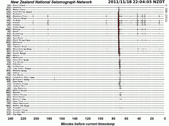
Update 181111 – as accurately forecast:

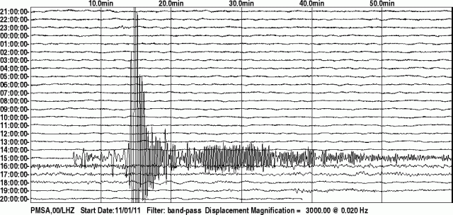
Gisborne mag 6.1 quake - GNS 181111c

Gisborne mag 6.1 quake - GNS 181111c

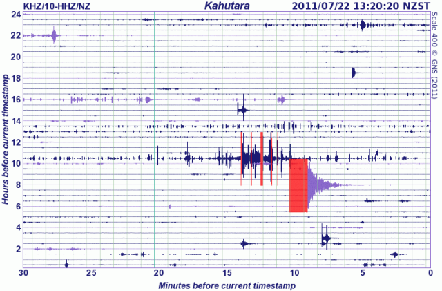
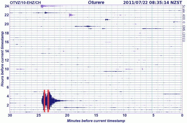
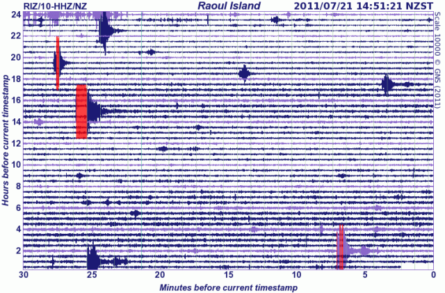
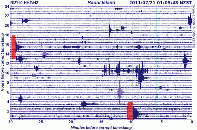
Source: geonet.org.nz/earthquake/drums/ + Powerful 6.1 earthquake off Gisborne Stuff 181111
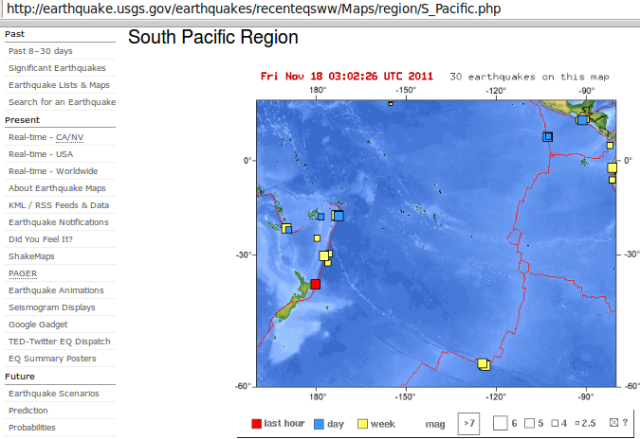
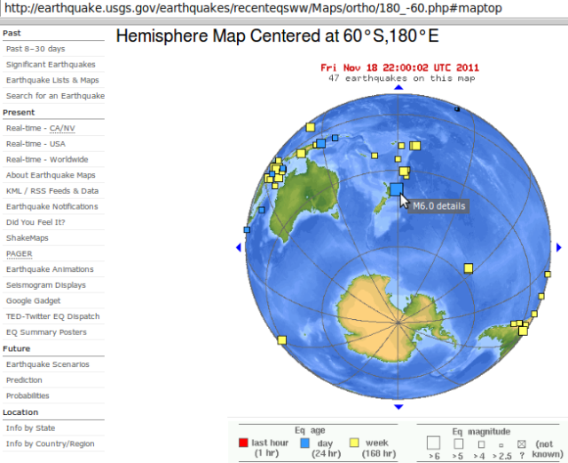
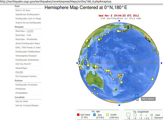
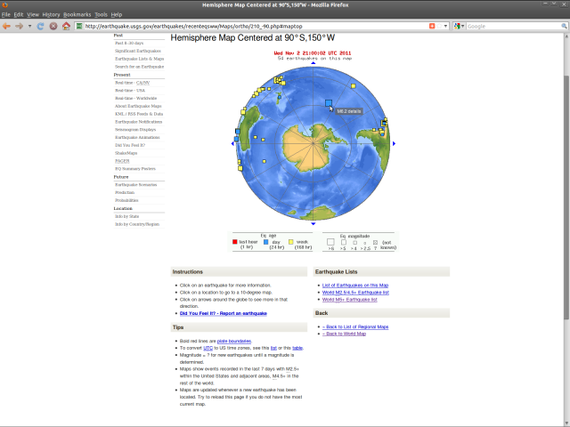
NZ mag 6.1 quake, south Pacific plate view - USGS 191111

NZ mag 6.1 quake, south Pacific plate view - USGS 191111

Source: http://earthquake.usgs.gov/earthquakes/recenteqsww/Maps/region/S_Pacific.php

List from quakes.globalincidentmap.com (magnitude + km depth + data feed source):

Friday November 18 2011, 09:31:56 UTC Island of Hawaii, Hawaii 2.1 15.5 USGS
Friday November 18 2011, 09:28:44 UTC Central California 2.2 4.8 USGS
Friday November 18 2011, 09:14:12 UTC Northern California 1.9 2.1 USGS
Friday November 18 2011, 09:13:40 UTC Northern California 1.0 1.8 USGS
Friday November 18 2011, 09:13:28 UTC Northern California 1.2 2.0 USGS
Friday November 18 2011, 08:56:07 UTC New Britain region, Papua New Guinea 5.1 24.2 USGS
Friday November 18 2011, 07:51:27 UTC off east coast North Island of New Zealand 6.1 26.0 USGS
Friday November 18 2011, 07:41:08 UTC Oklahoma 2.7 4.8 USGS
Friday November 18 2011, 07:31:41 UTC Tajikistan 4.7 216.3 USGS
Friday November 18 2011, 06:57:54 UTC Nias region, Indonesia 4.7 40.4 USGS
Friday November 18 2011, 06:21:07 UTC Central Alaska 3.1 0.2 USGS
Friday November 18 2011, 06:18:04 UTC Virgin Islands region 3.3 22.0 USGS
Friday November 18 2011, 06:12:38 UTC Oklahoma 2.6 5.0 USGS
Friday November 18 2011, 06:11:30 UTC Central Alaska 2.2 99.8 USGS
Friday November 18 2011, 06:00:54 UTC northern Mid-Atlantic Ridge 5.3 9.9 USGS
Friday November 18 2011, 04:34:07 UTC off east coast of North Island of New Zealand 5.7 20.1 USGS
Friday November 18 2011, 04:33:20 UTC Central California 3.0 0.5 USGS
Friday November 18 2011, 04:17:35 UTC Island of Hawaii, Hawaii 2.8 10.4 USGS
Friday November 18 2011, 04:09:43 UTC Baja California, Mexico 1.4 6.4 USGS
Friday November 18 2011, 03:49:32 UTC Southern Alaska 2.1 34.9 USGS
Friday November 18 2011, 03:46:40 UTC San Diego County urban area, California 1.1 0.1 USGS
Friday November 18 2011, 03:21:11 UTC Southern Alaska 2.3 113.7 USGS
Friday November 18 2011, 03:08:42 UTC Puerto Rico region 3.0 117.5 USGS
Friday November 18 2011, 02:43:54 UTC off east coast North Island of New Zealand 5.2 18.4 USGS
Next day: told you so!..
Friday November 18 2011, 02:42:02 UTC Island of Hawaii, Hawaii 2.1 36.2 USGS
Friday November 18 2011, 02:27:08 UTC Nevada 1.5 3.4 USGS
Friday November 18 2011, 02:14:30 UTC Southern California 2.3 7.7 USGS
Friday November 18 2011, 01:10:54 UTC Nevada 2.3 14.7 USGS
Friday November 18 2011, 01:10:18 UTC Alaska Peninsula 3.8 144.8 USGS
Friday November 18 2011, 01:07:01 UTC Central California 2.4 6.3 USGS
Friday November 18 2011, 00:30:25 UTC Northern California 2.2 1.9 USGS
Friday November 18 2011, 00:12:40 UTC Central Alaska 2.4 59.4 USGS
Thursday November 17 2011, 23:39:08 UTC Nevada 1.5 0.0 USGS
Thursday November 17 2011, 22:38:07 UTC Kodiak Island region, Alaska 2.5 55.3 USGS
Thursday November 17 2011, 22:21:21 UTC Southern Alaska 2.5 8.3 USGS
Thursday November 17 2011, 20:59:43 UTC Island of Hawaii, Hawaii 1.9 36.6 USGS
Thursday November 17 2011, 20:45:45 UTC Central California 2.1 4.9 USGS
Thursday November 17 2011, 20:28:52 UTC Northern California 2.6 23.2 USGS
Thursday November 17 2011, 20:13:14 UTC Nevada 1.9 8.2 USGS
Thursday November 17 2011, 20:04:18 UTC Central Alaska 2.8 120.8 USGS
Thursday November 17 2011, 19:47:49 UTC Greater Los Angeles area, California 2.1 10.8 USGS
Thursday November 17 2011, 19:04:52 UTC Guam region 5.1 43.1 USGS
Thursday November 17 2011, 18:41:54 UTC Southern Alaska 2.9 112.3 USGS
Thursday November 17 2011, 18:19:05 UTC Utah 2.5 0.8 USGS
Thursday November 17 2011, 18:08:48 UTC Utah 1.7 0.0 USGS
Thursday November 17 2011, 18:02:37 UTC Central California 2.2 11.4 USGS
Thursday November 17 2011, 17:22:45 UTC Central Alaska 2.1 7.7 USGS
Thursday November 17 2011, 17:08:54 UTC Southern Alaska 2.1 0.0 USGS
Thursday November 17 2011, 16:50:58 UTC Southern Alaska 2.3 7.3 USGS
Thursday November 17 2011, 15:53:12 UTC Virgin Islands region 3.7 22.5 USGS
Thursday November 17 2011, 15:36:39 UTC offshore Northern California 2.8 20.6 USGS
Thursday November 17 2011, 15:33:36 UTC Tonga region 5.0 37.1 USGS
Thursday November 17 2011, 14:21:12 UTC Southern Alaska 2.1 25.0 USGS
Thursday November 17 2011, 13:31:00 UTC offshore Guatemala 5.2 46.1 USGS
Thursday November 17 2011, 13:06:41 UTC offshore Guatemala 5.0 74.6 USGS
Thursday November 17 2011, 12:44:48 UTC offshore Guatemala 4.6 38.7 USGS

Thursday November 17 2011, 12:38:33 UTC eastern Turkey 4.5 10.7 USGS
Thursday November 17 2011, 11:53:06 UTC Central Alaska 2.2 2.3 USGS
Thursday November 17 2011, 11:52:12 UTC Central Alaska 2.2 2.7 USGS
Thursday November 17 2011, 11:18:29 UTC Utah 1.5 2.4 USGS
Thursday November 17 2011, 11:05:24 UTC Baja California, Mexico 2.5 10.0 USGS
Thursday November 17 2011, 11:01:26 UTC Central Alaska 2.4 88.8 USGS
Thursday November 17 2011, 10:57:12 UTC Baja California, Mexico 2.5 10.0 USGS
Thursday November 17 2011, 10:57:11 UTC Baja California, Mexico 2.7 12.4 USGS
Thursday November 17 2011, 10:28:40 UTC Utah 1.5 1.7 USGS
Thursday November 17 2011, 10:09:20 UTC Nevada 1.6 6.7 USGS
Thursday November 17 2011, 10:01:14 UTC Central Alaska 1.9 76.4 USGS
Thursday November 17 2011, 10:01:12 UTC Central Alaska 2.1 100.7 USGS
Thursday November 17 2011, 09:43:02 UTC near east coast Honshu, Japan 5.1 17.4 USGS
Thursday November 17 2011, 09:18:09 UTC north of Halmahera, Indonesia 4.5 76.0 USGS
Thursday November 17 2011, 09:14:10 UTC southeast of the Loyalty Islands 4.8 87.1 USGS
Thursday November 17 2011, 08:34:34 UTC near the east coast of Honshu, Japan 4.7 59.2 USGS
Thursday November 17 2011, 07:50:57 UTC Sulawesi, Indonesia 4.7 14.8 USGS
Thursday November 17 2011, 07:45:31 UTC Fiji region 4.5 583.7 USGS
Thursday November 17 2011, 07:17:00 UTC northern East Pacific Rise 4.5 10.1 USGS
Thursday November 17 2011, 06:58:50 UTC Banda Sea 4.7 155.9 USGS
Thursday November 17 2011, 06:52:41 UTC northern East Pacific Rise 4.9 10.0 USGS
Thursday November 17 2011, 06:25:50 UTC Bio-Bio, Chile 4.5 27.3 USGS
Thursday November 17 2011, 06:11:52 UTC northern East Pacific Rise 4.8 10.0 USGS
Thursday November 17 2011, 06:10:03 UTC Island of Hawaii, Hawaii 1.8 3.1 USGS

Thursday November 17 2011, 05:22:52 UTC Virgin Islands region 3.2 33.7 USGS
Thursday November 17 2011, 03:47:38 UTC Kenai Peninsula, Alaska 2.1 43.5 USGS
Thursday November 17 2011, 03:42:57 UTC Dominican Republic region 3.3 45.8 USGS
Thursday November 17 2011, 03:31:29 UTC Northern California 2.2 1.8 USGS
Thursday November 17 2011, 03:31:29 UTC Northern California 2.0 1.9 USGS
Thursday November 17 2011, 03:31:02 UTC Northern California 2.0 1.1 USGS
Thursday November 17 2011, 03:31:02 UTC Northern California 2.0 1.6 USGS
Thursday November 17 2011, 03:13:21 UTC offshore Northern California 3.3 1.3 USGS
Thursday November 17 2011, 02:37:21 UTC eastern Turkey 4.8 19.4 USGS
Thursday November 17 2011, 02:15:34 UTC Southern Alaska 2.6 13.4 USGS
Thursday November 17 2011, 01:57:05 UTC off the coast of Ecuador 5.7 29.8 USGS
Thursday November 17 2011, 01:37:49 UTC Northern California 2.3 2.3 USGS
Thursday November 17 2011, 01:06:59 UTC Central Alaska 2.6 106.7 USGS
Thursday November 17 2011, 00:42:00 UTC Utah 1.3 0.4 USGS
Thursday November 17 2011, 00:41:48 UTC San Francisco Bay area, California 2.0 0.0 USGS
Wednesday November 16 2011, 23:58:34 UTC northern Alaska 1.8 0.1 USGS
Wednesday November 16 2011, 22:15:13 UTC Puerto Rico 2.3 20.0 USGS
Wednesday November 16 2011, 22:13:24 UTC Northern California 1.1 0.2 USGS
Wednesday November 16 2011, 22:05:54 UTC southwestern Sakha, Russia 5.1 15.8 USGS
Wednesday November 16 2011, 21:58:27 UTC Canada 4.0 0.0 Natural Resources Canada
Wednesday November 16 2011, 21:46:24 UTC Central Alaska 2.3 0.1 USGS Feed Detail
Wednesday November 16 2011, 21:26:30 UTC Utah 1.5 1.2 USGS
Wednesday November 16 2011, 21:21:35 UTC Utah 1.0 1.8 USGS
Wednesday November 16 2011, 21:19:05 UTC Channel Islands region, California 1.8 7.1 USGS
Wednesday November 16 2011, 21:12:00 UTC Canada 1.8 0.0 Natural Resources Canada
Wednesday November 16 2011, 20:50:34 UTC Canada 2.1 0.0 Natural Resources Canada
Wednesday November 16 2011, 20:35:11 UTC Alaska Peninsula 2.9 30.3 USGS
Wednesday November 16 2011, 20:27:32 UTC Hawaii region, Hawaii 2.6 5.4 USGS
Wednesday November 16 2011, 20:16:27 UTC San Francisco Bay area, California 1.4 0.0 USGS
Wednesday November 16 2011, 20:13:37 UTC Canada 2.1 86.0 Natural Resources Canada
Wednesday November 16 2011, 20:11:43 UTC Nevada 1.8 2.6 USGS
Wednesday November 16 2011, 19:53:40 UTC San Francisco Bay area, California 1.3 0.0 USGS
Wednesday November 16 2011, 19:46:39 UTC San Francisco Bay area, California 1.6 0.0 USGS
Wednesday November 16 2011, 17:58:43 UTC Fox Islands, Aleutian Islands, Alaska 3.8 25.6 USGS
Wednesday November 16 2011, 17:21:22 UTC Island of Hawaii, Hawaii 1.8 7.7 USGS
Wednesday November 16 2011, 17:06:28 UTC Central Alaska 2.2 79.2 USGS
Wednesday November 16 2011, 16:51:50 UTC Central California 1.8 4.6 USGS
Wednesday November 16 2011, 16:32:29 UTC Southern Alaska 2.9 168.8 USGS
Wednesday November 16 2011, 16:24:14 UTC offshore Guatemala 4.3 30.7 USGS
Wednesday November 16 2011, 14:56:40 UTC Washington 2.3 0.0 USGS
Wednesday November 16 2011, 14:53:01 UTC Central Alaska 2.3 0.2 USGS
Wednesday November 16 2011, 14:27:18 UTC Tennessee 1.5 6.0 USGS
Wednesday November 16 2011, 14:02:14 UTC near the coast of central Peru 4.6 52.0 USGS
Wednesday November 16 2011, 13:59:59 UTC Baja California, Mexico 3.1 10.0 USGS
Wednesday November 16 2011, 13:54:34 UTC Kenai Peninsula, Alaska 2.0 70.4 USGS
Wednesday November 16 2011, 13:33:14 UTC Kodiak Island region, Alaska 2.3 49.9 USGS
Wednesday November 16 2011, 13:30:51 UTC Northern California 1.8 3.3 USGS
Wednesday November 16 2011, 13:24:03 UTC Central Alaska 2.5 23.6 USGS
Wednesday November 16 2011, 12:04:49 UTC Fox Islands, Aleutian Islands, Alaska 2.1 10.2 USGS
Wednesday November 16 2011, 11:37:28 UTC Fox Islands, Aleutian Islands, Alaska 2.9 39.0 USGS
Wednesday November 16 2011, 11:35:06 UTC Fox Islands, Aleutian Islands, Alaska 2.8 22.4 USGS
Wednesday November 16 2011, 11:15:19 UTC Kodiak Island region, Alaska 4.4 28.4 USGS
Wednesday November 16 2011, 09:30:51 UTC Southern Alaska 2.1 39.2 USGS
Wednesday November 16 2011, 09:08:55 UTC Southern Alaska 2.2 66.8 USGS
Wednesday November 16 2011, 09:07:47 UTC western Montana 1.5 9.7 USGS
Wednesday November 16 2011, 09:07:25 UTC northern Idaho 2.8 5.0 USGS
Wednesday November 16 2011, 08:32:56 UTC Canada 1.6 0.0 Natural Resources Canada
Wednesday November 16 2011, 07:05:56 UTC Seattle-Tacoma urban area, Washington 2.0 0.0 USGS
Wednesday November 16 2011, 06:06:53 UTC Central Alaska 3.1 132.9 USGS
Wednesday November 16 2011, 05:48:11 UTC Baja California, Mexico 2.5 11.0 USGS
Wednesday November 16 2011, 05:43:27 UTC Northern California 2.3 2.9 USGS
Wednesday November 16 2011, 05:17:11 UTC Oklahoma 2.3 5.3 USGS
Wednesday November 16 2011, 04:02:56 UTC Nevada 1.4 0.5 USGS
Wednesday November 16 2011, 02:28:39 UTC Central Alaska 1.8 1.3 USGS
Wednesday November 16 2011, 01:48:28 UTC Central Alaska 1.8 4.5 USGS
Wednesday November 16 2011, 01:43:48 UTC Tonga 5.5 61.9 USGS
Wednesday November 16 2011, 01:41:20 UTC Puerto Rico region 2.8 65.5 USGS
Wednesday November 16 2011, 01:39:07 UTC Island of Hawaii, Hawaii 1.9 36.6 USGS
Wednesday November 16 2011, 01:33:36 UTC Puerto Rico region 2.0 20.0 USGS
Wednesday November 16 2011, 00:58:39 UTC Greater Los Angeles area, California 1.8 12.9 USGS
Wednesday November 16 2011, 00:51:34 UTC Kenai Peninsula, Alaska 1.8 103.5 USGS
Wednesday November 16 2011, 00:43:58 UTC off east coast Honshu, Japan 5.3 37.7 USGS
Wednesday November 16 2011, 00:18:16 UTC Southern California 1.8 0.0 USGS
Wednesday November 16 2011, 00:03:48 UTC Southern Alaska 2.2 14.9 USGS
Tuesday November 15 2011, 23:51:29 UTC Southern Alaska 2.2 0.7 USGS
Tuesday November 15 2011, 23:42:28 UTC Papua, Indonesia 5.8 8.9 USGS
Tuesday November 15 2011, 23:41:36 UTC Canada 3.9 0.0 Natural Resources Canada
Tuesday November 15 2011, 23:41:16 UTC Central Alaska 2.0 119.6 USGS
Tuesday November 15 2011, 22:55:47 UTC Puerto Rico region 3.0 21.7 USGS
Tuesday November 15 2011, 22:06:29 UTC San Francisco Bay area, California 1.6 1.1 USGS
Tuesday November 15 2011, 21:52:45 UTC Central California 2.8 3.0 USGS
Tuesday November 15 2011, 21:30:53 UTC Central California 3.0 3.2 USGS
Tuesday November 15 2011, 20:28:50 UTC Kuril Islands 4.8 58.3 USGS
Tuesday November 15 2011, 20:17:53 UTC Baja California, Mexico 2.1 2.4 USGS
Tuesday November 15 2011, 20:04:53 UTC Arizona 2.0 0.1 USGS
Tuesday November 15 2011, 19:53:06 UTC Virgin Islands region 3.2 61.7 USGS
Tuesday November 15 2011, 19:42:21 UTC Central California 1.7 0.0 USGS
Tuesday November 15 2011, 19:33:55 UTC Caspian Sea, offshore Azerbaijan 4.5 47.1 USGS
Tuesday November 15 2011, 19:02:27 UTC Island of Hawaii, Hawaii 2.9 40.0 USGS
Tuesday November 15 2011, 18:44:48 UTC Island of Hawaii, Hawaii 1.8 34.7 USGS

Tuesday November 15 2011, 18:15:31 UTC Las Vegas urban area, Nevada 2.4 3.4 USGS
Tuesday November 15 2011, 17:14:25 UTC Northern California 2.0 1.4 USGS
Tuesday November 15 2011, 14:51:01 UTC Channel Islands region, California 2.8 10.8 USGS
Tuesday November 15 2011, 13:04:22 UTC Central California 1.8 4.1 USGS
Tuesday November 15 2011, 12:39:14 UTC Southern California 2.4 5.5 USGS
Tuesday November 15 2011, 12:24:28 UTC Southern California 2.5 5.5 USGS
Tuesday November 15 2011, 12:10:16 UTC Southern Alaska 2.0 46.7 USGS
Tuesday November 15 2011, 12:09:05 UTC Southern Alaska 2.1 45.6 USGS
Tuesday November 15 2011, 11:54:13 UTC Southern California 1.9 2.7 USGS
Tuesday November 15 2011, 10:50:11 UTC Kodiak Island region, Alaska 2.7 29.6 USGS
Tuesday November 15 2011, 10:43:50 UTC Sulawesi, Indonesia 5.8 262.9 USGS
Tuesday November 15 2011, 10:20:48 UTC Central California 2.2 13.7 USGS
Tuesday November 15 2011, 10:20:16 UTC Salta, Argentina 5.1 43.1 USGS
Tuesday November 15 2011, 10:18:40 UTC Andaman Islands, India region 4.8 129.0 USGS
Tuesday November 15 2011, 09:46:01 UTC Central Alaska 3.1 0.2 USGS
Tuesday November 15 2011, 09:44:08 UTC Nevada 3.1 11.0 USGS
Tuesday November 15 2011, 09:31:46 UTC South Dakota 3.3 4.9 USGS
Tuesday November 15 2011, 09:24:53 UTC Andreanof Islands, Aleutian Islands, Alaska 2.2 12.6 USGS
Tuesday November 15 2011, 08:47:33 UTC Island of Hawaii, Hawaii 1.8 30.6 USGS
Tuesday November 15 2011, 08:25:54 UTC Island of Hawaii, Hawaii 1.8 30.4 USGS
Tuesday November 15 2011, 07:56:02 UTC Kepulauan Barat Daya, Indonesia 5.5 162.7 USGS
Tuesday November 15 2011, 07:49:48 UTC Southern Alaska 3.3 4.7 USGS
Tuesday November 15 2011, 06:17:32 UTC Central California 1.8 2.3 USGS
Tuesday November 15 2011, 05:10:06 UTC offshore Valparaiso, Chile 4.7 22.6 USGS
Tuesday November 15 2011, 04:54:12 UTC Central Alaska 3.3 113.3 USGS
Tuesday November 15 2011, 04:10:10 UTC Dominican Republic region 3.7 83.8 USGS
Tuesday November 15 2011, 04:04:58 UTC Andreanof Islands, Aleutian Islands, Alaska 3.2 24.8 USGS
Tuesday November 15 2011, 03:49:37 UTC Central Alaska 2.0 2.0 USGS
Tuesday November 15 2011, 03:49:36 UTC Central Alaska 2.1 0.0 USGS
Tuesday November 15 2011, 02:51:56 UTC Central California 2.7 5.0 USGS
Tuesday November 15 2011, 02:13:57 UTC Southern Alaska 3.1 77.7 USGS
Tuesday November 15 2011, 01:49:03 UTC south of Panama 4.7 29.2 USGS
Tuesday November 15 2011, 01:21:50 UTC Northern California 2.2 5.0 USGS
Tuesday November 15 2011, 00:40:18 UTC Central California 3.4 3.8 USGS
Tuesday November 15 2011, 00:19:13 UTC San Francisco Bay area, California 1.7 0.0 USGS
Tuesday November 15 2011, 00:01:51 UTC Baja California, Mexico 1.8 4.5 USGS
Monday November 14 2011, 23:58:01 UTC Central Alaska 1.7 68.3 USGS
Monday November 14 2011, 23:48:37 UTC Oklahoma 2.7 1.1 USGS
Monday November 14 2011, 22:37:29 UTC Central California 1.8 4.3 USGS
Monday November 14 2011, 22:36:36 UTC Central California 1.8 2.8 USGS
Monday November 14 2011, 22:35:35 UTC Southern Alaska 1.9 9.1 USGS
Monday November 14 2011, 22:33:33 UTC Central California 3.2 4.8 USGS
Monday November 14 2011, 22:08:15 UTC eastern Turkey 5.2 10.0 USG
Monday November 14 2011, 17:25:44 UTC Central Alaska 2.0 99.0 USGS
Monday November 14 2011, 17:19:43 UTC San Francisco Bay area, California 1.4 0.0 USGS
Monday November 14 2011, 16:47:16 UTC eastern Turkey 4.7 8.3 USGS
Monday November 14 2011, 16:31:30 UTC eastern Turkey 4.6 1.5 USGS
Monday November 14 2011, 15:40:11 UTC southern Peru 4.2 217.8 USGS
Monday November 14 2011, 15:29:53 UTC Southern Alaska 3.3 74.2 USGS
Monday November 14 2011, 15:26:43 UTC Island of Hawaii, Hawaii 2.3 3.5 USGS
Monday November 14 2011, 13:34:41 UTC Kenai Peninsula, Alaska 2.2 92.6 USGS
Monday November 14 2011, 13:31:16 UTC Island of Hawaii, Hawaii 1.8 39.0 USGS
Monday November 14 2011, 13:20:14 UTC Timor region 4.4 26.3 USGS
Monday November 14 2011, 13:13:38 UTC Arkansas 2.1 6.0 USGS
Monday November 14 2011, 12:00:06 UTC Alaska Peninsula 2.8 15.7 USGS
Monday November 14 2011, 11:53:35 UTC Haiti region 4.3 10.0 USGS
Monday November 14 2011, 08:50:28 UTC Gulf of Alaska 2.1 7.9 USGS
Monday November 14 2011, 08:25:56 UTC Central California 2.6 0.0 USGS
Monday November 14 2011, 08:10:05 UTC Island of Hawaii, Hawaii 1.9 35.5 USGS
Monday November 14 2011, 08:07:47 UTC Island of Hawaii, Hawaii 2.1 35.7 USGS
Monday November 14 2011, 06:51:39 UTC South Dakota 3.7 5.0 USGS
Monday November 14 2011, 06:39:00 UTC Island of Hawaii, Hawaii 1.9 36.0 USGS
Monday November 14 2011, 06:24:33 UTC near the coast of northern Peru 4.4 42.3 USGS
Monday November 14 2011, 06:20:04 UTC Kepulauan Sula, Indonesia 4.7 29.7 USGS

Monday November 14 2011, 05:31:41 UTC Oklahoma 3.3 3.0 USGS
Monday November 14 2011, 04:59:18 UTC Greater Los Angeles area, California 3.0 12.0 USGS
Monday November 14 2011, 04:47:37 UTC Fox Islands, Aleutian Islands, Alaska 4.4 54.8 USGS
Monday November 14 2011, 04:46:41 UTC Island of Hawaii, Hawaii 1.7 0.2 USGS
Monday November 14 2011, 04:38:34 UTC Island of Hawaii, Hawaii 1.9 37.9 USGS
Monday November 14 2011, 04:05:12 UTC Molucca Sea 6.3 19.4 USGS
Monday November 14 2011, 03:51:01 UTC Andreanof Islands, Aleutian Islands, Alaska 2.8 115.9 USGS
Monday November 14 2011, 03:36:29 UTC Georgia, USA 1.8 14.4 USGS
Monday November 14 2011, 03:21:18 UTC Puerto Rico region 3.2 15.8 USGS
Monday November 14 2011, 02:37:20 UTC Central Alaska 2.7 32.7 USGS
Monday November 14 2011, 00:03:23 UTC Island of Hawaii, Hawaii 2.0 36.6 USGS
Sunday November 13 2011, 23:14:58 UTC Banda Sea 4.9 120.0 USGS
Sunday November 13 2011, 21:36:24 UTC Northern California 2.0 3.3 USGS
Sunday November 13 2011, 21:01:13 UTC Canada 2.3 87.0 Natural Resources Canada
Sunday November 13 2011, 20:14:09 UTC Mona Passage, Puerto Rico 2.2 19.0 USGS
Sunday November 13 2011, 19:53:35 UTC Alaska Peninsula 2.3 2.2 USGS
Sunday November 13 2011, 19:21:38 UTC Tonga region 5.0 24.3 USGS
Sunday November 13 2011, 18:41:36 UTC Kenai Peninsula, Alaska 3.2 34.7 USGS
Sunday November 13 2011, 17:54:08 UTC Northern California 2.0 6.1 USGS
Sunday November 13 2011, 17:42:05 UTC Southern California 2.1 20.6 USGS
Sunday November 13 2011, 17:19:29 UTC Tajikistan 4.5 35.0 USGS
Sunday November 13 2011, 17:09:40 UTC Baja California, Mexico 1.8 6.6 USGS
Sunday November 13 2011, 16:56:03 UTC Fox Islands, Aleutian Islands, Alaska 4.7 25.7 USGS
Sunday November 13 2011, 15:50:13 UTC Island of Hawaii, Hawaii 1.7 40.7 USGS
Sunday November 13 2011, 15:40:51 UTC Kermadec Islands, New Zealand 5.1 71.3 USGS
Sunday November 13 2011, 14:43:49 UTC Kermadec Islands region 4.7 82.3 USGS

Sunday November 13 2011, 14:11:02 UTC southern Iran 4.8 10.0 USGS
Sunday November 13 2011, 13:49:17 UTC Southern Alaska 2.1 29.6 USGS
Sunday November 13 2011, 12:58:53 UTC eastern New Guinea region, Papua New Guinea 4.6 91.4 USGS
Sunday November 13 2011, 12:24:30 UTC Northern California 2.1 2.3 USGS
Sunday November 13 2011, 12:16:24 UTC Island of Hawaii, Hawaii 3.3 39.7 USGS
Sunday November 13 2011, 11:49:09 UTC Georgia, USA 1.9 6.5 USGS
Sunday November 13 2011, 11:42:13 UTC Nevada 1.9 7.0 USGS
Sunday November 13 2011, 09:49:11 UTC Oklahoma 3.0 5.0 USGS
Sunday November 13 2011, 09:44:08 UTC Central California 2.1 6.3 USGS
Sunday November 13 2011, 09:09:47 UTC Central Alaska 2.5 6.9 USGS
Sunday November 13 2011, 09:01:24 UTC Oklahoma 2.2 5.0 USGS
Sunday November 13 2011, 08:53:28 UTC San Francisco Bay area, California 1.7 4.8 USGS
Sunday November 13 2011, 08:30:40 UTC Central Alaska 1.9 1.5 USGS
Sunday November 13 2011, 08:00:17 UTC southeastern Iran 4.6 10.1 USGS
Sunday November 13 2011, 07:15:29 UTC Nevada 1.3 0.5 USGS
Sunday November 13 2011, 06:52:57 UTC Central California 2.4 4.0 USGS
Sunday November 13 2011, 05:51:23 UTC Virgin Islands region 3.4 45.8 USGS
Sunday November 13 2011, 05:39:58 UTC Baja California, Mexico 2.7 7.3 USGS
Sunday November 13 2011, 05:05:15 UTC Virgin Islands region 2.7 61.5 USGS
Sunday November 13 2011, 04:45:50 UTC Kermadec Islands region 4.8 20.2 USGS
Sunday November 13 2011, 03:45:02 UTC Virgin Islands region 3.5 40.4 USGS
Sunday November 13 2011, 03:15:16 UTC southern East Pacific Rise 5.1 10.0 USGS
Sunday November 13 2011, 03:13:29 UTC Central California 2.1 5.9 USGS
Sunday November 13 2011, 03:08:38 UTC Alaska Peninsula 4.9 25.8 USGS
Sunday November 13 2011, 03:06:52 UTC Southern Alaska 2.6 100.2 USGS
Sunday November 13 2011, 03:05:24 UTC Virgin Islands region 3.4 58.4 USGS
Sunday November 13 2011, 02:27:47 UTC Southern Alaska 2.6 177.1 USGS
Sunday November 13 2011, 02:15:57 UTC Molucca Sea 4.6 87.2 USGS
Sunday November 13 2011, 01:39:43 UTC Virgin Islands region 3.1 9.9 USGS
Sunday November 13 2011, 01:17:04 UTC Virgin Islands region 3.6 60.3 USGS
Sunday November 13 2011, 00:33:18 UTC Virgin Islands region 3.5 54.1 USGS
Sunday November 13 2011, 00:33:18 UTC Virgin Islands region 3.5 54.6 USGS
Sunday November 13 2011, 00:20:30 UTC Virgin Islands region 3.4 15.1 USGS
Sunday November 13 2011, 00:19:07 UTC Virgin Islands region 2.6 48.0 USGS
Sunday November 13 2011, 00:18:28 UTC Virgin Islands region 2.5 65.0 USGS
Sunday November 13 2011, 00:08:22 UTC Virgin Islands region 3.7 40.0 USGS
Sunday November 13 2011, 00:02:59 UTC Virgin Islands region 2.7 57.0 USGS
Sunday November 13 2011, 00:01:35 UTC Jujuy, Argentina 4.8 208.1 USGS
Saturday November 12 2011, 23:54:41 UTC Central California 2.3 0.0 USGS
Saturday November 12 2011, 23:46:00 UTC Virgin Islands region 4.9 41.9 USGS
Saturday November 12 2011, 23:45:59 UTC Virgin Islands region 4.7 40.0 USGS
Saturday November 12 2011, 23:43:06 UTC Central California 2.7 4.2 USGS
Saturday November 12 2011, 23:22:55 UTC Nevada 1.4 5.2 USGS
Saturday November 12 2011, 23:13:17 UTC Baja California, Mexico 3.0 10.7 USGS
Saturday November 12 2011, 23:12:20 UTC Virgin Islands region 4.7 33.7 USGS
Saturday November 12 2011, 23:12:11 UTC Virgin Islands region 4.2 40.0 USGS
Saturday November 12 2011, 23:12:09 UTC Virgin Islands region 4.2 56.5 USGS
Saturday November 12 2011, 23:07:09 UTC Central Alaska 2.2 83.0 USGS
Saturday November 12 2011, 22:10:32 UTC Halmahera, Indonesia 4.6 134.1 USGS
Saturday November 12 2011, 22:08:56 UTC Southern Alaska 3.0 193.0 USGS
Saturday November 12 2011, 21:48:44 UTC Long Valley area, California 2.5 8.0 USGS
Saturday November 12 2011, 21:16:17 UTC San Francisco Bay area, California 2.3 7.9 USGS
Saturday November 12 2011, 20:07:51 UTC Central Alaska 2.0 107.5 USGS
Saturday November 12 2011, 18:46:51 UTC southeastern Missouri 1.3 7.7 USGS
Saturday November 12 2011, 18:35:52 UTC Kenai Peninsula, Alaska 2.4 35.8 USGS
Saturday November 12 2011, 18:31:29 UTC Southern California 2.4 10.1 USGS
Saturday November 12 2011, 18:28:23 UTC Southern California 1.8 6.8 USGS
Saturday November 12 2011, 18:28:15 UTC southern Greece 4.6 59.8 USGS
Saturday November 12 2011, 18:20:03 UTC eastern Turkey 4.6 12.4 USGS
Saturday November 12 2011, 18:11:41 UTC Puerto Rico region 2.1 11.8 USGS
Saturday November 12 2011, 18:07:22 UTC Northern California 1.8 1.0 USGS
Saturday November 12 2011, 18:02:12 UTC Northern California 2.7 2.8 USGS
Saturday November 12 2011, 16:22:06 UTC Puerto Rico region 2.4 15.9 USGS
Saturday November 12 2011, 15:35:25 UTC Northern California 1.9 2.1 USGS
Saturday November 12 2011, 14:56:05 UTC Southern Alaska 2.1 49.5 USGS
Saturday November 12 2011, 13:51:11 UTC Kenai Peninsula, Alaska 3.9 62.5 USGS
Saturday November 12 2011, 13:40:03 UTC Baja California, Mexico 2.9 12.5 USGS
Saturday November 12 2011, 13:39:17 UTC Southern California 1.9 8.3 USGS
Saturday November 12 2011, 13:10:59 UTC Central California 2.0 5.8 USGS
Saturday November 12 2011, 12:52:02 UTC offshore Sucre, Venezuela 5.0 81.9 USGS
Saturday November 12 2011, 12:32:08 UTC San Francisco Bay area, California 2.2 6.9 USGS
Saturday November 12 2011, 12:31:55 UTC Greater Los Angeles area, California 1.8 12.4 USGS
Saturday November 12 2011, 12:28:43 UTC Puerto Rico 2.8 52.3 USGS
Saturday November 12 2011, 11:20:37 UTC Central California 1.8 2.0 USGS
Saturday November 12 2011, 11:07:20 UTC Central Alaska 2.2 0.3 USGS
Saturday November 12 2011, 11:05:37 UTC Southern California 2.4 6.7 USGS
Saturday November 12 2011, 11:05:06 UTC Southern California 2.7 7.4 USGS
Saturday November 12 2011, 10:51:00 UTC Southern Alaska 2.4 138.1 USGS
Saturday November 12 2011, 10:34:53 UTC southern Texas 3.3 5.0 USGS
Saturday November 12 2011, 10:32:36 UTC Isla de Vieques, Puerto Rico 3.1 15.3 USGS
Saturday November 12 2011, 09:27:49 UTC Baja California, Mexico 1.8 8.6 USGS
Saturday November 12 2011, 09:19:26 UTC Gulf of Santa Catalina, California 1.8 7.4 USGS
Saturday November 12 2011, 09:02:14 UTC Northern California 1.7 3.3 USGS
Saturday November 12 2011, 08:57:12 UTC Central Alaska 2.0 0.4 USGS
Saturday November 12 2011, 08:41:52 UTC Baja California, Mexico 2.8 11.1 USGS
Saturday November 12 2011, 08:32:06 UTC Baja California, Mexico 2.8 12.9 USGS
Saturday November 12 2011, 08:32:03 UTC Central California 2.0 2.5 USGS
Saturday November 12 2011, 08:12:14 UTC Puerto Rico region 2.0 17.7 USGS
Saturday November 12 2011, 08:10:37 UTC Puerto Rico region 2.7 14.0 USGS
Saturday November 12 2011, 07:49:35 UTC Island of Hawaii, Hawaii 1.9 8.0 USGS
Saturday November 12 2011, 06:51:40 UTC Island of Hawaii, Hawaii 2.0 34.7 USGS
Saturday November 12 2011, 06:24:25 UTC Mona Passage, Puerto Rico 2.7 10.6 USGS
Saturday November 12 2011, 05:29:16 UTC Baja California, Mexico 2.3 1.4 USGS
Saturday November 12 2011, 05:15:11 UTC Utah 3.2 15.5 USGS
Saturday November 12 2011, 05:06:29 UTC Virgin Islands region 3.0 37.0 USGS
Saturday November 12 2011, 04:44:22 UTC Island of Hawaii, Hawaii 2.3 10.0 USGS
Saturday November 12 2011, 04:30:52 UTC Baja California, Mexico 2.7 13.6 USGS
Saturday November 12 2011, 04:19:08 UTC Southern Alaska 2.2 43.2 USGS
Saturday November 12 2011, 04:10:04 UTC Southwest Indian Ridge 5.0 13.5 USGS
Saturday November 12 2011, 03:30:34 UTC Arkansas 1.7 5.7 USGS
Saturday November 12 2011, 03:14:37 UTC Central Alaska 2.0 106.7 USGS
Saturday November 12 2011, 03:14:03 UTC Northern California 2.1 1.4 USGS
Saturday November 12 2011, 02:22:16 UTC Southern Alaska 2.1 100.2 USGS
Saturday November 12 2011, 02:18:31 UTC Puerto Rico region 3.0 82.0 USGS
Saturday November 12 2011, 02:12:11 UTC Central Alaska 2.0 0.0 USGS
Saturday November 12 2011, 02:12:10 UTC Central Alaska 1.8 10.1 USGS
Saturday November 12 2011, 02:07:56 UTC Northern California 2.3 12.2 USGS
Saturday November 12 2011, 01:38:41 UTC Taiwan region 4.8 25.2 USGS
Saturday November 12 2011, 01:24:30 UTC Alaska Peninsula 3.2 227.4 USGS
Saturday November 12 2011, 01:18:43 UTC Oklahoma 2.9 5.0 USGS
Saturday November 12 2011, 00:14:47 UTC Southern California 2.4 7.5 USGS
Friday November 11 2011, 22:46:21 UTC Portland urban area, Oregon 2.3 29.3 USGS
Friday November 11 2011, 22:11:45 UTC offshore Northern California 2.3 9.5 USGS
Friday November 11 2011, 21:58:05 UTC Island of Hawaii, Hawaii 2.3 38.9 USGS
Friday November 11 2011, 21:20:43 UTC Central California 2.2 5.5 USGS
Friday November 11 2011, 21:14:13 UTC Central Alaska 1.6 0.0 USGS
Friday November 11 2011, 20:43:30 UTC Baja California, Mexico 1.9 5.6 USGS
Friday November 11 2011, 19:53:48 UTC Baja California, Mexico 2.3 0.7 USGS
Friday November 11 2011, 19:39:50 UTC Nevada 1.3 5.0 USGS
Friday November 11 2011, 19:19:15 UTC Oklahoma 2.8 5.9 USGS
(Friday November 11 2011, 19:00:47 UTC New Caledonia 5.2 130.7 USGS)
Friday November 11 2011, 19:00:33 UTC southeast of the Loyalty Islands 5.2 102.2 USGS
Friday November 11 2011, 18:52:53 UTC Island of Hawaii, Hawaii 2.1 37.8 USGS
Friday November 11 2011, 18:51:26 UTC Northern California 1.9 30.0 USGS
Friday November 11 2011, 18:36:45 UTC San Francisco Bay area, California 1.8 0.1 USGS
Friday November 11 2011, 17:57:23 UTC eastern Turkey 4.1 26.3 USGS
Friday November 11 2011, 17:51:53 UTC western Montana 3.3 2.4 USGS
Friday November 11 2011, 17:09:46 UTC Ryukyu Islands, Japan 5.0 108.8 USGS
Friday November 11 2011, 16:36:54 UTC Southern Alaska 3.5 82.5 USGS
Friday November 11 2011, 16:13:57 UTC Island of Hawaii, Hawaii 2.5 10.0 USGS
Friday November 11 2011, 16:06:18 UTC off east coast of Honshu, Japan 4.9 37.9 USGS
Friday November 11 2011, 15:02:20 UTC Tonga region 5.6 9.8 USGS
Friday November 11 2011, 14:27:04 UTC Central Alaska 2.4 111.0 USGS
Friday November 11 2011, 14:01:29 UTC northern Idaho 2.6 13.4 USGS
Friday November 11 2011, 13:54:37 UTC Island of Hawaii, Hawaii 2.5 7.3 USGS
Friday November 11 2011, 13:35:28 UTC Utah 1.7 1.5 USGS
Friday November 11 2011, 12:44:12 UTC off east coast Honshu, Japan 5.0 33.6 USGS
Friday November 11 2011, 11:45:25 UTC Central Alaska 2.2 11.2 USGS
Friday November 11 2011, 11:41:22 UTC Kenai Peninsula, Alaska 2.1 20.6 USGS
Friday November 11 2011, 11:39:31 UTC Northern California 2.0 31.0 USGS
Friday November 11 2011, 11:34:45 UTC Ryukyu Islands, Japan 4.5 38.5 USGS
Friday November 11 2011, 10:46:12 UTC Northern California 2.0 29.7 USGS
Friday November 11 2011, 10:30:30 UTC Northern California 2.1 2.1 USGS
Friday November 11 2011, 10:19:41 UTC Island of Hawaii, Hawaii 2.0 1.9 USGS
Friday November 11 2011, 10:10:23 UTC Izu Islands, Japan region 4.6 41.4 USGS
Friday November 11 2011, 10:02:46 UTC off east coast Honshu, Japan 4.4 10.1 USGS
Friday November 11 2011, 09:06:18 UTC Baja California, Mexico 3.3 8.1 USGS
Friday November 11 2011, 08:52:32 UTC Kepulauan Talaud, Indonesia 4.6 64.0 USGS
Friday November 11 2011, 08:08:48 UTC Araucania, Chile 5.2 33.8 USGS

Friday November 11 2011, 06:30:00 UTC Island of Hawaii, Hawaii 1.7 0.4 USGS
Friday November 11 2011, 05:29:21 UTC Alaska Peninsula 2.9 10.4 USGS
Friday November 11 2011, 05:03:21 UTC Northern California 2.3 29.6 USGS
Friday November 11 2011, 01:58:00 UTC Greater Los Angeles area, California 2.5 12.8 USGS
Friday November 11 2011, 00:58:02 UTC Nevada 2.2 6.4 USGS
Thursday November 10 2011, 23:29:24 UTC Arkansas 2.0 10.4 USGS
Thursday November 10 2011, 23:22:51 UTC Southern California 2.1 10.4 USGS
Thursday November 10 2011, 23:04:08 UTC Kenai Peninsula, Alaska 2.1 37.8 USGS
Thursday November 10 2011, 23:02:50 UTC Central California 2.2 6.4 USGS
Thursday November 10 2011, 22:53:59 UTC Alaska Peninsula 3.1 10.0 USGS
Thursday November 10 2011, 22:20:31 UTC Alaska Peninsula 2.1 78.7 USGS
Thursday November 10 2011, 22:17:34 UTC south of the Mariana Islands 5.0 26.9 USGS
Thursday November 10 2011, 21:56:30 UTC Canada 2.0 37.0 Natural Resources Canada
Thursday November 10 2011, 21:56:30 UTC Puget Sound region, Washington 2.4 22.3 USGS
Thursday November 10 2011, 21:34:20 UTC Central Alaska 1.8 0.1 USGS
Thursday November 10 2011, 20:57:25 UTC Puerto Rico region 2.2 8.6 USGS
Thursday November 10 2011, 20:25:07 UTC Nevada 1.9 1.8 USGS
Thursday November 10 2011, 17:50:36 UTC Puerto Rico region 3.3 93.0 USGS
Thursday November 10 2011, 17:39:24 UTC Central Alaska 3.2 122.8 USGS
Thursday November 10 2011, 17:25:40 UTC Greece 5.2 6.9 USGS
Thursday November 10 2011, 15:39:34 UTC Northern California 2.0 3.8 USGS
Thursday November 10 2011, 15:16:19 UTC Island of Hawaii, Hawaii 2.9 8.4 USGS
Thursday November 10 2011, 14:36:43 UTC Island of Hawaii, Hawaii 1.9 10.3 USGS
Thursday November 10 2011, 13:18:52 UTC Virgin Islands region 3.8 9.0 USGS
Thursday November 10 2011, 13:05:01 UTC Island of Hawaii, Hawaii 1.7 13.2 USGS
Thursday November 10 2011, 12:49:57 UTC offshore Guatemala 4.5 58.1 USGS
Thursday November 10 2011, 12:38:54 UTC Virgin Islands region 2.8 42.0 USGS
Thursday November 10 2011, 12:38:48 UTC Northern California 2.1 3.5 USGS
Thursday November 10 2011, 12:12:30 UTC Puerto Rico 1.2 13.5 USGS
Thursday November 10 2011, 12:11:58 UTC Virgin Islands region 3.3 56.0 USGS
Thursday November 10 2011, 12:10:59 UTC Virgin Islands region 3.0 10.8 USGS
Thursday November 10 2011, 12:09:31 UTC Virgin Islands region 2.2 61.0 USGS
Thursday November 10 2011, 12:09:09 UTC Kenai Peninsula, Alaska 2.3 40.1 USGS
Thursday November 10 2011, 12:07:48 UTC Central California 2.4 5.6 USGS
Thursday November 10 2011, 11:47:44 UTC Northern California 2.1 1.9 USGS
Thursday November 10 2011, 11:05:55 UTC Central California 2.4 9.3 USGS
Thursday November 10 2011, 10:18:05 UTC Southern Alaska 2.1 80.8 USGS
Thursday November 10 2011, 08:36:38 UTC Oklahoma 3.2 4.9 USGS
Thursday November 10 2011, 07:51:26 UTC southeast of the Loyalty Islands 5.0 99.2 USGS
Thursday November 10 2011, 07:44:44 UTC Central Alaska 1.8 0.0 USGS
Thursday November 10 2011, 07:33:10 UTC Alaska Peninsula 2.9 0.1 USGS
Thursday November 10 2011, 07:28:36 UTC Alaska Peninsula 3.3 0.0 USGS
Thursday November 10 2011, 07:19:17 UTC Hawaii region, Hawaii 2.3 22.3 USGS
Thursday November 10 2011, 07:03:20 UTC Island of Hawaii, Hawaii 3.3 13.0 USGS
Thursday November 10 2011, 06:47:07 UTC Baja California, Mexico 2.2 0.7 USGS
Thursday November 10 2011, 06:34:43 UTC eastern Tennessee 2.4 4.9 USGS
Thursday November 10 2011, 06:34:42 UTC eastern Tennessee 2.4 12.7 USGS
Thursday November 10 2011, 04:27:45 UTC Utah 4.1 0.1 USGS
Thursday November 10 2011, 02:34:53 UTC near the north coast of Papua, Indonesia 5.3 30.4 USGS

Thursday November 10 2011, 01:52:16 UTC Southern Alaska 1.9 0.0 USGS
Thursday November 10 2011, 01:47:33 UTC Southern Alaska 2.2 94.5 USGS
Wednesday November 9 2011, 23:17:07 UTC Nevada 2.0 2.7 USGS
Wednesday November 9 2011, 22:38:20 UTC eastern Turkey 4.5 10.1 USGS
Wednesday November 9 2011, 22:01:27 UTC Kenai Peninsula, Alaska 2.1 12.0 USGS
Wednesday November 9 2011, 22:01:04 UTC east coast Kamchatka Peninsula, Russia 5.1 51.3 USGS
Wednesday November 9 2011, 21:52:20 UTC south of the Mariana Islands 5.7 9.9 USGS

Wednesday November 9 2011, 21:47:16 UTC Northern California 2.2 2.5 USGS
Wednesday November 9 2011, 21:35:50 UTC Southern Alaska 2.1 29.8 USGS
Wednesday November 9 2011, 21:07:35 UTC Kermadec Islands region 4.8 56.1 USGS
Wednesday November 9 2011, 20:22:40 UTC Sonora, Mexico 3.4 10.0 USGS
Wednesday November 9 2011, 20:18:56 UTC Virgin Islands region 3.8 123.7 USGS
Wednesday November 9 2011, 19:23:35 UTC eastern Turkey 5.7 4.8 USGS
Wednesday November 9 2011, 18:23:02 UTC Northern California 2.0 2.4 USGS
Wednesday November 9 2011, 18:22:59 UTC northern Peru 4.9 43.3 USGS
Wednesday November 9 2011, 16:44:34 UTC Georgia, USA 2.7 5.2 USGS
Wednesday November 9 2011, 16:17:22 UTC Central California 2.1 9.8 USGS
Wednesday November 9 2011, 15:35:30 UTC Southern California 2.0 12.7 USGS
Wednesday November 9 2011, 15:35:03 UTC Southern California 2.1 11.9 USGS
Wednesday November 9 2011, 14:18:55 UTC Kenai Peninsula, Alaska 2.1 47.6 USGS
Wednesday November 9 2011, 13:49:21 UTC Tonga 4.7 10.0 USGS
Wednesday November 9 2011, 13:47:40 UTC Central Alaska 2.6 89.4 USGS
Wednesday November 9 2011, 13:11:09 UTC Alaska Peninsula 3.5 9.9 USGS
Wednesday November 9 2011, 12:35:48 UTC Tennessee 2.5 7.7 USGS
Wednesday November 9 2011, 12:08:36 UTC Oklahoma 3.0 4.9 USGS
Wednesday November 9 2011, 11:39:09 UTC Kodiak Island region, Alaska 2.9 41.4 USGS
Wednesday November 9 2011, 11:23:26 UTC Banda Sea 4.8 440.2 USGS
Wednesday November 9 2011, 11:13:55 UTC Canada 3.2 358.0 Natural Resources Canada
Wednesday November 9 2011, 09:55:38 UTC Southern Alaska 2.8 0.1 USGS
Wednesday November 9 2011, 09:25:15 UTC Central Alaska 2.2 38.2 USGS
Wednesday November 9 2011, 09:07:35 UTC Bismarck Sea 4.9 34.7 USGS
Wednesday November 9 2011, 08:31:34 UTC Canada 3.2 193.0 Natural Resources Canada
Wednesday November 9 2011, 06:42:49 UTC Southern Alaska 2.6 2.9 USGS
Wednesday November 9 2011, 06:40:23 UTC Nevada 4.0 0.0 USGS
Wednesday November 9 2011, 06:15:08 UTC Mona Passage, Puerto Rico 3.0 116.3 USGS
Wednesday November 9 2011, 05:51:50 UTC Southern Alaska 2.2 25.2 USGS
Wednesday November 9 2011, 05:38:38 UTC Central California 2.2 5.8 USGS
Wednesday November 9 2011, 04:59:11 UTC Canada 2.0 83.0 Natural Resources Canada
Wednesday November 9 2011, 03:27:54 UTC Southern Alaska 2.3 0.8 USGS
Wednesday November 9 2011, 03:17:59 UTC Island of Hawaii, Hawaii 1.7 36.5 USGS
Wednesday November 9 2011, 03:08:18 UTC Southern Alaska 2.6 42.9 USGS
Wednesday November 9 2011, 02:35:33 UTC Salta, Argentina 4.4 200.2 USGS
Wednesday November 9 2011, 02:08:56 UTC Nevada 2.1 0.0 USGS
Wednesday November 9 2011, 01:20:44 UTC northern Iran 4.2 30.0 USGS
Tuesday November 8 2011, 22:54:40 UTC Central California 2.6 2.8 USGS
Tuesday November 8 2011, 22:45:08 UTC near the east coast of Honshu, Japan 5.0 35.0 USGS
Tuesday November 8 2011, 22:06:11 UTC Salta, Argentina 4.4 142.6 USGS
Tuesday November 8 2011, 22:05:51 UTC eastern Turkey 5.6 9.4 USGS

Tuesday November 8 2011, 21:33:17 UTC Southern Alaska 2.1 36.7 USGS
Tuesday November 8 2011, 20:56:14 UTC Baja California, Mexico 1.8 6.8 USGS
Tuesday November 8 2011, 20:07:48 UTC Bonin Islands, Japan region 4.9 34.4 USGS
Tuesday November 8 2011, 20:03:46 UTC Arizona 2.2 9.5 USGS
Tuesday November 8 2011, 19:47:27 UTC Northern California 2.0 2.2 USGS
Tuesday November 8 2011, 19:32:44 UTC Northern California 3.0 2.4 USGS
Tuesday November 8 2011, 19:32:37 UTC Northern California 2.8 2.5 USGS
Tuesday November 8 2011, 19:32:37 UTC Northern California 3.1 2.1 USGS
Tuesday November 8 2011, 19:05:17 UTC Oklahoma 3.6 5.1 USGS
Tuesday November 8 2011, 18:27:32 UTC Southern California 3.0 11.1 USGS
Tuesday November 8 2011, 18:18:11 UTC Nevada 2.2 12.5 USGS
Tuesday November 8 2011, 17:18:11 UTC offshore Libertador O’Higgins, Chile 5.3 11.0 USGS
Tuesday November 8 2011, 15:54:32 UTC Baja California, Mexico 2.4 7.4 USGS
Tuesday November 8 2011, 15:08:01 UTC Kodiak Island region, Alaska 3.1 5.8 USGS
Tuesday November 8 2011, 14:35:37 UTC eastern Turkey 4.5 6.0 USGS
Tuesday November 8 2011, 14:04:56 UTC Northern California 2.4 3.1 USGS
Tuesday November 8 2011, 13:42:39 UTC Island of Hawaii, Hawaii 1.9 32.7 USGS
Tuesday November 8 2011, 13:40:30 UTC western Montana 2.5 10.5 USGS
Tuesday November 8 2011, 13:28:24 UTC Canada 2.3 82.0 Natural Resources Canada
Tuesday November 8 2011, 13:09:42 UTC Mount Hood area, Oregon 1.8 7.1 USGS
Tuesday November 8 2011, 12:36:15 UTC south of the Fiji Islands 4.4 498.1 USGS
Tuesday November 8 2011, 12:00:26 UTC Southern Alaska 2.0 31.6 USGS
Tuesday November 8 2011, 11:56:44 UTC San Francisco Bay area, California 2.8 9.6 USGS
Tuesday November 8 2011, 10:52:44 UTC Alaska Peninsula 2.1 25.6 USGS
Tuesday November 8 2011, 10:34:11 UTC Mariana Islands region 4.7 231.1 USGS
Tuesday November 8 2011, 10:29:04 UTC Puget Sound region, Washington 2.5 10.3 USGS
Tuesday November 8 2011, 10:17:27 UTC Fiji region 4.1 563.2 USGS
Tuesday November 8 2011, 09:47:18 UTC Southern Alaska 4.0 135.2 USGS

Tuesday November 8 2011, 09:25:19 UTC Southern Alaska 2.2 69.1 USGS
Tuesday November 8 2011, 09:14:09 UTC Canada 3.8 224.0 Natural Resources Canada
Tuesday November 8 2011, 09:11:11 UTC northern East Pacific Rise 4.7 10.1 USGS
Tuesday November 8 2011, 08:36:10 UTC Colima, Mexico 4.2 18.8 USGS
Tuesday November 8 2011, 08:35:00 UTC off east coast Honshu, Japan 5.0 36.1 USGS

Tuesday November 8 2011, 06:49:15 UTC Central Alaska 3.1 11.6 USGS
Tuesday November 8 2011, 06:11:48 UTC Santa Cruz Islands 4.5 186.5 USGS
Tuesday November 8 2011, 06:05:27 UTC Southeastern Alaska 2.3 19.2 USGS
Tuesday November 8 2011, 06:05:26 UTC Canada 2.6 129.0 Natural Resources Canada
Tuesday November 8 2011, 04:52:44 UTC Andreanof Islands, Aleutian Islands, Alaska 2.4 14.6 USGS
Tuesday November 8 2011, 04:52:42 UTC Northern California 2.2 2.2 USGS
Tuesday November 8 2011, 03:29:37 UTC Fox Islands, Aleutian Islands, Alaska 3.6 30.9 USGS
Tuesday November 8 2011, 03:13:53 UTC Izu Islands, Japan region 5.2 35.9 USGS
Tuesday November 8 2011, 03:02:40 UTC Dominican Republic 3.8 93.9 USGS
Tuesday November 8 2011, 02:59:08 UTC northeast of Taiwan 6.8 222.0 USGS
Tuesday November 8 2011, 02:59:06 UTC northeast of Taiwan 6.9 209.5 USGS
Tuesday November 8 2011, 02:46:57 UTC Oklahoma 4.7 5.0 USGS
Tuesday November 8 2011, 02:41:52 UTC Savu Sea 5.1 79.8 USGS
Tuesday November 8 2011, 01:37:26 UTC Ryukyu Islands, Japan 4.6 53.1 USGS

Tuesday November 8 2011, 01:36:48 UTC eastern Tennessee 2.0 21.2 USGS
Tuesday November 8 2011, 00:54:31 UTC Canada 2.0 14.0 Natural Resources Canada
Tuesday November 8 2011, 00:48:09 UTC Baja California, Mexico 2.1 10.0 USGS
Tuesday November 8 2011, 00:03:41 UTC Kodiak Island region, Alaska 2.2 52.4 USGS
Monday November 7 2011, 22:54:05 UTC Central California 2.0 14.6 USGS
Monday November 7 2011, 22:35:27 UTC Nicaragua 5.9 183.4 USGS
Monday November 7 2011, 22:14:16 UTC eastern Turkey 4.5 10.0 USGS
Monday November 7 2011, 22:04:28 UTC Bali Sea 4.6 11.7 USGS
Monday November 7 2011, 21:59:46 UTC Kodiak Island region, Alaska 2.8 36.3 USGS
Monday November 7 2011, 21:10:00 UTC Canada 2.0 110.0 Natural Resources Canada
Monday November 7 2011, 19:57:55 UTC Arkansas 2.3 3.8 USGS
Monday November 7 2011, 19:14:05 UTC Central Alaska 2.3 136.6 USGS
Monday November 7 2011, 18:27:32 UTC Northern California 2.6 5.4 USGS
Monday November 7 2011, 16:51:24 UTC Balleny Islands region 5.6 0.1 USGS

Balleny Islands region mag 5.6 quake - GIM 081111

Balleny Islands region mag 5.6 quake - GIM 081111

Quake list follows on from Antarctic volcano season soon page – update:

NZ mag 6.1 quake, Antarctic view - USGS 191111

NZ mag 6.1 quake, Antarctic view - USGS 191111

Pacific-Antarctic Ridge mag 6.2 quake - Palmer Station seismometer 031111

Pacific-Antarctic Ridge mag 6.2 quake - Palmer Station seismometer 031111


Graphic: Palmer Station seismometer, Antarctica

Pacific-Antarctic Ridge mag 6.2 quake - USGS 031111

Pacific-Antarctic Ridge mag 6.2 quake - USGS 031111


Graphic: earthquake.usgs.gov

Pacific-Antarctic Ridge mag 6.2 quake - Erebus MAC seismometer 031111

Pacific-Antarctic Ridge mag 6.2 quake - Erebus MAC seismometer 031111


Pacific-Antarctic Ridge mag 6.2 quake - Lower Erebus Hut 031111

Pacific-Antarctic Ridge mag 6.2 quake - Lower Erebus Hut 031111


Mount Erebus Antarctica erebus.nmt.edu views: station= MAC / LEH_B

081111 Update:

Balleny Islands mag 5.6 quake - GIM 081111

Balleny Islands mag 5.6 quake - GIM 081111

This quake list is followed by South Pacific quake run on NZ page. List from quakes.globalincidentmap.com (magnitude + km depth + data feed source):

Monday November 7 2011, 16:51:24 UTC Balleny Islands region 5.6 0.1 USGS Antarctic region *****
Monday November 7 2011, 16:11:24 UTC Southern California 2.0 7.2 USGS
Monday November 7 2011, 15:48:32 UTC Southern Alaska 2.0 25.9 USGS
Monday November 7 2011, 15:48:31 UTC Southern Alaska 2.1 16.2 USGS
Monday November 7 2011, 15:43:54 UTC Island of Hawaii, Hawaii 1.8 10.2 USGS
Monday November 7 2011, 14:51:55 UTC Island of Hawaii, Hawaii 2.5 30.9 USGS
Monday November 7 2011, 14:42:02 UTC eastern Honshu, Japan 4.6 16.4 USGS
Monday November 7 2011, 14:30:38 UTC Potosi, Bolivia 4.0 275.9 USGS
Monday November 7 2011, 14:18:57 UTC Mount Hood area, Oregon 1.8 6.1 USGS
Monday November 7 2011, 13:56:20 UTC Vanuatu 4.8 114.0 USGS
Monday November 7 2011, 13:50:20 UTC Oklahoma 2.8 5.0 USGS
Monday November 7 2011, 13:28:15 UTC Central California 2.0 1.9 USGS
Monday November 7 2011, 12:06:51 UTC Unimak Island region, Alaska 2.6 37.7 USGS
Monday November 7 2011, 11:59:32 UTC Hindu Kush region, Afghanistan 5.5 219.0 USGS
Monday November 7 2011, 11:57:40 UTC Central Alaska 2.0 16.6 USGS
Monday November 7 2011, 11:48:21 UTC Baja California, Mexico 2.3 10.0 USGS
Monday November 7 2011, 11:46:44 UTC Hawaii region, Hawaii 3.9 42.0 USGS
Monday November 7 2011, 11:45:52 UTC Central Alaska 3.0 79.0 USGS
Monday November 7 2011, 10:57:43 UTC Southern Alaska 2.2 20.7 USGS
Monday November 7 2011, 10:36:40 UTC near the coast of central Peru 4.7 52.4 USGS
Monday November 7 2011, 09:45:37 UTC Eastern Turkey 3.5 18.0 CSEM-EMSC
Monday November 7 2011, 09:43:20 UTC Mindanao, Philippines 5.0 86.2 USGS
Monday November 7 2011, 09:43:20 UTC Mindanao, Philippines 5.1 80.0 CSEM-EMSC
Monday November 7 2011, 09:38:44 UTC Eastern Turkey 3.1 7.0 CSEM-EMSC
Monday November 7 2011, 09:30:59 UTC Eastern Turkey 3.3 7.0 CSEM-EMSC
Monday November 7 2011, 09:19:38 UTC Crete, Greece 3.8 10.0 CSEM-EMSC
Monday November 7 2011, 08:43:07 UTC Eastern Turkey 3.2 7.0 CSEM-EMSC
Monday November 7 2011, 08:39:15 UTC Komandorskiye Ostrova, Russia region 4.5 20.3 USGS
Monday November 7 2011, 08:39:13 UTC Komandorskiye Ostrova Region 4.6 10.0 CSEM
Monday November 7 2011, 08:20:49 UTC Central Alaska 2.6 1.3 USGS
Monday November 7 2011, 08:12:35 UTC Oklahoma 2.9 5.0 USGS
Monday November 7 2011, 08:06:50 UTC Eastern Turkey 3.2 7.0 CSEM-EMSC
Monday November 7 2011, 08:03:14 UTC Western Turkey 3.0 8.0 CSEM-EMSC
Monday November 7 2011, 07:31:19 UTC Eastern Turkey 3.0 19.0 CSEM-EMSC
Monday November 7 2011, 07:23:17 UTC Eastern Turkey 3.9 7.0 CSEM-EMSC
Monday November 7 2011, 07:16:25 UTC Virgin Islands region 3.6 65.9 USGS
Monday November 7 2011, 07:02:36 UTC Canary Islands, Spain Region 2.6 19.0 CSEM-EMSC
Monday November 7 2011, 06:57:08 UTC Canary Islands, Spain Region 2.6 16.0 CSEM-EMSC
Monday November 7 2011, 06:45:02 UTC Eastern Turkey 3.8 15.0 CSEM-EMSC
Monday November 7 2011, 06:26:03 UTC Eastern Turkey 3.3 7.0 CSEM-EMSC
Monday November 7 2011, 06:19:02 UTC Canary Islands, Spain Region 3.0 20.0 CSEM-EMSC
Monday November 7 2011, 06:12:01 UTC Azores Islands, Portugal 2.8 1.0 CSEM-EMSC
Monday November 7 2011, 06:09:55 UTC Eastern Turkey 3.3 16.0 CSEM-EMSC
Monday November 7 2011, 06:08:06 UTC Ionian Sea 2.3 10.0 CSEM-EMSC
Monday November 7 2011, 05:50:46 UTC Northeastern Iran 3.7 2.0 CSEM-EMSC
Monday November 7 2011, 05:30:41 UTC Nevada 3.1 0.0 USGS
Monday November 7 2011, 05:24:58 UTC Eastern Turkey 2.8 16.0 CSEM-EMSC
Monday November 7 2011, 05:23:03 UTC Sicily, Italy 2.6 46.0 CSEM-EMSC
Monday November 7 2011, 05:18:10 UTC Eastern Turkey 2.9 7.0 CSEM-EMSC
Monday November 7 2011, 05:13:32 UTC Virgin Islands region 2.8 2.2 USGS
Monday November 7 2011, 05:00:55 UTC Eastern Turkey 3.4 19.0 CSEM-EMSC
Monday November 7 2011, 04:44:38 UTC Bismarck Sea 5.2 40.0 CSEM-EMSC
Monday November 7 2011, 04:44:37 UTC Bismarck Sea 5.2 34.8 USGS
Monday November 7 2011, 04:43:46 UTC Central Mediterranean Sea 2.3 10.0 CSEM-EMSC
Monday November 7 2011, 04:30:14 UTC Eastern Turkey 3.2 10.0 CSEM-EMSC
Monday November 7 2011, 04:18:54 UTC Eastern Turkey 2.6 19.0 CSEM-EMSC
Monday November 7 2011, 04:14:03 UTC southern Peru 4.5 105.3 USGS
Monday November 7 2011, 04:14:03 UTC Southern Peru 4.5 105.0 CSEM-EMSC
Monday November 7 2011, 04:01:40 UTC Bismarck Sea 5.1 40.0 CSEM-EMSC
Monday November 7 2011, 04:01:39 UTC Bismarck Sea 5.1 35.0 USGS Feed
Monday November 7 2011, 03:54:19 UTC Eastern Turkey 3.6 2.0 CSEM-EMSC
Monday November 7 2011, 03:32:18 UTC Eastern Turkey 3.0 7.0 CSEM-EMSC
Monday November 7 2011, 03:31:52 UTC Southern Alaska 2.1 108.6 USGS
Monday November 7 2011, 02:59:17 UTC Crete, Greece 2.8 17.0 CSEM-EMSC
Monday November 7 2011, 02:30:40 UTC Canary Islands, Spain Region 2.9 19.0 CSEM-EMSC
Monday November 7 2011, 02:28:08 UTC Bismarck Sea 4.7 35.0 USGS
Monday November 7 2011, 02:13:44 UTC Virgin Islands region 3.6 36.6 USGS
Monday November 7 2011, 01:51:13 UTC Southern California 2.1 8.4 USGS
Monday November 7 2011, 01:46:36 UTC Kuril Islands 5.1 158.4 USGS
Monday November 7 2011, 01:46:34 UTC Kuril Islands 5.0 145.0 CSEM-EMSC
Monday November 7 2011, 01:45:55 UTC Southern Alaska 2.3 115.7 USGS
Monday November 7 2011, 01:44:44 UTC Bosnia And Herzegovina 2.6 2.0 CSEM-EMSC
Monday November 7 2011, 01:43:38 UTC Bismarck Sea 5.1 35.0 USGS
Monday November 7 2011, 01:43:35 UTC Bismarck Sea 5.1 10.0 CSEM-EMSC
Monday November 7 2011, 01:33:45 UTC Central California 2.4 6.6 USGS
Monday November 7 2011, 01:33:40 UTC Eastern Turkey 3.0 7.0 CSEM-EMSC
Monday November 7 2011, 01:26:31 UTC Oklahoma 3.4 4.9 USGS
Monday November 7 2011, 01:25:29 UTC Eastern Turkey 3.3 13.0 CSEM-EMSC
Monday November 7 2011, 01:22:28 UTC Eastern Turkey 3.9 17.0 CSEM-EMSC
Monday November 7 2011, 01:17:13 UTC Oklahoma 3.3 5.0 USGS
Monday November 7 2011, 01:06:59 UTC Kodiak Island region, Alaska 2.7 34.9 USGS
Monday November 7 2011, 01:00:05 UTC Northern California 2.0 7.4 USGS
Monday November 7 2011, 00:43:31 UTC Bismarck Sea 4.7 35.2 USGS
Monday November 7 2011, 00:38:51 UTC Southern Alaska 2.3 13.2 USGS
Monday November 7 2011, 00:32:57 UTC Southern Alaska 2.4 97.4 USGS
Monday November 7 2011, 00:28:04 UTC Eastern Turkey 3.1 19.0 CSEM-EMSC
Monday November 7 2011, 00:09:42 UTC Central California 2.4 5.3 USGS
Monday November 7 2011, 00:09:07 UTC Croatia 3.1 2.0 CSEM-EMSC
Monday November 7 2011, 00:08:55 UTC Eastern Turkey 3.0 2.0 CSEM-EMSC
Monday November 7 2011, 00:05:03 UTC Andreanof Islands, Aleutian Islands, Alaska 2.0 23.8 USGS
Monday November 7 2011, 00:03:51 UTC Oklahoma 2.9 4.7 USGS
Sunday November 6 2011, 23:55:57 UTC Eastern Turkey 2.9 5.0 CSEM-EMSC
Sunday November 6 2011, 23:42:54 UTC Eastern Turkey 2.8 10.0 CSEM-EMSC
Sunday November 6 2011, 23:27:39 UTC Cyprus Region 3.2 16.0 CSEM-EMSC
Sunday November 6 2011, 23:26:25 UTC Central Alaska 2.2 0.8 USGS
Sunday November 6 2011, 23:22:49 UTC Southern Alaska 2.2 70.9 USGS
Sunday November 6 2011, 23:15:08 UTC Northern California 2.7 10.9 USGS
Sunday November 6 2011, 23:04:09 UTC Eastern Turkey 2.4 6.0 CSEM-EMSC
Sunday November 6 2011, 23:00:44 UTC Eastern Turkey 3.2 17.0 CSEM-EMSC
Sunday November 6 2011, 22:58:14 UTC Eastern Turkey 3.4 7.0 CSEM-EMSC
Sunday November 6 2011, 22:54:44 UTC Eastern Turkey 3.2 7.0 CSEM-EMSC
Sunday November 6 2011, 22:54:43 UTC Central California 2.2 8.0 USGS
Sunday November 6 2011, 22:48:12 UTC Island of Hawaii, Hawaii 1.7 7.4 USGS
Sunday November 6 2011, 22:38:07 UTC Cyprus Region 3.1 10.0 CSEM-EMSC
Sunday November 6 2011, 22:28:47 UTC Eastern Turkey 3.1 7.0 CSEM-EMSC
Sunday November 6 2011, 22:26:23 UTC Eastern Turkey 3.1 5.0 CSEM-EMSC
Sunday November 6 2011, 22:23:11 UTC Western Turkey 3.2 4.0 CSEM-EMSC
Sunday November 6 2011, 22:15:42 UTC Eastern Turkey 2.7 2.0 CSEM-EMSC
Sunday November 6 2011, 22:04:18 UTC Southern Yukon Territory, Canada 2.2 0.0 USGS
Sunday November 6 2011, 21:59:10 UTC Southern Yukon Territory, Canada 2.2 1.8 USGS
Sunday November 6 2011, 21:57:29 UTC Eastern Xizang 4.9 45.0 CSEM-EMSC
Sunday November 6 2011, 21:57:29 UTC eastern Xizang 4.9 44.6 USGS
Sunday November 6 2011, 21:36:06 UTC Crete, Greece 3.0 5.0 CSEM-EMSC
Sunday November 6 2011, 21:18:19 UTC Near The Coast Of Western Turkey 2.3 5.0 CSEM-EMSC
Sunday November 6 2011, 21:15:40 UTC Eastern Turkey 3.7 15.0 CSEM-EMSC
Sunday November 6 2011, 21:14:37 UTC Canada 3.7 187.0 Natural Resources Canada
Sunday November 6 2011, 21:08:03 UTC Eastern Turkey 3.3 15.0 CSEM-EMSC
Sunday November 6 2011, 20:56:52 UTC Crete, Greece 4.8 36.6 USGS
Sunday November 6 2011, 20:56:50 UTC Crete, Greece 4.7 13.0 CSEM-EMSC
Sunday November 6 2011, 20:56:00 UTC Eastern Turkey 4.2 5.0 CSEM-EMSC
Sunday November 6 2011, 20:42:07 UTC Island of Hawaii, Hawaii 2.5 32.6 USGS
Sunday November 6 2011, 20:38:54 UTC Southern Italy 2.4 9.0 CSEM-EMSC
Sunday November 6 2011, 20:20:52 UTC Northern California 2.6 20.7 USGS
Sunday November 6 2011, 20:06:11 UTC Crete, Greece 3.4 2.0 CSEM-EMSC
Sunday November 6 2011, 20:06:11 UTC Crete, Greece 3.5 2.0 CSEM-EMSC
Sunday November 6 2011, 19:57:03 UTC Dodecanese Islands, Greece 2.3 10.0 CSEM-EMSC
Sunday November 6 2011, 19:34:45 UTC Western Turkey 2.3 12.0 CSEM-EMSC
Sunday November 6 2011, 19:32:54 UTC Eastern Turkey 2.7 7.0 CSEM-EMSC
Sunday November 6 2011, 19:28:28 UTC Western Turkey 2.3 12.0 CSEM-EMSC
Sunday November 6 2011, 19:28:17 UTC Off East Coast Of Kamchatka 4.6 40.0 CSEM-EMSC
Sunday November 6 2011, 19:24:33 UTC Virgin Islands region 2.6 29.8 USGS
Sunday November 6 2011, 18:53:27 UTC Fiji Region 4.8 645.0 CSEM-EMSC
Sunday November 6 2011, 18:53:24 UTC Fiji region 4.7 596.8 USGS

Sunday November 6 2011, 18:51:33 UTC Canary Islands, Spain Region 3.1 22.0 CSEM-EMSC
Sunday November 6 2011, 18:43:58 UTC Eastern Turkey 3.5 17.0 CSEM-EMSC
Sunday November 6 2011, 18:26:56 UTC Oklahoma 3.3 5.0 USGS
Sunday November 6 2011, 18:25:39 UTC Canary Islands, Spain Region 3.9 20.0

Sunday November 6 2011, 19:34:45 UTC Western Turkey 2.3 12.0 CSEM-EMSC
Sunday November 6 2011, 19:28:28 UTC Western Turkey 2.3 12.0 CSEM-EMSC
Sunday November 6 2011, 18:53:27 UTC Fiji Region 4.8 645.0 CSEM-EMSC
Sunday November 6 2011, 18:53:24 UTC Fiji region 4.7 596.8 USGS

Sunday November 6 2011, 18:51:33 UTC Canary Islands, Spain Region 3.1 22.0 CSEM-EMSC
Sunday November 6 2011, 18:43:58 UTC Eastern Turkey 3.5 17.0 CSEM-EMSC
Sunday November 6 2011, 18:30:19 UTC Southern Alaska 1.9 18.1 USGS
Sunday November 6 2011, 18:26:56 UTC Oklahoma 3.3 5.0 USGS
Sunday November 6 2011, 18:25:39 UTC Canary Islands, Spain Region 3.9 20.0 CSEM-EMSC
Sunday November 6 2011, 18:15:29 UTC Eastern Turkey 3.7 4.0 CSEM-EMSC
Sunday November 6 2011, 18:09:49 UTC Northern California 2.1 2.0 USGS
Sunday November 6 2011, 18:09:00 UTC Eastern Turkey 3.6 11.0 CSEM-EMSC
Sunday November 6 2011, 18:06:40 UTC Northern California 2.2 0.0 USGS
Sunday November 6 2011, 17:52:34 UTC Oklahoma 3.7 5.0 USGS
Sunday November 6 2011, 17:50:16 UTC Eastern Turkey 3.2 11.0 CSEM-EMSC
Sunday November 6 2011, 17:42:32 UTC Eastern Turkey 2.8 2.0 CSEM-EMSC
Sunday November 6 2011, 17:40:04 UTC Eastern Turkey 2.9 7.0 CSEM-EMSC
Sunday November 6 2011, 17:36:46 UTC Eastern Turkey 3.1 7.0 CSEM-EMSC
Sunday November 6 2011, 17:25:23 UTC Near South Coast Of France 2.1 2.0 CSEM-EMSC
Sunday November 6 2011, 17:18:16 UTC Eastern Turkey 2.5 7.0 CSEM-EMSC
Sunday November 6 2011, 16:49:05 UTC Eastern Turkey 2.3 17.0 CSEM-EMSC
Sunday November 6 2011, 16:30:31 UTC Canary Islands, Spain Region 3.4 19.0 CSEM-EMSC
Sunday November 6 2011, 16:06:07 UTC Eastern Turkey 2.7 7.0 CSEM-EMSC
Sunday November 6 2011, 16:03:50 UTC Sicily, Italy 2.8 15.0 CSEM-EMSC
Sunday November 6 2011, 15:51:04 UTC Virgin Islands region 3.1 36.0 USGS
Sunday November 6 2011, 15:44:01 UTC Virgin Islands region 2.9 35.0 USGS
Sunday November 6 2011, 15:43:38 UTC Southern Greece 2.1 10.0 CSEM-EMSC
Sunday November 6 2011, 15:35:32 UTC Eastern Turkey 2.4 5.0 CSEM-EMSC
Sunday November 6 2011, 15:26:27 UTC Southern California 2.0 18.8 USGS
Sunday November 6 2011, 15:22:57 UTC Aegean Sea 2.5 2.0 CSEM-EMSC
Sunday November 6 2011, 15:22:51 UTC Virgin Islands region 3.6 34.0 USGS
Sunday November 6 2011, 15:21:22 UTC southern Peru 4.4 118.2
Sunday November 6 2011, 15:21:02 UTC Eastern Turkey 2.8 20.0 CSEM-EMSC
Sunday November 6 2011, 15:12:02 UTC Eastern Turkey 2.9 7.0 CSEM-EMSC
Sunday November 6 2011, 15:07:06 UTC Oklahoma 4.0 5.0 CSEM-EMSC
Sunday November 6 2011, 15:07:05 UTC Oklahoma 3.9 5.0 USGS
Sunday November 6 2011, 14:57:38 UTC Southern Alaska 3.4 67.0 USGS
Sunday November 6 2011, 14:55:40 UTC Eastern Turkey 2.7 14.0 CSEM-EMSC
Sunday November 6 2011, 14:17:47 UTC southern Sumatra, Indonesia 4.8 153.4 USGS
Sunday November 6 2011, 14:14:39 UTC Canary Islands, Spain Region 2.7 20.0 CSEM-EMSC
Sunday November 6 2011, 14:08:13 UTC Eastern Turkey 2.7 7.0 CSEM-EMSC
Sunday November 6 2011, 14:03:10 UTC near the east coast of the Kamchatka Peninsula, Russia 4.5 160.8 USGS
Sunday November 6 2011, 14:03:09 UTC Near East Coast Of Kamchatka 4.6 156.0 CSEM-EMSC
Sunday November 6 2011, 13:49:36 UTC Eastern Turkey 3.2 7.0 CSEM-EMSC
Sunday November 6 2011, 13:35:45 UTC Andreanof Islands, Aleutian Islands, Alaska 2.9 60.0 USGS
Sunday November 6 2011, 13:34:23 UTC eastern Turkey 4.3 10.0 USGS
Sunday November 6 2011, 13:34:23 UTC Eastern Turkey 4.2 7.0 CSEM-EMSC
Sunday November 6 2011, 13:17:05 UTC Eastern Turkey 2.7 4.0 CSEM-EMSC
Sunday November 6 2011, 13:11:27 UTC Eastern Turkey 2.6 10.0 CSEM-EMSC
Sunday November 6 2011, 13:08:06 UTC Canary Islands, Spain Region 2.7 19.0 CSEM-EMSC
Sunday November 6 2011, 12:52:57 UTC Western Turkey 3.0 7.0 CSEM-EMSC
Sunday November 6 2011, 12:28:06 UTC Eastern Turkey 3.5 7.0 CSEM-EMSC
Sunday November 6 2011, 12:25:59 UTC Eastern Turkey 3.5 7.0 CSEM-EMSC
Sunday November 6 2011, 11:57:26 UTC Canary Islands, Spain Region 2.6 22.0 CSEM-EMSC
Sunday November 6 2011, 11:29:25 UTC Eastern Turkey 3.4 7.0 CSEM-EMSC
Sunday November 6 2011, 11:20:55 UTC Southern Italy 2.2 7.0 CSEM-EMSC
Sunday November 6 2011, 11:20:23 UTC Oklahoma 3.2 5.0 USGS
Sunday November 6 2011, 11:18:40 UTC Eastern Turkey 3.3 7.0 CSEM-EMSC
Sunday November 6 2011, 11:16:20 UTC Oklahoma 3.0 4.9 USGS
Sunday November 6 2011, 11:12:33 UTC Canary Islands, Spain Region 2.6 18.0 CSEM-EMSC
Sunday November 6 2011, 11:03:52 UTC Oklahoma 3.4 5.0 USGS
Sunday November 6 2011, 10:59:35 UTC Southern Alaska 2.1 37.8 USGS
Sunday November 6 2011, 10:52:35 UTC Oklahoma 3.9 5.0 USGS
Sunday November 6 2011, 10:42:17 UTC Nevada 2.5 0.0 USGS
Sunday November 6 2011, 10:41:05 UTC Alaska Peninsula 5.3 43.0 CSEM-EMSC
Sunday November 6 2011, 10:41:05 UTC Alaska Peninsula 5.1 34.0 USGS
Sunday November 6 2011, 10:41:03 UTC Alaska Peninsula 5.2 30.4 USGS
Sunday November 6 2011, 10:33:31 UTC Eastern Turkey 2.7 8.0 CSEM-EMSC
Sunday November 6 2011, 10:33:01 UTC Canary Islands, Spain Region 2.7 20.0 CSEM-EMSC
Sunday November 6 2011, 10:08:54 UTC Western Turkey 3.0 6.0 CSEM-EMSC
Sunday November 6 2011, 10:03:40 UTC Czech Republic 2.0 2.0 CSEM-EMSC
Sunday November 6 2011, 09:53:38 UTC Southern Yukon Territory, Canada 1.9 0.4 USGS
Sunday November 6 2011, 09:52:35 UTC Greece 2.1 10.0 CSEM-EMSC
Sunday November 6 2011, 09:50:42 UTC Canary Islands, Spain Region 3.4 18.0 CSEM-EMSC
Sunday November 6 2011, 09:39:57 UTC Oklahoma 4.0 5.0 CSEM-EMSC
Sunday November 6 2011, 09:39:57 UTC Oklahoma 4.0 5.0 USGS
Sunday November 6 2011, 09:37:05 UTC Eastern Turkey 2.4 9.0 CSEM-EMSC
Sunday November 6 2011, 09:31:55 UTC Eastern Turkey 2.4 17.0 CSEM-EMSC
Sunday November 6 2011, 09:30:12 UTC Aegean Sea 2.6 34.0 CSEM-EMSC
Sunday November 6 2011, 09:26:49 UTC Eastern Turkey 3.0 7.0 CSEM-EMSC
Sunday November 6 2011, 09:22:04 UTC Oklahoma 3.4 5.0 USGS
Sunday November 6 2011, 09:20:50 UTC Andreanof Islands, Aleutian Islands, Alaska 3.2 15.3 USGS
Sunday November 6 2011, 09:20:28 UTC Eastern Turkey 3.7 6.0 CSEM-EMSC
Sunday November 6 2011, 09:08:29 UTC Eastern Turkey 2.9 7.0 CSEM-EMSC
Sunday November 6 2011, 09:05:00 UTC Alaska Peninsula 4.8 48.6 USGS
Sunday November 6 2011, 09:04:59 UTC Alaska Peninsula 4.9 36.0 CSEM-EMSC
Sunday November 6 2011, 09:01:37 UTC Eastern Turkey 2.4 14.0 CSEM-EMSC
Sunday November 6 2011, 08:46:58 UTC Eastern Turkey 3.2 5.0 CSEM-EMSC
Sunday November 6 2011, 08:43:31 UTC Eastern Turkey 2.7 11.0 CSEM-EMSC
Sunday November 6 2011, 08:40:13 UTC off the east coast of Honshu, Japan 4.5 10.3 USGS
Sunday November 6 2011, 08:40:13 UTC Off East Coast Of Honshu, Japan 4.5 10.0 CSEM-EMSC
Sunday November 6 2011, 08:38:43 UTC Canary Islands, Spain Region 2.5 20.0 CSEM-EMSC
Sunday November 6 2011, 08:31:28 UTC Tonga Region 4.6 35.0 CSEM-EMSC
Sunday November 6 2011, 08:31:28 UTC Tonga region 4.6 34.8 USGS

Sunday November 6 2011, 08:28:31 UTC Eastern Turkey 2.5 3.0 CSEM-EMSC
Sunday November 6 2011, 08:24:50 UTC Eastern Turkey 3.3 7.0 CSEM-EMSC
Sunday November 6 2011, 08:14:12 UTC Oklahoma 2.7 5.0 USGS
Sunday November 6 2011, 08:08:15 UTC Alaska Peninsula 5.5 42.0 CSEM-EMSC
Sunday November 6 2011, 08:08:15 UTC Alaska Peninsula 5.4 34.0 USGS
Sunday November 6 2011, 08:08:14 UTC Alaska Peninsula 5.3 24.9 USGS
Sunday November 6 2011, 07:58:36 UTC Island of Hawaii, Hawaii 1.9 16.3 USGS
Sunday November 6 2011, 07:58:24 UTC Eastern Turkey 3.1 24.0 CSEM-EMSC
Sunday November 6 2011, 07:53:23 UTC Aegean Sea 2.9 5.0 CSEM-EMSC
Sunday November 6 2011, 07:48:19 UTC Crete, Greece 2.4 2.0 CSEM-EMSC
Sunday November 6 2011, 07:43:45 UTC Canary Islands, Spain Region 2.5 18.0 CSEM-EMSC
Sunday November 6 2011, 07:38:22 UTC Aegean Sea 3.1 5.0 CSEM-EMSC
Sunday November 6 2011, 07:34:40 UTC Eastern Turkey 2.4 18.0 CSEM-EMSC
Sunday November 6 2011, 07:34:15 UTC Tonga region 5.1 17.2 USGS
Sunday November 6 2011, 07:34:13 UTC Tonga Region 5.1 2.0 CSEM-EMSC

Sunday November 6 2011, 07:32:40 UTC Oklahoma 3.2 4.9 USGS
Sunday November 6 2011, 07:31:10 UTC Oklahoma 3.8 5.0 USGS
Sunday November 6 2011, 07:20:52 UTC Southern Alaska 2.9 104.1 USGS
Sunday November 6 2011, 06:51:30 UTC Strait Of Gibraltar 2.6 66.0 CSEM-EMSC
Sunday November 6 2011, 06:45:12 UTC trait Of Gibraltar 4.0 15.0 CSEM-EMSC
Sunday November 6 2011, 06:35:43 UTC Eastern Turkey 2.8 7.0 CSEM-EMSC
Sunday November 6 2011, 06:31:08 UTC Eastern Turkey 3.3 7.0 CSEM-EMSC
Sunday November 6 2011, 06:09:08 UTC Eastern Turkey 2.5 7.0 CSEM-EMSC
Sunday November 6 2011, 06:07:27 UTC Eastern Turkey 2.2 5.0 CSEM-EMSC
Sunday November 6 2011, 06:07:15 UTC Central California 2.1 7.9 USGS
Sunday November 6 2011, 05:55:41 UTC Central Alaska 2.7 127.0 USGS
Sunday November 6 2011, 05:54:00 UTC Oklahoma 3.0 5.0 USGS
Sunday November 6 2011, 05:52:16 UTC Eastern Turkey 2.6 17.0 CSEM-EMSC
Sunday November 6 2011, 05:41:57 UTC Java, Indonesia 5.3 162.0 CSEM-EMSC
Sunday November 6 2011, 05:41:56 UTC Java, Indonesia 5.3 160.1 USGS
Sunday November 6 2011, 05:20:15 UTC Southeastern Alaska 2.2 3.1 USGS
Sunday November 6 2011, 05:19:37 UTC Eastern Turkey 3.6 5.0 CSEM-EMSC
Sunday November 6 2011, 05:16:52 UTC Eastern Turkey 2.5 24.0 CSEM-EMSC
Sunday November 6 2011, 05:15:08 UTC Puerto Rico 2.5 8.3 USGS
Sunday November 6 2011, 05:09:54 UTC Eastern Turkey 2.6 16.0 CSEM-EMSC
Sunday November 6 2011, 05:07:40 UTC Eastern Turkey 3.4 5.0 CSEM-EMSC
Sunday November 6 2011, 05:03:41 UTC Oklahoma 3.6 5.0 USGS
Sunday November 6 2011, 05:02:03 UTC Eastern Turkey 2.7 6.0 CSEM-EMSC
Sunday November 6 2011, 05:00:05 UTC Fiji region 4.9 533.8 USGS
Sunday November 6 2011, 05:00:04 UTC Fiji Region 4.7 507.0 CSEM-EMSC

Sunday November 6 2011, 04:58:10 UTC Western Turkey 2.2 7.0 CSEM-EMSC
Sunday November 6 2011, 04:55:43 UTC Eastern Turkey 3.1 5.0 CSEM-EMSC
Sunday November 6 2011, 04:53:10 UTC Oklahoma 5.6 5.0 USGS
Sunday November 6 2011, 04:53:10 UTC Oklahoma 5.6 2.0 CSEM-EMSC
Sunday November 6 2011, 04:50:21 UTC Southern Alaska 2.4 17.2 USGS
Sunday November 6 2011, 04:43:30 UTC Island of Hawaii, Hawaii 1.7 3.3 USGS
Sunday November 6 2011, 04:42:52 UTC Eastern Turkey 2.4 5.0 CSEM-EMSC
Sunday November 6 2011, 04:41:47 UTC Island of Hawaii, Hawaii 2.1 0.0 USGS
Sunday November 6 2011, 04:39:45 UTC Northern California 2.3 2.6 USGS
Sunday November 6 2011, 04:37:14 UTC Eastern Turkey 2.3 18.0 CSEM-EMSC
Sunday November 6 2011, 04:33:09 UTC Eastern Turkey 3.1 5.0 CSEM-EMSC
Sunday November 6 2011, 04:30:53 UTC Eastern Turkey 3.9 5.0 CSEM-EMSC
Sunday November 6 2011, 04:20:11 UTC Canary Islands, Spain Region 2.6 16.0 CSEM-EMSC
Sunday November 6 2011, 04:18:34 UTC Greece 2.7 5.0 CSEM-EMSC
Sunday November 6 2011, 04:09:41 UTC Western Turkey 2.4 5.0 CSEM-EMSC
Sunday November 6 2011, 04:09:34 UTC Eastern Turkey 3.0 5.0 CSEM-EMSC
Sunday November 6 2011, 04:07:46 UTC Eastern Turkey 2.9 5.0 CSEM-EMSC
Sunday November 6 2011, 04:00:27 UTC Canary Islands, Spain Region 2.6 21.0 CSEM-EMSC
Sunday November 6 2011, 03:47:50 UTC Dodecanese Islands, Greece 2.8 10.0 CSEM-EMSC
Sunday November 6 2011, 03:43:14 UTC eastern Turkey 4.7 8.6 USGS
Sunday November 6 2011, 03:43:13 UTC Eastern Turkey 4.7 3.0

Saturday November 5 2011, 21:03:13 UTC Crete, Greece 2.8 10.0 CSEM-EMSC
Saturday November 5 2011, 20:55:02 UTC Eastern Turkey 2.7 3.0 CSEM-EMSC
Saturday November 5 2011, 20:53:11 UTC Eastern Turkey 2.7 17.0 CSEM-EMSC
Saturday November 5 2011, 20:46:41 UTC off the coast of Southeastern Alaska 4.7 20.0 USGS
Saturday November 5 2011, 20:35:02 UTC Eastern Turkey 2.3 5.0 CSEM-EMSC
Saturday November 5 2011, 20:33:20 UTC Greater Los Angeles area, California 2.7 22.7 USGS
Saturday November 5 2011, 20:24:34 UTC Eastern Turkey 2.8 5.0 CSEM-EMSC
Saturday November 5 2011, 20:20:02 UTC Eastern Turkey 2.3 17.0 CSEM-EMSC
Saturday November 5 2011, 20:00:48 UTC Southern Greece 3.2 400.0 CSEM-EMSC
Saturday November 5 2011, 19:57:57 UTC Virgin Islands region 3.0 33.5 USGS
Saturday November 5 2011, 19:56:07 UTC Eastern Turkey 3.0 7.0 CSEM-EMSC
Saturday November 5 2011, 19:54:00 UTC Minahasa, Sulawesi, Indonesia 4.7 40.0 CSEM-EMSC
Saturday November 5 2011, 19:53:59 UTC Minahasa, Sulawesi, Indonesia 4.7 42.7 USGS
Saturday November 5 2011, 19:49:59 UTC Eastern Turkey 2.5 4.0 CSEM-EMSC
Saturday November 5 2011, 19:47:03 UTC Eastern Turkey 3.0 7.0 CSEM-EMSC
Saturday November 5 2011, 19:31:29 UTC Eastern Turkey 2.5 22.0 CSEM-EMSC
Saturday November 5 2011, 19:28:06 UTC Eastern Turkey 2.4 12.0 CSEM-EMSC
Saturday November 5 2011, 19:25:38 UTC Eastern Turkey 3.2 7.0 CSEM-EMSC
Saturday November 5 2011, 19:22:38 UTC Eastern Turkey 2.6 14.0 CSEM-EMSC
Saturday November 5 2011, 19:21:07 UTC Northern California 2.2 3.2 USGS
Saturday November 5 2011, 19:19:16 UTC Eastern Turkey 4.3 19.0 CSEM-EMSC
Saturday November 5 2011, 19:15:50 UTC Eastern Turkey 2.7 5.0 CSEM-EMSC
Saturday November 5 2011, 19:11:33 UTC Eastern Turkey 2.3 5.0 CSEM-EMSC
Saturday November 5 2011, 19:04:11 UTC Baja California, Mexico 2.1 10.0 USGS
Saturday November 5 2011, 19:00:24 UTC Baja California, Mexico 2.2 9.8 USGS
Saturday November 5 2011, 18:40:33 UTC Eastern Turkey 2.2 6.0 CSEM-EMSC
Saturday November 5 2011, 18:38:31 UTC Dodecanese Islands, Greece 2.5 10.0 CSEM-EMSC
Saturday November 5 2011, 18:28:19 UTC Dodecanese Islands, Greece 2.2 5.0 CSEM-EMSC
Saturday November 5 2011, 18:24:38 UTC Eastern Turkey 2.4 5.0 CSEM-EMSC
Saturday November 5 2011, 18:22:35 UTC Strait Of Gibraltar 2.7 40.0 CSEM-EMSC
Saturday November 5 2011, 18:22:33 UTC Eastern Turkey 2.4 3.0 CSEM-EMSC
Saturday November 5 2011, 18:19:51 UTC Dodecanese Islands, Greece 2.0 10.0 CSEM-EMSC
Saturday November 5 2011, 18:18:11 UTC Eastern Turkey 2.1 8.0 CSEM-EMSC
Saturday November 5 2011, 18:13:41 UTC Eastern Turkey 2.5 4.0 CSEM-EMSC
Saturday November 5 2011, 17:44:59 UTC Eastern Turkey 2.4 16.0 CSEM-EMSC
Saturday November 5 2011, 17:43:28 UTC Central California 2.5 5.8 USGS
Saturday November 5 2011, 17:34:09 UTC Eastern Turkey 2.1 13.0 CSEM-EMSC
Saturday November 5 2011, 17:26:42 UTC Eastern Turkey 2.2 11.0 CSEM-EMSC
Saturday November 5 2011, 17:11:27 UTC Dodecanese Islands, Greece 3.7 2.0 CSEM-EMSC
Saturday November 5 2011, 17:06:25 UTC Near The Coast Of Western Turkey 2.5 5.0 CSEM-EMSC
Saturday November 5 2011, 16:54:00 UTC Eastern Turkey 2.3 18.0 CSEM-EMSC
Saturday November 5 2011, 16:50:57 UTC Aegean Sea 2.5 5.0 CSEM-EMSC
Saturday November 5 2011, 16:49:37 UTC Kermadec Islands region 5.1 50.7 USGS
Saturday November 5 2011, 16:49:36 UTC Kermadec Islands Region 5.1 40.0 CSEM-EMSC

Saturday November 5 2011, 16:44:09 UTC Eastern Turkey 2.5 7.0 CSEM-EMSC
Saturday November 5 2011, 16:23:03 UTC Puget Sound region, Washington 2.0 24.5 USGS
Saturday November 5 2011, 16:21:24 UTC Aegean Sea 2.4 7.0 CSEM-EMSC
Saturday November 5 2011, 15:56:21 UTC Eastern Turkey 2.3 18.0 CSEM-EMSC
Saturday November 5 2011, 15:33:28 UTC Poland 2.8 6.0 CSEM-EMSC
Saturday November 5 2011, 15:30:16 UTC Fyr Of Macedonia 2.7 5.0 CSEM-EMSC
Saturday November 5 2011, 15:24:46 UTC Fox Islands, Aleutian Islands, Alaska 3.7 48.0 USGS
Saturday November 5 2011, 15:24:35 UTC Turkey-iraq Border Region 3.7 10.0 CSEM-EMSC
Saturday November 5 2011, 15:20:47 UTC Eastern Turkey 2.7 18.0 CSEM-EMSC
Saturday November 5 2011, 15:16:19 UTC Eastern Turkey 2.7 14.0 CSEM-EMSC
Saturday November 5 2011, 14:57:44 UTC Eastern Turkey 3.8 12.0 CSEM-EMSC
Saturday November 5 2011, 14:47:25 UTC Eastern Turkey 2.5 20.0 CSEM-EMSC
Saturday November 5 2011, 14:36:30 UTC Oklahoma 3.6 4.9 USGS
Saturday November 5 2011, 14:27:40 UTC Eastern Turkey 2.7 8.0 CSEM-EMSC
Saturday November 5 2011, 14:27:10 UTC Azores Islands Region 3.0 5.0 CSEM-EMSC
Saturday November 5 2011, 14:11:49 UTC Eastern Turkey 2.6 5.0 CSEM-EMSC
Saturday November 5 2011, 13:59:38 UTC Northern California 2.0 19.7 USGS
Saturday November 5 2011, 13:54:10 UTC Azores Islands Region 3.2 15.0 CSEM-EMSC
Saturday November 5 2011, 13:52:01 UTC Dominican Republic region 3.4 8.1 USGS
Saturday November 5 2011, 13:50:49 UTC Eastern Turkey 2.6 40.0 CSEM-EMSC
Saturday November 5 2011, 13:42:26 UTC Oklahoma 3.4 5.0 USGS
Saturday November 5 2011, 13:31:06 UTC Aegean Sea 2.5 5.0 CSEM-EMSC
Saturday November 5 2011, 13:28:12 UTC Central Alaska 2.2 124.7 USGS
Saturday November 5 2011, 13:25:38 UTC Eastern Turkey 2.5 17.0 CSEM-EMSC
Saturday November 5 2011, 13:12:07 UTC Virgin Islands region 2.9 5.5 USGS
Saturday November 5 2011, 13:06:51 UTC Eastern Turkey 2.6 13.0 CSEM-EMSC
Saturday November 5 2011, 12:58:39 UTC Southern Alaska 3.1 105.1 USGS
Saturday November 5 2011, 12:56:41 UTC Eastern Turkey 2.8 12.0 CSEM-EMSC
Saturday November 5 2011, 12:51:17 UTC Strait Of Gibraltar 2.5 10.0 CSEM-EMSC
Saturday November 5 2011, 12:47:35 UTC Azores-cape St. Vincent Ridge 3.1 10.0 CSEM-EMSC
Saturday November 5 2011, 12:43:24 UTC Eastern Turkey 3.2 9.0 CSEM-EMSC
Saturday November 5 2011, 12:40:44 UTC Crete, Greece 3.4 10.0 CSEM-EMSC
Saturday November 5 2011, 12:37:26 UTC Eastern Turkey 3.0 7.0 CSEM-EMSC
Saturday November 5 2011, 12:33:37 UTC Eastern Turkey 2.5 12.0 CSEM-EMSC
Saturday November 5 2011, 12:30:38 UTC Northern Italy 2.4 28.0 CSEM-EMSC
Saturday November 5 2011, 12:09:47 UTC Canary Islands, Spain Region 2.5 19.0 CSEM-EMSC
Saturday November 5 2011, 12:09:44 UTC Papua, Indonesia 4.8 43.8 USGS
Saturday November 5 2011, 12:09:44 UTC Papua, Indonesia 4.8 40.0 CSEM-EMSC
Saturday November 5 2011, 12:06:42 UTC Canary Islands, Spain Region 2.8 21.0 CSEM-EMSC
Saturday November 5 2011, 11:48:18 UTC Aegean Sea 2.7 5.0 CSEM-EMSC
Saturday November 5 2011, 11:46:19 UTC Eastern Turkey 2.8 7.0 CSEM-EMSC
Saturday November 5 2011, 11:41:03 UTC Central Alaska 1.8 20.4 USGS
Saturday November 5 2011, 11:37:34 UTC Central Alaska 2.4 131.2 USGS
Saturday November 5 2011, 11:30:55 UTC Eastern Turkey 3.0 7.0 CSEM-EMSC
Saturday November 5 2011, 11:24:15 UTC Oklahoma 3.3 5.0 USGS
Saturday November 5 2011, 11:17:53 UTC Spain 2.7 10.0 CSEM-EMSC
Saturday November 5 2011, 11:06:25 UTC Eastern Turkey 2.6 5.0 CSEM-EMSC
Saturday November 5 2011, 10:54:20 UTC Eastern Turkey 2.9 19.0 CSEM-EMSC
Saturday November 5 2011, 10:27:23 UTC English Channel 3.2 2.0 CSEM-EMSC
Saturday November 5 2011, 10:22:57 UTC Eastern Turkey 3.0 7.0 CSEM-EMSC
Saturday November 5 2011, 10:20:19 UTC Eastern Turkey 2.7 5.0 CSEM-EMSC
Saturday November 5 2011, 10:14:47 UTC Pyrenees 2.6 2.0 CSEM-EMSC
Saturday November 5 2011, 09:56:59 UTC Sicily, Italy 2.1 10.0 CSEM-EMSC
Saturday November 5 2011, 09:44:44 UTC Canary Islands, Spain Region 3.9 20.0 CSEM-EMSC
Saturday November 5 2011, 09:13:52 UTC Eastern Turkey 2.9 14.0 CSEM-EMSC
Saturday November 5 2011, 09:12:11 UTC Oklahoma 3.3 4.9 USGS
Saturday November 5 2011, 09:09:05 UTC Eastern Turkey 2.6 18.0 CSEM-EMSC
Saturday November 5 2011, 09:05:00 UTC Canary Islands, Spain Region 3.5 20.0 CSEM-EMSC
Saturday November 5 2011, 08:59:01 UTC Canary Islands, Spain Region 3.0 22.0 CSEM-EMSC
Saturday November 5 2011, 08:58:45 UTC southwestern Siberia, Russia 4.7 27.3 USGS
Saturday November 5 2011, 08:58:43 UTC Southwestern Siberia, Russia 4.6 30.0 CSEM-EMSC
Saturday November 5 2011, 08:46:24 UTC Eastern Turkey 2.7 2.0 CSEM-EMSC
Saturday November 5 2011, 08:39:38 UTC Eastern Turkey 2.5 9.0 CSEM-EMSC
Saturday November 5 2011, 08:33:56 UTC Eastern Turkey 2.5 16.0 CSEM-EMSC
Saturday November 5 2011, 08:30:42 UTC Eastern Turkey 2.6 8.0 CSEM-EMSC
Saturday November 5 2011, 08:24:53 UTC Baja California, Mexico 2.4 11.8 USGS
Saturday November 5 2011, 08:22:00 UTC Eastern Turkey 2.6 17.0 CSEM-EMSC
Saturday November 5 2011, 07:56:54 UTC off the east coast of Honshu, Japan 4.8 41.1 USGS
Saturday November 5 2011, 07:56:53 UTC Off East Coast Of Honshu, Japan 4.8 33.0 CSEM-EMSC
Saturday November 5 2011, 07:55:00 UTC Eastern Turkey 2.5 8.0 CSEM-EMSC
Saturday November 5 2011, 07:50:42 UTC Oklahoma 2.7 4.8 USGS
Saturday November 5 2011, 07:45:43 UTC Southern Iran 3.5 25.0 CSEM-EMSC
Saturday November 5 2011, 07:44:34 UTC Oklahoma 2.7 5.0 USGS
Saturday November 5 2011, 07:42:46 UTC Puget Sound region, Washington 2.3 13.5 USGS
Saturday November 5 2011, 07:35:44 UTC Eastern Turkey 3.1 3.0 CSEM-EMSC
Saturday November 5 2011, 07:32:32 UTC Eastern Turkey 3.3 7.0 CSEM-EMSC
Saturday November 5 2011, 07:27:20 UTC Oklahoma 3.4 5.0 USGS
Saturday November 5 2011, 07:24:48 UTC Eastern Turkey 2.8 7.0 CSEM-EMSC
Saturday November 5 2011, 07:24:14 UTC Baja California, Mexico 2.4 5.9 USGS
Saturday November 5 2011, 07:21:10 UTC Eastern Turkey 2.7 12.0 CSEM-EMSC
Saturday November 5 2011, 07:16:07 UTC Western Turkey 3.0 7.0 CSEM-EMSC
Saturday November 5 2011, 07:13:59 UTCAntofagasta, Chile 5.8 44.0 CSEM-EMSC
Saturday November 5 2011, 07:13:57 UTC Antofagasta, Chile 5.7 27.3 USGS
Saturday November 5 2011, 07:12:45 UTC Oklahoma 4.7 8.0 CSEM-EMSC
Saturday November 5 2011, 07:12:45 UTC Oklahoma 4.7 4.0 USGS
Saturday November 5 2011, 06:59:42 UTC Eastern Turkey 2.9 5.0 CSEM-EMSC
Saturday November 5 2011, 06:53:02 UTC Eastern Turkey 2.6 7.0 CSEM-EMSC
Saturday November 5 2011, 06:43:47 UTC Fox Islands, Aleutian Islands, Alaska 3.4 3.2 USGS
Saturday November 5 2011, 06:39:37 UTC Eastern Turkey 3.4 12.0 CSEM-EMSC
Saturday November 5 2011, 06:35:01 UTC Eastern Turkey 3.0 3.0 CSEM-EMSC
Saturday November 5 2011, 06:05:29 UTC Eastern Turkey 2.6 8.0 CSEM-EMSC
Saturday November 5 2011, 05:54:11 UTC Eastern Turkey 2.5 5.0 CSEM-EMSC
Saturday November 5 2011, 05:32:53 UTC Eastern Turkey 2.8 24.0 CSEM-EMSC
Saturday November 5 2011, 05:24:22 UTC Eastern Turkey 2.6 15.0 CSEM-EMSC
Saturday November 5 2011, 05:18:04 UTC Puerto Rico region 3.2 4.9 USGS
Saturday November 5 2011, 05:10:42 UTC Southern Greece 2.2 10.0 CSEM-EMSC
Saturday November 5 2011, 05:09:39 UTC Eastern Turkey 2.6 17.0 CSEM-EMSC
Saturday November 5 2011, 05:01:13 UTC Eastern Turkey 3.0 16.0 CSEM-EMSC
Saturday November 5 2011, 04:40:22 UTC Eastern Turkey 3.2 23.0 CSEM-EMSC
Saturday November 5 2011, 04:39:46 UTC Virgin Islands region 2.8 17.1 USGS
Saturday November 5 2011, 04:28:04 UTC Eastern Turkey 2.9 9.0 CSEM-EMSC
Saturday November 5 2011, 04:21:55 UTC Eastern Turkey 2.6 19.0 CSEM-EMSC
Saturday November 5 2011, 04:12:38 UTC Eastern Turkey 2.3 13.0 CSEM-EMSC
Saturday November 5 2011, 03:55:03 UTC Eastern Turkey 3.0 15.0 CSEM-EMSC
Saturday November 5 2011, 03:45:20 UTC Aegean Sea 2.2 14.0 CSEM-EMSC
Saturday November 5 2011, 03:43:11 UTC Southern Alaska 2.4 1.0 USGS
Saturday November 5 2011, 03:40:52 UTC Eastern Turkey 3.0 21.0 CSEM-EMSC
Saturday November 5 2011, 03:40:22 UTC Western Turkey 2.4 8.0 CSEM-EMSC
Saturday November 5 2011, 03:37:35 UTC Eastern Turkey 3.0 15.0 CSEM-EMSC
Saturday November 5 2011, 03:33:26 UTC Dodecanese Islands, Greece 2.5 10.0 CSEM-EMSC
Saturday November 5 2011, 03:31:05 UTC Eastern Turkey 3.3 11.0 CSEM-EMSC
Saturday November 5 2011, 03:29:52 UTC Rat Islands, Aleutian Islands, Alaska 3.6 43.8 USGS
Saturday November 5 2011, 03:23:47 UTC Eastern Turkey 4.3 20.0 CSEM-EMSC
Saturday November 5 2011, 03:22:29 UTC Kyrgyzstan 4.9 2.0 CSEM-EMSC
Saturday November 5 2011, 03:22:28 UTC Tajikistan 4.8 10.0 USGS
Saturday November 5 2011, 03:18:06 UTC Eastern Turkey 2.3 14.0 CSEM-EMSC
Saturday November 5 2011, 03:16:30 UTC Western Turkey 2.2 9.0 CSEM-EMSC
Saturday November 5 2011, 03:13:16 UTC Central Alaska 2.1 101.8 USGS
Saturday November 5 2011, 03:08:54 UTC Western Turkey 1.9 5.0 CSEM-EMSC
Saturday November 5 2011, 03:06:49 UTC Eastern Turkey 3.3 5.0 CSEM-EMSC
Saturday November 5 2011, 03:00:55 UTC Eastern Turkey 2.0 6.0 CSEM-EMSC
Saturday November 5 2011, 02:57:58 UTC Central Alaska 2.8 84.7

Friday November 4 2011, 18:20:45 UTC Eastern Turkey 2.7 5.0
Friday November 4 2011, 18:06:29 UTC Eastern Turkey 2.6 5.0
Friday November 4 2011, 18:05:04 UTC Sicily, Italy 2.0 9.0
Friday November 4 2011, 17:53:40 UTC Eastern Turkey 2.4 7.0
Friday November 4 2011, 17:44:31 UTC Eastern Turkey 2.2 8.0
Friday November 4 2011, 17:41:05 UTC Eastern Turkey 2.9 5.0
Friday November 4 2011, 17:28:11 UTC Western Turkey 2.1 3.0
Friday November 4 2011, 17:15:18 UTC Crete, Greece 2.2 10.0
Friday November 4 2011, 17:11:32 UTC Eastern Turkey 2.2 7.0
Friday November 4 2011, 17:02:58 UTC Western Turkey 3.0 5.0
Friday November 4 2011, 16:50:48 UTC Eastern Turkey 2.4 9.0
Friday November 4 2011, 16:50:21 UTC Southern Alaska 2.2 20.3
Friday November 4 2011, 16:39:56 UTC Eastern Turkey 2.7 5.0
Friday November 4 2011, 16:28:56 UTC Eastern Turkey 3.7 5.0
Friday November 4 2011, 16:28:49 UTC Dodecanese Islands, Greece 3.0 44.0
Friday November 4 2011, 15:58:06 UTC Aegean Sea 2.2 5.0
Friday November 4 2011, 15:43:45 UTC Vanuatu 5.8 145.8 USGS
Friday November 4 2011, 15:43:45 UTC Vanuatu 5.8 141.0 CSEM-EMSC

Friday November 4 2011, 15:36:58 UTC Northern California 2.0 1.7
Friday November 4 2011, 15:28:53 UTC Eastern Turkey 2.7 14.0
Friday November 4 2011, 15:26:18 UTC Eastern Turkey 2.6 14.0
Friday November 4 2011, 15:23:37 UTC Eastern Turkey 3.1 5.0
Friday November 4 2011, 15:21:07 UTC Eastern Turkey 2.0 8.0
Friday November 4 2011, 15:18:58 UTC Central California 2.4 4.2
Friday November 4 2011, 15:16:10 UTC Eastern Turkey 3.0 2.0
Friday November 4 2011, 15:07:47 UTC Crete, Greece 3.1 25.0
Friday November 4 2011, 15:07:29 UTC Eastern Turkey 3.0 2.0
Friday November 4 2011, 14:59:54 UTC South Of Bali, Indonesia 5.1 100.0
Friday November 4 2011, 14:59:53 UTC Bali region, Indonesia 5.1 98.3
Friday November 4 2011, 14:58:56 UTC Southern Alaska 2.3 22.7
Friday November 4 2011, 14:56:35 UTC near the east coast of Honshu, Japan 4.9 54.2
Friday November 4 2011, 14:56:34 UTC Near East Coast Of Honshu, Japan 4.9 47.0
Friday November 4 2011, 14:39:48 UTC Eastern Turkey 3.1 7.0
Friday November 4 2011, 14:28:34 UTC Eastern Turkey 3.1 6.0
Friday November 4 2011, 14:17:48 UTC Southern Greece 2.7 10.0
Friday November 4 2011, 13:46:35 UTC Eastern Turkey 3.4 2.0
Friday November 4 2011, 13:41:16 UTC Canary Islands, Spain Region 3.8 21.0
Friday November 4 2011, 13:33:11 UTC Greece 2.0 10.0
Friday November 4 2011, 13:10:42 UTC Eastern Turkey 3.3 15.0
Friday November 4 2011, 12:56:29 UTC Eastern Turkey 4.1 22.0
Friday November 4 2011, 12:53:41 UTC Canary Islands, Spain Region 3.0 20.0
Friday November 4 2011, 12:45:59 UTC Aegean Sea 2.3 9.0
Friday November 4 2011, 12:38:19 UTC Canary Islands, Spain Region 2.5 20.0
Friday November 4 2011, 12:31:48 UTC Central Alaska 2.9 3.7
Friday November 4 2011, 12:25:03 UTC Eastern Turkey 3.3 7.0
Friday November 4 2011, 12:11:19 UTC Central Alaska 2.3 23.3
Friday November 4 2011, 12:05:01 UTC Eastern Turkey 3.3 1.0
Friday November 4 2011, 11:57:34 UTC Eastern Turkey 3.1 8.0
Friday November 4 2011, 11:49:49 UTC Slovenia 2.0 10.0
Friday November 4 2011, 11:23:47 UTC Eastern Turkey 3.0 5.0
Friday November 4 2011, 11:22:06 UTC Tyrrhenian Sea 4.5 325.8
Friday November 4 2011, 11:22:05 UTC Tyrrhenian Sea 4.1 331.0
Friday November 4 2011, 11:19:37 UTC Eastern Turkey 3.2 4.0
Friday November 4 2011, 11:05:07 UTC France 2.6 15.0
Friday November 4 2011, 11:05:01 UTC Northern Italy 3.0 20.0
Friday November 4 2011, 11:03:26 UTC Greece 2.1 400.0
Friday November 4 2011, 10:55:37 UTC Eastern Turkey 4.1 11.0
Friday November 4 2011, 10:44:59 UTC Central Alaska 2.1 0.0
Friday November 4 2011, 10:37:51 UTC Canary Islands, Spain Region 2.6 17.0
Friday November 4 2011, 10:37:06 UTC Eastern Turkey 3.2 19.0
Friday November 4 2011, 10:29:27 UTC Hokkaido, Japan region 4.6 190.1
Friday November 4 2011, 10:29:26 UTC Hokkaido, Japan Region 4.6 185.0
Friday November 4 2011, 10:11:38 UTC Island of Hawaii, Hawaii 1.8 1.0
Friday November 4 2011, 09:58:24 UTC Washington 2.3 0.0
Friday November 4 2011, 09:54:51 UTC Eastern Turkey 3.0 2.0
Friday November 4 2011, 09:51:17 UTC Northern Italy 2.3 22.0
Friday November 4 2011, 09:18:14 UTC Alaska Peninsula 3.3 77.9
Friday November 4 2011, 09:01:12 UTC Canary Islands, Spain Region 2.7 18.0
Friday November 4 2011, 08:50:00 UTC Eastern Turkey 2.8 7.0
Friday November 4 2011, 08:34:50 UTC Eastern Turkey 3.0 6.0
Friday November 4 2011, 08:25:38 UTC Alaska Peninsula 1.9 0.3
Friday November 4 2011, 08:10:25 UTC Eastern Turkey 2.8 12.0
Friday November 4 2011, 08:05:26 UTC Southern Alaska 2.1 50.4
Friday November 4 2011, 08:01:56 UTC Eastern Turkey 2.6 20.0
Friday November 4 2011, 07:53:05 UTC Baja California, Mexico 2.9 12.3
Friday November 4 2011, 07:35:04 UTC Dodecanese Islands, Greece 3.0 2.0
Friday November 4 2011, 07:31:14 UTC Eastern Turkey 3.0 7.0
Friday November 4 2011, 07:13:24 UTC Eastern Turkey 3.2 7.0
Friday November 4 2011, 06:59:34 UTC Eastern Turkey 3.3 7.0
Friday November 4 2011, 06:57:02 UTC Eastern Turkey 3.2 16.0
Friday November 4 2011, 06:56:00 UTC West Of Gibraltar 2.1 23.0
Friday November 4 2011, 06:55:40 UTC Central California 2.2 6.9
Friday November 4 2011, 06:49:10 UTC Eastern Turkey 2.5 9.0
Friday November 4 2011, 06:46:11 UTC Dodecanese Islands, Greece 2.9 10.0
Friday November 4 2011, 06:44:17 UTC Eastern Turkey 3.0 10.0
Friday November 4 2011, 06:41:03 UTC Eastern Turkey 2.3 16.0
Friday November 4 2011, 06:34:15 UTC Canary Islands, Spain Region 2.8 22.0
Friday November 4 2011, 06:26:43 UTC Eastern Turkey 2.9 2.0
Friday November 4 2011, 06:14:08 UTC Canary Islands, Spain Region 2.6 23.0
Friday November 4 2011, 05:56:27 UTC Eastern Turkey 2.7 15.0
Friday November 4 2011, 05:49:10 UTC Central California 2.0 4.7
Friday November 4 2011, 05:37:46 UTC Cyprus Region 3.4 20.0
Friday November 4 2011, 05:30:24 UTC Tajikistan 4.2 150.0
Friday November 4 2011, 05:21:32 UTC Western Turkey 3.2 5.0
Friday November 4 2011, 05:04:48 UTC Eastern Turkey 3.9 2.0
Friday November 4 2011, 04:52:04 UTC Kenai Peninsula, Alaska 1.8 57.5
Friday November 4 2011, 04:34:55 UTC Eastern Turkey 3.2 2.0
Friday November 4 2011, 03:50:25 UTC Canary Islands, Spain Region 2.9 15.0
Friday November 4 2011, 03:15:54 UTC Nevada 1.3 21.4
Friday November 4 2011, 03:12:15 UTC Eastern Turkey 3.6 8.0
Friday November 4 2011, 03:09:28 UTC Central Alaska 2.5 14.1
Friday November 4 2011, 03:01:26 UTC Baja California, Mexico 3.2 8.1
Friday November 4 2011, 02:59:18 UTC near the east coast of Honshu, Japan 5.0 35.0
Friday November 4 2011, 02:59:14 UTC Near East Coast Of Honshu, Japan 5.1 10.0
Friday November 4 2011, 02:55:17 UTC Southern Greece 2.6 10.0
Friday November 4 2011, 02:47:11 UTC Crete, Greece 2.3 10.0
Friday November 4 2011, 02:39:41 UTC Revilla Gigedo Islands region 4.0 10.0
Friday November 4 2011, 02:36:08 UTC Canary Islands, Spain Region 2.6 20.0
Friday November 4 2011, 02:35:27 UTC Mount St. Helens area, Washington 1.9 1.5
Friday November 4 2011, 02:31:42 UTC Albania 2.4 30.0
Friday November 4 2011, 02:30:39 UTC Eastern Turkey 3.2 2.0
Friday November 4 2011, 02:19:40 UTC Canary Islands, Spain Region 2.5 20.0
Friday November 4 2011, 02:15:53 UTC Southern Alaska 2.2 50.0
Friday November 4 2011, 02:06:40 UTC Greater Los Angeles area, California 1.9 0.0
Friday November 4 2011, 02:04:14 UTC Eastern Turkey 2.4 6.0
Friday November 4 2011, 02:00:12 UTC Azerbaijan 3.1 10.0
Friday November 4 2011, 01:51:31 UTC Central Italy 2.9 8.0
Friday November 4 2011, 01:41:42 UTC Eastern Turkey 2.4 4.0
Friday November 4 2011, 01:40:45 UTC Canary Islands, Spain Region 2.8 21.0 CSEM-EMSC Feed Detail
Friday November 4 2011, 01:39:13 UTC Eastern Turkey 2.5 2.0 CSEM-EMSC
Friday November 4 2011, 01:38:49 UTC Southern Greece 2.0 10.0 CSEM-EMSC
Friday November 4 2011, 01:29:59 UTC Washington 1.3 0.8 USGS
Friday November 4 2011, 01:29:20 UTC Eastern Turkey 3.3 2.0 CSEM-EMSC
Friday November 4 2011, 01:15:08 UTC Canary Islands, Spain Region 2.6 17.0 CSEM-EMSC
Friday November 4 2011, 01:10:10 UTC Eastern Turkey 2.5 5.0 CSEM-EMSC
Friday November 4 2011, 00:54:57 UTC Eastern Turkey 2.2 5.0 CSEM-EMSC
Friday November 4 2011, 00:54:06 UTC Puerto Rico region 3.2 22.0 USGS
Friday November 4 2011, 00:52:50 UTC Eastern Turkey 1.9 10.0 CSEM-EMSC
Friday November 4 2011, 00:51:20 UTC Eastern Turkey 2.3 30.0 CSEM-EMSC
Friday November 4 2011, 00:47:20 UTC Eastern Turkey 3.5 2.0 CSEM-EMSC
Friday November 4 2011, 00:46:20 UTC Canary Islands, Spain Region 2.5 19.0
Friday November 4 2011, 00:45:41 UTC Central Alaska 1.9 0.8 USGS
Friday November 4 2011, 00:37:35 UTC Canary Islands, Spain Region 2.5 18.0
Friday November 4 2011, 00:32:12 UTC Crete, Greece 2.3 5.0 CSEM-EMSC
Friday November 4 2011, 00:20:21 UTC Canary Islands, Spain Region 2.9 21.0
Friday November 4 2011, 00:19:52 UTC Eastern Turkey 3.1 7.0 CSEM-EMSC
Friday November 4 2011, 00:15:04 UTC Eastern Turkey 2.2 12.0 CSEM-EMSC
Friday November 4 2011, 00:14:56 UTC Crete, Greece 2.3 39.0 CSEM-EMSC
Friday November 4 2011, 00:10:53 UTC Sicily, Italy 2.1 10.0 CSEM-EMSC
Friday November 4 2011, 00:09:55 UTC Eastern Turkey 2.2 5.0 CSEM-EMSC
Thursday November 3 2011, 23:58:25 UTC Eastern Turkey 3.1 7.0 CSEM-EMSC
Thursday November 3 2011, 23:54:13 UTC Canary Islands, Spain Region 2.9 21.0 CSEM-EMSC
Thursday November 3 2011, 23:54:01 UTC Eastern Turkey 3.0 7.0 CSEM-EMSC
Thursday November 3 2011, 23:38:23 UTC Eastern Turkey 2.4 6.0 CSEM-EMSC
Thursday November 3 2011, 23:28:22 UTC Eastern Turkey 3.8 8.0 CSEM-EMSC
Thursday November 3 2011, 23:20:38 UTC Eastern Turkey 3.2 10.0 CSEM-EMSC
Thursday November 3 2011, 23:14:44 UTC Eastern Turkey 2.6 8.0 CSEM-EMSC
Thursday November 3 2011, 23:13:54 UTC Central Mediterranean Sea 3.1 21.0 CSEM-EMSC
Thursday November 3 2011, 23:06:28 UTC Canary Islands, Spain Region 3.2 22.0 CSEM-EMSC
Thursday November 3 2011, 22:59:34 UTC Eastern Turkey 3.2 8.0 CSEM-EMSC
Thursday November 3 2011, 22:35:33 UTC Northern Italy 2.4 12.0 CSEM-EMSC
Thursday November 3 2011, 22:35:22 UTC Southern Alaska 2.3 118.3 USGS
Thursday November 3 2011, 22:31:05 UTC Eastern Turkey 2.5 5.0 CSEM-EMSC
Thursday November 3 2011, 22:07:50 UTC Eastern Turkey 3.5 2.0 CSEM-EMSC
Thursday November 3 2011, 22:02:13 UTC Aegean Sea 2.1 10.0 CSEM-EMSC
Thursday November 3 2011, 21:59:11 UTC Sicily, Italy 2.2 11.0 CSEM-EMSC
Thursday November 3 2011, 21:59:01 UTC Poland 2.5 2.0 CSEM-EMSC
Thursday November 3 2011, 21:57:30 UTC Canary Islands, Spain Region 2.7 20.0 CSEM-EMSC
Thursday November 3 2011, 21:47:57 UTC Eastern Turkey 2.4 15.0 CSEM-EMSC
Thursday November 3 2011, 21:23:47 UTC Eastern Turkey 3.7 15.0 CSEM-EMSC
Thursday November 3 2011, 21:13:56 UTC Eastern Turkey 3.0 7.0 CSEM-EMSC
Thursday November 3 2011, 21:11:44 UTC Eastern Turkey 3.1 7.0 CSEM-EMSC
Thursday November 3 2011, 20:38:10 UTC Canary Islands, Spain Region 2.7 22.0 CSEM-EMSC
Thursday November 3 2011, 20:35:49 UTC Eastern Turkey 2.6 16.0 CSEM-EMSC
Thursday November 3 2011, 20:23:51 UTC Andreanof Islands, Aleutian Islands, Alaska 4.2 26.0 USGS
Thursday November 3 2011, 20:19:56 UTC Eastern Turkey 2.8 9.0

Thursday November 3 2011, 10:47:31 UTC Southern Alaska 2.1 0.2 USGS
Thursday November 3 2011, 10:46:03 UTC Turkey-iran Border Region 3.2 5.0 CSEM-EMSC
Thursday November 3 2011, 10:34:30 UTC Near S. Coast Of Honshu, Japan 5.1 80.0 CSEM-EMSC
Thursday November 3 2011, 10:34:29 UTC near the south coast of Honshu, Japan 5.1 70.4 USGS
Thursday November 3 2011, 10:25:48 UTC Northern Italy 2.2 10.0 CSEM-EMSC
Thursday November 3 2011, 10:09:54 UTC Canary Islands, Spain Region 2.5 16.0 CSEM-EMSC
Thursday November 3 2011, 09:57:24 UTC offshore Coquimbo, Chile 4.6 21.6 USGS
Thursday November 3 2011, 09:57:24 UTC Offshore Coquimbo, Chile 4.6 22.0 CSEM-EMSC
Thursday November 3 2011, 09:12:35 UTC Baja California, Mexico 2.7 13.3 USGS
Thursday November 3 2011, 09:07:58 UTC Canary Islands, Spain Region 2.7 24.0 CSEM-EMS
Thursday November 3 2011, 08:50:25 UTC Sicily, Italy 2.2 10.0 CSEM-EMSC
Thursday November 3 2011, 08:26:56 UTC Eastern Turkey 3.3 7.0 CSEM-EMSC
Thursday November 3 2011, 08:14:21 UTC Northern Xinjiang, China 3.3 1.0 CSEM-EMSC
Thursday November 3 2011, 08:12:10 UTC Eastern Turkey 2.8 2.0 CSEM-EMSC
Thursday November 3 2011, 07:59:30 UTC Eastern Turkey 2.5 8.0 CSEM-EMSC
Thursday November 3 2011, 07:55:00 UTC offshore Libertador O’Higgins, Chile 4.6 13.0 USGS
Thursday November 3 2011, 07:55:00 UTC Offshore O’higgins, Chile 4.6 13.0 CSEM-EMSC

Thursday November 3 2011, 07:53:14 UTC Sicily, Italy 2.4 5.0 CSEM-EMSC
Thursday November 3 2011, 07:47:02 UTC Northern Algeria 3.4 10.0 CSEM-EMSC
Thursday November 3 2011, 07:42:47 UTC Puerto Rico region 3.4 7.0 USGS
Thursday November 3 2011, 07:34:07 UTC Eastern Turkey 2.7 11.0 CSEM-EMSC
Thursday November 3 2011, 07:33:44 UTC Canary Islands, Spain Region 2.5 19.0 CSEM-EMSC
Thursday November 3 2011, 06:51:48 UTC Western Turkey 2.8 4.0 CSEM-EMSC
Thursday November 3 2011, 06:46:07 UTC Canary Islands, Spain Region 2.6 19.0 CSEM-EMSC
Thursday November 3 2011, 06:42:37 UTC Southern Greece 2.5 5.0 CSEM-EMSC Feed Detail
Thursday November 3 2011, 06:37:49 UTC South Sandwich Islands region 4.9 46.2 USGS
Thursday November 3 2011, 06:37:49 UTC South Sandwich Islands Region 4.9 46.0 CSEM-EMSC

Thursday November 3 2011, 06:32:20 UTC Eastern Turkey 3.1 7.0 CSEM-EMSC
Thursday November 3 2011, 06:25:32 UTC Aegean Sea 3.3 17.0 CSEM-EMSC
Thursday November 3 2011, 06:06:15 UTC Crete, Greece 2.8 10.0 CSEM-EMSC
Thursday November 3 2011, 05:49:23 UTC Baja California, Mexico 2.7 20.4 USGS
Thursday November 3 2011, 05:47:42 UTC Canary Islands, Spain Region 2.7 15.0 CSEM-EMSC
Thursday November 3 2011, 05:42:24 UTC Flores Region, Indonesia 4.5 184.0 CSEM-EMSC
Thursday November 3 2011, 05:42:22 UTC Flores region, Indonesia 4.4 184.3 USGS
Thursday November 3 2011, 05:37:33 UTC Eastern Turkey 3.0 16.0 CSEM-EMSC
Thursday November 3 2011, 05:12:29 UTC Central Alaska 2.4 69.8 USGS
Thursday November 3 2011, 04:45:55 UTC Northern California 1.8 1.9 USGS
Thursday November 3 2011, 04:37:52 UTC Southern Greece 2.4 77.0 CSEM-EMSC
Thursday November 3 2011, 04:21:28 UTC Baja California, Mexico 2.9 22.3 USGS
Thursday November 3 2011, 04:10:25 UTC Central Alaska 2.3 92.3 USGS
Thursday November 3 2011, 03:44:45 UTC Eastern Turkey 3.2 5.0 CSEM-EMSC
Thursday November 3 2011, 03:14:31 UTC Northern California 2.6 4.9 USGS
Thursday November 3 2011, 03:03:57 UTC Central Mediterranean Sea 2.6 62.0 CSEM-EMSC
Thursday November 3 2011, 03:01:13 UTC Aegean Sea 2.4 6.0 CSEM-EMSC
Thursday November 3 2011, 02:49:51 UTC Central Alaska 1.9 5.1 USGS
Thursday November 3 2011, 02:49:07 UTC Eastern Turkey 3.0 5.0 CSEM-EMSC
Thursday November 3 2011, 02:23:57 UTC Island of Hawaii, Hawaii 2.9 7.8 USGS
Thursday November 3 2011, 01:51:41 UTC offshore Coquimbo, Chile 4.7 22.4 USGS
Thursday November 3 2011, 01:51:41 UTC Offshore Coquimbo, Chile 4.7 22.0 CSEM-EMSC
Thursday November 3 2011, 01:49:07 UTC Puerto Rico region 3.4 23.0 USGS
Thursday November 3 2011, 01:34:48 UTC Canary Islands, Spain Region 2.5 21.0 CSEM-EMSC
Thursday November 3 2011, 01:30:13 UTC Spain 2.5 10.0 CSEM-EMSC
Thursday November 3 2011, 01:05:47 UTC Eastern Turkey 4.0 5.0 CSEM-EMSC
Thursday November 3 2011, 00:40:15 UTC Southern Greece 2.2 10.0 CSEM-EMSC
Thursday November 3 2011, 00:39:20 UTC Svalbard Region 2.9 15.0 CSEM-EMSC
Thursday November 3 2011, 00:34:55 UTC Albania 2.4 7.0 CSEM-EMSC
Thursday November 3 2011, 00:32:40 UTC Southern Greece 3.0 10.0 CSEM-EMSC
Thursday November 3 2011, 00:19:00 UTC Solomon Islands 4.7 54.4 USGS
Thursday November 3 2011, 00:19:00 UTC Solomon Islands 4.7 54.0 CSEM-EMSC
Thursday November 3 2011, 00:02:53 UTC Eastern Turkey 2.8 5.0 CSEM-EMSC
Wednesday November 2 2011, 23:47:38 UTC Strait Of Gibraltar 3.0 70.0
Wednesday November 2 2011, 23:41:13 UTC Eastern Turkey 2.8 5.0
Wednesday November 2 2011, 23:33:19 UTC Montenegro 1.9 9.0
Wednesday November 2 2011, 23:07:52 UTC Turkey-iraq Border Region 3.1 7.0
Wednesday November 2 2011, 23:03:21 UTC Central California 2.2 3.1
Wednesday November 2 2011, 22:53:57 UTC Eastern Turkey 2.7 5.0
Wednesday November 2 2011, 22:39:25 UTC Greece 2.0 5.0
Wednesday November 2 2011, 22:39:24 UTC Fox Islands, Aleutian Islands, Alaska 3.3 17.1
Wednesday November 2 2011, 22:38:16 UTC Eastern Turkey 3.1 5.0
Wednesday November 2 2011, 22:34:55 UTC Eastern Turkey 3.0 7.0
Wednesday November 2 2011, 22:28:57 UTC Canary Islands, Spain Region 2.6 17.0
Wednesday November 2 2011, 22:25:02 UTC Southern Greece 2.4 1.0
Wednesday November 2 2011, 22:21:44 UTC Eastern Turkey 3.4 15.0
Wednesday November 2 2011, 22:09:19 UTC Eastern Turkey 3.0 7.0
Wednesday November 2 2011, 22:08:43 UTC Canary Islands, Spain Region 3.1 21.0
Wednesday November 2 2011, 21:44:15 UTC eastern Turkey 4.4 5.0
Wednesday November 2 2011, 21:44:13 UTC Eastern Turkey 4.1 5.0
Wednesday November 2 2011, 21:26:00 UTC Southern Alaska 2.2 18.9
Wednesday November 2 2011, 21:14:25 UTC Albania 2.0 4.0
Wednesday November 2 2011, 21:09:38 UTC Eastern Turkey 3.2 5.0
Wednesday November 2 2011, 20:49:22 UTC Southern Greece 2.1 5.0
Wednesday November 2 2011, 20:48:23 UTC Eastern Turkey 4.2 10.0
Wednesday November 2 2011, 20:28:07 UTC offshore Baja California, Mexico 3.4 12.2
Wednesday November 2 2011, 20:15:20 UTC Southern Greece 2.3 10.0
Wednesday November 2 2011, 19:53:28 UTC Southern Greece 2.6 5.0
Wednesday November 2 2011, 19:51:29 UTC San Francisco Bay area, California 2.4 5.9
Wednesday November 2 2011, 19:36:14 UTC Eastern Turkey 2.7 5.0
Wednesday November 2 2011, 19:31:33 UTC Northern Italy 2.0 27.0
Wednesday November 2 2011, 19:15:49 UTC Northern Italy 2.8 26.0
Wednesday November 2 2011, 19:01:34 UTC Costa Rica 5.0 40.0
Wednesday November 2 2011, 19:01:33 UTC Costa Rica 5.4 39.6

Wednesday November 2 2011, 18:56:50 UTC Canary Islands, Spain Region 2.7 17.0
Wednesday November 2 2011, 18:49:38 UTC Aegean Sea 3.0 5.0
Wednesday November 2 2011, 18:45:45 UTC Eastern Turkey 3.3 5.0
Wednesday November 2 2011, 18:40:50 UTC Central California 2.3 3.0
Wednesday November 2 2011, 18:32:52 UTC Turkey-iraq Border Region 3.4 5.0
Wednesday November 2 2011, 18:10:38 UTC Canary Islands, Spain Region 3.8 10.0
Wednesday November 2 2011, 18:08:46 UTC Eastern Turkey 3.6 14.0
Wednesday November 2 2011, 18:03:01 UTC Eastern Turkey 3.0 5.0
Wednesday November 2 2011, 17:32:05 UTC San Francisco Bay area, California 2.7 19.1
Wednesday November 2 2011, 17:30:11 UTC Arizona 2.0 1.9
Wednesday November 2 2011, 17:20:48 UTC Eastern Turkey 3.3 5.0
Wednesday November 2 2011, 16:54:48 UTC Eastern Turkey 3.5 5.0
Wednesday November 2 2011, 16:52:16 UTC Eastern Turkey 4.0 18.0
Wednesday November 2 2011, 16:46:39 UTC Fox Islands, Aleutian Islands, Alaska 2.6 33.5
Wednesday November 2 2011, 16:38:51 UTC Turkey-iraq Border Region 3.5 7.0
Wednesday November 2 2011, 16:15:23 UTC Eastern Turkey 3.2 7.0
Wednesday November 2 2011, 16:13:00 UTC Central Alaska 2.1 112.0
Wednesday November 2 2011, 16:02:11 UTC Aegean Sea 3.3 14.0
Wednesday November 2 2011, 15:59:47 UTC Turkey-iraq Border Region 3.1 5.0
Wednesday November 2 2011, 15:54:18 UTC Southern Greece 2.5 21.0
Wednesday November 2 2011, 15:53:56 UTC Eastern Turkey 3.0 7.0
Wednesday November 2 2011, 15:51:22 UTC Eastern Turkey 2.5 20.0
Wednesday November 2 2011, 15:48:37 UTC Eastern Turkey 3.2 11.0
Wednesday November 2 2011, 15:46:09 UTC Eastern Turkey 3.6 5.0
Wednesday November 2 2011, 15:41:11 UTC Southern Greece 2.7 12.0
Wednesday November 2 2011, 15:41:05 UTC Northern Italy 2.0 22.0
Wednesday November 2 2011, 15:33:12 UTC Southern Greece 2.3 19.0
Wednesday November 2 2011, 15:27:46 UTC Eastern Turkey 3.0 7.0
Wednesday November 2 2011, 15:25:52 UTC Greece 2.4 31.0
Wednesday November 2 2011, 15:23:38 UTC Eastern Turkey 2.9 15.0
Wednesday November 2 2011, 14:59:29 UTC Pacific-antarctic Ridge 6.0 10.0
Wednesday November 2 2011, 14:59:26 UTC Pacific-Antarctic Ridge 6.2 1.1

Wednesday November 2 2011, 14:58:52 UTC Eastern Turkey 3.3 7.0
Wednesday November 2 2011, 14:51:58 UTC Aegean Sea 3.2 12.0
Wednesday November 2 2011, 14:47:50 UTC Nevada 2.6 10.6
Wednesday November 2 2011, 14:41:18 UTC Eastern Turkey 2.8 12.0
Wednesday November 2 2011, 14:38:27 UTC Eastern Turkey 2.5 5.0
Wednesday November 2 2011, 14:36:37 UTC Kyrgyzstan 3.3 1.0
Wednesday November 2 2011, 14:31:25 UTC Baja California, Mexico 2.1 12.5
Wednesday November 2 2011, 14:30:52 UTC Eastern Turkey 2.6 17.0
Wednesday November 2 2011, 14:20:43 UTC Central California 2.8 2.3
Wednesday November 2 2011, 14:10:54 UTC Eastern Turkey 2.6 18.0
Wednesday November 2 2011, 14:02:12 UTC Southern Italy 2.4 7.0
Wednesday November 2 2011, 13:58:09 UTC Aegean Sea 2.4 11.0
Wednesday November 2 2011, 13:55:40 UTC Eastern Turkey 3.6 7.0
Wednesday November 2 2011, 13:47:34 UTC Canary Islands, Spain Region 2.7 23.0
Wednesday November 2 2011, 13:40:44 UTC Poland 3.2 2.0
Wednesday November 2 2011, 13:34:03 UTC Eastern Turkey 3.3 7.0
Wednesday November 2 2011, 13:24:02 UTC eastern Turkey 4.6 10.0
Wednesday November 2 2011, 13:24:02 UTC Eastern Turkey 4.6 22.0
Wednesday November 2 2011, 13:23:30 UTC Puerto Rico 2.6 14.2
Wednesday November 2 2011, 13:20:55 UTC Eastern Turkey 2.8 18.0
Wednesday November 2 2011, 13:18:26 UTC Aegean Sea 2.5 8.0
Wednesday November 2 2011, 13:09:05 UTC Western Turkey 3.0 9.0
Wednesday November 2 2011, 12:44:14 UTC Canary Islands, Spain Region 3.3 21.0
Wednesday November 2 2011, 12:35:54 UTC Eritrea – Ethiopia Region 3.9 8.0
Wednesday November 2 2011, 12:35:53 UTC Eastern Turkey 2.3 17.0
Wednesday November 2 2011, 12:09:05 UTC Island of Hawaii, Hawaii 2.6 16.4
Wednesday November 2 2011, 12:07:16 UTC southeastern Missouri 1.5 8.6
Wednesday November 2 2011, 12:03:49 UTC Eastern Turkey 2.3 2.0
Wednesday November 2 2011, 11:57:42 UTC Eastern Turkey 2.4 17.0
Wednesday November 2 2011, 11:55:45 UTC Turkey-iraq Border Region 3.2 7.0
Wednesday November 2 2011, 11:51:51 UTC Turkey-iran-iraq Border Region 3.3 7.0
Wednesday November 2 2011, 11:43:04 UTC Turkey-Iraq border region 4.7 10.0
Wednesday November 2 2011, 11:43:03 UTC Turkey-iraq Border Region 4.8 2.0
Wednesday November 2 2011, 11:32:23 UTC Eastern Turkey 2.6 20.0
Wednesday November 2 2011, 11:29:37 UTC Eastern Turkey 2.7 5.0
Wednesday November 2 2011, 11:27:47 UTC Puerto Rico region 3.0 35.0
Wednesday November 2 2011, 11:26:15 UTC Eastern Turkey 3.2 2.0
Wednesday November 2 2011, 11:21:43 UTC Eastern Turkey 3.3 7.0
Wednesday November 2 2011, 11:15:34 UTC Eastern Turkey 2.9 15.0
Wednesday November 2 2011, 11:10:41 UTC Eastern Turkey 2.9 30.0
Wednesday November 2 2011, 10:57:27 UTC Eastern Turkey 2.5 11.0
Wednesday November 2 2011, 10:53:03 UTC Eastern Turkey 3.3 24.0
Wednesday November 2 2011, 10:48:34 UTC northern Alaska 2.8 0.2
Wednesday November 2 2011, 10:41:07 UTC Western Turkey 2.3 5.0
Wednesday November 2 2011, 10:25:48 UTC Eastern Turkey 2.7 15.0
Wednesday November 2 2011, 10:24:14 UTC France 2.5 2.0
Wednesday November 2 2011, 10:23:28 UTC Baja California, Mexico 3.0 16.5
Wednesday November 2 2011, 10:13:27 UTC Virgin Islands region 3.4 33.2
Wednesday November 2 2011, 10:13:25 UTC Southern Alaska 3.3 108.0
Wednesday November 2 2011, 10:11:32 UTC Virgin Islands region 3.4 53.0
Wednesday November 2 2011, 10:07:16 UTC Eastern Turkey 2.8 10.0
Wednesday November 2 2011, 10:03:46 UTC Eastern Turkey 2.3 11.0
Wednesday November 2 2011, 09:41:57 UTC Eastern Turkey 3.0 10.0
Wednesday November 2 2011, 09:11:33 UTC Central Alaska 2.4 0.1
Wednesday November 2 2011, 09:03:22 UTC Sicily, Italy 2.4 10.0
Wednesday November 2 2011, 08:49:16 UTC Eastern Turkey 2.6 5.0
Wednesday November 2 2011, 08:30:27 UTC Turkey-iran Border Region 2.6 25.0
Wednesday November 2 2011, 08:23:26 UTC Central Italy 2.4 10.0
Wednesday November 2 2011, 08:23:01 UTC Eastern Turkey 2.3 5.0
Wednesday November 2 2011, 08:07:56 UTC Southern California 2.0 21.5
Wednesday November 2 2011, 08:04:06 UTC Central Alaska 2.2 17.4
Wednesday November 2 2011, 07:54:52 UTC Canary Islands, Spain Region 3.9 19.0
Wednesday November 2 2011, 07:35:16 UTC Southern Alaska 3.1 93.3
Wednesday November 2 2011, 07:31:12 UTC Eastern Turkey 2.9 8.0
Wednesday November 2 2011, 07:18:23 UTC Eastern Turkey 3.0 10.0
Wednesday November 2 2011, 07:17:04 UTC Eastern Turkey 3.3 6.0
Wednesday November 2 2011, 07:17:00 UTC Canary Islands, Spain Region 2.5 21.0
Wednesday November 2 2011, 07:10:49 UTC Eastern Turkey 2.4 17.0
Wednesday November 2 2011, 07:01:39 UTC Eastern Turkey 2.4 25.0
Wednesday November 2 2011, 06:57:20 UTC Canary Islands, Spain Region 2.6 21.0
Wednesday November 2 2011, 06:51:11 UTC Canary Islands, Spain Region 2.6 15.0
Wednesday November 2 2011, 06:49:34 UTC Eastern Turkey 2.6 14.0
Wednesday November 2 2011, 06:45:12 UTC Eastern Turkey 2.9 20.0
Wednesday November 2 2011, 06:38:11 UTC Southern Alaska 2.5 116.0
Wednesday November 2 2011, 06:36:50 UTC Canary Islands, Spain Region 2.7 19.0
Wednesday November 2 2011, 06:35:05 UTC Northern California 1.9 2.2
Wednesday November 2 2011, 06:33:29 UTC Sulawesi, Indonesia 5.0 130.8
Wednesday November 2 2011, 06:33:29 UTC Sulawesi, Indonesia 5.1 132.0
Wednesday November 2 2011, 06:26:35 UTC Eastern Turkey 3.0 7.0
Wednesday November 2 2011, 06:17:26 UTC Eastern Turkey 2.8 22.0
Wednesday November 2 2011, 05:58:06 UTC Eastern Turkey 3.4 7.0
Wednesday November 2 2011, 05:55:19 UTC Hindu Kush region, Afghanistan 4.5 51.8
Wednesday November 2 2011, 05:55:18 UTC Hindu Kush Region, Afghanistan 4.7 40.0
Wednesday November 2 2011, 05:47:32 UTC Nevada 1.8 1.2
Wednesday November 2 2011, 05:46:20 UTC Nevada 2.3 5.9
Wednesday November 2 2011, 05:44:13 UTC Eastern Turkey 3.9 2.0
Wednesday November 2 2011, 05:38:24 UTC Eastern Turkey 2.8 11.0
Wednesday November 2 2011, 05:14:56 UTC Eastern Turkey 2.9 7.0
Wednesday November 2 2011, 04:59:33 UTC Eastern Turkey 3.0 5.0
Wednesday November 2 2011, 04:50:25 UTC Western Turkey 2.9 6.0
Wednesday November 2 2011, 04:49:59 UTC San Juan Islands region, Washington 2.1 13.2
Wednesday November 2 2011, 04:42:23 UTC Kuril Islands 4.0 40.0
Wednesday November 2 2011, 04:36:35 UTC Eastern Turkey 3.4 10.0
Wednesday November 2 2011, 04:34:24 UTC eastern Turkey 4.5 7.2
Wednesday November 2 2011, 04:34:24 UTC Eastern Turkey 4.7 7.0
Wednesday November 2 2011, 04:22:49 UTC Western Turkey 2.8 24.0
Wednesday November 2 2011, 04:14:29 UTC Eastern Turkey 2.9 5.0
Wednesday November 2 2011, 04:08:35 UTC Eastern Turkey 2.9 5.0
Wednesday November 2 2011, 04:04:50 UTC Eastern Turkey 3.1 5.0
Wednesday November 2 2011, 04:02:50 UTC Central Turkey 3.2 5.0
Wednesday November 2 2011, 03:40:38 UTC Puerto Rico region 2.8 81.0
Wednesday November 2 2011, 03:08:37 UTC northern Yukon Territory, Canada 3.1 10.7
Wednesday November 2 2011, 03:08:27 UTC Canada 3.7 194.0
Wednesday November 2 2011, 03:05:36 UTC Greece 2.6 10.0
Wednesday November 2 2011, 03:00:12 UTC Southern Greece 2.6 10.0
Wednesday November 2 2011, 02:42:26 UTC Southern Alaska 2.1 92.9
Wednesday November 2 2011, 02:26:52 UTC Southern Greece 2.5 11.0
Wednesday November 2 2011, 02:24:39 UTC Canary Islands, Spain Region 2.8 20.0
Wednesday November 2 2011, 02:12:34 UTC Eastern Turkey 2.9 5.0
Wednesday November 2 2011, 02:06:26 UTC near the coast of central Peru 4.5 36.5
Wednesday November 2 2011, 02:06:26 UTC Near Coast Of Central Peru 4.5 36.0

Wednesday November 2 2011, 01:55:40 UTC Eastern Turkey 2.8 5.0
Wednesday November 2 2011, 01:43:28 UTC eastern Honshu, Japan 4.6 74.5
Wednesday November 2 2011, 01:43:27 UTC Eastern Honshu, Japan 4.6 72.0
Wednesday November 2 2011, 01:38:40 UTC Eastern Mediterranean Sea 2.9 5.0
Wednesday November 2 2011, 01:32:01 UTC Kuril Islands 4.2 50.0
Wednesday November 2 2011, 01:28:57 UTC Dodecanese Islands, Greece 2.3 5.0
Wednesday November 2 2011, 01:27:52 UTC Eastern Turkey 3.0 7.0

Previous list: Turkey #quake overshadows #RWC2011 global convergence #Maui

Pacific-Antarctic Ridge mag 6.2 quake - USGS 031111a

Pacific-Antarctic Ridge mag 6.2 quake - USGS 031111a

http://earthquake.usgs.gov/earthquakes/recenteqsww/Maps/ortho/210_-90.php#maptop

[22Oct11 update] Bingo! Quake forecast correct:

NZ seismograph drums, mag 7.5 Kermadecs quake - GNS 221011

NZ seismograph drums, mag 7.5 Kermadecs quake - GNS 221011

mag 7.5 Kermadec Islands area quake - GIM 221011 NZDT

mag 7.5 Kermadec Islands area quake - GIM 221011 NZDT

151011 – Prediction made: “Locally, … 17 October 2011?” (approx place and date)

stalled energy release, prior to ... - Quake.Crowe.co.nz 151011

stalled energy release, prior to ... - Quake.Crowe.co.nz 151011


Source: canterburyquakelive.co.nz/QuakeEnergy/
Kermadec Islands mag 5.1 quake - GIM 151011

Kermadec Islands mag 5.1 quake - GIM 151011


Source: quakes.globalincidentmap.com; the Eurasian land mass southern boundary has come alive tectonically in the past week; after correct the Mediterranean erupts forecast / Turkey #quake overshadows #RWC2011 global convergence #Maui ~ #eqnz #NZ next page result; (listing shows magnitude + km depth):

Friday October 21 2011, 17:57:18 UTC Kermadec Islands Region 7.4 40.0 CSEM-EMSC Feed
Friday October 21 2011, 17:57:17 UTC Kermadec Islands Region 7.5 40.0 CSEM-EMSC Feed
Friday October 21 2011, 17:57:16 UTC Kermadec Islands region 7.4 32.9 USGS Feed

Friday October 21 2011, 17:53:28 UTC San Francisco Bay area, California 1.7 0.2
Friday October 21 2011, 17:51:40 UTC Central California 2.0 14.1
Friday October 21 2011, 17:49:55 UTC Eastern Turkey 3.6 13.0
Friday October 21 2011, 17:48:19 UTC Bulgaria 2.0 10.0
Friday October 21 2011, 17:44:41 UTC Island of Hawaii, Hawaii 2.4 5.8
Friday October 21 2011, 17:28:03 UTC Southern Yukon Territory, Canada 3.1 6.0
Friday October 21 2011, 17:25:29 UTC Island of Hawaii, Hawaii 1.9 1.7
Friday October 21 2011, 17:09:41 UTC Southern Alaska 3.7 10.0
Friday October 21 2011, 17:03:44 UTC Nevada 1.9 7.1
Friday October 21 2011, 16:38:59 UTC Southern Italy 2.1 9.0
Friday October 21 2011, 16:22:43 UTC Central California 2.9 6.9
Friday October 21 2011, 16:05:36 UTC Crete, Greece 2.6 24.0
Friday October 21 2011, 15:55:07 UTC Poland 2.8 10.0
Friday October 21 2011, 15:53:16 UTC Bulgaria 2.2 69.0
Friday October 21 2011, 15:43:19 UTC Utah 1.5 2.6
Friday October 21 2011, 15:38:00 UTC Western Turkey 2.7 8.0
Friday October 21 2011, 15:24:32 UTC Nevada 1.8 16.7
Friday October 21 2011, 15:00:41 UTC Western Turkey 2.5 6.0
Friday October 21 2011, 14:58:21 UTC Island of Hawaii, Hawaii 2.1 0.5
Friday October 21 2011, 14:56:05 UTC Tonga 4.9 191.6
Friday October 21 2011, 14:56:01 UTC Tonga 4.8 150.0
Friday October 21 2011, 14:52:31 UTC Western Turkey 2.5 6.0
Friday October 21 2011, 14:37:21 UTC Central Turkey 2.6 3.0
Friday October 21 2011, 14:32:22 UTC Central California 2.3 7.4
Friday October 21 2011, 14:28:43 UTC Southern Alaska 2.9 93.3
Friday October 21 2011, 13:53:50 UTC Northern California 1.4 3.3
Friday October 21 2011, 13:49:44 UTC Kenai Peninsula, Alaska 1.9 35.8
Friday October 21 2011, 13:31:46 UTC Near The Coast Of Western Turkey 2.2 10.0
Friday October 21 2011, 13:19:55 UTC Central Alaska 1.8 2.3
Friday October 21 2011, 13:18:30 UTC Bulgaria 2.3 2.0
Friday October 21 2011, 13:17:23 UTC offshore Baja California Sur, Mexico 4.2 15.4
Friday October 21 2011, 13:17:20 UTC Offshore Baja Calif. Sur, Mexico 4.3 10.0

Friday October 21 2011, 12:49:02 UTC Central California 2.6 27.4
Friday October 21 2011, 12:26:32 UTC Bulgaria 3.1 2.0
Friday October 21 2011, 12:02:58 UTC Utah 1.0 9.2
Friday October 21 2011, 11:38:00 UTC northern Alaska 3.3 9.1
Friday October 21 2011, 11:31:50 UTC Island of Hawaii, Hawaii 1.9 3.5
Friday October 21 2011, 10:58:33 UTC Southern Greece 3.4 10.0
Friday October 21 2011, 10:36:38 UTC Canary Islands, Spain Region 2.6 24.0
Friday October 21 2011, 10:35:44 UTC Fox Islands, Aleutian Islands, Alaska 2.3 48.9
Friday October 21 2011, 10:31:34 UTC Arkansas 2.0 6.0
Friday October 21 2011, 10:22:24 UTC Southern Alaska 2.4 35.1
Friday October 21 2011, 10:05:11 UTC Greece 2.0 10.0
Friday October 21 2011, 10:05:10 UTC Greece 2.5 14.0
Friday October 21 2011, 09:25:57 UTC Central Alaska 2.2 120.9
Friday October 21 2011, 09:07:16 UTC Arkansas 2.0 3.0
Friday October 21 2011, 09:06:18 UTC southeastern Missouri 1.5 7.6
Friday October 21 2011, 08:40:47 UTC Arkansas 2.4 5.2
Friday October 21 2011, 08:40:39 UTC Central California 1.1 7.0
Friday October 21 2011, 08:39:21 UTC Baja California, Mexico 3.3 0.9
Friday October 21 2011, 08:38:18 UTC Utah 1.7 2.4
Friday October 21 2011, 08:17:34 UTC Southern Greece 2.1 5.0
Friday October 21 2011, 08:16:09 UTC Kenai Peninsula, Alaska 3.2 22.5
Friday October 21 2011, 08:02:37 UTC Hokkaido, Japan region 6.1 185.0
Friday October 21 2011, 08:02:37 UTC Hokkaido, Japan Region 6.1 182.0
Friday October 21 2011, 07:52:37 UTC Virgin Islands region 3.2 115.6
Friday October 21 2011, 07:51:47 UTC Baja California, Mexico 3.0 26.6
Friday October 21 2011, 07:40:09 UTC Utah 1.3 13.3
Friday October 21 2011, 07:18:35 UTC Alaska Peninsula 2.4 81.9
Friday October 21 2011, 07:08:26 UTC Northern Italy 2.5 5.0
Friday October 21 2011, 06:47:45 UTC Utah 1.1 2.2
Friday October 21 2011, 06:08:58 UTC Northern California 2.0 5.7
Friday October 21 2011, 06:06:45 UTC Crete, Greece 2.5 1.0
Friday October 21 2011, 06:04:05 UTC Southern Alaska 1.9 30.5
Friday October 21 2011, 06:02:18 UTC Utah 1.3 2.4
Friday October 21 2011, 05:58:47 UTC Central California 2.1 6.8
Friday October 21 2011, 05:50:22 UTC Sulawesi, Indonesia 4.6 43.9
Friday October 21 2011, 05:50:20 UTC Sulawesi, Indonesia 4.8 30.0
Friday October 21 2011, 05:39:09 UTC Strait Of Gibraltar 3.0 80.0
Friday October 21 2011, 05:29:31 UTC Central Italy 2.1 10.0
Friday October 21 2011, 05:12:27 UTC Western Turkey 3.2 13.0
Friday October 21 2011, 05:11:44 UTC Puerto Rico region 2.8 9.3
Friday October 21 2011, 05:01:57 UTC Andreanof Islands, Aleutian Islands, Alaska 3.0 19.3
Friday October 21 2011, 04:56:45 UTC Southern Greece 2.6 128.0
Friday October 21 2011, 03:51:47 UTC Island of Hawaii, Hawaii 2.5 14.7
Friday October 21 2011, 03:48:02 UTC Sicily, Italy 3.0 21.0
Friday October 21 2011, 03:16:05 UTC San Francisco Bay area, California 3.8 9.6
Friday October 21 2011, 03:13:22 UTC Central Italy 2.0 8.0
Friday October 21 2011, 02:55:59 UTC Banda Sea 5.1 116.0
Friday October 21 2011, 02:55:58 UTC Banda Sea 5.1 112.3
Friday October 21 2011, 02:23:14 UTC Central Alaska 2.2 0.3
Friday October 21 2011, 02:03:35 UTC Sicily, Italy 2.6 133.0
Friday October 21 2011, 01:49:11 UTC Central Alaska 2.1 87.9
Friday October 21 2011, 01:46:54 UTC Island of Hawaii, Hawaii 2.6 14.9
Friday October 21 2011, 01:32:32 UTC Southern California 2.0 3.4
Friday October 21 2011, 01:25:14 UTC near the east coast of Honshu, Japan 4.7 27.4
Friday October 21 2011, 01:25:12 UTC Near East Coast Of Honshu, Japan 4.8 10.0
Friday October 21 2011, 01:13:29 UTC Nevada 1.5 3.7
Friday October 21 2011, 01:11:53 UTC Greece 2.0 40.0
Friday October 21 2011, 00:58:54 UTC Eastern Mediterranean Sea 3.1 7.0
Friday October 21 2011, 00:55:59 UTC Nevada 1.1 14.0
Friday October 21 2011, 00:53:53 UTC Southern Greece 2.8 22.0
Friday October 21 2011, 00:23:30 UTC Dodecanese Islands, Greece 2.9 7.0
Friday October 21 2011, 00:03:47 UTC Greece 2.7 10.0
Thursday October 20 2011, 23:50:25 UTC San Francisco Bay area, California 2.2 8.7
Thursday October 20 2011, 23:26:44 UTC Jujuy, Argentina 5.1 224.9
Thursday October 20 2011, 23:26:41 UTC Jujuy, Argentina 5.1 200.0

Thursday October 20 2011, 23:22:43 UTC Poland 2.5 2.0
Thursday October 20 2011, 23:11:13 UTC Western Turkey 2.8 8.0
Thursday October 20 2011, 22:44:57 UTC Central Italy 2.2 10.0
Thursday October 20 2011, 22:41:06 UTC Ohio 2.3 2.3
Thursday October 20 2011, 22:35:50 UTC Baja California, Mexico 2.0 12.2
Thursday October 20 2011, 22:35:22 UTC Utah 1.7 2.4
Thursday October 20 2011, 22:35:15 UTC Greece 2.1 52.0
Thursday October 20 2011, 22:09:26 UTC Aegean Sea 2.6 137.0
Thursday October 20 2011, 22:09:20 UTC San Francisco Bay area, California 1.8 9.0
Thursday October 20 2011, 21:58:42 UTC Baja California, Mexico 2.5 21.9
Thursday October 20 2011, 21:48:05 UTC Central Mediterranean Sea 2.8 10.0
Thursday October 20 2011, 21:41:04 UTC San Francisco Bay area, California 4.0 8.2
Thursday October 20 2011, 21:30:23 UTC Baja California, Mexico 2.6 2.8
Thursday October 20 2011, 21:10:18 UTC Utah 1.3 6.0
Thursday October 20 2011, 21:01:26 UTC Central Italy 2.6 23.0
Thursday October 20 2011, 20:52:37 UTC Xinjiang-xizang Border Region 4.9 15.0
Thursday October 20 2011, 20:38:43 UTC Albania 2.2 18.0
Thursday October 20 2011, 20:27:01 UTC Southern Iran 3.7 14.0
Thursday October 20 2011, 20:18:12 UTC Southern Greece 2.4 5.0
Thursday October 20 2011, 19:44:50 UTC Eastern Mediterranean Sea 3.0 11.0
Thursday October 20 2011, 18:33:07 UTC Eastern Mediterranean Sea 3.2 5.0
Thursday October 20 2011, 18:31:01 UTC Aegean Sea 2.0 119.0
Thursday October 20 2011, 18:12:38 UTC Island of Hawaii, Hawaii 2.2 17.8
Thursday October 20 2011, 17:50:08 UTC Greece 2.3 21.0
Thursday October 20 2011, 17:24:10 UTC Greece 3.1 5.0
Thursday October 20 2011, 17:20:52 UTC Southern Greece 2.2 10.0
Thursday October 20 2011, 17:18:41 UTC Gujarat, India 4.9 60.0
Thursday October 20 2011, 17:18:35 UTC Gujarat, India 5.0 15.5
Thursday October 20 2011, 17:17:04 UTC Central Italy 2.6 9.0
Thursday October 20 2011, 17:13:47 UTC Southern Greece 2.4 15.0
Thursday October 20 2011, 17:09:01 UTC Puerto Rico 2.4 18.0
Thursday October 20 2011, 16:35:39 UTC Mount Hood area, Oregon 1.2 1.2
Thursday October 20 2011, 16:31:46 UTC Mount Hood area, Oregon 1.3 0.6
Thursday October 20 2011, 16:07:29 UTC West Of Macquarie Island 5.0 60.0
Thursday October 20 2011, 16:07:24 UTC west of Macquarie Island 5.1 15.2

Thursday October 20 2011, 15:43:42 UTC Central Italy 2.0 11.0
Thursday October 20 2011, 15:26:47 UTC Central Alaska 2.6 41.1
Thursday October 20 2011, 15:26:46 UTC Central Alaska 2.3 17.3
Thursday October 20 2011, 15:26:00 UTC Central Alaska 1.9 71.4
Thursday October 20 2011, 15:13:51 UTC Central Alaska 1.4 23.0
Thursday October 20 2011, 14:20:31 UTC Western Turkey 3.1 2.0
Thursday October 20 2011, 13:55:59 UTC Albania 2.8 6.0
Thursday October 20 2011, 13:46:57 UTC Aegean Sea 2.8 10.0
Thursday October 20 2011, 13:13:36 UTC Island of Hawaii, Hawaii 2.2 17.5
Thursday October 20 2011, 12:56:53 UTC Island of Hawaii, Hawaii 2.1 16.7
Thursday October 20 2011, 12:43:12 UTC Puerto Rico region 1.8 12.7
Thursday October 20 2011, 12:28:35 UTC Northern Italy 3.0 10.0
Thursday October 20 2011, 12:24:41 UTC Southern Texas 4.8 2.0
Thursday October 20 2011, 12:24:41 UTC southern Texas 4.7 5.0
Thursday October 20 2011, 12:24:40 UTC southern Texas 4.8 3.0
Thursday October 20 2011, 12:14:51 UTC Dodecanese Islands, Greece 2.5 10.0
Thursday October 20 2011, 12:03:06 UTC Arkansas 2.1 6.0
Thursday October 20 2011, 11:58:07 UTC Central Italy 2.4 21.0
Thursday October 20 2011, 11:56:25 UTC Canada 3.1 0.0
Thursday October 20 2011, 11:40:04 UTC Arkansas 2.3 0.1
Thursday October 20 2011, 10:59:08 UTC Central Italy 2.2 8.0
Thursday October 20 2011, 10:50:01 UTC Island of Hawaii, Hawaii 2.2 13.9
Thursday October 20 2011, 10:45:04 UTC Arkansas 2.3 3.7
Thursday October 20 2011, 10:42:12 UTC Western Turkey 2.6 12.0
Thursday October 20 2011, 10:28:51 UTC Bulgaria 2.0 2.0
Thursday October 20 2011, 10:27:53 UTC Southern California 2.3 23.1
Thursday October 20 2011, 10:05:28 UTC Island of Hawaii, Hawaii 2.5 17.8
Thursday October 20 2011, 09:55:07 UTC Island of Hawaii, Hawaii 2.1 17.2
Thursday October 20 2011, 09:42:06 UTC Island of Hawaii, Hawaii 3.2 19.2
Thursday October 20 2011, 09:35:10 UTC Northern Italy 2.2 11.0
Thursday October 20 2011, 09:34:11 UTC Southern Greece 2.3 10.0
Thursday October 20 2011, 09:32:11 UTC Island of Hawaii, Hawaii 2.2 17.6
Thursday October 20 2011, 09:27:05 UTC Sicily, Italy 2.9 152.0
Thursday October 20 2011, 09:18:27 UTC Northern Italy 2.0 11.0
Thursday October 20 2011, 09:14:15 UTC Virgin Islands region 3.2 25.2
Thursday October 20 2011, 08:15:51 UTC Central Turkey 2.5 45.0
Thursday October 20 2011, 08:08:39 UTC Island of Hawaii, Hawaii 2.4 17.3
Thursday October 20 2011, 07:59:31 UTC Eastern Uzbekistan 4.3 2.0
Thursday October 20 2011, 07:53:16 UTC Greece 2.0 2.0
Thursday October 20 2011, 07:47:47 UTC Dominican Republic region 3.1 79.6
Thursday October 20 2011, 07:03:26 UTC Southern Italy 2.2 3.0
Thursday October 20 2011, 06:57:25 UTC Southern Iran 4.6 10.0
Thursday October 20 2011, 06:57:25 UTC southern Iran 4.5 10.0
Thursday October 20 2011, 06:54:22 UTC Montenegro 2.2 13.0
Thursday October 20 2011, 06:39:45 UTC Island of Hawaii, Hawaii 2.2 18.1
Thursday October 20 2011, 06:39:14 UTC Northern Italy 3.1 10.0
Thursday October 20 2011, 06:31:24 UTC Northern Italy 2.7 10.0
Thursday October 20 2011, 06:28:48 UTC Northern Italy 2.3 6.0
Thursday October 20 2011, 06:18:25 UTC Northern Italy 3.0 11.0
Thursday October 20 2011, 06:18:18 UTC Greece 3.0 9.0
Thursday October 20 2011, 06:16:44 UTC Northern Italy 3.4 2.0
Thursday October 20 2011, 06:15:40 UTC Island of Hawaii, Hawaii 2.1 17.4
Thursday October 20 2011, 06:14:05 UTC Northern Italy 2.6 12.0
Thursday October 20 2011, 06:11:00 UTC Central Turkey 2.4 6.0
Thursday October 20 2011, 06:10:52 UTC Northern Italy 4.2 10.0
Thursday October 20 2011, 06:09:22 UTC Northern Italy 3.0 7.0
Thursday October 20 2011, 06:04:29 UTC Island of Hawaii, Hawaii 2.6 16.6
Thursday October 20 2011, 05:50:23 UTC Greater Los Angeles area, California 2.3 12.3
Thursday October 20 2011, 05:34:29 UTC Greece 2.0 10.0
Thursday October 20 2011, 05:31:56 UTC Southern Greece 2.4 153.0
Thursday October 20 2011, 05:19:41 UTC Southern Greece 2.3 113.0
Thursday October 20 2011, 04:42:08 UTC Island of Hawaii, Hawaii 2.4 17.7
Thursday October 20 2011, 04:33:29 UTC Island of Hawaii, Hawaii 2.0 5.9
Thursday October 20 2011, 04:32:05 UTC Arkansas 2.4 3.7
Thursday October 20 2011, 04:32:05 UTC Arkansas 2.4 3.6
Thursday October 20 2011, 04:32:04 UTC Island of Hawaii, Hawaii 1.9 19.2
Thursday October 20 2011, 04:17:33 UTC Island of Hawaii, Hawaii 3.7 9.9
Thursday October 20 2011, 04:12:08 UTC Island of Hawaii, Hawaii 2.2 16.6
Thursday October 20 2011, 03:52:09 UTC Southern Greece 2.4 10.0
Thursday October 20 2011, 03:38:58 UTC Kermadec Islands region 4.8 34.7
Thursday October 20 2011, 03:38:53 UTC Kermadec Islands Region 4.9 2.0

Thursday October 20 2011, 03:27:58 UTC Southern Greece 2.3 2.0
Thursday October 20 2011, 03:21:26 UTC Island of Hawaii, Hawaii 2.5 14.3
Thursday October 20 2011, 03:16:08 UTC Island of Hawaii, Hawaii 2.7 19.3
Thursday October 20 2011, 02:45:05 UTC Puerto Rico region 3.0 9.9
Thursday October 20 2011, 02:30:47 UTC Greece 2.0 10.0
Thursday October 20 2011, 02:16:34 UTC Crete, Greece 2.1 10.0
Thursday October 20 2011, 02:15:19 UTC Eastern Turkey 3.0 21.0
Thursday October 20 2011, 02:14:31 UTC Island of Hawaii, Hawaii 2.3 14.8
Thursday October 20 2011, 02:01:01 UTC Eastern Turkey 3.2 7.0
Thursday October 20 2011, 01:48:54 UTC Island of Hawaii, Hawaii 2.0 17.6
Thursday October 20 2011, 01:48:49 UTC Golfe De Tadjoura, Djibouti 3.6 6.0
Thursday October 20 2011, 01:42:19 UTC Island of Hawaii, Hawaii 2.2 17.2
Thursday October 20 2011, 01:37:04 UTC Western Turkey 2.7 16.0
Thursday October 20 2011, 01:29:13 UTC Island of Hawaii, Hawaii 2.3 17.0
Thursday October 20 2011, 01:24:05 UTC Island of Hawaii, Hawaii 2.5 17.9
Thursday October 20 2011, 01:22:20 UTC Island of Hawaii, Hawaii 2.1 17.6
Thursday October 20 2011, 01:11:01 UTC Island of Hawaii, Hawaii 2.7 17.0
Thursday October 20 2011, 01:04:37 UTC Island of Hawaii, Hawaii 2.1 18.0
Thursday October 20 2011, 00:59:00 UTC Island of Hawaii, Hawaii 3.3 19.5
Thursday October 20 2011, 00:57:49 UTC Central Alaska 2.1 16.3
Thursday October 20 2011, 00:57:03 UTC Island of Hawaii, Hawaii 2.4 14.8
Thursday October 20 2011, 00:48:01 UTC Island of Hawaii, Hawaii 2.6 16.7
Thursday October 20 2011, 00:45:56 UTC Island of Hawaii, Hawaii 2.4 14.7
Thursday October 20 2011, 00:45:17 UTC Island of Hawaii, Hawaii 2.8 15.2
Thursday October 20 2011, 00:40:37 UTC Nevada 2.4 10.8
Thursday October 20 2011, 00:33:40 UTC Island of Hawaii, Hawaii 2.1 18.1
Thursday October 20 2011, 00:31:52 UTC Island of Hawaii, Hawaii 1.7 16.2
Thursday October 20 2011, 00:30:47 UTC Island of Hawaii, Hawaii 2.0 16.7
Thursday October 20 2011, 00:27:44 UTC Island of Hawaii, Hawaii 2.5 18.6
Thursday October 20 2011, 00:25:52 UTC Arkansas 2.2 5.3
Thursday October 20 2011, 00:25:25 UTC Island of Hawaii, Hawaii 2.4 16.3
Thursday October 20 2011, 00:21:04 UTC Island of Hawaii, Hawaii 3.1 15.7
Thursday October 20 2011, 00:19:18 UTC Puerto Rico region 2.4 18.2
Thursday October 20 2011, 00:18:11 UTC Island of Hawaii, Hawaii 2.0 16.9
Thursday October 20 2011, 00:16:15 UTC Island of Hawaii, Hawaii 1.9 17.8
Thursday October 20 2011, 00:13:52 UTC Island of Hawaii, Hawaii 1.9 15.8
Thursday October 20 2011, 00:12:34 UTC Island of Hawaii, Hawaii 3.6 18.4
Thursday October 20 2011, 00:10:04 UTC Island of Hawaii, Hawaii 4.5 18.8
Thursday October 20 2011, 00:05:08 UTC Guatemala 4.3 79.9
Wednesday October 19 2011, 23:57:11 UTC Southern Greece 2.6 10.0
Wednesday October 19 2011, 23:42:51 UTC Washington 1.7 12.3
Wednesday October 19 2011, 23:42:27 UTC Central Alaska 3.5 17.6
Wednesday October 19 2011, 23:36:12 UTC Central California 3.2 9.4
Wednesday October 19 2011, 23:21:04 UTC Wasatch Front Urban Corridor, Utah 1.5 0.2
Wednesday October 19 2011, 23:19:40 UTC Southern Greece 2.5 1.0
Wednesday October 19 2011, 23:10:13 UTC Eastern Mediterranean Sea 3.2 29.0
Wednesday October 19 2011, 22:45:27 UTC Poland 2.8 10.0
Wednesday October 19 2011, 22:41:32 UTC Central Turkey 2.8 8.0
Wednesday October 19 2011, 22:35:03 UTC Greenland Sea 4.3 2.0

Wednesday October 19 2011, 19:39:12 UTC Greece 3.6 5.0
Wednesday October 19 2011, 19:30:07 UTC Dodecanese Islands, Greece 2.8 15.0
Wednesday October 19 2011, 19:22:36 UTC Adriatic Sea 2.6 33.0
Wednesday October 19 2011, 19:03:20 UTC Chiapas, Mexico 4.9 100.0
Wednesday October 19 2011, 19:03:18 UTC offshore Chiapas, Mexico 5.0 85.1

Wednesday October 19 2011, 18:51:24 UTC Central Italy 2.5 10.0
Wednesday October 19 2011, 18:49:48 UTC Southern Greece 3.0 5.0
Wednesday October 19 2011, 18:31:10 UTC Eastern Turkey 3.0 7.0
Wednesday October 19 2011, 18:28:46 UTC Dodecanese Islands, Greece 2.4 5.0
Wednesday October 19 2011, 18:03:17 UTC Canary Islands, Spain Region 2.6 22.0
Wednesday October 19 2011, 18:02:20 UTC Eastern Turkey 2.8 5.0
Wednesday October 19 2011, 17:55:17 UTC Spain 2.0 18.0
Wednesday October 19 2011, 17:41:37 UTC Albania 3.0 3.0
Wednesday October 19 2011, 17:33:31 UTC Crete, Greece 2.6 15.0
Wednesday October 19 2011, 17:10:40 UTC Southern Greece 2.2 12.0
Wednesday October 19 2011, 16:49:48 UTC Island of Hawaii, Hawaii 2.3 11.0
Wednesday October 19 2011, 15:57:59 UTC Central Mediterranean Sea 2.3 10.0
Wednesday October 19 2011, 15:33:50 UTC Crete, Greece 2.7 8.0
Wednesday October 19 2011, 15:22:10 UTC Central Alaska 3.2 11.2
Wednesday October 19 2011, 15:22:00 UTC Crete, Greece 2.5 2.0
Wednesday October 19 2011, 14:32:37 UTC Central Turkey 2.8 6.0
Wednesday October 19 2011, 14:27:09 UTC Andreanof Islands, Aleutian Islands, Alaska 2.8 55.7
Wednesday October 19 2011, 14:19:18 UTC Armenia 3.5 2.0
Wednesday October 19 2011, 13:34:19 UTC Eastern Turkey 3.7 4.0
Wednesday October 19 2011, 13:31:52 UTC Hindu Kush Region, Afghanistan 4.6 60.0
Wednesday October 19 2011, 13:31:49 UTC Hindu Kush region, Afghanistan 4.3 38.7
Wednesday October 19 2011, 13:26:07 UTC Easter Island Region 5.0 33.0
Wednesday October 19 2011, 13:26:03 UTC Easter Island region 5.1 10.0

Wednesday October 19 2011, 12:54:11 UTC Central Italy 2.0 10.0
Wednesday October 19 2011, 12:35:48 UTC Western Turkey 3.1 3.0
Wednesday October 19 2011, 12:26:59 UTC Island of Hawaii, Hawaii 1.7 7.3
Wednesday October 19 2011, 12:03:06 UTC Izu Islands, Japan region 4.6 24.8
Wednesday October 19 2011, 12:03:04 UTC Izu Islands, Japan Region 4.8 10.0
Wednesday October 19 2011, 11:46:31 UTC Vanuatu 4.8 20.0 CSEM-EMSC Feed
Wednesday October 19 2011, 11:46:30 UTC Vanuatu 4.8 10.0 CSEM-EMSC Feed
Wednesday October 19 2011, 11:46:30 UTC Vanuatu 4.8 9.9 USGS Feed

Wednesday October 19 2011, 11:29:35 UTC Philippine Islands region 4.8 59.2
Wednesday October 19 2011, 11:29:34 UTC Philippine Islands Region 4.9 60.0
Wednesday October 19 2011, 11:28:26 UTC Island of Hawaii, Hawaii 2.3 52.7
Wednesday October 19 2011, 11:05:23 UTC Western Turkey 2.6 4.0
Wednesday October 19 2011, 10:57:24 UTC Western Turkey 2.7 7.0
Wednesday October 19 2011, 10:40:39 UTC southern Mid-Atlantic Ridge 5.2 9.8
Wednesday October 19 2011, 10:40:39 UTC Southern Mid-atlantic Ridge 5.2 2.0

Wednesday October 19 2011, 10:29:50 UTC Southern Alaska 2.7 8.2
Wednesday October 19 2011, 10:13:38 UTC Central Italy 2.2 10.0
Wednesday October 19 2011, 10:07:26 UTC Eastern Turkey 1.8 12.0
Wednesday October 19 2011, 10:04:59 UTC Central Italy 2.4 11.0
Wednesday October 19 2011, 10:00:16 UTC Central Italy 2.1 10.0
Wednesday October 19 2011, 09:52:26 UTC Western Turkey 2.9 5.0
Wednesday October 19 2011, 09:51:18 UTC Turkey-syria Border Region 2.4 5.0
Wednesday October 19 2011, 09:19:32 UTC Greece 2.4 21.0
Wednesday October 19 2011, 09:13:37 UTC Central Italy 2.3 11.0
Wednesday October 19 2011, 08:11:06 UTC Bonin Islands, Japan Region 4.7 40.0
Wednesday October 19 2011, 08:00:58 UTC Dominican Republic region 3.5 90.0
Wednesday October 19 2011, 07:35:30 UTC Greece 2.4 10.0
Wednesday October 19 2011, 07:25:52 UTC Central Italy 2.0 10.0
Wednesday October 19 2011, 07:13:19 UTC Central Italy 2.1 10.0
Wednesday October 19 2011, 07:08:59 UTC Central Italy 2.2 10.0
Wednesday October 19 2011, 06:43:40 UTC Southern Italy 2.0 10.0
Wednesday October 19 2011, 06:43:31 UTC Northern California 2.4 2.8
Wednesday October 19 2011, 06:37:50 UTC Central Italy 2.1 10.0
Wednesday October 19 2011, 06:24:17 UTC Western Turkey 3.0 11.0
Wednesday October 19 2011, 06:23:43 UTC Azores Islands region 4.9 12.2
Wednesday October 19 2011, 06:23:41 UTC Azores Islands Region 4.9 2.0
Wednesday October 19 2011, 06:05:55 UTC Southern Italy 2.1 13.0
Wednesday October 19 2011, 05:26:15 UTC Crete, Greece 3.6 2.0
Wednesday October 19 2011, 05:14:54 UTC Island of Hawaii, Hawaii 1.8 0.0
Wednesday October 19 2011, 04:59:19 UTC Southern Alaska 2.5 20.0
Wednesday October 19 2011, 04:54:24 UTC near the south coast of Papua, Indonesia 4.8 9.8
Wednesday October 19 2011, 04:54:23 UTC Near S Coast Of Papua, Indonesia 5.0 2.0
Wednesday October 19 2011, 04:43:44 UTC Puerto Rico region 3.5 41.0
Wednesday October 19 2011, 04:41:30 UTC Virgin Islands region 2.0 24.8
Wednesday October 19 2011, 04:32:52 UTC Southern Italy 2.0 9.0
Wednesday October 19 2011, 03:10:25 UTC Southern Iran 4.0 34.0
Wednesday October 19 2011, 03:08:08 UTC Central Mongolia 4.5 2.0
Wednesday October 19 2011, 02:52:44 UTC southern Iran 5.2 7.0
Wednesday October 19 2011, 02:52:40 UTC Southern Iran 5.5 12.0
Wednesday October 19 2011, 02:36:44 UTC Kyushu, Japan 4.8 37.1
Wednesday October 19 2011, 02:18:52 UTC Near East Coast Of Honshu, Japan 4.8 50.0
Wednesday October 19 2011, 02:02:29 UTC Crete, Greece 3.6 30.0
Wednesday October 19 2011, 01:10:37 UTC Western Turkey 2.8 7.0
Wednesday October 19 2011, 00:58:07 UTC southern Iran 4.5 38.9
Wednesday October 19 2011, 00:58:07 UTC Southern Iran 4.2 46.0
Wednesday October 19 2011, 00:50:44 UTC Timor Region 4.9 30.0
Wednesday October 19 2011, 00:50:44 UTC Timor region 4.9 29.2
Wednesday October 19 2011, 00:37:41 UTC Puerto Rico 2.6 20.0
Wednesday October 19 2011, 00:33:00 UTC Azores-cape St. Vincent Ridge 2.1 10.0
Wednesday October 19 2011, 00:21:11 UTC Central Italy 2.0 8.0
Wednesday October 19 2011, 00:08:38 UTC northern Idaho 1.7 0.7
Wednesday October 19 2011, 00:02:44 UTC Virginia 2.3 3.1
Tuesday October 18 2011, 23:55:39 UTC Crete, Greece 2.0 22.0
Tuesday October 18 2011, 23:49:42 UTC Antigua and Barbuda region, Leeward Islands 4.1 25.5
Tuesday October 18 2011, 23:32:57 UTC Santa Cruz Islands 4.8 88.0
Tuesday October 18 2011, 23:32:54 UTC Santa Cruz Islands 4.8 74.3

Tuesday October 18 2011, 23:26:29 UTC Georgia (sak’art’velo) 4.0 2.0
Tuesday October 18 2011, 23:05:37 UTC Southern Alaska 2.9 204.1
Tuesday October 18 2011, 22:28:28 UTC Southern Alaska 2.2 85.3
Tuesday October 18 2011, 21:57:02 UTC Utah 1.6 3.0
Tuesday October 18 2011, 21:52:07 UTC Virgin Islands region 3.4 29.0
Tuesday October 18 2011, 21:48:13 UTC Arkansas 2.4 5.7
Tuesday October 18 2011, 21:45:00 UTC Virgin Islands region 3.2 55.0
Tuesday October 18 2011, 21:34:03 UTC Utah 1.7 2.5
Tuesday October 18 2011, 21:13:07 UTC Central Italy 3.3 10.0
Tuesday October 18 2011, 20:59:21 UTC Aegean Sea 2.9 20.0
Tuesday October 18 2011, 20:54:38 UTC Near The Coast Of Western Turkey 2.8 8.0
Tuesday October 18 2011, 20:53:02 UTC Central Mediterranean Sea 2.2 36.0
Tuesday October 18 2011, 20:43:50 UTC Aegean Sea 3.5 6.0
Tuesday October 18 2011, 20:20:35 UTC Crete, Greece 2.0 21.0
Tuesday October 18 2011, 19:35:10 UTC Dodecanese Islands, Greece 2.2 10.0
Tuesday October 18 2011, 19:31:04 UTC Poland 2.9 2.0
Tuesday October 18 2011, 19:23:26 UTC Western Turkey 2.9 10.0
Tuesday October 18 2011, 18:35:44 UTC Dodecanese Islands, Greece 2.0 5.0
Tuesday October 18 2011, 18:19:29 UTC Southern Sumatra, Indonesia 5.1 100.0
Tuesday October 18 2011, 18:07:45 UTC Eastern Turkey 2.8 8.0
Tuesday October 18 2011, 18:01:24 UTC Baja California, Mexico 2.0 4.0
Tuesday October 18 2011, 17:59:32 UTC Greece 2.7 18.0
Tuesday October 18 2011, 17:37:10 UTC Arkansas 2.0 3.2
Tuesday October 18 2011, 17:26:07 UTC Nevada 2.0 2.0
Tuesday October 18 2011, 17:23:55 UTC Virgin Islands region 3.0 7.5
Tuesday October 18 2011, 17:02:20 UTC Arkansas 2.3 5.9
Tuesday October 18 2011, 16:39:28 UTC Southern Italy 2.1 14.0
Tuesday October 18 2011, 16:22:19 UTC Poland 2.7 10.0
Tuesday October 18 2011, 16:19:39 UTC Southern California 2.4 7.2
Tuesday October 18 2011, 16:03:25 UTC Arizona 2.1 8.2
Tuesday October 18 2011, 15:52:25 UTC near the coast of South Australia 3.3 17.0
Tuesday October 18 2011, 15:48:43 UTC Jujuy, Argentina 4.3 174.3

Tuesday October 18 2011, 15:15:38 UTC Turkey-syria-iraq Border Region 3.0 7.0
Tuesday October 18 2011, 14:51:25 UTC Canada 2.0 23.0
Tuesday October 18 2011, 14:49:44 UTC Arkansas 2.1 5.6
Tuesday October 18 2011, 14:29:15 UTC Sicily, Italy 2.4 117.0
Tuesday October 18 2011, 14:21:52 UTC Eastern Turkey 2.8 8.0
Tuesday October 18 2011, 13:47:08 UTC northern Alaska 3.0 2.4
Tuesday October 18 2011, 13:34:10 UTC Central Turkey 2.3 7.0
Tuesday October 18 2011, 13:34:05 UTC Western Turkey 2.4 17.0
Tuesday October 18 2011, 13:24:49 UTC Southern Yukon Territory, Canada 2.6 10.1
Tuesday October 18 2011, 13:23:01 UTC Crete, Greece 3.5 15.0
Tuesday October 18 2011, 13:12:46 UTC Crete, Greece 3.2 14.0
Tuesday October 18 2011, 12:58:53 UTC Aegean Sea 2.3 10.0
Tuesday October 18 2011, 12:25:30 UTC Oregon 2.9 20.8
Tuesday October 18 2011, 12:10:04 UTC Central Turkey 2.0 4.0
Tuesday October 18 2011, 11:58:12 UTC Southern Greece 2.4 10.0
Tuesday October 18 2011, 11:56:41 UTC Western Turkey 2.4 6.0
Tuesday October 18 2011, 11:51:10 UTC Aegean Sea 3.1 20.0
Tuesday October 18 2011, 11:22:38 UTC Western Turkey 2.0 9.0
Tuesday October 18 2011, 11:09:54 UTC Iceland Region 3.6 13.0
Tuesday October 18 2011, 10:51:47 UTC Iceland Region 3.4 12.0
Tuesday October 18 2011, 10:34:56 UTC Russia-mongolia Border Region 4.0 15.0
Tuesday October 18 2011, 10:23:53 UTC Western Turkey 2.4 8.0
Tuesday October 18 2011, 10:22:43 UTC Central Turkey 2.5 10.0
Tuesday October 18 2011, 09:34:45 UTC Cyprus Region 3.2 15.0
Tuesday October 18 2011, 09:22:30 UTC Western Turkey 3.0 7.0
Tuesday October 18 2011, 08:26:28 UTC Jujuy, Argentina 4.4 178.2
Tuesday October 18 2011, 08:14:51 UTC Western Turkey 2.2 28.0
Tuesday October 18 2011, 08:08:09 UTC Aegean Sea 2.8 12.0
Tuesday October 18 2011, 08:00:40 UTC Eastern Turkey 3.2 2.0
Tuesday October 18 2011, 07:41:43 UTC Western Turkey 2.4 6.0
Tuesday October 18 2011, 07:36:39 UTC Unimak Island region, Alaska 2.4 175.6
Tuesday October 18 2011, 07:32:24 UTC Eastern Turkey 2.3 5.0
Tuesday October 18 2011, 07:32:01 UTC Bonin Islands, Japan Region 4.5 138.0
Tuesday October 18 2011, 07:32:01 UTC Volcano Islands, Japan region 4.5 133.3
Tuesday October 18 2011, 07:28:33 UTC Nevada 2.1 7.9
Tuesday October 18 2011, 07:01:48 UTC Azerbaijan 3.0 34.0
Tuesday October 18 2011, 06:42:18 UTC Andreanof Islands, Aleutian Islands, Alaska 2.6 64.8
Tuesday October 18 2011, 06:40:31 UTC Dodecanese Islands, Greece 3.1 56.0
Tuesday October 18 2011, 05:51:27 UTC Oklahoma City urban area, Oklahoma 2.9 5.0
Tuesday October 18 2011, 05:10:39 UTC Canada 2.8 31.0
Tuesday October 18 2011, 05:05:05 UTC New Britain Region, P.n.g. 6.0 20.0
Tuesday October 18 2011, 05:05:05 UTC New Britain region, Papua New Guinea 6.0 21.0

Tuesday October 18 2011, 05:04:48 UTC Island of Hawaii, Hawaii 2.5 13.2
Tuesday October 18 2011, 04:49:17 UTC Oregon 1.7 17.6
Tuesday October 18 2011, 04:23:59 UTC Greece 2.0 45.0
Tuesday October 18 2011, 04:05:06 UTC Oregon 1.5 9.5
Tuesday October 18 2011, 03:58:31 UTC Island of Hawaii, Hawaii 1.8 40.2
Tuesday October 18 2011, 02:24:28 UTC Southern Alaska 2.5 53.7
Tuesday October 18 2011, 01:59:12 UTC Southern Italy 2.8 246.0
Tuesday October 18 2011, 01:51:47 UTC Northern Italy 2.0 10.0
Tuesday October 18 2011, 01:46:45 UTC Northern Italy 3.0 2.0
Tuesday October 18 2011, 01:39:33 UTC Jujuy, Argentina 5.2 194.0
Tuesday October 18 2011, 01:39:33 UTC Jujuy, Argentina 5.2 192.4

Tuesday October 18 2011, 01:26:17 UTC Western Turkey 3.0 5.0
Tuesday October 18 2011, 01:15:34 UTC Southern Italy 2.0 8.0
Tuesday October 18 2011, 00:50:26 UTC Southern Italy 3.0 287.0
Tuesday October 18 2011, 00:48:32 UTC Island of Hawaii, Hawaii 2.2 18.0
Monday October 17 2011, 23:53:42 UTC Western Turkey 2.9 7.0
Monday October 17 2011, 23:23:22 UTC Western Turkey 2.8 6.0
Monday October 17 2011, 23:22:53 UTC Nevada 1.3 9.8
Monday October 17 2011, 22:11:38 UTC Southern Greece 2.2 5.0
Monday October 17 2011, 22:08:02 UTC France 2.4 5.0
Monday October 17 2011, 21:40:53 UTC France 2.3 2.0
Monday October 17 2011, 21:38:12 UTC Albania 2.4 10.0
Monday October 17 2011, 21:29:08 UTC Crete, Greece 2.5 10.0
Monday October 17 2011, 21:28:29 UTC Mid-indian Ridge 4.9 33.0
Monday October 17 2011, 21:28:26 UTC Mid-Indian Ridge 4.9 10.0

Monday October 17 2011, 21:25:34 UTC Southern California 3.6 2.4
Monday October 17 2011, 20:34:01 UTC off the east coast of Honshu, Japan 4.9 33.3
Monday October 17 2011, 20:34:01 UTC Off East Coast Of Honshu, Japan 5.1 30.0
Monday October 17 2011, 20:20:13 UTC Western Turkey 3.0 7.0
Monday October 17 2011, 20:19:13 UTC Nevada 1.7 7.1
Monday October 17 2011, 20:05:57 UTC Southern California 4.0 1.1
Monday October 17 2011, 19:51:55 UTC New Britain region, Papua New Guinea 5.3 47.2
Monday October 17 2011, 19:51:55 UTC New Britain Region, P.n.g. 5.3 46.0

Monday October 17 2011, 19:42:37 UTC Aegean Sea 2.4 10.0
Monday October 17 2011, 19:36:19 UTC Arizona 1.8 5.1
Monday October 17 2011, 19:10:38 UTC Aegean Sea 2.4 10.0
Monday October 17 2011, 19:05:02 UTC Aegean Sea 2.5 12.0
Monday October 17 2011, 18:55:37 UTC Aegean Sea 3.1 20.0
Monday October 17 2011, 18:42:57 UTC Southern Greece 2.3 5.0
Monday October 17 2011, 18:32:45 UTC Greece 2.0 10.0
Monday October 17 2011, 18:19:08 UTC Western Turkey 2.7 7.0
Monday October 17 2011, 17:33:11 UTC Southern California 3.1 9.7
Monday October 17 2011, 17:31:23 UTC Southern California 2.2 9.8
Monday October 17 2011, 17:17:25 UTC Canada 2.0 85.0
Monday October 17 2011, 17:15:14 UTC Bulgaria 2.7 10.0
Monday October 17 2011, 17:02:54 UTC Albania 2.5 7.0
Monday October 17 2011, 17:02:21 UTC Sicily, Italy 2.8 25.0
Monday October 17 2011, 16:58:18 UTC Greece 2.0 10.0
Monday October 17 2011, 16:52:26 UTC Banda Sea 4.4 168.0
Monday October 17 2011, 16:41:11 UTC Southern Alaska 3.1 60.2
Monday October 17 2011, 16:38:50 UTC New Mexico 3.8 1.1
Monday October 17 2011, 16:27:47 UTC Kepulauan Kai, Indonesia 4.4 13.9
Monday October 17 2011, 16:19:18 UTC Arkansas 2.8 6.5
Monday October 17 2011, 16:14:46 UTC Arizona 2.2 10.8
Monday October 17 2011, 16:12:23 UTC Western Turkey 2.8 14.0
Monday October 17 2011, 16:09:21 UTC Arkansas 2.0 4.7
Monday October 17 2011, 16:06:26 UTC Arkansas 2.5 0.8
Monday October 17 2011, 15:50:05 UTC Nevada 1.7 12.7
Monday October 17 2011, 15:32:52 UTC Eastern Turkey 2.8 5.0
Monday October 17 2011, 15:22:43 UTC northern Peru 4.7 39.7
Monday October 17 2011, 15:22:43 UTC Northern Peru 4.7 40.0

Monday October 17 2011, 15:08:36 UTC Nevada 2.1 4.9
Monday October 17 2011, 15:05:04 UTC Crete, Greece 2.4 10.0
Monday October 17 2011, 15:01:28 UTC Arkansas 2.5 4.7
Monday October 17 2011, 14:44:43 UTC Central California 2.3 17.3
Monday October 17 2011, 14:35:24 UTC Georgia (sak’art’velo) 3.8 10.0
Monday October 17 2011, 14:15:46 UTC Nevada 1.0 15.5
Monday October 17 2011, 14:03:15 UTC Crete, Greece 2.5 1.0
Monday October 17 2011, 14:02:14 UTC Eastern Turkey 2.7 15.0
Monday October 17 2011, 13:50:45 UTC Greece 2.9 3.0
Monday October 17 2011, 13:50:30 UTC Western Turkey 2.8 5.0
Monday October 17 2011, 13:42:25 UTC Southern Alaska 2.1 98.9
Monday October 17 2011, 13:35:40 UTC Southern Greece 2.6 10.0
Monday October 17 2011, 13:20:34 UTC Virgin Islands region 3.2 90.4
Monday October 17 2011, 13:17:27 UTC Southwestern Ryukyu Isl., Japan 4.6 56.0
Monday October 17 2011, 13:17:27 UTC southwestern Ryukyu Islands, Japan 4.5 53.3
Monday October 17 2011, 12:59:55 UTC Baja California, Mexico 2.3 18.3
Monday October 17 2011, 12:55:30 UTC Canary Islands, Spain Region 2.5 16.0
Monday October 17 2011, 12:53:54 UTC Central Alaska 2.0 0.0
Monday October 17 2011, 12:49:53 UTC Southern Greece 2.1 10.0
Monday October 17 2011, 12:43:25 UTC Turkey-syria Border Region 2.7 9.0
Monday October 17 2011, 12:24:31 UTC Vanuatu region 4.9 25.7
Monday October 17 2011, 12:24:28 UTC Vanuatu Region 4.9 10.0

Monday October 17 2011, 11:44:48 UTC Eastern Kazakhstan 3.8 54.0
Monday October 17 2011, 11:33:49 UTC Central Turkey 2.6 5.0
Monday October 17 2011, 11:29:01 UTC Central Turkey 2.6 16.0
Monday October 17 2011, 11:05:57 UTC Central Turkey 2.9 5.0
Monday October 17 2011, 11:04:00 UTC Southern Greece 2.1 5.0
Monday October 17 2011, 10:55:51 UTC Kuril Islands 4.1 33.0
Monday October 17 2011, 10:47:43 UTC Kodiak Island region, Alaska 2.7 26.3
Monday October 17 2011, 10:46:55 UTC Czech Republic 2.0 10.0
Monday October 17 2011, 10:35:48 UTC Southern Greece 3.1 9.0
Monday October 17 2011, 10:34:08 UTC Turkey-syria Border Region 2.7 13.0
Monday October 17 2011, 10:33:07 UTC Hawaii region, Hawaii 2.1 40.0
Monday October 17 2011, 10:28:27 UTC Central Turkey 2.6 13.0
Monday October 17 2011, 10:07:39 UTC Southeastern Iran 3.7 10.0 CSEM-EMSC Feed Detail
Monday October 17 2011, 10:00:05 UTC Greece 3.4 24.0 CSEM-EMSC Feed Detail
Monday October 17 2011, 09:54:00 UTC northern Sumatra, Indonesia 4.8 50.2
Monday October 17 2011, 09:53:58 UTC Northern Sumatra, Indonesia 4.9 45.0
Monday October 17 2011, 09:32:07 UTC Southern Greece 2.5 10.0
Monday October 17 2011, 09:17:54 UTC Azores-cape St. Vincent Ridge 2.2 31.0
Monday October 17 2011, 09:15:22 UTC near the east coast of Honshu, Japan 4.8 26.1
Monday October 17 2011, 09:15:22 UTC Near East Coast Of Honshu, Japan 4.8 26.0
Monday October 17 2011, 09:15:22 UTC Near East Coast Of Honshu, Japan 4.9 30.0
Monday October 17 2011, 08:54:24 UTC Cyprus Region 2.6 17.0
Monday October 17 2011, 07:58:45 UTC Crete, Greece 2.3 15.0
Monday October 17 2011, 07:27:12 UTC Western Turkey 2.8 5.0
Monday October 17 2011, 07:25:00 UTC Gulf of Alaska 2.6 0.0
Monday October 17 2011, 07:02:04 UTC Montenegro 1.9 12.0
Monday October 17 2011, 06:28:28 UTC Central Alaska 2.0 0.0
Monday October 17 2011, 06:14:43 UTC Pribilof Islands, Alaska region 4.5 52.8
Monday October 17 2011, 06:14:40 UTC Pribilof Islands, Alaska region 4.4 33.0
Monday October 17 2011, 06:14:39 UTC Pribilof Islands, Alaska Region 4.5 20.0
Monday October 17 2011, 06:03:48 UTC southeast of Taiwan 5.0 10.0
Monday October 17 2011, 06:03:47 UTC Southeast Of Taiwan 5.1 2.0

Monday October 17 2011, 05:56:35 UTC Crete, Greece 2.5 13.0
Monday October 17 2011, 05:55:58 UTC Bulgaria 1.8 2.0
Monday October 17 2011, 05:45:43 UTC Central Turkey 3.3 7.0
Monday October 17 2011, 05:38:43 UTC Western Turkey 3.1 5.0
Monday October 17 2011, 04:43:36 UTC Greece 2.0 12.0
Monday October 17 2011, 04:42:27 UTC Fox Islands, Aleutian Islands, Alaska 3.8 35.4
Monday October 17 2011, 04:38:09 UTC Southern Greece 2.4 10.0
Monday October 17 2011, 04:18:37 UTC Bulgaria 3.0 2.0
Monday October 17 2011, 04:12:52 UTC Canada 3.4 123.0
Monday October 17 2011, 04:06:11 UTC Vanuatu 4.7 224.0
Monday October 17 2011, 04:06:10 UTC Vanuatu 4.7 215.5

Monday October 17 2011, 03:59:31 UTC Island of Hawaii, Hawaii 1.8 8.3
Monday October 17 2011, 03:11:56 UTC Aegean Sea 2.0 62.0
Monday October 17 2011, 03:06:21 UTC Kyrgyzstan 3.8 1.0
Monday October 17 2011, 02:30:57 UTC Fyr Of Macedonia 2.0 1.0
Monday October 17 2011, 02:06:41 UTC Island of Hawaii, Hawaii 1.7 6.9
Monday October 17 2011, 02:02:42 UTC Minahasa, Sulawesi, Indonesia 4.7 335.3
Monday October 17 2011, 02:02:40 UTC Minahasa, Sulawesi, Indonesia 4.8 300.0
Monday October 17 2011, 01:55:51 UTC Southern Greece 2.1 5.0
Monday October 17 2011, 01:46:33 UTC Vanuatu 4.7 69.4
Monday October 17 2011, 01:46:33 UTC Vanuatu 4.7 69.0

Monday October 17 2011, 01:29:56 UTC Southern Italy 2.0 19.0
Monday October 17 2011, 01:25:08 UTC Fox Islands, Aleutian Islands, Alaska 3.3 36.5

Sunday October 16 2011, 11:35:07 UTC Central Turkey 2.9 6.0 CSEM-EMSC Feed
Sunday October 16 2011, 11:18:26 UTC Aegean Sea 2.1 5.0 CSEM-EMSC Feed
Sunday October 16 2011, 10:50:36 UTC Southern Greece 2.5 10.0 CSEM-EMSC Feed
Sunday October 16 2011, 10:42:49 UTC Central Turkey 2.8 6.0 CSEM-EMSC Feed
Sunday October 16 2011, 10:39:48 UTC Valparaiso, Chile 5.0 45.0 CSEM-EMSC
Sunday October 16 2011, 10:39:47 UTC offshore Valparaiso, Chile 4.9 48.1 USGS
Sunday October 16 2011, 10:22:18 UTC south of the Fiji Islands 4.7 229.2 USGS
Sunday October 16 2011, 10:22:18 UTC South Of Fiji Islands 4.7 229.0 CSEM-EMSC

Sunday October 16 2011, 10:01:42 UTC Greece 2.6 10.0
Sunday October 16 2011, 09:48:59 UTC Southern Greece 2.6 5.0
Sunday October 16 2011, 09:47:14 UTC Kuril Islands 5.3 137.0
Sunday October 16 2011, 09:47:13 UTC Kuril Islands 5.5 119.0
Sunday October 16 2011, 09:46:01 UTC off the east coast of Honshu, Japan 4.7 12.3
Sunday October 16 2011, 09:46:01 UTC Off East Coast Of Honshu, Japan 4.7 12.0
Sunday October 16 2011, 09:36:38 UTC Southern Greece 2.1 7.0
Sunday October 16 2011, 09:28:41 UTC Eastern Mediterranean Sea 3.6 8.0
Sunday October 16 2011, 09:23:09 UTC Nevada 1.8 14.7
Sunday October 16 2011, 09:10:34 UTC Western Turkey 2.5 3.0
Sunday October 16 2011, 08:54:19 UTC Southern Alaska 3.4 6.8
Sunday October 16 2011, 08:51:30 UTC Washington 2.1 9.6
Sunday October 16 2011, 08:44:42 UTC Greece 2.6 51.0
Sunday October 16 2011, 08:06:11 UTC Western Turkey 2.3 20.0
Sunday October 16 2011, 07:03:36 UTC Aegean Sea 2.3 10.0
Sunday October 16 2011, 06:47:16 UTC Bonin Islands, Japan Region 4.4 552.0
Sunday October 16 2011, 06:47:16 UTC Bonin Islands, Japan Region 4.6 547.0
Sunday October 16 2011, 06:40:05 UTC Southern Greece 2.2 10.0
Sunday October 16 2011, 06:36:44 UTC Western Turkey 2.3 24.0
Sunday October 16 2011, 05:31:41 UTC Western Turkey 2.3 16.0
Sunday October 16 2011, 05:21:48 UTC Western Turkey 2.2 13.0
Sunday October 16 2011, 04:49:45 UTC Southern Italy 2.3 9.0
Sunday October 16 2011, 04:43:42 UTC Dodecanese Islands, Greece 2.9 134.0
Sunday October 16 2011, 04:27:51 UTC Central Italy 2.0 8.0
Sunday October 16 2011, 04:24:45 UTC Vanuatu 5.3 80.0
Sunday October 16 2011, 04:24:44 UTC Vanuatu 5.1 75.8

Sunday October 16 2011, 04:02:31 UTC Eastern Turkey 3.3 5.0
Sunday October 16 2011, 04:01:52 UTC Crete, Greece 2.3 10.0
Sunday October 16 2011, 04:01:37 UTC Kamchatka Peninsula, Russia 4.1 200.0
Sunday October 16 2011, 03:42:25 UTC Western Turkey 3.8 7.0
Sunday October 16 2011, 03:37:47 UTC Greece 2.5 10.0
Sunday October 16 2011, 03:14:11 UTC Ionian Sea 2.3 10.0
Sunday October 16 2011, 03:07:16 UTC Dominican Republic 3.9 96.4
Sunday October 16 2011, 02:58:03 UTC Greece 2.1 10.0
Sunday October 16 2011, 02:41:20 UTC Crete, Greece 2.1 10.0
Sunday October 16 2011, 02:34:03 UTC Southern Greece 2.1 5.0
Sunday October 16 2011, 02:31:45 UTC Aegean Sea 2.5 2.0
Sunday October 16 2011, 02:17:57 UTC Southern Greece 2.5 5.0
Sunday October 16 2011, 01:44:45 UTC Poland 2.6 10.0
Sunday October 16 2011, 01:31:54 UTC Sicily, Italy 2.2 7.0
Sunday October 16 2011, 01:21:41 UTC Kermadec Islands region 5.0 211.9
Sunday October 16 2011, 01:21:39 UTC Kermadec Islands Region 5.1 200.0

Sunday October 16 2011, 01:15:32 UTC Washington 1.6 0.0
Sunday October 16 2011, 01:12:46 UTC Sicily, Italy 2.1 9.0
Sunday October 16 2011, 01:04:04 UTC Southern Greece 2.3 10.0
Sunday October 16 2011, 01:00:14 UTC Azores-cape St. Vincent Ridge 2.6 31.0
Sunday October 16 2011, 01:00:01 UTC Central Alaska 3.0 4.4
Sunday October 16 2011, 00:52:18 UTC Northern California 2.9 2.9
Sunday October 16 2011, 00:31:34 UTC south of the Fiji Islands 4.5 510.6
Sunday October 16 2011, 00:31:14 UTC northwestern Kashmir 4.3 100.3
Sunday October 16 2011, 00:31:11 UTC Northwestern Kashmir 4.3 40.0
Sunday October 16 2011, 00:16:00 UTC Iceland Region 3.9 1.0
Sunday October 16 2011, 00:01:59 UTC Greece 2.0 17.0
Saturday October 15 2011, 23:39:24 UTC Sicily, Italy 2.3 5.0
Saturday October 15 2011, 23:29:29 UTC Mariana Islands Region 4.7 300.0 CSEM-EMSC
Saturday October 15 2011, 23:29:28 UTC Mariana Islands region 4.7 294.5 USGS
Saturday October 15 2011, 23:22:45 UTC Pagan region, Northern Mariana Islands 4.6 567.1 USGS
Saturday October 15 2011, 23:22:45 UTC Pagan Reg., N. Mariana Islands 4.7 563.0 CSEM-EMSC

Saturday October 15 2011, 23:19:30 UTC Southern Greece 2.4 5.0
Saturday October 15 2011, 23:00:55 UTC Sicily, Italy 2.3 7.0
Saturday October 15 2011, 22:58:30 UTC Southern Greece 2.3 5.0
Saturday October 15 2011, 22:30:17 UTC Southern Greece 2.3 10.0
Saturday October 15 2011, 22:24:50 UTC south of the Fiji Islands 5.2 153.2 USGS Feed
Saturday October 15 2011, 22:24:44 UTC South Of Fiji Islands 5.3 100.0 CSEM-EMSC Feed
Saturday October 15 2011, 22:14:10 UTC offshore Coquimbo, Chile 4.5 49.8 USGS Feed
Saturday October 15 2011, 22:14:10 UTC Offshore Coquimbo, Chile 4.5 50.0 CSEM-EMSC Feed

Saturday October 15 2011, 22:09:02 UTC Romania 3.4 136.0
Saturday October 15 2011, 22:06:41 UTC Southern Greece 3.6 2.0
Saturday October 15 2011, 21:26:51 UTC Southern Greece 2.2 10.0
Saturday October 15 2011, 21:15:18 UTC Southern Greece 2.4 5.0
Saturday October 15 2011, 20:36:06 UTC Western Turkey 3.2 5.0
Saturday October 15 2011, 20:32:45 UTC Southern Italy 2.5 10.0
Saturday October 15 2011, 19:42:58 UTC Central Mongolia 4.7 10.0 CSEM-EMSC Feed
Saturday October 15 2011, 19:38:32 UTC Dodecanese Islands, Greece 1.8 10.0 CSEM-EMSC Feed
Saturday October 15 2011, 19:33:29 UTC Southern Greece 2.6 28.0
Saturday October 15 2011, 19:16:33 UTC Southern Greece 2.3 29.0
Saturday October 15 2011, 18:58:44 UTC off the coast of Southeastern Alaska 3.7 5.0 USGS Feed
Saturday October 15 2011, 18:36:12 UTC Southern Italy 2.1 7.0
Saturday October 15 2011, 17:01:02 UTC Southern Greece 2.0 10.0
Saturday October 15 2011, 16:40:32 UTC Puerto Rico region 3.3 27.0 USGS Feed
Saturday October 15 2011, 16:24:26 UTC Greece 2.3 5.0
Saturday October 15 2011, 14:18:34 UTC Southern Iran 3.6 18.0 CSEM-EMSC Feed
Saturday October 15 2011, 12:27:38 UTC Western Turkey 3.4 2.0 CSEM-EMSC Feed
Saturday October 15 2011, 12:02:14 UTC Dodecanese Islands, Greece 3.0 2.0
Saturday October 15 2011, 11:47:26 UTC Greece 2.4 5.0
Saturday October 15 2011, 11:46:41 UTC Northern Italy 2.1 4.0
Saturday October 15 2011, 11:42:29 UTC Central California 4.0 10.0 CSEM-EMSC Feed
Saturday October 15 2011, 11:42:29 UTC Central California 4.0 9.8 USGS Feed
Saturday October 15 2011, 11:36:41 UTC Southern Greece 3.3 5.0
Saturday October 15 2011, 11:26:15 UTC Arkansas 2.1 5.0 USGS Feed
Saturday October 15 2011, 11:03:08 UTC Crete, Greece 3.1 10.0
Saturday October 15 2011, 10:47:40 UTC Poland 2.7 10.0
Saturday October 15 2011, 10:26:29 UTC Arkansas 2.3 4.7 USGS Feed
Saturday October 15 2011, 10:24:46 UTC Southern Greece 2.1 5.0
Saturday October 15 2011, 10:16:35 UTC Southern Greece 2.7 10.0
Saturday October 15 2011, 09:47:47 UTC Greece 2.0 10.0
Saturday October 15 2011, 09:46:00 UTC Iceland 3.8 2.0 CSEM-EMSC Feed
Saturday October 15 2011, 09:39:43 UTC Canary Islands, Spain Region 2.5 15.0
Saturday October 15 2011, 09:38:55 UTC Southern Greece 2.2 6.0
Saturday October 15 2011, 09:36:09 UTC Southern Greece 2.1 10.0
Saturday October 15 2011, 09:30:34 UTC Central Alaska 3.0 14.1 USGS Feed
Saturday October 15 2011, 09:27:28 UTC Kuril Islands 4.3 100.0 CSEM-EMSC Feed
Saturday October 15 2011, 09:03:08 UTC Iceland 3.8 2.0 CSEM-EMSC Feed
Saturday October 15 2011, 08:57:04 UTC Central Turkey 3.0 11.0
Saturday October 15 2011, 08:38:34 UTC Southern Italy 2.1 10.0
Saturday October 15 2011, 08:27:05 UTC Eastern Mediterranean Sea 4.0 20.0 CSEM-EMSC Feed
Saturday October 15 2011, 08:23:46 UTC Hokkaido, Japan region 4.5 72.7 USGS Feed
Saturday October 15 2011, 08:23:46 UTC Hokkaido, Japan Region 4.5 70.0 CSEM-EMSC Feed
Saturday October 15 2011, 08:10:15 UTC Dodecanese Islands, Greece 2.8 2.0
Saturday October 15 2011, 07:50:51 UTC Strait Of Gibraltar 3.2 10.0
Saturday October 15 2011, 07:36:31 UTC Southern Italy 2.8 1.0
Saturday October 15 2011, 07:29:56 UTC Southern Greece 2.1 10.0
Saturday October 15 2011, 06:35:45 UTC Greece 2.4 15.0
Saturday October 15 2011, 06:11:29 UTC Washington 3.4 1.4 USGS Feed
Saturday October 15 2011, 06:02:39 UTC Aegean Sea 2.5 11.0
Saturday October 15 2011, 05:24:06 UTC Island of Hawaii, Hawaii 1.9 25.0 USGS Feed
Saturday October 15 2011, 05:16:56 UTC Central Mediterranean Sea 2.8 2.0
Saturday October 15 2011, 05:14:21 UTC Albania 2.0 10.0 CSEM-EMSC Feed
Saturday October 15 2011, 05:05:22 UTC Southern Greece 2.8 69.0
Saturday October 15 2011, 04:59:45 UTC Southern Greece 2.3 10.0
Saturday October 15 2011, 03:52:21 UTC Canary Islands, Spain Region 2.7 16.0 CSEM-EMSC Feed
Saturday October 15 2011, 03:48:33 UTC Dodecanese Islands, Greece 2.7 34.0
Saturday October 15 2011, 02:29:19 UTC Crete, Greece 3.3 2.0
Saturday October 15 2011, 02:09:58 UTC Central Turkey 3.3 18.0
Saturday October 15 2011, 01:59:08 UTC Potosi, Bolivia 4.8 139.8 USGS Feed
Saturday October 15 2011, 01:59:07 UTC Potosi, Bolivia 4.7 119.0 CSEM-EMSC Feed

Saturday October 15 2011, 01:41:41 UTC Central Italy 2.1 16.0
Saturday October 15 2011, 01:13:19 UTC Southern Greece 2.1 10.0
Saturday October 15 2011, 01:10:16 UTC Baja California, Mexico 3.8 29.6 USGS Feed
Saturday October 15 2011, 01:03:52 UTC Sicily, Italy 2.3 9.0
Saturday October 15 2011, 00:34:24 UTC Dodecanese Islands, Greece 2.4 100.0
Friday October 14 2011, 23:30:39 UTC Eastern Turkey 2.9 9.0
Friday October 14 2011, 23:29:12 UTC Mount Rainier area, Washington 2.9 2.0

Friday October 14 2011, 22:25:16 UTC Washington 2.8 8.3 USGS Feed
Friday October 14 2011, 22:15:39 UTC Western Turkey 2.9 5.0
Friday October 14 2011, 22:10:04 UTC Southern Greece 2.3 5.0
Friday October 14 2011, 21:25:34 UTC Nevada 1.8 0.0 USGS Feed
Friday October 14 2011, 21:22:47 UTC Central Turkey 2.9 6.0
Friday October 14 2011, 21:09:10 UTC northern Peru 4.3 118.8 USGS Feed
Friday October 14 2011, 21:09:10 UTC Northern Peru 4.3 119.0 CSEM-EMSC Feed

Friday October 14 2011, 21:00:05 UTC Southern Greece 2.8 17.0
Friday October 14 2011, 20:53:59 UTC Spain 3.2 10.0
Friday October 14 2011, 20:39:01 UTC Southern Xinjiang, China 3.6 2.0 CSEM-EMSC Feed
Friday October 14 2011, 20:29:36 UTC Eastern Turkey 3.3 7.0
Friday October 14 2011, 20:12:45 UTC Southern Greece 3.1 5.0
Friday October 14 2011, 19:28:50 UTC Central Italy 2.3 8.0
Friday October 14 2011, 19:00:27 UTC San Francisco Bay, California 1.1 0.0 USGS Feed
Friday October 14 2011, 18:58:26 UTC Cyprus Region 3.2 2.0 CSEM-EMSC Feed
Friday October 14 2011, 18:24:02 UTC Crete, Greece 2.7 19.0 CSEM-EMSC Feed
Friday October 14 2011, 18:00:49 UTC Kermadec Islands Region 5.1 40.0 CSEM-EMSC Feed
Friday October 14 2011, 18:00:46 UTC Kermadec Islands region 5.1 21.7 USGS Feed

Friday October 14 2011, 17:46:00 UTC Greece 2.9 117.0
Friday October 14 2011, 17:31:09 UTC West Of Gibraltar 2.1 17.0 CSEM-EMSC Feed
Friday October 14 2011, 17:30:25 UTC Southern Italy 3.6 2.0
Friday October 14 2011, 17:28:51 UTC Baja California, Mexico 3.7 1.7 USGS Feed
Friday October 14 2011, 17:24:30 UTC Banda Sea 4.5 404.0 CSEM-EMSC Feed
Friday October 14 2011, 17:24:29 UTC Banda Sea 4.6 400.6 USGS Feed
Friday October 14 2011, 16:58:42 UTC Turkey-syria-iraq Border Region 3.0 2.0 CSEM-EMSC Feed
Friday October 14 2011, 16:25:56 UTC Iceland Region 4.3 8.0 CSEM-EMSC Feed
Friday October 14 2011, 16:16:04 UTC Arizona 2.5 5.0 USGS Feed
Friday October 14 2011, 16:02:55 UTC Western Turkey 3.1 13.0
Friday October 14 2011, 15:51:50 UTC Southern Greece 2.5 12.0
Friday October 14 2011, 15:31:58 UTC offshore Maule, Chile 4.8 25.1 USGS Feed
Friday October 14 2011, 15:31:58 UTC Offshore Maule, Chile 4.8 25.0 CSEM-EMSC Feed

Friday October 14 2011, 15:08:31 UTC Western Turkey 3.2 13.0 CSEM-EMSC Feed
Friday October 14 2011, 15:00:20 UTC France 2.7 2.0
Friday October 14 2011, 14:01:45 UTC La Rioja, Argentina 4.6 90.4 USGS Feed
Friday October 14 2011, 14:01:45 UTC La Rioja, Argentina 4.6 90.0 CSEM-EMSC Feed

Friday October 14 2011, 13:56:42 UTC Southern Alaska 2.8 58.9 USGS Feed
Friday October 14 2011, 13:50:56 UTC Greece 2.7 10.0
Friday October 14 2011, 13:30:17 UTC Virgin Islands region 3.0 74.7 USGS Feed
Friday October 14 2011, 13:16:09 UTC Southern Greece 2.4 10.0
Friday October 14 2011, 13:08:14 UTC Virgin Islands region 3.2 80.3 USGS Feed
Friday October 14 2011, 13:03:07 UTC Gulf of Alaska 3.7 28.6 USGS Feed
Friday October 14 2011, 12:58:42 UTC Crete, Greece 2.3 4.0
Friday October 14 2011, 12:44:24 UTC Crete, Greece 3.0 23.0
Friday October 14 2011, 12:17:18 UTC Central Turkey 3.0 7.0
Friday October 14 2011, 12:11:49 UTC Andreanof Islands, Aleutian Islands, Alaska 3.7 67.0
Friday October 14 2011, 12:09:12 UTC Western Turkey 3.2 14.0
Friday October 14 2011, 12:00:06 UTC Czech Republic 2.2 2.0 CSEM-EMSC Feed
Friday October 14 2011, 11:54:51 UTC Southern Greece 2.4 10.0
Friday October 14 2011, 11:44:26 UTC Southern Italy 2.4 10.0
Friday October 14 2011, 11:01:45 UTC Tonga 4.9 40.7 USGS Feed
Friday October 14 2011, 11:01:40 UTC Tonga 5.0 10.0 CSEM-EMSC Feed

Friday October 14 2011, 10:59:42 UTC Southern Greece 2.6 10.0
Friday October 14 2011, 10:58:43 UTC Central Italy 2.3 9.0
Friday October 14 2011, 10:47:47 UTC Utah 1.4 4.8
Friday October 14 2011, 10:29:19 UTC Crete, Greece 2.8 16.0
Friday October 14 2011, 10:01:09 UTC Halmahera, Indonesia 4.7 111.3 USGS Feed
Friday October 14 2011, 10:01:06 UTC Halmahera, Indonesia 4.7 70.0 CSEM-EMSC Feed
Friday October 14 2011, 09:50:28 UTC Southern Greece 2.0 70.0
Friday October 14 2011, 09:42:03 UTC Southern Greece 2.4 1.0
Friday October 14 2011, 09:31:22 UTC Southern Greece 2.5 56.0
Friday October 14 2011, 09:26:53 UTC Near East Coast Of Honshu, Japan 4.7 67.0 CSEM-EMSC Feed
Friday October 14 2011, 09:26:53 UTC near the east coast of Honshu, Japan 4.8 66.6 USGS Feed
Friday October 14 2011, 09:07:49 UTC Crete, Greece 2.6 12.0
Friday October 14 2011, 08:57:21 UTC Eastern Turkey 3.2 6.0
Friday October 14 2011, 08:55:16 UTC Canary Islands, Spain Region 2.5 13.0
Friday October 14 2011, 08:44:14 UTC Southern Greece 2.3 23.0
Friday October 14 2011, 08:14:48 UTC Utah 1.6 2.6
Friday October 14 2011, 07:53:03 UTC Utah 1.6 6.5
Friday October 14 2011, 07:40:20 UTC Island of Hawaii, Hawaii 1.9 4.7
Friday October 14 2011, 07:32:11 UTC Lake Baykal Region, Russia 4.2 10.0
Friday October 14 2011, 07:30:15 UTC Armenia 3.6 2.0
Friday October 14 2011, 07:24:49 UTC Northern Italy 2.0 11.0
Friday October 14 2011, 07:13:18 UTC Utah 1.6 1.9
Friday October 14 2011, 07:08:17 UTC Greater Los Angeles area, California 1.5 16.7
Friday October 14 2011, 06:45:54 UTC Near East Coast Of Kamchatka 4.3 33.0
Friday October 14 2011, 06:27:38 UTC Puerto Rico region 2.7 13.7
Friday October 14 2011, 06:10:15 UTC Amurskaya Oblast’, Russia 6.1 15.3
Friday October 14 2011, 06:10:14 UTC Amurskaya Oblast’, Russia 6.0 10.0

Friday October 14 2011, 06:09:28 UTC Banda Sea 4.2 86.7
Friday October 14 2011, 06:09:28 UTC Banda Sea 4.2 87.0
Friday October 14 2011, 05:53:32 UTC Island of Hawaii, Hawaii 1.7 1.7
Friday October 14 2011, 05:36:55 UTC Nevada 1.3 2.3
Friday October 14 2011, 05:25:09 UTC Montenegro 2.1 9.0
Friday October 14 2011, 05:12:51 UTC Utah 1.2 2.7
Friday October 14 2011, 04:54:48 UTC Greece 2.6 162.0
Friday October 14 2011, 04:43:50 UTC Central Turkey 3.1 7.0
Friday October 14 2011, 04:35:33 UTC Washington 1.9 16.5
Friday October 14 2011, 04:29:12 UTC Washington 1.9 16.5
Friday October 14 2011, 04:15:45 UTC Poland 4.2 2.0
Friday October 14 2011, 03:59:50 UTC Utah 1.6 5.5
Friday October 14 2011, 03:52:53 UTC Utah 1.1 6.0
Friday October 14 2011, 03:49:07 UTC West Of Gibraltar 2.1 1.0
Friday October 14 2011, 03:48:22 UTC Vanuatu 4.9 283.9 USGS
Friday October 14 2011, 03:48:22 UTC Vanuatu 4.9 284.0 CSEM-EMSC

Friday October 14 2011, 03:43:34 UTC Southern Greece 2.4 2.0
Friday October 14 2011, 03:35:17 UTC eastern New Guinea region, Papua New Guinea 6.7 53.0 USGS
Friday October 14 2011, 03:35:15 UTC eastern New Guinea region, Papua New Guinea 6.7 45.4 USGS
Friday October 14 2011, 03:35:15 UTC Eastern New Guinea Reg., P.n.g. 6.5 43.0 CSEM-EMSC

Friday October 14 2011, 03:23:03 UTC San Pedro Channel, California 2.6 0.0
Friday October 14 2011, 03:20:36 UTC Southern Alaska 3.4 116.5
Friday October 14 2011, 03:13:27 UTC Southern Greece 2.4 2.0
Friday October 14 2011, 03:04:52 UTC Aegean Sea 3.1 2.0
Friday October 14 2011, 02:56:55 UTC Utah 1.2 2.2
Friday October 14 2011, 02:32:15 UTC Eastern Turkey 3.0 7.0
Friday October 14 2011, 02:23:44 UTC Dodecanese Islands, Greece 2.5 10.0
Friday October 14 2011, 01:37:26 UTC Dominican Republic region 3.1 69.5
Friday October 14 2011, 01:36:51 UTC Central Italy 2.4 22.0
Friday October 14 2011, 01:17:47 UTC Utah 1.6 8.6
Friday October 14 2011, 01:11:33 UTC Greece 3.4 2.0
Friday October 14 2011, 01:00:30 UTC Dominican Republic region 3.2 33.2
Friday October 14 2011, 00:46:56 UTC Western Turkey 2.6 12.0
Friday October 14 2011, 00:43:11 UTC Island of Hawaii, Hawaii 1.8 10.7
Friday October 14 2011, 00:37:03 UTC eastern Tennessee 1.9 17.8
Friday October 14 2011, 00:35:16 UTC Southern California 2.0 2.5
Friday October 14 2011, 00:29:24 UTC Maui region, Hawaii 2.8 9.7
Thursday October 13 2011, 23:43:59 UTC Andreanof Islands, Aleutian Islands, Alaska 2.6 26.8
Thursday October 13 2011, 23:36:50 UTC Sicily, Italy 2.8 120.0
Thursday October 13 2011, 23:35:12 UTC Southern Greece 2.0 5.0

Previous page: the Mediterranean erupts

Updating Next NZ quake ? RWC2011 effect watch, undersea quakes zero in on mainland Alpine NZ..

Snares Islands area mag 5.9 quake - GIM 011011

Snares Islands area mag 5.9 quake - GIM 011011


Snares Islands area mag 5.9 quake - GIM 011011

Snares Islands area mag 5.9 quake - GIM 011011


South of Fiji mag 5.1, Kermadec 4.9 quakes - GIM 021011

South of Fiji mag 5.1, Kermadec 4.9 quakes - GIM 021011

offshore North Island NZ mag 5.7 quake - GIM 061011

offshore North Island NZ mag 5.7 quake - GIM 061011

Global earthquake watchlist from quakes.globalincidentmap.com, succeeded by page The Mediterranean erupts, magnitude + km depth shown:

Friday October 14 2011, 11:01:45 UTC Tonga 4.9 40.7
Friday October 14 2011, 11:01:40 UTC Tonga 5.0 10.0

Friday October 14 2011, 07:32:11 UTC Lake Baykal Region, Russia 4.2 10.0
Friday October 14 2011, 07:30:15 UTC Armenia 3.6 2.0
Friday October 14 2011, 06:45:54 UTC Near East Coast Of Kamchatka 4.3 33.0
Friday October 14 2011, 06:10:15 UTC Amurskaya Oblast’, Russia 6.1 15.3
Friday October 14 2011, 06:10:14 UTC Amurskaya Oblast’, Russia 6.0 10.0
Friday October 14 2011, 03:48:22 UTC Vanuatu 4.9 283.9
Friday October 14 2011, 03:35:17 UTC eastern New Guinea region, Papua New Guinea 6.7 53.0
Friday October 14 2011, 03:35:15 UTC eastern New Guinea region, Papua New Guinea 6.7 45.4
Friday October 14 2011, 03:35:15 UTC Eastern New Guinea Reg., P.n.g. 6.5 43.0

Friday October 14 2011, 03:23:03 UTC San Pedro Channel, California 2.6 0.0
Friday October 14 2011, 03:13:27 UTC Southern Greece 2.4 2.0
Friday October 14 2011, 03:04:52 UTC Aegean Sea 3.1 2.0
Friday October 14 2011, 02:32:15 UTC Eastern Turkey 3.0 7.0
Friday October 14 2011, 02:23:44 UTC Dodecanese Islands, Greece 2.5 10.0
Friday October 14 2011, 01:37:26 UTC Dominican Republic region 3.1 69.5
Friday October 14 2011, 01:36:51 UTC Central Italy 2.4 22.0
Friday October 14 2011, 01:11:33 UTC Greece 3.0 1.0
Friday October 14 2011, 01:00:30 UTC Dominican Republic region 3.2 33.2
Friday October 14 2011, 00:46:56 UTC Western Turkey 2.6 12.0
Friday October 14 2011, 00:43:11 UTC Island of Hawaii, Hawaii 2.0 8.6
Thursday October 13 2011, 23:36:50 UTC Sicily, Italy 2.8 120.0
Thursday October 13 2011, 23:35:12 UTC Southern Greece 2.0 5.0
Thursday October 13 2011, 23:27:31 UTC South Atlantic Ocean 4.8 10.0
Thursday October 13 2011, 22:30:48 UTC Dodecanese Islands, Greece 2.0 10.0
Thursday October 13 2011, 22:09:41 UTC Eastern Turkey 3.8 4.0
Thursday October 13 2011, 22:04:45 UTC Dominican Republic region 2.9 63.8
Thursday October 13 2011, 21:53:57 UTC Western Turkey 2.9 6.0
Thursday October 13 2011, 21:50:52 UTC Oklahoma 2.6 4.9
Thursday October 13 2011, 21:05:15 UTC off the east coast of Honshu, Japan 4.8 28.1
Thursday October 13 2011, 21:05:11 UTC Off East Coast Of Honshu, Japan 4.7 10.0
Thursday October 13 2011, 20:46:02 UTC Aegean Sea 2.0 5.0
Thursday October 13 2011, 20:03:17 UTC Romania 3.6 137.0
Thursday October 13 2011, 19:38:58 UTC Georgia (sak’art’velo) 3.3 1.0
Thursday October 13 2011, 19:38:29 UTC Lake Baykal Region, Russia 4.2 10.0
Thursday October 13 2011, 19:35:00 UTC Near The Coast Of Western Turkey 2.9 5.0
Thursday October 13 2011, 18:23:31 UTC Central Alaska 3.4 17.1
Thursday October 13 2011, 18:09:03 UTC off the east coast of Honshu, Japan 4.9 17.8
Thursday October 13 2011, 18:09:00 UTC Off East Coast Of Honshu, Japan 4.9 5.0
Thursday October 13 2011, 17:59:36 UTC Southern Greece 2.1 17.0
Thursday October 13 2011, 17:53:22 UTC Mariana Islands region 5.3 34.9
Thursday October 13 2011, 17:53:18 UTC Mariana Islands Region 5.3 10.0
Thursday October 13 2011, 17:14:14 UTC Cyprus Region 4.0 60.0
Thursday October 13 2011, 17:11:10 UTC Southern Greece 3.1 2.0
Thursday October 13 2011, 16:53:44 UTC Aegean Sea 2.8 8.0
Thursday October 13 2011, 16:34:53 UTC Island of Hawaii, Hawaii 2.0 0.0
Thursday October 13 2011, 16:34:01 UTC Near The Coast Of Western Turkey 2.7 4.0
Thursday October 13 2011, 16:18:20 UTC Crete, Greece 2.5 5.0
Thursday October 13 2011, 16:00:48 UTC Baja California, Mexico 2.6 6.0
Thursday October 13 2011, 15:57:14 UTC Baja California, Mexico 4.3 6.0
Thursday October 13 2011, 15:06:16 UTC northern Peru 5.3 17.3
Thursday October 13 2011, 15:06:16 UTC Northern Peru 5.2 10.0
Thursday October 13 2011, 15:05:04 UTC Southwest Of Sumatra, Indonesia 4.7 40.0
Thursday October 13 2011, 15:00:42 UTC Dodecanese Islands, Greece 2.1 5.0
Thursday October 13 2011, 14:56:21 UTC Northern Italy 2.0 8.0
Thursday October 13 2011, 14:44:42 UTC Aegean Sea 4.4 2.0
Thursday October 13 2011, 14:04:43 UTC Near The Coast Of Western Turkey 3.0 2.0
Thursday October 13 2011, 13:47:14 UTC Aegean Sea 2.4 30.0
Thursday October 13 2011, 13:43:51 UTC Poland 2.4 2.0
Thursday October 13 2011, 13:42:52 UTC West Of Gibraltar 2.3 20.0
Thursday October 13 2011, 13:15:12 UTC Central Italy 2.0 23.0
Thursday October 13 2011, 12:43:42 UTC Southern Greece 2.0 10.0
Thursday October 13 2011, 12:32:39 UTC Spain 2.8 11.0
Thursday October 13 2011, 12:16:37 UTC South Of Sumba, Indonesia 4.8 30.0
Thursday October 13 2011, 12:16:33 UTC south of Sumba, Indonesia 4.5 10.0
Thursday October 13 2011, 11:58:53 UTC Southern Alaska 2.5 7.8
Thursday October 13 2011, 11:58:36 UTC Aegean Sea 2.7 4.0
Thursday October 13 2011, 11:39:46 UTC southeastern Missouri 2.0 5.4
Thursday October 13 2011, 11:15:51 UTC Spain 3.5 10.0
Thursday October 13 2011, 10:16:11 UTC eastern Uzbekistan 4.4 11.0
Thursday October 13 2011, 10:16:10 UTC Eastern Uzbekistan 4.4 10.0
Thursday October 13 2011, 10:07:49 UTC Arkansas 2.5 4.9
Thursday October 13 2011, 10:07:18 UTC Southern Greece 2.0 10.0
Thursday October 13 2011, 09:48:57 UTC Canada 2.7 23.0
Thursday October 13 2011, 09:05:07 UTC Albania 2.5 14.0
Thursday October 13 2011, 08:12:24 UTC Baja California, Mexico 2.7 14.1
Thursday October 13 2011, 07:54:53 UTC Greece 2.2 10.0
Thursday October 13 2011, 07:52:48 UTC South Of Bali, Indonesia 5.0 65.0
Thursday October 13 2011, 07:52:45 UTC south of Bali, Indonesia 4.9 35.0
Thursday October 13 2011, 06:51:01 UTC Aegean Sea 2.3 10.0
Thursday October 13 2011, 06:45:18 UTC North Sea 2.5 1.0
Thursday October 13 2011, 06:27:38 UTC Tennessee 1.9 10.0
Thursday October 13 2011, 06:16:34 UTC Southern Alaska 1.5 33.5
Thursday October 13 2011, 05:45:42 UTC Southern Alaska 2.9 119.6
Thursday October 13 2011, 05:06:22 UTC Greece 2.1 1.0
Thursday October 13 2011, 05:01:10 UTC Dominican Republic region 3.3 114.0
Thursday October 13 2011, 04:58:42 UTC Aegean Sea 2.0 5.0
Thursday October 13 2011, 04:56:29 UTC Central California 2.2 24.1
Thursday October 13 2011, 04:36:48 UTC Southern Alaska 2.5 57.2
Thursday October 13 2011, 04:27:33 UTC Puerto Rico region 2.9 9.8
Thursday October 13 2011, 04:18:08 UTC Greece 2.1 5.0
Thursday October 13 2011, 04:14:00 UTC Off Coast Of Oregon 5.3 15.0 CSEM-EMSC
Thursday October 13 2011, 04:13:59 UTC off the coast of Oregon 5.9 10.0 USGS
Thursday October 13 2011, 04:13:59 UTC Off Coast Of Oregon 5.6 10.0
Thursday October 13 2011, 04:13:59 UTC off the coast of Oregon 5.3 10.3

Thursday October 13 2011, 04:10:32 UTC Southern Alaska 2.0 1.5
Thursday October 13 2011, 04:05:38 UTC Puerto Rico region 3.1 9.0
Thursday October 13 2011, 04:05:27 UTC Taiwan Region 4.5 30.0
Thursday October 13 2011, 04:05:26 UTC Taiwan Region 4.5 33.0 CSEM-EMSC
Thursday October 13 2011, 03:29:01 UTC Western Turkey 3.3 5.0
Thursday October 13 2011, 03:16:32 UTC South Of Bali, Indonesia 6.1 60.0
Thursday October 13 2011, 03:16:29 UTC south of Bali, Indonesia 6.1 35.1

Thursday October 13 2011, 03:09:29 UTC Dodecanese Islands, Greece 2.2 10.0 CSEM-EMSC
Thursday October 13 2011, 03:09:27 UTC Dodecanese Islands, Greece 2.3 12.0
Thursday October 13 2011, 02:55:12 UTC Sicily, Italy 2.0 2.0
Thursday October 13 2011, 02:03:16 UTC Southern California 2.0 6.7
Thursday October 13 2011, 01:55:42 UTC northern Alaska 2.7 7.1
Thursday October 13 2011, 01:13:32 UTC Island of Hawaii, Hawaii 2.1 46.6
Thursday October 13 2011, 00:30:56 UTC Crete, Greece 3.2 7.0
Thursday October 13 2011, 00:29:26 UTC Dodecanese Islands, Greece 2.8 10.0
Thursday October 13 2011, 00:24:48 UTC Southern Greece 2.0 10.0
Thursday October 13 2011, 00:21:40 UTC Puerto Rico region 3.6 56.9
Wednesday October 12 2011, 23:04:17 UTC Azerbaijan 3.0 42.0
Wednesday October 12 2011, 22:24:37 UTC Near The Coast Of Western Turkey 2.8 7.0
Wednesday October 12 2011, 21:15:20 UTC Romania 2.3 67.0
Wednesday October 12 2011, 21:07:54 UTC Arkansas 2.1 5.9
Wednesday October 12 2011, 21:06:22 UTC Southern Alaska 2.2 15.3
Wednesday October 12 2011, 20:51:33 UTC Eastern Mediterranean Sea 4.5 40.0
Wednesday October 12 2011, 20:46:16 UTC Southern Alaska 2.4 195.4
Wednesday October 12 2011, 20:17:13 UTC Dodecanese Islands, Greece 3.1 12.0
Wednesday October 12 2011, 19:29:12 UTC Southern Greece 2.1 5.0
Wednesday October 12 2011, 19:18:31 UTC Ionian Sea 2.1 11.0
Wednesday October 12 2011, 18:39:43 UTC Canada 2.8 51.0
Wednesday October 12 2011, 18:19:22 UTC Southern Italy 2.1 8.0
Wednesday October 12 2011, 18:11:34 UTC Baja California, Mexico 1.9 6.4
Wednesday October 12 2011, 18:09:11 UTC Greece 2.0 5.0
Wednesday October 12 2011, 17:58:56 UTC Nevada 1.9 3.5
Wednesday October 12 2011, 17:58:56 UTC Nevada 2.2 3.5
Wednesday October 12 2011, 17:36:13 UTC Southern Greece 2.2 10.0
Wednesday October 12 2011, 17:15:27 UTC Southern Alaska 2.1 23.8
Wednesday October 12 2011, 16:58:44 UTC Kodiak Island region, Alaska 2.3 37.5
Wednesday October 12 2011, 16:40:00 UTC Virginia 3.0 4.1
Wednesday October 12 2011, 16:24:58 UTC Nevada 2.0 5.2
Wednesday October 12 2011, 16:24:25 UTC Western Turkey 3.1 20.0
Wednesday October 12 2011, 16:18:53 UTC Arkansas 2.1 3.6
Wednesday October 12 2011, 15:59:23 UTC Southern Greece 2.1 5.0
Wednesday October 12 2011, 15:56:52 UTC Northern California 2.4 1.9
Wednesday October 12 2011, 15:45:59 UTC Southern Greece 2.1 19.0
Wednesday October 12 2011, 15:45:58 UTC Central California 2.2 2.5
Wednesday October 12 2011, 15:41:55 UTC Greece 2.1 10.0
Wednesday October 12 2011, 15:37:18 UTC Southern Greece 2.7 1.0
Wednesday October 12 2011, 15:11:46 UTC Western Turkey 2.2 6.0
Wednesday October 12 2011, 14:51:15 UTC Molucca Sea 4.7 68.0
Wednesday October 12 2011, 14:51:15 UTC Molucca Sea 4.6 76.7
Wednesday October 12 2011, 14:47:38 UTC Greece 2.0 10.0
Wednesday October 12 2011, 14:42:58 UTC Western Turkey 3.0 5.0
Wednesday October 12 2011, 14:41:32 UTC Mexicali-Calexico urban area, California 2.3 16.5
Wednesday October 12 2011, 14:24:41 UTC Southern Greece 2.1 10.0
Wednesday October 12 2011, 14:12:44 UTC Island of Hawaii, Hawaii 1.8 36.2
Wednesday October 12 2011, 14:01:34 UTC Crete, Greece 3.2 23.0
Wednesday October 12 2011, 13:56:10 UTC Kuril Islands 4.3 10.0
Wednesday October 12 2011, 13:46:32 UTC Southern Greece 2.3 6.0
Wednesday October 12 2011, 12:48:54 UTC Dodecanese Islands, Greece 2.4 5.0
Wednesday October 12 2011, 12:30:26 UTC Western Turkey 2.5 16.0
Wednesday October 12 2011, 12:27:24 UTC Canary Islands, Spain Region 2.6 13.0
Wednesday October 12 2011, 12:05:56 UTC Eastern Turkey 2.2 3.0
Wednesday October 12 2011, 12:00:30 UTC Dodecanese Islands, Greece 3.4 2.0
Wednesday October 12 2011, 10:54:34 UTC off the coast of Jalisco, Mexico 4.4 10.1
Wednesday October 12 2011, 10:54:34 UTC Off Coast Of Jalisco, Mexico 4.4 10.0
Wednesday October 12 2011, 10:38:00 UTC Aegean Sea 2.2 10.0
Wednesday October 12 2011, 10:33:32 UTC Greece 2.1 10.0
Wednesday October 12 2011, 10:01:31 UTC Virgin Islands region 3.1 53.6
Wednesday October 12 2011, 08:59:56 UTC Kep. Mentawai Region, Indonesia 4.9 24.0
Wednesday October 12 2011, 08:59:56 UTC Kepulauan Mentawai region, Indonesia 4.8 32.0
Wednesday October 12 2011, 08:44:20 UTC Andreanof Islands, Aleutian Islands, Alaska 3.8 4.2
Wednesday October 12 2011, 08:41:41 UTC Canary Islands, Spain Region 2.6 14.0
Wednesday October 12 2011, 08:20:24 UTC Estonia 1.9 1.0
Wednesday October 12 2011, 07:51:39 UTC Western Turkey 2.4 8.0
Wednesday October 12 2011, 05:53:03 UTC Central Italy 2.0 5.0
Wednesday October 12 2011, 05:20:44 UTC Kenai Peninsula, Alaska 2.7 74.9
Wednesday October 12 2011, 05:03:33 UTC Canada 3.8 239.0
Wednesday October 12 2011, 05:03:33 UTC Canada 3.2 239.0
Wednesday October 12 2011, 04:59:42 UTC Southern Greece 2.5 9.0
Wednesday October 12 2011, 04:22:11 UTC Southern Greece 2.5 2.0
Wednesday October 12 2011, 04:11:37 UTC Greece 2.3 2.0
Wednesday October 12 2011, 04:07:21 UTC Aegean Sea 2.2 6.0
Wednesday October 12 2011, 04:03:55 UTC Southern Greece 2.7 10.0
Wednesday October 12 2011, 04:01:37 UTC Greece 2.1 10.0
Wednesday October 12 2011, 03:02:44 UTC Arkansas 2.2 4.6
Wednesday October 12 2011, 03:00:47 UTC south of the Fiji Islands 4.8 56.7 USGS
Wednesday October 12 2011, 03:00:46 UTC South Of Fiji Islands 4.8 48.0 CSEM-EMSC

Wednesday October 12 2011, 02:55:19 UTC Western Turkey 2.4 15.0
Wednesday October 12 2011, 02:35:26 UTC Aegean Sea 2.2 5.0
Wednesday October 12 2011, 02:27:32 UTC Aegean Sea 2.4 2.0
Wednesday October 12 2011, 02:13:39 UTC Southern Greece 2.7 2.0
Wednesday October 12 2011, 01:28:56 UTC Central Turkey 3.1 2.0
Wednesday October 12 2011, 01:17:39 UTC Greece 2.8 15.0
Wednesday October 12 2011, 01:15:56 UTC Southern Greece 2.7 10.0
Wednesday October 12 2011, 00:55:23 UTC Southern California 2.0 5.6
Wednesday October 12 2011, 00:41:04 UTC Sicily, Italy 2.9 104.0
Tuesday October 11 2011, 23:55:10 UTC Southern Greece 2.6 105.0
Tuesday October 11 2011, 23:35:42 UTC West Of Gibraltar 2.1 14.0
Tuesday October 11 2011, 23:26:01 UTC near the coast of southern Peru 4.6 35.0
Tuesday October 11 2011, 23:10:52 UTC Central Alaska 2.2 19.1
Tuesday October 11 2011, 23:10:50 UTC Central Alaska 2.2 8.4
Tuesday October 11 2011, 22:26:11 UTC Washington 1.8 5.3
Tuesday October 11 2011, 21:34:41 UTC Southern Alaska 3.5 34.9
Tuesday October 11 2011, 20:09:48 UTC Virgin Islands region 3.3 23.0
Tuesday October 11 2011, 19:39:53 UTC Central Alaska 1.9 0.0
Tuesday October 11 2011, 19:27:27 UTC Central Alaska 2.1 128.1
Tuesday October 11 2011, 19:08:54 UTC Central Alaska 2.7 100.3
Tuesday October 11 2011, 18:38:58 UTC Canada 3.0 62.0
Tuesday October 11 2011, 18:21:18 UTC Greater Los Angeles area, California 2.0 3.5
Tuesday October 11 2011, 17:42:07 UTC Nevada 1.9 0.1
Tuesday October 11 2011, 17:13:43 UTC Easter Island region 5.1 13.6
Tuesday October 11 2011, 17:06:32 UTC Southern Alaska 2.0 63.1
Tuesday October 11 2011, 16:59:31 UTC Central Alaska 1.9 0.1
Tuesday October 11 2011, 16:46:13 UTC Pakistan 4.9 34.8
Tuesday October 11 2011, 16:06:35 UTC Southern Alaska 2.7 118.0
Tuesday October 11 2011, 15:25:31 UTC Baja California, Mexico 2.4 10.0
Tuesday October 11 2011, 15:05:11 UTC Wasatch Front Urban Corridor, Utah 3.4 23.8
Tuesday October 11 2011, 14:59:13 UTC Southern Alaska 2.1 0.0
Tuesday October 11 2011, 14:54:50 UTC Southern California 1.9 0.2
Tuesday October 11 2011, 14:50:59 UTC Nevada 3.6 0.0
Tuesday October 11 2011, 13:58:52 UTC Central Alaska 2.0 99.7
Tuesday October 11 2011, 13:40:41 UTC Andaman Islands, India region 4.8 91.5
Tuesday October 11 2011, 13:25:27 UTC Southern California 3.1 6.5
Tuesday October 11 2011, 13:05:48 UTC Papua, Indonesia 5.7 20.3
Tuesday October 11 2011, 12:39:51 UTC Island of Hawaii, Hawaii 2.1 3.5
Tuesday October 11 2011, 12:39:12 UTC Northern California 2.2 0.8
Tuesday October 11 2011, 12:24:46 UTC Southern Alaska 2.3 88.6
Tuesday October 11 2011, 12:01:02 UTC Baja California, Mexico 3.2 0.2
Tuesday October 11 2011, 11:36:50 UTC central Peru 4.8 38.7
Tuesday October 11 2011, 11:16:24 UTC Kermadec Islands region 4.9 10.0

Tuesday October 11 2011, 10:25:12 UTC southwest of Sumatra, Indonesia 4.7 5.6
Tuesday October 11 2011, 10:12:27 UTC Southern California 3.1 35.1
Tuesday October 11 2011, 10:12:02 UTC Southern California 3.5 5.4
Tuesday October 11 2011, 09:14:15 UTC Nevada 2.4 5.0
Tuesday October 11 2011, 07:16:25 UTC Oklahoma City urban area, Oklahoma 2.1 5.0
Tuesday October 11 2011, 06:41:19 UTC Baja California, Mexico 2.9 12.3
Tuesday October 11 2011, 05:27:32 UTC Central Alaska 2.2 0.1
Tuesday October 11 2011, 05:05:02 UTC Solomon Islands 4.8 43.2
Tuesday October 11 2011, 04:12:26 UTC Kodiak Island region, Alaska 2.9 35.1
Tuesday October 11 2011, 03:26:12 UTC off the east coast of Honshu, Japan 5.0 33.8
Tuesday October 11 2011, 02:48:49 UTC off the east coast of Honshu, Japan 4.7 27.4
Tuesday October 11 2011, 01:17:22 UTC Tajikistan 4.5 41.2
Tuesday October 11 2011, 00:50:54 UTC Kermadec Islands region 4.9 30.9
Tuesday October 11 2011, 00:20:11 UTC Guatemala 4.5 10.6
Tuesday October 11 2011, 00:19:55 UTC Nevada 1.4 6.8
Tuesday October 11 2011, 00:16:01 UTC Nevada 1.1 6.7
Tuesday October 11 2011, 00:13:31 UTC Nevada 2.5 7.3
Tuesday October 11 2011, 00:01:56 UTC Nevada 1.6 2.1
Monday October 10 2011, 23:53:08 UTC Southern California 1.8 0.0
Monday October 10 2011, 22:54:18 UTC Hindu Kush region, Afghanistan 4.4 187.4
Monday October 10 2011, 22:15:52 UTC Nevada 1.4 5.2
Monday October 10 2011, 22:11:36 UTC Nevada 1.4 6.7
Monday October 10 2011, 22:08:55 UTC Nevada 2.6 12.0
Monday October 10 2011, 21:29:12 UTC Izu Islands, Japan region 4.7 48.6
Monday October 10 2011, 21:28:01 UTC Southern California 2.1 7.8
Monday October 10 2011, 21:13:43 UTC Arkansas 2.4 4.9
Monday October 10 2011, 21:13:43 UTC Arkansas 2.4 3.7
Monday October 10 2011, 20:54:09 UTC Alaska Peninsula 3.5 43.3
Monday October 10 2011, 20:54:07 UTC Alaska Peninsula 3.6 106.8
Monday October 10 2011, 19:07:03 UTC southern Greece 5.1 15.3
Monday October 10 2011, 18:14:24 UTC Kermadec Islands region 5.3 50.3

Monday October 10 2011, 17:38:35 UTC San Pedro Channel, California 2.3 3.8
Monday October 10 2011, 17:30:10 UTC Southern Alaska 2.5 35.6
Monday October 10 2011, 17:21:39 UTC Nevada 2.1 3.3
Monday October 10 2011, 16:06:23 UTC Michoacan, Mexico 4.2 91.5
Monday October 10 2011, 15:52:06 UTC Central Alaska 2.0 6.5
Monday October 10 2011, 13:46:42 UTC Island of Hawaii, Hawaii 1.8 7.5
Monday October 10 2011, 13:36:14 UTC Central California 2.5 5.6
Monday October 10 2011, 13:26:28 UTC Colorado 3.1 1.5
Monday October 10 2011, 12:59:21 UTC Southern California 2.1 7.1
Monday October 10 2011, 11:47:00 UTC Central Alaska 2.3 97.9
Monday October 10 2011, 10:47:08 UTC Guam region 4.6 93.8
Monday October 10 2011, 10:21:59 UTC Southern Alaska 1.8 0.2
Monday October 10 2011, 09:29:01 UTC Alaska Peninsula 2.6 150.0
Monday October 10 2011, 08:51:23 UTC Fox Islands, Aleutian Islands, Alaska 4.0 11.1
Monday October 10 2011, 08:45:52 UTC Andreanof Islands, Aleutian Islands, Alaska 2.4 60.0
Monday October 10 2011, 08:29:02 UTC Central California 2.0 8.2
Monday October 10 2011, 08:16:58 UTC Arkansas 2.4 2.7
Monday October 10 2011, 08:13:17 UTC Arkansas 2.1 3.9
Monday October 10 2011, 08:03:31 UTC northwest of the Kuril Islands 4.5 170.1
Monday October 10 2011, 07:17:40 UTC Central Alaska 2.0 11.9
Monday October 10 2011, 07:03:13 UTC Central Alaska 2.3 0.7
Monday October 10 2011, 07:03:13 UTC Central Alaska 2.2 18.9
Monday October 10 2011, 06:51:46 UTC Greater Los Angeles area, California 2.0 14.6
Monday October 10 2011, 06:16:06 UTC Central Alaska 2.4 10.0
Monday October 10 2011, 06:15:59 UTC Seram, Indonesia 4.8 52.5
Monday October 10 2011, 06:13:24 UTC Southern Alaska 2.2 0.3
Monday October 10 2011, 06:03:09 UTC Northern California 2.7 8.2
Monday October 10 2011, 05:39:32 UTC Vancouver Island, Canada region 4.2 30.8
Monday October 10 2011, 05:18:11 UTC Southern East Pacific Rise 5.5 9.8
Monday October 10 2011, 04:43:15 UTC New Britain region, Papua New Guinea 5.3 138.0

Monday October 10 2011, 03:28:07 UTC Greater Los Angeles area, California 2.4 9.9
Monday October 10 2011, 03:05:10 UTC Northern California 2.3 7.4
Monday October 10 2011, 02:45:57 UTC near the east coast of Honshu, Japan 5.7 43.8
Monday October 10 2011, 02:24:57 UTC Arkansas 2.3 5.8
Monday October 10 2011, 01:34:24 UTC Greater Los Angeles area, California 2.2 10.6
Monday October 10 2011, 01:15:00 UTC off the east coast of the Kamchatka Peninsula, Russia 5.1 59.6
Monday October 10 2011, 01:04:53 UTC Virginia 2.1 5.5
Monday October 10 2011, 01:04:49 UTC Central California 2.0 3.7
Monday October 10 2011, 00:54:14 UTC Vanuatu 5.2 78.1
Sunday October 9 2011, 22:51:52 UTC offshore Baja California, Mexico 2.6 10.0
Sunday October 9 2011, 22:43:51 UTC Alaska Peninsula 2.2 51.3
Sunday October 9 2011, 22:18:10 UTC northern Alaska 3.6 0.3
Sunday October 9 2011, 21:23:09 UTC central Mediterranean Sea 4.7 39.2
Sunday October 9 2011, 20:33:00 UTC Northern California 2.4 1.8
Sunday October 9 2011, 20:28:04 UTC south of the Kermadec Islands 4.9 26.1
Sunday October 9 2011, 18:29:40 UTC northern Alaska 2.1 10.5
Sunday October 9 2011, 17:41:14 UTC Nevada 2.0 2.0
Sunday October 9 2011, 17:36:01 UTC Island of Hawaii, Hawaii 1.9 7.6
Sunday October 9 2011, 16:49:15 UTC Central California 2.0 1.6
Sunday October 9 2011, 16:34:08 UTC Kuril Islands 4.9 80.3
Sunday October 9 2011, 15:59:48 UTC San Francisco Bay area, California 2.5 11.4
Sunday October 9 2011, 15:57:12 UTC Southern Alaska 2.7 11.6
Sunday October 9 2011, 15:53:24 UTC Virginia 2.4 3.5
Sunday October 9 2011, 15:39:43 UTC Northern California 2.5 0.6
Sunday October 9 2011, 14:47:18 UTC South Indian Ocean 5.1 14.1
Sunday October 9 2011, 14:39:29 UTC Northern California 2.0 7.0
Sunday October 9 2011, 14:14:42 UTC Central California 2.1 3.8
Sunday October 9 2011, 13:25:36 UTC Luzon, Philippines 4.7 45.7
Sunday October 9 2011, 12:33:54 UTC Celebes Sea 4.6 579.4

Sunday October 9 2011, 07:34:38 UTC off the east coast of the South Island of New Zealand 4.7 4.4
Sunday October 9 2011, 07:13:26 UTC Baja California, Mexico 1.9 0.2
Sunday October 9 2011, 07:04:54 UTC Virgin Islands region 3.1 17.3
Sunday October 9 2011, 05:44:50 UTC Colorado 2.8 5.0
Sunday October 9 2011, 05:13:39 UTC Mariana Islands region 5.1 20.9
Sunday October 9 2011, 03:46:30 UTC Central Alaska 2.0 0.0
Sunday October 9 2011, 01:32:21 UTC Southern Alaska 2.0 95.9
Sunday October 9 2011, 01:31:58 UTC Island of Hawaii, Hawaii 1.7 5.8
Sunday October 9 2011, 01:02:44 UTC Virgin Islands region 3.1 37.2
Sunday October 9 2011, 00:50:43 UTC offshore Antofagasta, Chile 4.5 42.3
Saturday October 8 2011, 19:41:37 UTC Virgin Islands region 3.4 48.0
Saturday October 8 2011, 19:21:16 UTC Kodiak Island region, Alaska 2.7 16.0
Saturday October 8 2011, 19:11:23 UTC Island of Hawaii, Hawaii 1.9 36.5
Saturday October 8 2011, 18:55:21 UTC Central California 3.1 4.0
Saturday October 8 2011, 17:51:21 UTC Puerto Rico region 2.6 18.9
Saturday October 8 2011, 17:09:38 UTC Nevada 2.0 9.6
Saturday October 8 2011, 16:08:47 UTC near the east coast of Honshu, Japan 4.8 69.3
Saturday October 8 2011, 15:15:52 UTC Kenai Peninsula, Alaska 2.6 65.9
Saturday October 8 2011, 15:08:33 UTC Fiji region 4.5 591.4
Saturday October 8 2011, 12:52:32 UTC Virgin Islands region 3.8 99.1
Saturday October 8 2011, 12:29:30 UTC southern Peru 4.6 205.6
Saturday October 8 2011, 12:09:51 UTC Central Alaska 2.0 5.3
Saturday October 8 2011, 11:26:49 UTC Baja California, Mexico 1.9 0.1
Saturday October 8 2011, 11:00:20 UTC Maine 1.4 14.2
Saturday October 8 2011, 10:59:41 UTC northern Alaska 2.1 22.4
Saturday October 8 2011, 10:50:37 UTC Nevada 1.9 2.8
Saturday October 8 2011, 10:44:36 UTC Fox Islands, Aleutian Islands, Alaska 4.8 56.7
Saturday October 8 2011, 10:32:28 UTC Central California 2.2 6.6
Saturday October 8 2011, 10:10:57 UTC Virgin Islands region 3.4 46.9
Saturday October 8 2011, 08:53:12 UTC Tonga 5.9 6.5
Saturday October 8 2011, 08:36:44 UTC Southern Alaska 2.6 115.6
Saturday October 8 2011, 08:13:06 UTC Salta, Argentina 4.9 19.8
Saturday October 8 2011, 07:49:26 UTC Washington 1.9 7.9 Detail
Saturday October 8 2011, 05:42:54 UTC Mona Passage, Dominican Republic 2.7 55.2
Saturday October 8 2011, 05:38:56 UTC near the south coast of Papua, Indonesia 5.6 18.3
Saturday October 8 2011, 05:28:48 UTC Southern Yukon Territory, Canada 2.0 0.0
Saturday October 8 2011, 04:46:01 UTC Southern California 2.0 6.1
Saturday October 8 2011, 04:36:10 UTC Southern Alaska 2.6 192.5
Saturday October 8 2011, 03:45:43 UTC Central Alaska 2.3 26.5
Saturday October 8 2011, 02:53:23 UTC Greater Los Angeles area, California 2.2 2.8
Saturday October 8 2011, 02:33:22 UTC Central Alaska 2.3 0.1
Saturday October 8 2011, 01:55:59 UTC Island of Hawaii, Hawaii 1.8 9.1
Saturday October 8 2011, 01:48:11 UTC Island of Hawaii, Hawaii 3.2 8.7
Saturday October 8 2011, 01:32:40 UTC Central California 2.1 2.5
Saturday October 8 2011, 01:13:40 UTC Virgin Islands region 3.4 44.3
Saturday October 8 2011, 00:52:02 UTC Central Alaska 2.4 3.5
Saturday October 8 2011, 00:29:01 UTC Baja California, Mexico 2.1 2.8
Friday October 7 2011, 23:47:50 UTC Alaska Peninsula 2.3 7.7
Friday October 7 2011, 23:13:13 UTC Central California 2.2 11.1
Friday October 7 2011, 23:11:14 UTC Central Alaska 2.2 15.0
Friday October 7 2011, 22:51:16 UTC Nevada 2.0 7.8
Friday October 7 2011, 22:10:10 UTC Central California 4.0 0.0
Friday October 7 2011, 21:17:38 UTC Izu Islands, Japan region 4.1 382.0
Friday October 7 2011, 20:53:01 UTC Arkansas 2.5 4.9
Friday October 7 2011, 20:52:25 UTC Virgin Islands region 3.2 42.2
Friday October 7 2011, 19:59:03 UTC Virgin Islands region 3.3 66.5
Friday October 7 2011, 19:54:01 UTC near the coast of Aisen, Chile 5.0 15.3
Friday October 7 2011, 17:56:56 UTC Virgin Islands region 3.0 39.0
Friday October 7 2011, 17:54:54 UTC Arkansas 2.6 5.1
Friday October 7 2011, 17:50:04 UTC Nevada 2.4 14.6
Friday October 7 2011, 17:43:45 UTC Virgin Islands region 3.4 29.7
Friday October 7 2011, 16:42:14 UTC Colombia 4.6 171.5
Friday October 7 2011, 16:04:08 UTC Arkansas 2.2 3.8
Friday October 7 2011, 15:56:14 UTC Utah 1.5 2.6
Friday October 7 2011, 15:41:48 UTC Arkansas 2.5 4.2
Friday October 7 2011, 15:12:54 UTC Baja California, Mexico 2.2 12.5
Friday October 7 2011, 12:48:19 UTC Utah 1.8 1.7
Friday October 7 2011, 12:46:05 UTC western Montana 1.3 6.4
Friday October 7 2011, 12:44:07 UTC Kuril Islands 4.9 35.2
Friday October 7 2011, 12:14:36 UTC south of the Kermadec Islands 4.8 49.3
Friday October 7 2011, 10:48:34 UTC Ryukyu Islands, Japan 4.7 37.3
Friday October 7 2011, 10:23:36 UTC Virgin Islands region 3.5 144.3
Friday October 7 2011, 09:25:52 UTC off the east coast of Honshu, Japan 4.6 37.6
Friday October 7 2011, 08:58:29 UTC south of the Kermadec Islands 6.1 40.0
Friday October 7 2011, 06:58:23 UTC New Ireland region, Papua New Guinea 4.7 47.6
Friday October 7 2011, 06:35:20 UTC Gulf of California 4.1 10.0
Friday October 7 2011, 06:30:18 UTC southeast of the Loyalty Islands 5.4 103.2
Friday October 7 2011, 06:19:47 UTC Kepulauan Mentawai region, Indonesia 4.8 43.5
Friday October 7 2011, 02:51:21 UTC Hokkaido, Japan region 5.3 74.3
Thursday October 6 2011, 23:53:00 UTC Reykjanes Ridge 4.8 10.0
Thursday October 6 2011, 23:47:04 UTC Mindanao, Philippines 4.8 38.0
Thursday October 6 2011, 21:52:37 UTC Kepulauan Babar, Indonesia 4.8 99.0
Thursday October 6 2011, 16:47:16 UTC Kyrgyzstan 4.6 12.9
Thursday October 6 2011, 15:26:25 UTC Vanuatu 5.1 177.4
Thursday October 6 2011, 15:17:32 UTC Puerto Rico region 3.3 72.5
Thursday October 6 2011, 14:56:34 UTC Tarapaca, Chile 5.1 98.1
Thursday October 6 2011, 13:59:27 UTC Kermadec Islands region 4.7 69.9
Thursday October 6 2011, 13:51:07 UTC Southern Alaska 3.0 16.6
Thursday October 6 2011, 11:12:29 UTC Jujuy, Argentina 6.2 9.5
Thursday October 6 2011, 10:37:17 UTC eastern Honshu, Japan 4.7 29.6
Thursday October 6 2011, 08:38:10 UTC near the coast of Nicaragua 4.4 59.8
Thursday October 6 2011, 08:37:32 UTC near the east coast of Honshu, Japan 4.7 31.2
Thursday October 6 2011, 08:37:20 UTC Puerto Rico region 3.1 3.1
Thursday October 6 2011, 07:55:32 UTC Puerto Rico region 3.1 14.1
Thursday October 6 2011, 07:37:03 UTC State of Yap, Federated States of Micronesia 5.8 35.7
Thursday October 6 2011, 07:25:06 UTC Yellowstone National Park, Wyoming 1.0 10.6
Thursday October 6 2011, 07:24:12 UTC Yellowstone National Park, Wyoming 1.5 2.3
Thursday October 6 2011, 07:12:06 UTC Mona Passage, Puerto Rico 3.1 18.1
Thursday October 6 2011, 06:15:02 UTC Andreanof Islands, Aleutian Islands, Alaska 3.1 48.5
Thursday October 6 2011, 06:04:29 UTC Utah 2.0 0.1
Thursday October 6 2011, 06:00:31 UTC Rat Islands, Aleutian Islands, Alaska 3.5 50.7
Thursday October 6 2011, 05:14:58 UTC Puerto Rico region 2.8 17.3
Thursday October 6 2011, 05:11:50 UTC Oaxaca, Mexico 4.2 88.3
Thursday October 6 2011, 04:00:48 UTC Puerto Rico region 3.2 10.0
Thursday October 6 2011, 03:11:21 UTC Mona Passage, Dominican Republic 3.1 110.0
Thursday October 6 2011, 01:58:17 UTC Arkansas 2.1 4.6
Thursday October 6 2011, 00:39:33 UTC Reykjanes Ridge 5.6 10.2
Thursday October 6 2011, 00:31:32 UTC Southern California 2.8 7.6
Thursday October 6 2011, 00:06:19 UTC Alaska Peninsula 3.2 63.9
Thursday October 6 2011, 00:04:23 UTC Southern Alaska 2.4 0.1
Thursday October 6 2011, 00:03:04 UTC Reykjanes Ridge 5.0 10.0
Wednesday October 5 2011, 23:52:20 UTC Reykjanes Ridge 5.4 10.1

Wednesday October 5 2011, 23:26:30 UTC Arkansas 2.7 5.6
Wednesday October 5 2011, 23:07:24 UTC Central Alaska 2.3 41.6
Wednesday October 5 2011, 23:02:12 UTC Reykjanes Ridge 4.8 10.0
Wednesday October 5 2011, 22:54:47 UTC Sumbawa region, Indonesia 4.2 118.9
Wednesday October 5 2011, 20:20:50 UTC Apure, Venezuela 4.7 8.9
Wednesday October 5 2011, 19:42:34 UTC western Montana 1.8 6.6
Wednesday October 5 2011, 18:20:07 UTC Southern California 3.0 15.7
Wednesday October 5 2011, 17:47:58 UTC Hawaii region, Hawaii 2.7 50.0
Wednesday October 5 2011, 17:28:55 UTC Nevada 2.0 1.5
Wednesday October 5 2011, 16:50:54 UTC Alaska Peninsula 2.5 47.3
Wednesday October 5 2011, 15:17:39 UTC Southern California 2.4 6.6
Wednesday October 5 2011, 15:02:35 UTC Solomon Islands 4.3 85.5
Wednesday October 5 2011, 15:02:00 UTC Nevada 2.1 6.3
Wednesday October 5 2011, 14:41:28 UTC Crete, Greece 4.1 28.5
Wednesday October 5 2011, 14:40:48 UTC southern Xinjiang, China 4.9 16.1
Wednesday October 5 2011, 14:33:26 UTC Kyushu, Japan 4.7 4.2
Wednesday October 5 2011, 14:21:07 UTC Nevada 1.9 0.2
Wednesday October 5 2011, 14:13:45 UTC Nevada 1.2 11.4
Wednesday October 5 2011, 13:44:05 UTC Andreanof Islands, Aleutian Islands, Alaska 3.2 38.5
Wednesday October 5 2011, 11:42:03 UTC Andreanof Islands, Aleutian Islands, Alaska 3.8 33.1
Wednesday October 5 2011, 10:06:13 UTC eastern Honshu, Japan 4.9 8.9 Detail
Wednesday October 5 2011, 10:00:02 UTC eastern Honshu, Japan 4.9 9.8
Wednesday October 5 2011, 09:57:41 UTC North Island of New Zealand 4.6 315.4 [* 5.7 local]
Wednesday October 5 2011, 09:38:30 UTC Arkansas 3.4 4.9
Wednesday October 5 2011, 08:47:11 UTC Baja California, Mexico 2.5 19.0
Wednesday October 5 2011, 08:16:19 UTC Arkansas 2.3 5.2
Wednesday October 5 2011, 07:36:19 UTC Southern California 3.2 13.6
Wednesday October 5 2011, 07:34:49 UTC Mindanao, Philippines 4.8 112.3
Wednesday October 5 2011, 06:18:49 UTC Virginia 2.5 3.8
Wednesday October 5 2011, 05:55:26 UTC Northern California 2.4 27.4
Wednesday October 5 2011, 05:17:45 UTC offshore Central California 1.2 5.8
Wednesday October 5 2011, 04:58:39 UTC Greater Los Angeles area, California 1.5 18.8
Wednesday October 5 2011, 04:53:58 UTC Central Alaska 2.6 120.0
Wednesday October 5 2011, 04:42:48 UTC Central California 2.5 5.4
Wednesday October 5 2011, 04:13:35 UTC Greenland Sea 4.6 11.9
Wednesday October 5 2011, 01:17:14 UTC offshore Northern California 3.1 0.9
Wednesday October 5 2011, 00:50:51 UTC Canada 3.0 215.0
Wednesday October 5 2011, 00:47:18 UTC Central California 2.5 7.7
Wednesday October 5 2011, 00:36:07 UTC Central Alaska 2.6 0.7
Wednesday October 5 2011, 00:19:12 UTC Virgin Islands region 2.9 12.9
Tuesday October 4 2011, 22:52:02 UTC Nevada 1.2 2.0
Tuesday October 4 2011, 22:07:48 UTC Southern Alaska 3.6 52.1
Tuesday October 4 2011, 21:00:28 UTC southeast of the Loyalty Islands 4.9 67.9
Tuesday October 4 2011, 20:41:57 UTC Washington 2.1 21.8
Tuesday October 4 2011, 20:25:21 UTC Puerto Rico region 2.5 12.0
Tuesday October 4 2011, 20:02:29 UTC Island of Hawaii, Hawaii 2.1 1.2
Tuesday October 4 2011, 19:42:25 UTC Long Valley area, California 1.0 5.7
Tuesday October 4 2011, 17:43:01 UTC Puerto Rico region 3.3 45.0
Tuesday October 4 2011, 17:37:04 UTC Virgin Islands region 3.1 31.3
Tuesday October 4 2011, 17:04:36 UTC Puerto Rico region 2.7 15.6
Tuesday October 4 2011, 16:05:33 UTC Mount Rainier area, Washington 1.2 3.2
Tuesday October 4 2011, 15:11:52 UTC Central California 2.3 28.0
Tuesday October 4 2011, 15:10:40 UTC Island of Hawaii, Hawaii 1.9 17.7
Tuesday October 4 2011, 14:50:56 UTC Southern Alaska 2.9 18.9
Tuesday October 4 2011, 14:50:54 UTC Southern Alaska 3.1 0.4
Tuesday October 4 2011, 14:32:48 UTC Central Alaska 2.5 8.2
Tuesday October 4 2011, 13:00:04 UTC near the east coast of Honshu, Japan 4.8 19.6
Tuesday October 4 2011, 12:27:59 UTC Savu Sea 4.7 55.5
Tuesday October 4 2011, 12:21:52 UTC off the east coast of the Kamchatka Peninsula, Russia 4.6 32.9
Tuesday October 4 2011, 11:58:37 UTC near the east coast of Honshu, Japan 5.0 29.0
Tuesday October 4 2011, 11:02:28 UTC San Francisco Bay area, California 2.2 8.7
Tuesday October 4 2011, 10:26:26 UTC Tajikistan 4.7 13.4
Tuesday October 4 2011, 10:13:29 UTC Greater Los Angeles area, California 2.0 17.9
Tuesday October 4 2011, 09:26:54 UTC New Ireland region, Papua New Guinea 4.7 409.4
Tuesday October 4 2011, 09:26:29 UTC Greece 4.6 10.2
Tuesday October 4 2011, 09:08:01 UTC San Francisco Bay area, California 1.0 6.8
Tuesday October 4 2011, 09:00:57 UTC San Francisco Bay area, California 2.3 7.1
Tuesday October 4 2011, 08:57:52 UTC offshore Tarapaca, Chile 4.8 37.9
Tuesday October 4 2011, 06:48:23 UTC Central California 2.3 7.2
Tuesday October 4 2011, 05:56:55 UTC Central Alaska 2.1 17.7
Tuesday October 4 2011, 05:52:17 UTC Canada 3.2 185.0
Tuesday October 4 2011, 05:51:53 UTC Hindu Kush region, Afghanistan 4.6 24.7
Tuesday October 4 2011, 05:06:02 UTC Kenai Peninsula, Alaska 2.3 41.3
Tuesday October 4 2011, 05:03:53 UTC Greater Los Angeles area, California 1.2 8.5
Tuesday October 4 2011, 04:34:35 UTC Southern Alaska 2.4 39.7
Tuesday October 4 2011, 04:23:23 UTC Northern California 2.8 3.9
Tuesday October 4 2011, 03:44:34 UTC Santiago del Estero, Argentina 5.0 577.9
Tuesday October 4 2011, 02:40:48 UTC Romania 4.7 128.4
Tuesday October 4 2011, 02:36:48 UTC Greater Los Angeles area, California 2.5 2.7
Tuesday October 4 2011, 02:26:45 UTC Gulf of Alaska 3.6 30.2
Tuesday October 4 2011, 01:51:54 UTC Greater Los Angeles area, California 2.0 3.3
Tuesday October 4 2011, 01:37:27 UTC Bonin Islands, Japan region 5.7 437.5
Monday October 3 2011, 23:22:12 UTC West Chile Rise 5.2 10.0
Monday October 3 2011, 22:55:36 UTC Greater Los Angeles area, California 2.0 3.3
Monday October 3 2011, 22:49:57 UTC Island of Hawaii, Hawaii 1.8 7.7
Monday October 3 2011, 22:36:30 UTC Bermuda region 4.5 14.9
Monday October 3 2011, 22:31:38 UTC Greater Los Angeles area, California 2.3 16.4
Monday October 3 2011, 22:24:51 UTC Greater Los Angeles area, California 1.5 8.1
Monday October 3 2011, 22:18:04 UTC Bermuda region 4.5 10.0
Monday October 3 2011, 22:08:05 UTC Sumba region, Indonesia 4.9 69.9
Monday October 3 2011, 18:48:31 UTC Puerto Rico region 3.4 77.0
Monday October 3 2011, 17:56:26 UTC Canada 3.5 106.0
Monday October 3 2011, 17:44:02 UTC Southern Alaska 2.1 36.3
Monday October 3 2011, 17:40:24 UTC Southern Alaska 2.2 20.1
Monday October 3 2011, 17:35:52 UTC Tarapaca, Chile 4.9 90.5
Monday October 3 2011, 17:12:19 UTC Kodiak Island region, Alaska 2.9 62.7
Monday October 3 2011, 17:12:18 UTC Alaska Peninsula 2.5 84.1
Monday October 3 2011, 16:21:26 UTC Nevada 1.9 0.0
Monday October 3 2011, 15:48:06 UTC Nevada 2.3 8.7
Monday October 3 2011, 15:37:57 UTC Kodiak Island region, Alaska 2.1 74.4
Monday October 3 2011, 15:30:51 UTC Luzon, Philippines 4.5 83.1
Monday October 3 2011, 15:24:00 UTC south of the Fiji Islands 4.6 553.1
Monday October 3 2011, 15:03:45 UTC Greater Los Angeles area, California 2.0 2.2
Monday October 3 2011, 14:32:27 UTC southern Idaho 2.8 11.1
Monday October 3 2011, 14:18:58 UTC Santa Cruz Islands region 5.2 64.3
Monday October 3 2011, 12:23:52 UTC Central California 2.1 8.3
Monday October 3 2011, 12:18:22 UTC San Francisco Bay area, California 2.0 10.4
Monday October 3 2011, 11:56:38 UTC Alaska Peninsula 2.9 14.9
Monday October 3 2011, 11:37:47 UTC Nevada 2.3 4.7
Monday October 3 2011, 10:19:30 UTC Island of Hawaii, Hawaii 1.9 39.2
Monday October 3 2011, 09:28:09 UTC Canada 2.5 180.0
Monday October 3 2011, 08:57:51 UTC New Britain region, Papua New Guinea 5.2 57.4
Monday October 3 2011, 07:00:24 UTC Canada 2.5 121.0
Monday October 3 2011, 06:36:23 UTC Banda Sea 4.6 62.6
Monday October 3 2011, 05:52:57 UTC Virgin Islands region 3.0 15.6
Monday October 3 2011, 05:17:08 UTC offshore Tarapaca, Chile 4.6 27.1
Monday October 3 2011, 05:10:32 UTC Tonga 4.8 39.4
Monday October 3 2011, 04:35:02 UTC Andaman Islands, India region 4.9 27.6
Monday October 3 2011, 01:56:08 UTC Arkansas 2.4 4.0
Monday October 3 2011, 01:33:21 UTC Arkansas 2.9 4.4
Monday October 3 2011, 01:33:21 UTC Arkansas 2.9 5.0
Monday October 3 2011, 01:02:24 UTC Central Alaska 2.0 4.6
Monday October 3 2011, 00:55:43 UTC Kodiak Island region, Alaska 4.5 30.2
Monday October 3 2011, 00:52:11 UTC Oregon 2.3 17.6
Monday October 3 2011, 00:20:46 UTC Virgin Islands region 3.3 39.7
Sunday October 2 2011, 23:48:19 UTC Puerto Rico region 3.1 70.4
Sunday October 2 2011, 21:54:48 UTC San Francisco Bay area, California 2.0 10.9
Sunday October 2 2011, 21:48:59 UTC near the east coast of Honshu, Japan 4.7 26.5
Sunday October 2 2011, 19:21:11 UTC Puerto Rico region 2.4 4.8
Sunday October 2 2011, 17:48:59 UTC Hawaii region, Hawaii 2.8 12.4
Sunday October 2 2011, 17:29:40 UTC Tennessee 1.5 8.3
Sunday October 2 2011, 16:51:39 UTC Yellowstone National Park, Wyoming 1.0 3.5 Detail
Sunday October 2 2011, 16:50:17 UTC Yellowstone National Park, Wyoming 1.3 0.2 Detail
Sunday October 2 2011, 16:49:02 UTC near the east coast of Honshu, Japan 5.3 14.9
Sunday October 2 2011, 14:56:59 UTC Molucca Sea 5.3 40.1
Sunday October 2 2011, 14:39:12 UTC Molucca Sea 4.8 46.9
Sunday October 2 2011, 13:39:44 UTC Puerto Rico region 3.6 133.0
Sunday October 2 2011, 13:30:13 UTC off the east coast of Honshu, Japan 5.1 24.3
Sunday October 2 2011, 11:43:00 UTC near the east coast of the Kamchatka Peninsula, Russia 4.7 43.7
Sunday October 2 2011, 06:37:40 UTC south of the Kermadec Islands 4.7 35.0
Saturday October 1 2011, 23:20:15 UTC south of the Fiji Islands 5.1 523.3
Saturday October 1 2011, 10:54:34 UTC off west coast of South Island of New Zealand 5.6 34.9
[2]
Friday September 30 2011, 10:42:24 UTC off east coast of North Island of New Zealand 4.8 206.3 [1]
Friday September 30 2011, 10:18:27 UTC Auckland Islands, New Zealand region 4.6 26.8

[2] # Reference Number: 3587966
# NZDT: Sat, Oct 1 2011 11:54 pm
# Magnitude: 5.9
# Depth: 33 km
# Details: 200 km south-west of Snares Islands

[1] # Reference Number: 3587479
# NZDT: Fri, Sep 30 2011 11:42 pm
# Magnitude: 5.8
# Depth: 160 km
# Details: 110 km north-east of White Island

[update pix at foot of page] “Told ya so…” Atlantic shocks.. (US “Mineral” town 5.9 + storm Irene)

Latest South Pacific quakes are rocking inner Aotearoa New Zealand. Trace here from the magnitude 7.4 Vanuatu earthquake on Sunday morning, 21Aug2011:

NZ seismographs Vanuatu magnitude 7.4 quake effect - Geonet.org.nz 210811

NZ seismographs Vanuatu magnitude 7.4 quake effect - Geonet.org.nz 210811


That weekend’s Christchurch aftershock swarm built with an otherwise unnoticed magnitude 6.2 Fiji region quake, that preceded Japan’s 7.8 by an hour and a half on Friday afternoon NZST. Latest stats to watch and Be Very Wary of (magnitude + km depth shown):

Tuesday August 30 2011, 08:20:52 UTC Vanuatu 4.9 11.6
Tuesday August 30 2011, 07:19:18 UTC offshore Northern California 2.9 6.7
Tuesday August 30 2011, 07:02:26 UTC Southern Alaska 3.0 200.9
Tuesday August 30 2011, 06:57:41 UTC Banda Sea 6.8 465.0
Tuesday August 30 2011, 04:20:24 UTC Island of Hawaii, Hawaii 1.8 9.9
Tuesday August 30 2011, 03:48:28 UTC Virginia 2.6 8.5
Tuesday August 30 2011, 02:51:47 UTC Rat Islands, Aleutian Islands, Alaska 4.2 123.4
Tuesday August 30 2011, 02:42:07 UTC Volcano Islands, Japan region 4.6 583.4
Tuesday August 30 2011, 02:32:42 UTC Washington 2.2 2.5
Tuesday August 30 2011, 02:16:02 UTC Catamarca, Argentina 4.7 123.8
Monday August 29 2011, 23:39:50 UTC Virginia 2.2 6.0
Monday August 29 2011, 21:39:28 UTC Kepulauan Mentawai region, Indonesia 4.6 21.0
Monday August 29 2011, 18:57:39 UTC Vanuatu 5.6 204.2
Monday August 29 2011, 17:53:02 UTC Washington 1.8 5.0
Monday August 29 2011, 16:37:06 UTC central Peru 4.2 173.0
Monday August 29 2011, 16:28:39 UTC Seattle-Tacoma urban area, Washington 1.1 0.0
Monday August 29 2011, 15:28:33 UTC Moro Gulf, Mindanao, Philippines 4.7 605.7
Monday August 29 2011, 14:19:58 UTC off the east coast of Honshu, Japan 4.8 10.0
Monday August 29 2011, 13:00:41 UTC Central Alaska 3.0 10.1
Monday August 29 2011, 11:31:04 UTC Bismarck Sea 4.7 35.2
Monday August 29 2011, 09:48:50 UTC southeastern Missouri 2.4 0.1
Monday August 29 2011, 08:55:16 UTC south of Alaska 3.8 12.1
Monday August 29 2011, 08:26:44 UTC southeastern Missouri 2.1 8.5
Monday August 29 2011, 08:06:51 UTC off the east coast of Honshu, Japan 4.7 29.4
Monday August 29 2011, 08:04:07 UTC Northern California 2.4 5.7
Monday August 29 2011, 08:03:49 UTC Admiralty Islands region, Papua New Guinea 4.9 8.3
Monday August 29 2011, 07:01:01 UTC Washington 1.3 16.6
Monday August 29 2011, 06:12:25 UTC Nevada 2.4 0.0
Monday August 29 2011, 05:03:44 UTC Oregon 1.8 17.6
Monday August 29 2011, 04:19:26 UTC Virginia 2.2 4.2
Monday August 29 2011, 04:15:11 UTC Puerto Rico region 3.0 8.5
Monday August 29 2011, 03:16:50 UTC Virginia 2.7 4.2
Monday August 29 2011, 03:15:21 UTC Virginia 2.0 4.1
Monday August 29 2011, 02:18:01 UTC Gulf of Alaska 4.3 0.9
Monday August 29 2011, 01:23:27 UTC Island of Hawaii, Hawaii 2.0 44.7
Monday August 29 2011, 01:08:55 UTC south of the Kermadec Islands 4.9 37.5
Monday August 29 2011, 01:06:36 UTC Virginia 2.3 4.6
Sunday August 28 2011, 23:00:53 UTC Southern Alaska 3.6 54.0
Sunday August 28 2011, 22:57:31 UTC Island of Hawaii, Hawaii 2.1 6.8
Sunday August 28 2011, 22:07:31 UTC Vanuatu 4.5 147.6
Sunday August 28 2011, 21:32:36 UTC Southern Alaska 3.3 112.3
Sunday August 28 2011, 20:18:05 UTC Virginia 2.2 6.7
Sunday August 28 2011, 19:25:02 UTC Colorado 2.7 5.0
Sunday August 28 2011, 18:25:07 UTC Island of Hawaii, Hawaii 2.1 11.7
Sunday August 28 2011, 17:04:58 UTC Central California 2.9 6.9
Sunday August 28 2011, 16:18:24 UTC Central Alaska 3.1 0.9
Sunday August 28 2011, 16:02:36 UTC Dominican Republic region 3.3 110.4
Sunday August 28 2011, 12:09:54 UTC Molucca Sea 4.9 75.0
Sunday August 28 2011, 10:10:19 UTC southern East Pacific Rise 5.3 10.1
Sunday August 28 2011, 09:20:20 UTC New York 2.0 23.7
Sunday August 28 2011, 08:39:20 UTC New York 1.8 23.0
Sunday August 28 2011, 05:50:03 UTC Nevada 1.5 14.7
Sunday August 28 2011, 04:30:32 UTC offshore Valparaiso, Chile 5.2 11.9
Sunday August 28 2011, 04:24:36 UTC Santa Cruz Islands 4.9 240.6
Sunday August 28 2011, 03:03:22 UTC Central California 3.0 5.6
Sunday August 28 2011, 00:52:04 UTC Kyushu, Japan 4.9 46.2
Sunday August 28 2011, 00:44:52 UTC offshore Jalisco, Mexico 4.2 35.0
Sunday August 28 2011, 00:03:40 UTC northern Alaska 3.6 0.0
Saturday August 27 2011, 23:21:55 UTC Puerto Rico region 3.0 45.8
Saturday August 27 2011, 23:16:37 UTC Puerto Rico region 3.2 70.4
Saturday August 27 2011, 22:08:10 UTC Island of Hawaii, Hawaii 2.0 3.2
Saturday August 27 2011, 21:32:03 UTC Seattle-Tacoma urban area, Washington 2.8 25.0
Saturday August 27 2011, 20:31:53 UTC south of the Fiji Islands 5.5 503.7
Saturday August 27 2011, 20:14:20 UTC Island of Hawaii, Hawaii 1.7 10.7
Saturday August 27 2011, 19:39:14 UTC Vanuatu region 4.7 15.0
Saturday August 27 2011, 19:15:31 UTC Mariana Islands region 4.9 140.1
Saturday August 27 2011, 16:42:48 UTC Central California 3.0 4.9
Saturday August 27 2011, 16:15:26 UTC Aruba region 4.6 20.5
Saturday August 27 2011, 15:49:59 UTC Ryukyu Islands, Japan 4.6 47.7
Saturday August 27 2011, 14:48:30 UTC Chiapas, Mexico 4.3 153.2
Saturday August 27 2011, 14:38:40 UTC New York 2.9 22.2
Saturday August 27 2011, 14:29:30 UTC near the east coast of Honshu, Japan 4.9 56.1
Saturday August 27 2011, 14:07:38 UTC Kepulauan Mentawai region, Indonesia 4.7 21.4
Saturday August 27 2011, 12:07:35 UTC Vanuatu 5.2 53.0
Saturday August 27 2011, 11:28:06 UTC Guatemala 4.8 17.5
Saturday August 27 2011, 10:43:14 UTC Andreanof Islands, Aleutian Islands, Alaska 4.0 43.9
Saturday August 27 2011, 10:36:52 UTC Fiji region 5.1 35.0
Saturday August 27 2011, 10:29:47 UTC central Mongolia 5.4 14.3
Saturday August 27 2011, 10:26:09 UTC Nevada 1.5 8.5
Saturday August 27 2011, 10:03:04 UTC western Montana 1.6 15.9
Saturday August 27 2011, 09:42:19 UTC Fiji region 5.1 34.3
Saturday August 27 2011, 09:23:42 UTC Coquimbo, Chile 4.8 64.6
Saturday August 27 2011, 09:11:41 UTC Izu Islands, Japan region 4.5 162.5
Saturday August 27 2011, 09:02:29 UTC Virginia 2.0 0.1
Saturday August 27 2011, 08:19:03 UTC Central California 3.3 7.3
Saturday August 27 2011, 08:04:58 UTC Vanuatu region 4.5 13.8
Saturday August 27 2011, 08:00:10 UTC South Sandwich Islands region 4.8 34.5
Saturday August 27 2011, 07:39:33 UTC New York 1.7 21.1
Saturday August 27 2011, 07:21:59 UTC Central California 3.6 5.2
Saturday August 27 2011, 07:18:21 UTC Central California 4.6 7.6
Saturday August 27 2011, 06:36:53 UTC offshore Northern California 2.8 18.6
Saturday August 27 2011, 06:25:42 UTC southern Quebec, Canada 3.0 12.8
Saturday August 27 2011, 06:25:41 UTC southern Quebec, Canada 2.8 10.0
Saturday August 27 2011, 04:41:33 UTC Island of Hawaii, Hawaii 1.8 7.5
Saturday August 27 2011, 04:41:16 UTC Mariana Islands region 4.9 88.1
Saturday August 27 2011, 02:56:04 UTC southern Iran 4.4 34.7
Saturday August 27 2011, 00:16:40 UTC near the east coast of Honshu, Japan 4.8 40.9
Friday August 26 2011, 22:17:46 UTC Mariana Islands region 5.2 82.6
Friday August 26 2011, 22:01:55 UTC Vanuatu 4.8 20.4
Friday August 26 2011, 21:20:31 UTC northern Alaska 3.5 6.1
Friday August 26 2011, 21:00:07 UTC Jujuy, Argentina 4.6 182.6
Friday August 26 2011, 20:57:05 UTC Kuril Islands 4.8 64.2
Friday August 26 2011, 20:32:40 UTC Hindu Kush region, Afghanistan 5.4 199.1
Friday August 26 2011, 20:18:45 UTC Central Alaska 3.5 12.6
Friday August 26 2011, 18:25:23 UTC Mount St. Helens area, Washington 2.4 3.2
Friday August 26 2011, 16:43:55 UTC Island of Hawaii, Hawaii 1.9 40.8
Friday August 26 2011, 15:43:09 UTC Tonga 4.5 126.0
Friday August 26 2011, 14:39:14 UTC off the east coast of Honshu, Japan 4.7 26.7
Friday August 26 2011, 13:41:11 UTC Hawaii region, Hawaii 1.7 0.0
Friday August 26 2011, 11:39:57 UTC Island of Hawaii, Hawaii 2.2 9.3
Friday August 26 2011, 11:36:26 UTC Vanuatu 5.1 87.7
Friday August 26 2011, 09:56:31 UTC Colorado 2.3 5.0
Friday August 26 2011, 08:55:31 UTC southern Xinjiang, China 4.9 14.7
Friday August 26 2011, 07:47:12 UTC Guam region 5.2 126.6
Friday August 26 2011, 07:41:22 UTC South Sandwich Islands region 5.1 124.0
Friday August 26 2011, 05:59:37 UTC New York 1.7 20.0
Friday August 26 2011, 05:39:07 UTC Banda Sea 4.6 150.6
Friday August 26 2011, 04:55:20 UTC New York 2.2 22.9
Friday August 26 2011, 04:45:51 UTC Kodiak Island region, Alaska 3.8 11.9
Friday August 26 2011, 04:02:41 UTC south of Alaska 3.6 13.2
Friday August 26 2011, 03:27:29 UTC western Montana 1.7 14.3
Friday August 26 2011, 02:23:20 UTC southeastern Missouri 1.6 8.9
Friday August 26 2011, 01:59:55 UTC Baja California, Mexico 2.9 6.0
Friday August 26 2011, 00:00:31 UTC Gulf of Santa Catalina, California 2.0 2.1
Thursday August 25 2011, 23:40:56 UTC Virginia 2.6 4.9
Thursday August 25 2011, 21:28:52 UTC western Montana 2.9 14.0
Thursday August 25 2011, 20:34:36 UTC Colorado 2.5 2.7
Thursday August 25 2011, 19:26:09 UTC Central California 2.6 6.6
Thursday August 25 2011, 19:13:58 UTC Island of Hawaii, Hawaii 2.0 35.0
Thursday August 25 2011, 18:21:37 UTC Vanuatu 5.3 42.8
Thursday August 25 2011, 18:17:35 UTC Central California 3.2 7.3
Thursday August 25 2011, 17:51:23 UTC Island of Hawaii, Hawaii 1.9 41.2
Thursday August 25 2011, 16:18:30 UTC Vanuatu 5.0 25.3
Thursday August 25 2011, 16:16:31 UTC Vanuatu 5.0 27.8
Thursday August 25 2011, 16:02:16 UTC Kuril Islands 5.1 105.9
Thursday August 25 2011, 15:31:11 UTC Vanuatu 5.2 26.3
Thursday August 25 2011, 15:27:47 UTC Virginia 2.4 0.1
Thursday August 25 2011, 15:16:14 UTC Vanuatu 5.2 33.2
Thursday August 25 2011, 14:23:45 UTC Vanuatu 5.1 33.4
Thursday August 25 2011, 14:09:42 UTC Channel Islands region, California 2.5 10.0
Thursday August 25 2011, 13:43:18 UTC Hawaii region, Hawaii 2.9 7.0
Thursday August 25 2011, 13:13:32 UTC New York 2.8 18.5
Thursday August 25 2011, 13:13:30 UTC Canada 3.0 0.0
Thursday August 25 2011, 11:03:47 UTC Island of Hawaii, Hawaii 2.0 6.9
Thursday August 25 2011, 10:39:55 UTC Vanuatu 5.8 124.5
Thursday August 25 2011, 08:36:04 UTC south of the Fiji Islands 4.7 586.9
Thursday August 25 2011, 08:32:18 UTC Puerto Rico region 3.3 9.1
Thursday August 25 2011, 06:37:31 UTC Virginia 2.3 0.1
Thursday August 25 2011, 05:59:13 UTC West Virginia 2.7 12.9
Thursday August 25 2011, 05:07:51 UTC Virginia 4.5 6.0
Thursday August 25 2011, 05:07:50 UTC Virginia 4.5 5.0
Thursday August 25 2011, 04:06:47 UTC Virginia 2.5 0.1
Thursday August 25 2011, 03:44:41 UTC Colorado 3.2 7.4
Thursday August 25 2011, 03:17:32 UTC Palau region 5.1 10.1
Thursday August 25 2011, 03:10:08 UTC Fox Islands, Aleutian Islands, Alaska 4.4 56.5
Thursday August 25 2011, 02:17:22 UTC Panay, Philippines 4.9 70.1
Thursday August 25 2011, 02:14:53 UTC off the east coast of Honshu, Japan 4.9 39.2
Thursday August 25 2011, 01:08:01 UTC South Sandwich Islands region 5.1 57.7
Wednesday August 24 2011, 23:06:16 UTC Vanuatu 6.2 10.1
Wednesday August 24 2011, 19:50:43 UTC Hawaii region, Hawaii 1.9 15.5
Wednesday August 24 2011, 19:41:14 UTC Tonga 5.1 112.6
Wednesday August 24 2011, 18:16:51 UTC northern Peru 5.3 128.5
Wednesday August 24 2011, 17:58:15 UTC Hawaii region, Hawaii 2.3 10.9
Wednesday August 24 2011, 17:46:11 UTC northern Peru 7.0 145.1
Wednesday August 24 2011, 17:14:32 UTC Canada 3.5 46.0
Wednesday August 24 2011, 16:57:44 UTC San Francisco Bay area, California 3.5 9.2
Wednesday August 24 2011, 16:22:30 UTC Ryukyu Islands, Japan 5.0 49.2
Wednesday August 24 2011, 15:47:25 UTC eastern Turkey 4.4 2.9
Wednesday August 24 2011, 15:39:27 UTC offshore Jalisco, Mexico 4.3 60.7
Wednesday August 24 2011, 14:57:06 UTC Alaska Peninsula 3.3 90.8
Wednesday August 24 2011, 14:12:41 UTC Fiji region 4.7 512.8
Wednesday August 24 2011, 13:06:42 UTC Hindu Kush region, Afghanistan 4.8 117.5
Wednesday August 24 2011, 12:05:22 UTC Solomon Islands 5.2 10.0
Wednesday August 24 2011, 11:59:51 UTC Central California 4.2 10.0
Wednesday August 24 2011, 10:47:31 UTC Norwegian Sea 4.6 9.5
Wednesday August 24 2011, 09:32:10 UTC Island of Hawaii, Hawaii 1.8 2.6
Wednesday August 24 2011, 09:10:14 UTC Norwegian Sea 4.6 10.0
Wednesday August 24 2011, 08:16:01 UTC Island of Hawaii, Hawaii 1.7 7.5
Wednesday August 24 2011, 08:08:16 UTC Norwegian Sea 5.4 11.1
Wednesday August 24 2011, 07:15:57 UTC Colorado 3.0 5.0
Wednesday August 24 2011, 06:41:53 UTC San Francisco Bay area, California 2.3 8.4
Wednesday August 24 2011, 06:36:54 UTC San Francisco Bay area, California 3.6 9.1
Wednesday August 24 2011, 05:07:51 UTC Colorado 2.9 5.0
Wednesday August 24 2011, 04:45:26 UTC Virginia 3.4 4.9 Detail
Wednesday August 24 2011, 02:40:39 UTC Colorado 2.6 5.0
Wednesday August 24 2011, 00:04:36 UTC Virginia 4.2 7.8
Tuesday August 23 2011, 23:32:54 UTC off the east coast of Honshu, Japan 4.6 20.1
Tuesday August 23 2011, 19:53:30 UTC Fiji region 5.0 198.6
Tuesday August 23 2011, 19:29:52 UTC eastern New Guinea region, Papua New Guinea 5.2 30.8
Tuesday August 23 2011, 19:20:26 UTC Virginia 2.2 0.1
Tuesday August 23 2011, 19:01:51 UTC Minahasa, Sulawesi, Indonesia 4.8 44.9
Tuesday August 23 2011, 17:51:04 UTC Virginia 5.9 0.1
Tuesday August 23 2011, 17:51:03 UTC Virginia 5.8 6.0
Tuesday August 23 2011, 15:54:25 UTC Island of Hawaii, Hawaii 2.8 35.2
Tuesday August 23 2011, 14:28:55 UTC Hindu Kush region, Afghanistan 4.8 75.0
Tuesday August 23 2011, 09:37:57 UTC Colorado 3.2 5.0
Tuesday August 23 2011, 09:32:22 UTC Colorado 2.5 5.0
Tuesday August 23 2011, 07:17:58 UTC Colorado 3.8 4.8
Tuesday August 23 2011, 07:01:35 UTC Colorado 3.2 5.0
Tuesday August 23 2011, 06:56:59 UTC Colorado 3.5 5.0
Tuesday August 23 2011, 06:04:56 UTC Hokkaido, Japan region 4.8 45.6
Tuesday August 23 2011, 05:46:19 UTC Colorado 5.3 4.0
Tuesday August 23 2011, 04:56:52 UTC near the coast of Yemen 4.9 10.1
Tuesday August 23 2011, 03:55:57 UTC Guatemala 4.4 21.6
Tuesday August 23 2011, 03:20:01 UTC South Sandwich Islands region 4.9 110.1

Tuesday 2011/08/23 02:48:52 COLORADO 3.0 5.0
Tuesday 2011/08/23 00:41:14 SOUTH OF THE FIJI ISLANDS 4.6 519.8
Monday 2011/08/22 23:30:20 COLORADO 4.6 5.0
Monday 2011/08/22 22:24:53 FOX ISLANDS, ALEUTIAN ISLANDS, ALASKA 4.6 57.4
Monday 2011/08/22 22:18:50 FIJI REGION 5.0 629.6
Monday 2011/08/22 17:39:38 VANUATU 5.0 37.1
Monday 2011/08/22 16:02:08 FIJI REGION 4.6 628.5

Monday 2011/08/22 14:55:32 KEPULAUAN BARAT DAYA, INDONESIA 4.9 162.0
Monday 2011/08/22 13:52:34 COLORADO 2.9 5.0
Monday 2011/08/22 13:50:41 HAWAII REGION, HAWAII 2.8 16.7

Monday August 22 2011, 11:31:16 UTC Kodiak Island region, Alaska 4.2 1.0
Monday August 22 2011, 11:23:38 UTC near the east coast of Honshu, Japan 5.9 34.5
Monday August 22 2011, 11:21:24 UTC Kodiak Island region, Alaska 3.4 40.1
Monday August 22 2011, 09:55:11 UTC Vanuatu 4.8 36.8
Monday August 22 2011, 09:38:37 UTC Kermadec Islands region 5.5 6.5

Monday August 22 2011, 08:36:22 UTC near the east coast of Honshu, Japan 4.7 71.3
Monday August 22 2011, 06:04:57 UTC Vanuatu 5.8 34.9
Monday August 22 2011, 03:14:52 UTC Island of Hawaii, Hawaii 1.9 8.2
Monday August 22 2011, 02:52:34 UTC Vanuatu 5.0 66.9
Monday August 22 2011, 00:07:09 UTC Hokkaido, Japan region 4.7 32.3
Sunday August 21 2011, 21:39:58 UTC near the east coast of Honshu, Japan 4.5 54.2
Sunday August 21 2011, 21:14:05 UTC off the west coast of northern Sumatra 5.0 39.0
Sunday August 21 2011, 16:54:21 UTC Java, Indonesia 4.8 78.9
Sunday August 21 2011, 16:53:47 UTC Island of Hawaii, Hawaii 2.1 11.2
Sunday August 21 2011, 16:15:05 UTC northern Alaska 3.7 9.0
Sunday August 21 2011, 14:29:30 UTC Flores region, Indonesia 4.4 207.3
Sunday August 21 2011, 13:04:08 UTC New Britain region, Papua New Guinea 5.8 40.0
Sunday August 21 2011, 12:38:53 UTC South Sandwich Islands region 5.6 127.7

Sunday August 21 2011, 10:24:52 UTC Hawaii region, Hawaii 1.8 5.2
Sunday August 21 2011, 09:03:49 UTC Vanuatu 4.9 35.2
Sunday August 21 2011, 08:18:15 UTC off the west coast of northern Sumatra 5.3 35.1
Sunday August 21 2011, 06:52:31 UTC Alaska Peninsula 3.4 101.5
Sunday August 21 2011, 06:45:27 UTC Ceram Sea, Indonesia 4.8 35.4
Sunday August 21 2011, 06:14:19 UTC southern Greece 4.3 122.2
Sunday August 21 2011, 05:09:25 UTC offshore Atacama, Chile 4.6 25.7
Sunday August 21 2011, 04:44:05 UTC Solomon Islands 5.0 125.5
Sunday August 21 2011, 03:20:23 UTC Fiji region 4.3 487.4

Sunday August 21 2011, 02:31:43 UTC Kamchatka Peninsula, Russia 4.5 4.2
Sunday August 21 2011, 02:22:47 UTC Central California 3.3 2.5
Sunday August 21 2011, 02:09:16 UTC Vanuatu 5.2 35.7
Sunday August 21 2011, 01:24:13 UTC Vanuatu 5.2 32.9
Sunday August 21 2011, 00:23:39 UTC Vanuatu 5.6 28.8
Sunday August 21 2011, 00:09:22 UTC Vanuatu 5.0 16.2

Saturday August 20 2011, 22:58:42 UTC near the east coast of Honshu, Japan 5.0 52.2
Saturday August 20 2011, 21:38:23 UTC Vanuatu 5.0 53.8
Saturday August 20 2011, 20:24:38 UTC south of Java, Indonesia 4.6 30.6
Saturday August 20 2011, 20:13:41 UTC Vanuatu 4.9 48.9
Saturday August 20 2011, 19:37:22 UTC near the east coast of Honshu, Japan 4.8 35.4
Saturday August 20 2011, 19:23:06 UTC Vanuatu 5.0 60.4
Saturday August 20 2011, 18:19:27 UTC Vanuatu 7.4 36.0
Saturday August 20 2011, 18:19:24 UTC 2 hours ago Vanuatu 7.0 28.5
Saturday August 20 2011, 18:02:00 UTC 3 hours ago Vanuatu 5.2 35.3
Saturday August 20 2011, 17:44:27 UTC 3 hours ago Vanuatu 5.1 9.5

Saturday August 20 2011, 17:39:37 UTC 3 hours ago Island of Hawaii, Hawaii 1.8 8.5
Saturday August 20 2011, 17:28:52 UTC 3 hours ago Fiji region 4.8 371.2
Saturday August 20 2011, 17:13:07 UTC 3 hours ago Vanuatu 5.9 37.3
Saturday August 20 2011, 17:11:35 UTC 3 hours ago Vanuatu 5.6 40.9
Saturday August 20 2011, 17:08:36 UTC 3 hours ago Kermadec Islands region 5.0 227.9
Saturday August 20 2011, 16:55:02 UTC 4 hours ago Vanuatu 7.1 40.6

Saturday August 20 2011, 10:27:16 UTC Fiji region 5.1 2.6
Saturday August 20 2011, 10:08:18 UTC Fiji region 4.6 611.1
Saturday August 20 2011, 09:50:18 UTC Vanuatu 5.1 35.1
Saturday August 20 2011, 01:25:03 UTC Tonga region 5.2 34.2
Friday August 19 2011, 19:10:11 UTC Japan region 5.1 311.6
Friday August 19 2011, 05:36:32 UTC near the east coast of Honshu, Japan 6.5 39.1
Friday August 19 2011, 04:51:03 UTC eastern Honshu, Japan 4.6 32.7
Friday August 19 2011, 03:54:27 UTC Fiji region 6.2 413.2

This significant-quake listing follows on from my earlier Hikurangi update ~ Tokoroa 4.6 page, and is followed by Mag 6.8 quake near Timor-Leste shakes NZ.

Update 27Aug2011: Yet more unlisted deep quakes (left and right three strikes here, around Magnitude 3.5, Saturday, August 27 2011 at 7:49 am (NZST), 10 km south-west of Christchurch clutch) from NZ seismograph drums:

Another unlisted deep quake, NZ seismograph drums - GNS 270811

Another unlisted deep quake, NZ seismograph drums - GNS 270811

31Aug11 update: page succeeded by Mag 6.8 quake near Timor-Leste shakes NZ

N.B. Early Earthquake Warning System in iOS 5 for Japanese Users macrumors.com 21 Aug 2011

“No one can predict earthquakes” say New Zealand geologists. WRONG! and just proven so.

But blame is not simply due there, for few standing forms of authority have proven worthy of respect around the Canterbury earthquake sequence.

NZ recent Quakes - GNS 220711

NZ recent Quakes - GNS 220711

National-aligned profiteers are pillaging the public purse, taking the private opportunity that disaster too readily presents. Sufficient care is far from evident. With the crony system illegitimately imposed upon our region through an appointed and conflicted Environment Canterbury commission, under false title of “kaitiakitanga”, all kinds of rot have spread widely and will continue so until neutralised.

Christchurch City is broken and desolate, brought low for aligning with immoral cash-hunger, with those they would have us stupidly look up to – Tangata Whenua and Anglicanism.

This backward cabal of anti-democratic crime is tearing New Zealand apart. The evidence is now in, and so we must document it, for building the movement for ethical CHANGE.

Recent Aotearoa-NZ earthquakes – marked with stars at left, courtesy GeoNet – are confirming the dynamic trapezoid lattice of fault movement, from tectonic plate pressure that I outlined yesterday, thus, in
Waitaha kicks back ~ Te Anau 4.7:

Te Anau magnitude 4.7 quake - GNS Googlemap 210711c-2

Te Anau magnitude 4.7 quake - GNS Googlemap 210711c-2

Note the distorted, south-westward pressure driving the Greendale-linked Canterbury faults, and the doubled-reverse seismic effect that this directs back north-east through Wellington (Magnitude 2.9, July 21 2011 at 10:54 pm).

Note too the direct connection with Kermadec Trench movement, and with North Island volcanism, built over the tensioning Alpine fault:

Te Anau magnitude 4.7 quake - GNS Googlemap 210711b

Te Anau magnitude 4.7 quake - GNS Googlemap 210711b


The arrow pointing south-east, through the North Island to offshore Porongahau, shows why this area has recent ground movement (precedent to [5 July Taupo 6.5 quake and then] what?) …

Magnitude 5.1, Friday, July 22 2011 at 5:39 am (NZST), 40 km west of Christchurch:

Dunsandel magnitude 5.1 quake - GNS 220711

Dunsandel magnitude 5.1 quake - GNS 220711


Note the very clear connection now established between Kermadec Arc tectonic events – the two little ‘before-and-after’ blips on the top, Raoul Island line here, of deep distant resonance – and Canterbury’s events (and everything NZ seismic north and south of here).

Note too the equally obvious link between Canterbury’s quakes and those at the deep southern end of the Alpine Fault, with yesterday’s Te Anau 4.7 starting off these Canterbury seismograph records and today’s Dunsandel 5.1 finishing them:

Canterbury seismograph drums - GNS 220711a

Canterbury seismograph drums - GNS 220711a

Note too the ‘insulated’ nature of Inchbonnie zone, where geology is somehow very different, such that quake energy travels and releases very unevenly through there, suggesting it is pivotal in the major releases of Alpine fault energy of the past and to inevitably come.

Here is the precise prediction made that today’s large quake would occur, when and why: Next ChristChurch 6+ #quake correctly foresaw a significant event after “Line X” – the 10-Gigajoule average daily energy-release line – had been crossed on quake.crowe.co.nz/QuakeEnergy:

Dunsandel magnitude 5.1 quake - Crowe.co.nz/ChartEnergy 220711

Dunsandel magnitude 5.1 quake - Crowe.co.nz/ChartEnergy 220711

What added a surprising smidgen of remote energy into NZ tectonic motion overnight, again, to release both a small Banks Peninsula aftershock and this morning’s magnitude 5.1 – an otherwise undocumented, modest Kermadec Trench quake around 11:20pm NZST (top, RIZ line effects):

NZ seismograph drums - GNS 220711

NZ seismograph drums - GNS 220711


Raoul Island seismograph drum - GNS 220711

Raoul Island seismograph drum - GNS 220711


See Kermadec collision cont’d post for more detail on the recent history.

Here was the new energy being delivered onto the Canterbury fault system build-up, via the Hikurangi Trough north of Kaikoura:

Dunsandel mag 5.1 quake, Kahutara River seismograph drum, south-west of Kaikoura - GNS 220711

Dunsandel mag 5.1 quake, Kahutara River seismograph drum, south-west of Kaikoura - GNS 220711

North and south of New Zealand, the Pacific Plate is moving with evermore energy, at our mounting peril. Today:

Balleny Islands 5.6, Kermadec 5.0 quakes - GIM 220711a

Balleny Islands 5.6, Kermadec 5.0 quakes - GIM 220711a


Fiji magnitude 6.0 quake - GIM 220711a

Fiji magnitude 6.0 quake - GIM 220711a

Note how this morning’s Canterbury 5.1 ‘aftershock’ was a definitively volcanic trace:

Dunsandel mag 5.1 quake, Taranaki seismograph drum - GNS 220711

Dunsandel mag 5.1 quake, Taranaki seismograph drum - GNS 220711


Dunsandel mag 5.1 quake, Ngauruhoe seismograph drum - GNS 220711

Dunsandel mag 5.1 quake, Ngauruhoe seismograph drum - GNS 220711


Dunsandel mag 5.1 quake, Ruapehu seismograph drum - GNS 220711

Dunsandel mag 5.1 quake, Ruapehu seismograph drum 1 - GNS 220711


Dunsandel mag 5.1 quake, Ruapehu seismograph drum 2 - GNS 220711

Dunsandel mag 5.1 quake, Ruapehu seismograph drum 2 - GNS 220711


Dunsandel mag 5.1 quake, Taupo seismograph drum - GNS 220711

Dunsandel mag 5.1 quake, Taupo seismograph drum - GNS 220711


Dunsandel mag 5.1 quake, Northland seismograph drum - GNS 220711

Dunsandel mag 5.1 quake, Northland seismograph drum - GNS 220711

Remember, at root of New Zealand’s building geological crisis – that has claimed 211 lives already since November 2010 – is gross breach of ‘Godzone’ integrity.

The laws of nature have been transgressed for private gain, through the indefensible sale of Aotearoa-NZ mauri, that is mirrored in ignorant breach of humanity’s democratic principles. This has a moral, intellectual and ‘spiritual’, as well as a geophysical dimension, all of which require unifying resolution – with haste.

Our current Prime Minister has proven himself – through repeated inability to put the national interest above private interest – to be a major cause rather than a resolver of all this.

~ On November 26, JOHN KEY MUST GO!

(29) ~ “PIKE RIVER MINE” ~ lest we forget

Offshore earthquake impacts Aotearoa, triggering (small) Waitaha/Canterbury quake, yet again:

GNS Science seismograph drums - 180711

GNS Science seismograph drums - 180711


Circled here is the local record of this far offshore earthquake and its small local ‘aftershock’:
Queens Valley, Banks Peninsula seismometer - 180711

Queens Valley, Banks Peninsula seismometer - 180711

But is anybody watching? – Where is the data? (chart below big event is the ‘ghost’ source above) …

Raoul Island seismograph drum - 180711

Raoul Island seismograph drum - 180711

(+ 182) and where is our WARNING of what is to come?
(note the earlier, Kermadec magnitude 5.2 @ 23+ hour marks below)

Ruapehu volcano seismograph drum - GNS 180711

Ruapehu volcano seismograph drum - GNS 180711


White Island volcano seismograph drum - 180711

White Island volcano seismograph drum - 180711


Taranaki seismograph drum - GNS 180711

Taranaki seismograph drum - GNS 180711


Sources: geonet.org.nz / volcano/activity/white-island etc.

Again in Canterbury,

Canterbury seismograph drums - GNS 180711

Canterbury seismograph drums - GNS 180711


..only Inchbonnie records no local shaking from the Kermadec magnitude 5.2 (again, with significance); source: geonet.org.nz/canterbury-quakes/drums.

Source of energy ~23 hours earlier, another “Kermadec” 5+ quake:

'South of Kermadecs' magnitude 5.2 quake - GIM 170711

'South of Kermadecs' magnitude 5.2 quake - GIM 170711


Source: quakes.globalincidentmap.com / map_detail.php?id=123097

What the Kermadec Trench ghost quake trace then managed to shake free:
Magnitude 3.6, Tuesday, July 19 2011 at 2:12 am (NZST), 10 km east of Christchurch

NZ seismograph drums - GNS 190711

NZ seismograph drums - GNS 190711


See Kermadec collision continued blogpost record. …

(= 211: total geology privatisation victims to date).

Further ground-shock results after correct Kermadec Trench slippage forecast:

Kermadec magnitude 7.6 - USGS 100711

Kermadec magnitude 7.6 aftershocks to date - USGS 100711


USGS current rolling week’s Earthquake List for 10-degree Map Centered at 30°S, 180°E as above.

Below chart source: The current status of Raoul Island Volcano in the Kermadecs

Kermadec Arc magnitude 3 x 4.9 quakes - GNS 210711

Kermadec Arc 3 x mag 4.9 quakes around Solomon Islands 6.0, after big.. local mystery shake? - GNS 210711

Rauol Island seismograph drum - GNS 210711

Raoul Island seismograph drum - GNS 210711


Rauol Island seismograph drum - GNS 200711

Raoul Island seismograph drum - GNS 200711


Raoul Island seismometer drum - GNS 160711

Raoul Island seismometer drum - GNS 160711


Raoul Island seismometer drum - GNS 150711

Raoul Island seismometer drum - GNS 150711


Raoul Island seismometer drum - GNS 140711

Raoul Island seismometer drum - GNS 140711


Raoul Island seismometer drum - GNS 130711

Raoul Island seismometer drum - GNS 130711


Raoul Island seismometer drum - GNS 120711

Raoul Island seismometer drum - GNS 120711


Rauol Island seismometer - GNS 110711

Rauol Island seismometer - GNS 110711


Raoul Island seismometer - GNS 100711b

Rauol Island seismometer - GNS 100711b


Raoul Island seismometer - GNS 100711a

Rauol Island seismometer - GNS 100711a


Raoul Island seismograph drum - GNS 090711

Raoul Island seismograph drum - GNS 090711


Raoul Island seismometer drum - GNS 080711

Raoul Island seismometer drum - GNS 080711


Raoul Island magnitude 7.6 quake - GNS 070711b

Raoul Island region magnitude 7.6 quake - GNS 070711b


White Island drum - Kermadec 7.6 - GNS 070711a

White Island drum - Kermadec 7.6 - GNS 070711a


22 July: Now that the ChristChurch 5.1 quake call true expected has occurred, this current listing of Pacific quake energies can now cease, in favour of the next: Hikurangi update ~ Tokoroa 4.6.

Below: Data archive from Live Earthquakes Map (magnitude + depth; newest at top). Foreshocks to ..? the ChristChurch 5.1 / a Fijordland 4.9 / Tokoroa 4.6 e.g, but nothing bigger just yet (series is ever-continued… see Hikurangi update). See too mickey mouse NZ govt geology 18/07/2011.

Friday August 5 2011, 21:39:14 UTC northern Mid-Atlantic Ridge 4.8 10.0 = Iceland volcano link
Friday August 5 2011, 16:08:48 UTC Kermadec Islands region 5.3 24.0
Friday August 5 2011, 15:10:07 UTC off the coast of Oregon 4.5 37.2
Friday August 5 2011, 12:46:17 UTC Island of Hawaii, Hawaii 1.7 7.7
Friday August 5 2011, 11:16:05 UTC eastern Honshu, Japan 4.7 29.7
Friday August 5 2011, 10:53:22 UTC near the east coast of Honshu, Japan 4.9 55.5
Friday August 5 2011, 10:38:23 UTC Tonga 4.7 229.2
Friday August 5 2011, 09:42:40 UTC Island of Hawaii, Hawaii 2.1 10.1
Friday August 5 2011, 09:28:38 UTC Hawaii region, Hawaii 2.0 17.1
Friday August 5 2011, 08:04:21 UTC eastern New Guinea region, Papua New Guinea 5.0 67.5
Friday August 5 2011, 06:09:16 UTC Island of Hawaii, Hawaii 2.1 8.1
Friday August 5 2011, 01:13:26 UTC Santa Cruz Islands 5.3 42.3
Thursday August 4 2011, 16:34:03 UTC Kepulauan Mentawai region, Indonesia 4.8 36.6
Thursday August 4 2011, 13:51:36 UTC Kuril Islands 6.3 49.0
Thursday August 4 2011, 11:48:44 UTC Kermadec Islands, New Zealand 4.7 50.4
Thursday August 4 2011, 05:47:43 UTC Fiji region 4.8 613.4
Thursday August 4 2011, 05:41:16 UTC New Britain region, Papua New Guinea 4.5 91.9
Thursday August 4 2011, 05:12:33 UTC Panama-Costa Rica border region 4.8 18.5
Thursday August 4 2011, 04:20:06 UTC Vanuatu 4.8 35.7
Thursday August 4 2011, 03:13:10 UTC eastern Turkey 4.2 10.8
Thursday August 4 2011, 01:35:05 UTC central Mid-Atlantic Ridge 4.8 10.0
Thursday August 4 2011, 00:16:08 UTC southern Sumatra, Indonesia 5.8 37.8
Wednesday August 3 2011, 23:51:51 UTC near the east coast of Honshu, Japan 4.6 51.7
Wednesday August 3 2011, 22:52:16 UTC Molucca Sea 5.2 26.8
Wednesday August 3 2011, 22:48:12 UTC New Britain region, Papua New Guinea 5.2 23.9
Wednesday August 3 2011, 22:39:22 UTC New Britain region, Papua New Guinea 5.9 8.2
Wednesday August 3 2011, 21:44:10 UTC Fiji region 4.7 500.1
Wednesday August 3 2011, 21:41:19 UTC Mariana Islands region 4.3 307.4
Wednesday August 3 2011, 21:33:55 UTC northern Colombia 4.3 164.8
Wednesday August 3 2011, 20:39:39 UTC Vanuatu 5.1 191.7
Wednesday August 3 2011, 20:02:18 UTC northern Sumatra, Indonesia 5.2 80.1
Wednesday August 3 2011, 19:23:15 UTC Kermadec Islands region 5.0 52.3
Wednesday August 3 2011, 16:32:27 UTC near the east coast of Honshu, Japan 4.5 4.8
Wednesday August 3 2011, 16:22:50 UTC Island of Hawaii, Hawaii 1.7 6.0
Wednesday August 3 2011, 14:52:59 UTC Island of Hawaii, Hawaii 2.3 3.4
Wednesday August 3 2011, 14:51:54 UTC Island of Hawaii, Hawaii 1.9 2.7
Wednesday August 3 2011, 14:35:00 UTC Kepulauan Mentawai region, Indonesia 5.2 11.6
Wednesday August 3 2011, 14:23:24 UTC Salta, Argentina 4.4 182.9
Wednesday August 3 2011, 14:19:30 UTC Island of Hawaii, Hawaii 2.7 39.7
Wednesday August 3 2011, 13:32:50 UTC Molucca Sea 4.2 35.0
Wednesday August 3 2011, 06:11:33 UTC Kepulauan Sangihe, Indonesia 4.9 129.4
Wednesday August 3 2011, 06:10:48 UTC Fox Islands, Aleutian Islands, Alaska 4.6 34.0
Wednesday August 3 2011, 06:10:47 UTC Fox Islands, Aleutian Islands, Alaska 4.7 62.6
Wednesday August 3 2011, 06:08:40 UTC Central Alaska 4.6 5.0
Wednesday August 3 2011, 06:08:37 UTC Central Alaska 4.2 3.6
Wednesday August 3 2011, 04:51:42 UTC Fiji region 5.0 597.5
Wednesday August 3 2011, 03:20:21 UTC Fiji region 5.1 19.1
Wednesday August 3 2011, 01:36:11 UTC France 4.3 2.0
Tuesday August 2 2011, 23:24:33 UTC Ethiopia 4.6 15.0
Tuesday August 2 2011, 22:09:49 UTC western Iran 4.7 44.1
Tuesday August 2 2011, 22:07:17 UTC near the east coast of Honshu, Japan 4.7 13.0
Tuesday August 2 2011, 19:18:48 UTC south of the Fiji Islands 5.4 542.4
Tuesday August 2 2011, 18:08:37 UTC eastern Iran 4.4 27.9
Tuesday August 2 2011, 13:50:00 UTC Island of Hawaii, Hawaii 2.2 36.3
Tuesday August 2 2011, 12:13:07 UTC Island of Hawaii, Hawaii 2.2 17.1
Tuesday August 2 2011, 11:54:06 UTC Island of Hawaii, Hawaii 3.4 7.5
Tuesday August 2 2011, 10:32:15 UTC Vanuatu 4.7 53.0
Tuesday August 2 2011, 09:00:24 UTC Samar, Philippines 4.8 48.2
Tuesday August 2 2011, 07:14:44 UTC Catamarca, Argentina 4.8 118.5
Tuesday August 2 2011, 06:43:34 UTC Guam region 4.6 100.8
Tuesday August 2 2011, 05:09:26 UTC Banda Sea 5.4 125.6
Tuesday August 2 2011, 03:37:43 UTC near the east coast of Honshu, Japan 4.7 74.7
Tuesday August 2 2011, 01:44:17 UTC New Britain region, Papua New Guinea 4.9 45.8
Monday August 1 2011, 19:40:53 UTC western Xizang 5.1 13.6
Monday August 1 2011, 18:20:08 UTC Fox Islands, Aleutian Islands, Alaska 5.4 49.8
Monday August 1 2011, 18:20:05 UTC Fox Islands, Aleutian Islands, Alaska 5.6 39.0
Monday August 1 2011, 16:51:49 UTC Island of Hawaii, Hawaii 1.9 0.4
Monday August 1 2011, 16:51:25 UTC Island of Hawaii, Hawaii 2.1 1.4
Monday August 1 2011, 16:50:17 UTC Island of Hawaii, Hawaii 2.7 2.3
Monday August 1 2011, 16:40:11 UTC Molucca Sea 4.3 91.9
Monday August 1 2011, 16:06:49 UTC south of the Kermadec Islands 4.7 34.0
Monday August 1 2011, 15:23:18 UTC near the east coast of Honshu, Japan 4.6 25.6
Monday August 1 2011, 14:58:08 UTC near the south coast of Honshu, Japan 6.2 10.0
Monday August 1 2011, 14:39:06 UTC Andreanof Islands, Aleutian Islands, Alaska 4.2 26.5
Monday August 1 2011, 13:44:46 UTC near the east coast of Honshu, Japan 5.7 35.0
Monday August 1 2011, 13:38:24 UTC Molucca Sea 5.0 69.2
Monday August 1 2011, 06:09:20 UTC near the north coast of Papua New Guinea 5.0 35.7
Monday August 1 2011, 03:39:44 UTC offshore Bio-Bio, Chile 4.6 34.9
Monday August 1 2011, 03:28:39 UTC Guatemala 4.2 90.1
Monday August 1 2011, 03:13:58 UTC Kuril Islands 4.4 56.4
Monday August 1 2011, 03:03:43 UTC near the north coast of Papua, Indonesia 4.9 40.1
Monday August 1 2011, 01:48:04 UTC Fiji region 4.6 423.0
Monday August 1 2011, 00:09:45 UTC south of the Kermadec Islands 5.2 34.4

Sunday July 31 2011, 23:56:36 UTC northern Sumatra, Indonesia 5.1 81.5
Sunday July 31 2011, 23:38:57 UTC near the north coast of Papua New Guinea 6.8 16.8
Sunday July 31 2011, 17:36:29 UTC Catamarca, Argentina 5.2 166.2
Sunday July 31 2011, 17:35:57 UTC Hokkaido, Japan region 5.5 30.5
Sunday July 31 2011, 14:34:50 UTC Vanuatu region 6.2 23.1
Sunday July 31 2011, 13:29:36 UTC Kermadec Islands region 5.2 53.9
Sunday July 31 2011, 10:47:09 UTC south of the Fiji Islands 4.5 531.3

Sunday July 31 2011, 09:49:20 UTC near the south coast of Papua, Indonesia 4.5 26.0
Sunday July 31 2011, 08:46:29 UTC near the east coast of Honshu, Japan 4.6 47.7
Sunday July 31 2011, 04:08:57 UTC south of the Fiji Islands 4.6 167.1
Saturday July 30 2011, 23:27:39 UTC south of Java, Indonesia 4.6 34.2
Saturday July 30 2011, 18:53:52 UTC near the east coast of Honshu, Japan 6.4 43.5
Saturday July 30 2011, 17:48:51 UTC Guam region 5.6 120.1
Saturday July 30 2011, 12:17:24 UTC Tonga region 4.9 39.4
Friday July 29 2011, 21:08:23 UTC Kyrgyzstan 4.4 66.7
Friday July 29 2011, 19:57:36 UTC Island of Hawaii, Hawaii 2.1 4.0
Friday July 29 2011, 18:27:49 UTC near the east coast of Honshu, Japan 5.0 42.4
Friday July 29 2011, 14:53:21 UTC off the east coast of Honshu, Japan 5.1 32.7
Friday July 29 2011, 14:47:06 UTC Island of Hawaii, Hawaii 1.8 3.7
Friday July 29 2011, 12:32:21 UTC south of the Fiji Islands 4.7 513.2
Friday July 29 2011, 09:56:54 UTC Canada 4.0 200.0
Friday July 29 2011, 09:06:14 UTC Chihuahua, Mexico 3.9 13.6
Friday July 29 2011, 08:19:09 UTC south of the Fiji Islands 5.1 538.5
Friday July 29 2011, 07:50:57 UTC south of the Fiji Islands 5.2 552.1
Friday July 29 2011, 07:42:23 UTC south of the Fiji Islands 6.7 521.7

Friday July 29 2011, 03:40:00 UTC Island of Hawaii, Hawaii 2.5 2.4
Friday July 29 2011, 03:37:54 UTC Island of Hawaii, Hawaii 3.0 2.2
Friday July 29 2011, 03:36:18 UTC Mendoza, Argentina 4.5 81.4
Friday July 29 2011, 01:59:32 UTC Island of Hawaii, Hawaii 1.9 34.9
Friday July 29 2011, 01:57:09 UTC Island of Hawaii, Hawaii 2.1 34.2
Thursday July 28 2011, 23:56:33 UTC Kepulauan Babar, Indonesia 4.9 236.0
Thursday July 28 2011, 23:53:41 UTC Island of Hawaii, Hawaii 2.1 40.4
Thursday July 28 2011, 22:27:20 UTC southern Iran 4.5 9.9
Thursday July 28 2011, 20:34:45 UTC Puerto Rico region 4.3 23.0
Thursday July 28 2011, 20:34:40 UTC Dominican Republic region 4.6 10.4
Thursday July 28 2011, 19:50:19 UTC offshore Maule, Chile 5.6 26.1
Thursday July 28 2011, 19:49:41 UTC Island of Hawaii, Hawaii 2.4 7.9
Thursday July 28 2011, 16:05:58 UTC offshore Maule, Chile 5.2 22.4
Thursday July 28 2011, 14:20:27 UTC Dominican Republic 4.0 103.0
Thursday July 28 2011, 14:00:00 UTC Central Alaska 5.3 81.6
Thursday July 28 2011, 14:00:00 UTC Central Alaska 5.3 89.7
Thursday July 28 2011, 13:59:59 UTC Central Alaska 5.4 72.0
Thursday July 28 2011, 11:04:17 UTC Island of Hawaii, Hawaii 1.7 1.3
Thursday July 28 2011, 10:28:12 UTC Baja California, Mexico 3.5 0.8
Thursday July 28 2011, 09:18:12 UTC Greece 4.5 10.0
Thursday July 28 2011, 09:01:38 UTC off the east coast of Honshu, Japan 5.5 25.0
Thursday July 28 2011, 04:26:12 UTC Kermadec Islands region 5.1 10.1
Thursday July 28 2011, 01:19:30 UTC offshore Guatemala 4.6 71.5
Wednesday July 27 2011, 23:00:29 UTC northern Mid-Atlantic Ridge 5.9 6.3
Wednesday July 27 2011, 20:03:26 UTC southeast of the Loyalty Islands 5.0 49.6
Wednesday July 27 2011, 15:21:54 UTC Island of Hawaii, Hawaii 2.0 3.7
Wednesday July 27 2011, 15:04:19 UTC Island of Hawaii, Hawaii 2.3 3.7
Wednesday July 27 2011, 14:50:00 UTC near the east coast of Honshu, Japan 4.9 48.9
Wednesday July 27 2011, 10:16:20 UTC Island of Hawaii, Hawaii 2.2 2.9
Wednesday July 27 2011, 09:58:14 UTC western Turkey 4.8 9.9
Wednesday July 27 2011, 08:04:47 UTC offshore Guatemala 4.1 70.8
Wednesday July 27 2011, 06:48:22 UTC Fiji region 4.6 625.0
Wednesday July 27 2011, 06:10:45 UTC Tonga region 4.8 56.8
Wednesday July 27 2011, 05:59:18 UTC Guatemala 4.5 127.6
Wednesday July 27 2011, 05:05:57 UTC Kepulauan Tanimbar, Indonesia 5.2 35.0
Wednesday July 27 2011, 04:45:27 UTC north of Halmahera, Indonesia 4.5 69.5
Wednesday July 27 2011, 04:29:17 UTC Halmahera, Indonesia 4.6 116.2
Wednesday July 27 2011, 03:27:46 UTC Antofagasta, Chile 4.6 110.7
Wednesday July 27 2011, 03:17:17 UTC Hindu Kush region, Afghanistan 4.6 168.7
Wednesday July 27 2011, 03:13:49 UTC Gulf of California 4.0 9.9
Wednesday July 27 2011, 00:56:18 UTC east of the Mariana Islands 5.3 16.1
Tuesday July 26 2011, 20:58:29 UTC Peru-Ecuador border region 5.2 124.2
Tuesday July 26 2011, 19:40:28 UTC Gulf of California 5.0 12.5
Tuesday July 26 2011, 19:17:08 UTC Kuril Islands 4.8 91.3
Tuesday July 26 2011, 19:07:27 UTC Island of Hawaii, Hawaii 1.8 3.7
Tuesday July 26 2011, 18:57:11 UTC Gulf of California 4.3 11.5
Tuesday July 26 2011, 18:24:38 UTC Molucca Sea 4.7 85.2
Tuesday July 26 2011, 17:44:21 UTC Gulf of California 5.9 10.2
Tuesday July 26 2011, 17:40:51 UTC New Ireland region, Papua New Guinea 5.2 17.4
Tuesday July 26 2011, 15:19:03 UTC Island of Hawaii, Hawaii 2.1 4.8
Tuesday July 26 2011, 15:19:02 UTC Island of Hawaii, Hawaii 1.8 3.1
Tuesday July 26 2011, 14:53:56 UTC Island of Hawaii, Hawaii 1.9 3.6
Tuesday July 26 2011, 14:26:24 UTC Mid-Indian Ridge 5.2 13.2
Tuesday July 26 2011, 14:26:22 UTC Mid-Indian Ridge 5.7 10.0
Tuesday July 26 2011, 14:06:29 UTC eastern Tennessee 1.5 21.8
Tuesday July 26 2011, 13:36:01 UTC near the east coast of Honshu, Japan 4.6 59.7
Tuesday July 26 2011, 13:27:02 UTC southern Mid-Atlantic Ridge 4.8 10.0
Tuesday July 26 2011, 11:20:59 UTC Island of Hawaii, Hawaii 2.1 28.6
Tuesday July 26 2011, 08:52:37 UTC offshore Libertador O’Higgins, Chile 4.8 4.6
Tuesday July 26 2011, 08:02:34 UTC Mindanao, Philippines 5.1 79.2
Tuesday July 26 2011, 07:08:11 UTC Fiji region 4.8 583.1
Tuesday July 26 2011, 06:35:45 UTC north of Honduras 4.8 21.6
Tuesday July 26 2011, 06:17:38 UTC off the east coast of the Kamchatka Peninsula, Russia 5.8 43.8
Tuesday July 26 2011, 06:16:47 UTC off the east coast of the Kamchatka Peninsula, Russia 5.4 55.0
Tuesday July 26 2011, 05:58:41 UTC Island of Hawaii, Hawaii 1.8 37.4
Tuesday July 26 2011, 04:04:13 UTC northeastern Iran 5.0 16.9
Tuesday July 26 2011, 00:19:08 UTC Guatemala 4.2 16.1
Monday July 25 2011, 22:58:46 UTC Hokkaido, Japan region 4.9 65.2
Monday July 25 2011, 21:33:17 UTC near the east coast of Honshu, Japan 5.1 27.5
Monday July 25 2011, 20:39:56 UTC near the east coast of Honshu, Japan 4.8 63.2
Monday July 25 2011, 18:25:10 UTC northern Peru 5.4 115.7
Monday July 25 2011, 17:57:23 UTC western Turkey 4.9 17.5
Monday July 25 2011, 17:15:41 UTC Luzon, Philippines 5.9 35.0
Monday July 25 2011, 16:45:46 UTC Santiago del Estero, Argentina 4.3 603.1
Monday July 25 2011, 13:11:47 UTC Canada 4.2 30.0
Monday July 25 2011, 13:08:50 UTC Banda Sea 4.5 155.2
Monday July 25 2011, 12:31:25 UTC northern Italy 4.8 9.9
Monday July 25 2011, 11:54:50 UTC near the east coast of Honshu, Japan 5.2 19.1
Monday July 25 2011, 11:15:13 UTC Bio-Bio, Chile 5.3 26.5
Monday July 25 2011, 11:04:47 UTC near the east coast of Honshu, Japan 4.9 42.0
Monday July 25 2011, 08:48:32 UTC Tonga 4.6 119.6
Monday July 25 2011, 08:26:44 UTC Island of Hawaii, Hawaii 2.1 2.9
Monday July 25 2011, 06:26:41 UTC New Ireland region, Papua New Guinea 4.9 58.9
Monday July 25 2011, 05:30:26 UTC Tonga 5.3 32.7
Monday July 25 2011, 03:44:37 UTC Bio-Bio, Chile 4.6 27.1
Monday July 25 2011, 03:43:02 UTC Island of Hawaii, Hawaii 2.2 36.1
Monday July 25 2011, 03:41:18 UTC Island of Hawaii, Hawaii 2.0 39.6
Monday July 25 2011, 00:59:21 UTC New Ireland region, Papua New Guinea 5.1 32.6
Monday July 25 2011, 00:50:50 UTC New Ireland region, Papua New Guinea 6.2 34.5
Sunday July 24 2011, 22:39:01 UTC Solomon Islands 4.8 76.4

Friday July 22 2011, 06:56:40 UTC Fiji region 5.8 599.4
Friday July 22 2011, 06:39:04 UTC offshore Chiapas, Mexico 4.5 66.3
Friday July 22 2011, 04:24:11 UTC Near Islands, Aleutian Islands, Alaska 4.3 20.0
Friday July 22 2011, 00:56:27 UTC off the east coast of Honshu, Japan 4.8 23.4
Thursday July 21 2011, 23:23:48 UTC Ecuador 4.6 161.6
Thursday July 21 2011, 23:17:39 UTC Kermadec Islands region 5.0 20.2
Thursday July 21 2011, 23:01:42 UTC Balleny Islands region 5.6 10.0

Thursday July 21 2011, 22:48:41 UTC near the east coast of Honshu, Japan 4.6 51.4
Thursday July 21 2011, 22:16:45 UTC central Peru 4.4 161.5
Thursday July 21 2011, 21:00:00 UTC Island of Hawaii, Hawaii 1.7 2.6
Thursday July 21 2011, 19:12:00 UTC Kermadec Islands region 5.0 51.5
Thursday July 21 2011, 16:44:23 UTC southern Greece 4.4 8.0
Thursday July 21 2011, 15:35:29 UTC south of Tonga 5.0 20.2
Thursday July 21 2011, 13:55:55 UTC Zambia 5.2 13.5
Thursday July 21 2011, 11:42:15 UTC Island of Hawaii, Hawaii 1.8 3.2
Thursday July 21 2011, 07:37:33 UTC Island of Hawaii, Hawaii 1.7 3.5
Thursday July 21 2011, 06:48:05 UTC Nias region, Indonesia 5.1 31.6
Thursday July 21 2011, 06:20:11 UTC Southern Alaska 4.1 94.1
Thursday July 21 2011, 06:20:09 UTC Southern Alaska 4.1 122.0
Thursday July 21 2011, 05:45:53 UTC Rat Islands, Aleutian Islands, Alaska 4.1 35.1
Thursday July 21 2011, 03:09:24 UTC southeastern Iran 4.6 15.0
Thursday July 21 2011, 01:55:37 UTC Kermadec Islands region 4.9 33.5
Thursday July 21 2011, 01:13:51 UTC Kermadec Islands region 4.9 20.0

Thursday July 21 2011, 01:03:28 UTC off the east coast of Honshu, Japan 4.8 11.4
Thursday July 21 2011, 00:16:46 UTC Island of Hawaii, Hawaii 1.8 10.0
Wednesday July 20 2011, 22:04:59 UTC Solomon Islands 6.0 22.5
Wednesday July 20 2011, 21:18:21 UTC Island of Hawaii, Hawaii 1.8 3.6
Wednesday July 20 2011, 20:10:38 UTC Puerto Rico region 3.2 46.7
Wednesday July 20 2011, 19:39:43 UTC Island of Hawaii, Hawaii 2.2 39.7
Wednesday July 20 2011, 19:18:14 UTC Ryukyu Islands, Japan 5.4 51.0
Wednesday July 20 2011, 15:51:30 UTC south of Panama 5.4 20.1
Wednesday July 20 2011, 15:02:12 UTC Banda Sea 4.2 71.7
Wednesday July 20 2011, 13:27:43 UTC Kuril Islands 4.4 59.8
Wednesday July 20 2011, 13:09:44 UTC near the east coast of Honshu, Japan 4.5 48.1
Wednesday July 20 2011, 11:54:51 UTC Kermadec Islands region 4.9 34.8
Wednesday July 20 2011, 11:01:08 UTC off the coast of Costa Rica 4.6 23.2
Wednesday July 20 2011, 07:01:20 UTC Island of Hawaii, Hawaii 2.5 3.5
Wednesday July 20 2011, 06:12:18 UTC Taiwan region 4.8 28.2
Wednesday July 20 2011, 05:52:38 UTC southwest of Sumatra, Indonesia 4.4 30.8
Wednesday July 20 2011, 05:36:41 UTC Mona Passage, Puerto Rico 2.7 127.4
Wednesday July 20 2011, 05:33:34 UTC Puerto Rico region 2.5 11.6
Wednesday July 20 2011, 05:30:04 UTC Mona Passage, Puerto Rico 3.0 28.4
Wednesday July 20 2011, 04:59:11 UTC Puerto Rico region 3.2 81.0
Wednesday July 20 2011, 02:46:14 UTC northern Mid-Atlantic Ridge 4.7 10.5
Wednesday July 20 2011, 00:01:07 UTC Southern California 3.0 15.0
Tuesday July 19 2011, 22:06:00 UTC Anguilla region, Leeward Islands 4.0 35.0
Tuesday July 19 2011, 21:07:40 UTC off the east coast of Honshu, Japan 4.8 11.1
Tuesday July 19 2011, 19:35:43 UTC Kyrgyzstan 6.1 17.8
Tuesday July 19 2011, 18:20:31 UTC south of the Fiji Islands 5.0 588.2
Tuesday July 19 2011, 15:09:42 UTC Island of Hawaii, Hawaii 2.6 12.1
Tuesday July 19 2011, 14:01:09 UTC Taiwan 4.7 16.5
Tuesday July 19 2011, 13:37:23 UTC Island of Hawaii, Hawaii 2.1 1.4
Tuesday July 19 2011, 13:08:33 UTC off the east coast of Honshu, Japan 4.8 30.8
Tuesday July 19 2011, 11:54:53 UTC Fox Islands, Aleutian Islands, Alaska 4.9 44.8
Tuesday July 19 2011, 10:26:18 UTC Kermadec Islands region 4.6 51.2
Tuesday July 19 2011, 09:22:06 UTC Tajikistan 4.6 27.5
Tuesday July 19 2011, 07:15:54 UTC south of the Fiji Islands 5.2 552.2
Tuesday July 19 2011, 07:13:18 UTC Ionian Sea 5.1 13.6
Tuesday July 19 2011, 03:18:41 UTC near the north coast of Papua, Indonesia 5.0 34.8
Tuesday July 19 2011, 02:20:38 UTC Kermadec Islands, New Zealand 5.1 34.8
Tuesday July 19 2011, 01:38:51 UTC the east coast of Honshu, Japan 5.3 15.8
Tuesday July 19 2011, 01:30:43 UTC Rat Islands, Aleutian Islands, Alaska 4.7 58.4
Tuesday July 19 2011, 01:21:51 UTC Rat Islands, Aleutian Islands, Alaska 3.7 28.9
Monday July 18 2011, 23:30:03 UTC Island of Hawaii, Hawaii 1.8 5.6
Monday July 18 2011, 22:48:26 UTC Rat Islands, Aleutian Islands, Alaska 5.2 57.2
Monday July 18 2011, 22:38:41 UTC Rat Islands, Aleutian Islands, Alaska 5.3 36.0
Monday July 18 2011, 22:38:39 UTC Rat Islands, Aleutian Islands, Alaska 5.9 18.7
Monday July 18 2011, 20:40:33 UTC Sonora, Mexico 4.3 10.0
Monday July 18 2011, 19:09:24 UTC Andreanof Islands, Aleutian Islands, Alaska 4.8 9.4
Monday July 18 2011, 18:15:25 UTC northwest of the Kuril Islands 5.2 499.1
Monday July 18 2011, 17:26:53 UTC Island of Hawaii, Hawaii 2.0 10.0
Monday July 18 2011, 16:07:27 UTC southern Sumatra, Indonesia 4.4 40.7
Monday July 18 2011, 16:03:50 UTC Kermadec Islands region 5.2 47.4
Monday July 18 2011, 15:55:51 UTC Vanuatu 4.7 37.3
Monday July 18 2011, 11:27:48 UTC Baja California, Mexico 3.1 6.8
Monday July 18 2011, 10:52:32 UTC Island of Hawaii, Hawaii 2.0 7.4
Monday July 18 2011, 06:34:46 UTC south of Alaska 4.7 35.0
Monday July 18 2011, 03:20:27 UTC Vanuatu 4.7 208.9
Monday July 18 2011, 03:06:18 UTC Virgin Islands region 3.0 116.3
Monday July 18 2011, 02:35:40 UTC Fiji region 4.6 532.4
Monday July 18 2011, 02:23:52 UTC Andreanof Islands, Aleutian Islands, Alaska 4.4 54.5
Monday July 18 2011, 01:34:36 UTC Island of Hawaii, Hawaii 2.2 3.5
Monday July 18 2011, 00:43:02 UTC Negros, Philippines 4.9 41.3
Sunday July 17 2011, 18:30:28 UTC northern Italy 4.9 10.0
Sunday July 17 2011, 17:34:43 UTC New Britain region, Papua New Guinea 4.7 35.0
Sunday July 17 2011, 17:27:35 UTC Island of Hawaii, Hawaii 1.9 5.0
Sunday July 17 2011, 16:37:24 UTC central Mid-Atlantic Ridge 4.7 10.0
Sunday July 17 2011, 15:07:25 UTC Island of Hawaii, Hawaii 1.7 2.6
Sunday July 17 2011, 11:39:47 UTC south of the Kermadec Islands 5.2 46.2
Sunday July 17 2011, 11:21:18 UTC Hawaii region, Hawaii 1.9 8.3
Sunday July 17 2011, 10:59:08 UTC Java, Indonesia 4.8 83.2
Sunday July 17 2011, 09:55:52 UTC off the coast of Central America 4.4 10.0
Sunday July 17 2011, 09:21:00 UTC Near Islands, Aleutian Islands, Alaska 4.9 10.7
Sunday July 17 2011, 07:08:06 UTC Kermadec Islands, New Zealand 4.8 35.3
Sunday July 17 2011, 02:13:01 UTC Minahasa, Sulawesi, Indonesia 4.3 62.8
Sunday July 17 2011, 01:32:29 UTC northern Sumatra, Indonesia 4.6 168.6
Saturday July 16 2011, 21:54:07 UTC Kermadec Islands region 5.0 20.1
Saturday July 16 2011, 19:59:14 UTC Alaska Peninsula 6.1 48.2
Saturday July 16 2011, 19:59:13 UTC Alaska Peninsula 6.1 40.0
Saturday July 16 2011, 18:38:51 UTC Lake Baykal region, Russia 5.7 8.8
Saturday July 16 2011, 18:09:41 UTC Vanuatu 5.5 247.0
Saturday July 16 2011, 17:53:10 UTC Island of Hawaii, Hawaii 1.7 9.0
Saturday July 16 2011, 17:06:39 UTC Kepulauan Barat Daya, Indonesia 5.8 246.2

Saturday July 16 2011, 07:03:37 UTC Tonga region 5.9 35.7
Saturday July 16 2011, 05:17:42 UTC near the east coast of Honshu, Japan 4.7 66.0
Saturday July 16 2011, 04:20:03 UTC Baja California, Mexico 2.8 2.1
Saturday July 16 2011, 03:54:00 UTC Washington 3.2 7.8
Saturday July 16 2011, 02:09:11 UTC off the east coast of Honshu, Japan 4.5 33.6
Saturday July 16 2011, 01:57:06 UTC near the coast of Nicaragua 4.8 81.0
Saturday July 16 2011, 00:29:20 UTC Baja California, Mexico 3.6 22.7
Saturday July 16 2011, 00:26:13 UTC offshore Valparaiso, Chile 6.0 22.9
Saturday July 16 2011, 00:15:20 UTC offshore Northern California 2.6 3.3
Friday July 15 2011, 22:37:03 UTC Unimak Island region, Alaska 2.6 121.2
Friday July 15 2011, 21:59:56 UTC Central California 2.4 30.8
Friday July 15 2011, 21:48:48 UTC Island of Hawaii, Hawaii 1.9 3.9
Friday July 15 2011, 21:45:07 UTC Kermadec Islands region 5.1 50.0
Friday July 15 2011, 19:41:59 UTC Fox Islands, Aleutian Islands, Alaska 3.5 6.8
Friday July 15 2011, 18:35:34 UTC Seram, Indonesia 4.8 47.2
Friday July 15 2011, 18:32:54 UTC Salta, Argentina 4.3 184.0
Friday July 15 2011, 18:00:25 UTC Bonin Islands, Japan region 4.9 484.9
Friday July 15 2011, 16:14:16 UTC Kermadec Islands region 5.1 37.7
Friday July 15 2011, 15:00:51 UTC Vanuatu 5.4 57.1
Friday July 15 2011, 14:55:30 UTC Potosi, Bolivia 5.3 87.3
Friday July 15 2011, 13:26:02 UTC South Sandwich Islands region 5.9 9.9
Friday July 15 2011, 12:01:09 UTC near the east coast of Honshu, Japan 5.3 60.2
Friday July 15 2011, 10:37:57 UTC Baja California, Mexico 4.0 7.0
Friday July 15 2011, 08:51:20 UTC Island of Hawaii, Hawaii 2.0 3.8
Friday July 15 2011, 08:42:09 UTC Kermadec Islands region 5.0 34.4
Friday July 15 2011, 07:41:24 UTC Fiji region 4.8 609.1

Friday July 15 2011, 05:57:20 UTC off the east coast of Honshu, Japan 4.9 25.4
Friday July 15 2011, 05:50:28 UTC Kermadec Islands region 5.1 43.8
Friday July 15 2011, 05:36:21 UTC Central Alaska 4.0 116.1
Friday July 15 2011, 05:36:21 UTC Central Alaska 4.2 130.0
Friday July 15 2011, 05:27:44 UTC south of the Fiji Islands 4.7 510.2
Friday July 15 2011, 04:11:39 UTC Kenai Peninsula, Alaska 3.1 64.9
Friday July 15 2011, 02:39:55 UTC Island of Hawaii, Hawaii 2.3 8.3
Friday July 15 2011, 00:55:47 UTC south of Tonga 5.6 43.2
Friday July 15 2011, 00:38:09 UTC Island of Hawaii, Hawaii 2.1 7.6
Friday July 15 2011, 00:07:41 UTC Virgin Islands region 3.2 89.8
Thursday July 14 2011, 23:10:27 UTC Banda Sea 4.9 216.0
Thursday July 14 2011, 22:53:55 UTC southern Peru 4.5 240.9
Thursday July 14 2011, 22:51:17 UTC Island of Hawaii, Hawaii 1.9 2.6
Thursday July 14 2011, 21:48:17 UTC Virgin Islands region 3.1 74.9
Thursday July 14 2011, 21:47:46 UTC Fox Islands, Aleutian Islands, Alaska 4.5 48.0
Thursday July 14 2011, 20:29:10 UTC Virgin Islands region 2.8 82.6
Thursday July 14 2011, 19:06:36 UTC Alaska Peninsula 3.7 58.5
Thursday July 14 2011, 18:57:36 UTC Tarapaca, Chile 4.9 108.0
Thursday July 14 2011, 18:49:28 UTC Negros, Philippines 5.0 43.2
Thursday July 14 2011, 18:43:28 UTC Virgin Islands region 3.7 44.2
Thursday July 14 2011, 18:38:02 UTC Island of Hawaii, Hawaii 1.9 13.1
Thursday July 14 2011, 17:50:43 UTC Central California 2.9 8.7
Thursday July 14 2011, 11:17:32 UTC West Chile Rise 5.2 9.8
Thursday July 14 2011, 09:15:48 UTC Virgin Islands region 3.9 76.0
Thursday July 14 2011, 09:15:47 UTC Virgin Islands region 4.3 20.7
Thursday July 14 2011, 09:12:23 UTC near the coast of Nicaragua 4.3 35.9
Thursday July 14 2011, 08:52:32 UTC West Chile Rise 5.4 10.5
Thursday July 14 2011, 08:49:24 UTC West Chile Rise 5.3 10.5

Thursday July 14 2011, 08:09:54 UTC Virgin Islands region 3.0 83.7
Thursday July 14 2011, 08:01:42 UTC Island of Hawaii, Hawaii 2.2 6.9
Thursday July 14 2011, 07:52:53 UTC Nevada 3.1 7.7
Thursday July 14 2011, 07:01:35 UTC Virgin Islands region 3.1 84.5
Thursday July 14 2011, 06:21:53 UTC Virgin Islands region 2.9 32.0
Thursday July 14 2011, 05:51:32 UTC Western Australia 4.5 10.1
Thursday July 14 2011, 05:49:39 UTC Virgin Islands region 3.2 47.0
Thursday July 14 2011, 05:42:37 UTC Virgin Islands region 3.1 77.6
Thursday July 14 2011, 05:38:00 UTC Virgin Islands region 4.3 24.8
Thursday July 14 2011, 05:38:00 UTC Virgin Islands region 3.8 12.0
Thursday July 14 2011, 05:37:59 UTC Virgin Islands region 4.3 93.0
Thursday July 14 2011, 05:25:19 UTC near the coast of Nicaragua 4.8 40.4
Thursday July 14 2011, 04:31:43 UTC Northern California 2.3 3.9
Thursday July 14 2011, 04:10:56 UTC near the east coast of Honshu, Japan 5.0 20.4
Thursday July 14 2011, 03:20:36 UTC Virgin Islands region 3.3 66.9
Thursday July 14 2011, 02:59:30 UTC Virgin Islands region 3.4 103.5
Thursday July 14 2011, 02:38:05 UTC Virgin Islands region 3.0 81.9
Thursday July 14 2011, 02:31:51 UTC Virgin Islands region 3.4 96.9
Thursday July 14 2011, 01:47:01 UTC Jujuy, Argentina 4.7 239.3
Thursday July 14 2011, 01:34:58 UTC near the east coast of Honshu, Japan 4.9 73.7
Thursday July 14 2011, 01:26:53 UTC Virgin Islands region 3.6 68.0
Thursday July 14 2011, 01:22:07 UTC Virgin Islands region 3.7 103.7
Thursday July 14 2011, 01:11:17 UTC Virgin Islands region 3.6 114.0
Thursday July 14 2011, 01:06:26 UTC Virgin Islands region 3.1 90.4
Thursday July 14 2011, 01:04:29 UTC Virgin Islands region 2.7 102.5
Thursday July 14 2011, 01:02:55 UTC Virgin Islands region 2.5 111.0
Thursday July 14 2011, 01:00:02 UTC Virgin Islands region 3.6 109.0
Thursday July 14 2011, 00:52:17 UTC Virgin Islands region 3.0 58.9
Thursday July 14 2011, 00:43:12 UTC Virgin Islands region 2.6 107.8
Thursday July 14 2011, 00:41:48 UTC Virgin Islands region 3.5 104.8
Wednesday July 13 2011, 23:19:57 UTC Negros, Philippines 4.5 54.8
Wednesday July 13 2011, 20:34:53 UTC Island of Hawaii, Hawaii 2.6 9.0
Wednesday July 13 2011, 20:15:33 UTC Island of Hawaii, Hawaii 1.7 5.1
Wednesday July 13 2011, 19:35:42 UTC Fox Islands, Aleutian Islands, Alaska 4.1 13.7
Wednesday July 13 2011, 15:27:14 UTC south of the Kermadec Islands 5.0 18.4
Wednesday July 13 2011, 10:16:12 UTC Sonora, Mexico 3.2 0.1
Wednesday July 13 2011, 09:50:22 UTC offshore Tarapaca, Chile 4.6 35.5
Wednesday July 13 2011, 08:23:29 UTC southern Peru 4.4 136.2
Wednesday July 13 2011, 07:25:16 UTC Tonga 5.3 10.0

Wednesday July 13 2011, 07:19:40 UTC northeast of Taiwan 5.2 109.3
Wednesday July 13 2011, 05:54:07 UTC Baja California, Mexico 3.1 10.2
Wednesday July 13 2011, 05:06:51 UTC Kermadec Islands region 5.2 35.3
Wednesday July 13 2011, 03:26:08 UTC Puerto Rico region 3.0 28.7
Wednesday July 13 2011, 02:03:00 UTC Kepulauan Talaud, Indonesia 4.8 74.3
Wednesday July 13 2011, 02:01:58 UTC offshore Bio-Bio, Chile 4.7 31.5
Tuesday July 12 2011, 22:27:31 UTC Halmahera, Indonesia 4.5 135.3
Tuesday July 12 2011, 21:06:13 UTC Banda Sea 5.8 126.5
Tuesday July 12 2011, 20:51:27 UTC Costa Rica 5.1 30.9
Tuesday July 12 2011, 20:47:11 UTC near the east coast of Honshu, Japan 5.0 10.0
Tuesday July 12 2011, 20:18:01 UTC Costa Rica 5.1 59.0
Tuesday July 12 2011, 20:11:08 UTC Costa Rica 5.6 62.4
Tuesday July 12 2011, 17:16:01 UTC Kermadec Islands region 4.8 16.6
Tuesday July 12 2011, 16:30:48 UTC Fiji region 4.8 10.0
Tuesday July 12 2011, 15:37:24 UTC near the east coast of Honshu, Japan 5.2 52.1
Tuesday July 12 2011, 14:49:47 UTC Vanuatu 4.9 65.0
Tuesday July 12 2011, 14:46:15 UTC Pakistan 4.2 53.8
Tuesday July 12 2011, 13:40:11 UTC Azerbaijan 4.4 13.6
Tuesday July 12 2011, 13:25:40 UTC Hawaii region, Hawaii 2.6 13.7
Tuesday July 12 2011, 13:17:13 UTC Negros, Philippines 4.8 33.0
Tuesday July 12 2011, 11:29:24 UTC Negros, Philippines 4.7 52.9
Tuesday July 12 2011, 11:17:10 UTC Taiwan 5.1 25.8
Tuesday July 12 2011, 10:09:46 UTC Tonga 5.0 13.5
Tuesday July 12 2011, 09:00:01 UTC near the east coast of Honshu, Japan 4.7 67.4
Tuesday July 12 2011, 08:56:20 UTC Negros, Philippines 5.4 52.1
Tuesday July 12 2011, 08:10:28 UTC Island of Hawaii, Hawaii 2.3 36.7
Tuesday July 12 2011, 07:57:18 UTC Negros, Philippines 4.8 32.0
Tuesday July 12 2011, 07:15:09 UTC northern Italy 4.6 2.4
Tuesday July 12 2011, 06:53:24 UTC central Italy 4.5 7.1
Tuesday July 12 2011, 06:46:58 UTC off the east coast of Honshu, Japan 4.6 20.7
Tuesday July 12 2011, 06:33:48 UTC Baja California, Mexico 2.4 10.0
Tuesday July 12 2011, 06:12:16 UTC South Sandwich Islands region 4.9 98.4
Tuesday July 12 2011, 04:14:12 UTC Jujuy, Argentina 4.5 193.3
Tuesday July 12 2011, 04:13:56 UTC Fiji region 4.7 524.0
Tuesday July 12 2011, 00:09:51 UTC Kuril Islands 5.2 53.4
Monday July 11 2011, 23:04:55 UTC Negros, Philippines 4.7 35.0
Monday July 11 2011, 22:49:59 UTC Negros, Philippines 5.0 33.9
Monday July 11 2011, 21:51:56 UTC Kermadec Islands region 5.1 45.6
Monday July 11 2011, 21:10:11 UTC Mindanao, Philippines 4.9 50.3
Monday July 11 2011, 21:03:28 UTC Negros, Philippines 5.1 70.5
Monday July 11 2011, 20:47:04 UTC Negros, Philippines 6.4 20.1
Monday July 11 2011, 17:16:10 UTC Fiji region 4.9 12.8

Monday July 11 2011, 16:09:12 UTC western Turkey 4.5 3.8
Monday July 11 2011, 16:02:42 UTC Chiapas, Mexico 4.6 197.9
Monday July 11 2011, 15:51:23 UTC southern East Pacific Rise 5.5 10.0[1]
Monday July 11 2011, 15:43:04 UTC near the east coast of Honshu, Japan 4.8 21.3
Monday July 11 2011, 15:35:53 UTC Fiji region 4.7 535.3
Monday July 11 2011, 13:56:14 UTC Southern Alaska 3.5 78.3
Monday July 11 2011, 13:15:08 UTC Puerto Rico region 3.3 25.3
Monday July 11 2011, 13:10:59 UTC off the east coast of Honshu, Japan 4.5 10.0
Monday July 11 2011, 13:01:12 UTC Tonga region 5.0 49.9
Monday July 11 2011, 13:01:10 UTC Tonga region 5.1 35.4

Monday July 11 2011, 12:22:52 UTC Baja California, Mexico 3.1 0.2
Monday July 11 2011, 11:38:39 UTC Sulawesi, Indonesia 4.9 23.4
Monday July 11 2011, 10:48:31 UTC Tonga region 5.7 9.6
Monday July 11 2011, 10:43:21 UTC Baja California, Mexico 3.3 2.7
Monday July 11 2011, 09:57:33 UTC Mariana Islands region 4.9 6.7
Monday July 11 2011, 09:35:02 UTC Kermadec Islands region 4.8 10.0
Monday July 11 2011, 08:53:55 UTC Sulawesi, Indonesia 5.0 13.2
Monday July 11 2011, 07:55:29 UTC Tonga 4.6 226.1
Monday July 11 2011, 07:43:33 UTC Kermadec Islands, New Zealand 5.0 36.8
Monday July 11 2011, 07:15:44 UTC Kermadec Islands region 5.9 9.7
Monday July 11 2011, 06:37:24 UTC Kermadec Islands, New Zealand 5.3 39.2
Monday July 11 2011, 05:38:10 UTC Kermadec Islands region 4.9 55.0

Monday July 11 2011, 05:24:00 UTC Virgin Islands region 3.1 14.8
Monday July 11 2011, 04:45:27 UTC Island of Hawaii, Hawaii 2.0 36.3
Monday July 11 2011, 04:29:28 UTC near the east coast of Honshu, Japan 5.2 47.0
Monday July 11 2011, 03:52:17 UTC Island of Hawaii, Hawaii 1.8 4.0
Monday July 11 2011, 02:40:22 UTC Baja California, Mexico 2.8 21.7
Monday July 11 2011, 02:33:47 UTC Virgin Islands region 3.4 79.5
Monday July 11 2011, 01:58:53 UTC Southern California 4.1 4.5
Monday July 11 2011, 00:35:25 UTC Bismarck Sea 4.5 35.0
Monday July 11 2011, 00:27:28 UTC Bismarck Sea 5.1 34.7
Sunday July 10 2011, 23:16:00 UTC Myanmar 4.3 107.2
Sunday July 10 2011, 20:39:53 UTC Island of Hawaii, Hawaii 1.7 8.4
Sunday July 10 2011, 20:34:20 UTC Dominican Republic region 2.9 134.5
Sunday July 10 2011, 18:47:13 UTC Fiji region 5.3 1.3
Sunday July 10 2011, 18:00:44 UTC Baja California, Mexico 3.4 8.0
Sunday July 10 2011, 17:48:45 UTC Kermadec Islands, New Zealand 4.5 85.3
Sunday July 10 2011, 17:40:27 UTC Negros, Philippines 4.7 52.1
Sunday July 10 2011, 16:43:02 UTC Negros, Philippines 5.1 47.8
Sunday July 10 2011, 16:24:16 UTC Negros, Philippines 4.5 35.6
Sunday July 10 2011, 16:14:37 UTC Vanuatu 4.9 132.2
Sunday July 10 2011, 15:19:19 UTC Oaxaca, Mexico 4.3 111.1
Sunday July 10 2011, 12:13:53 UTC Island of Hawaii, Hawaii 2.2 31.4
Sunday July 10 2011, 12:07:52 UTC south of the Kermadec Islands 5.1 19.8
Sunday July 10 2011, 11:49:09 UTC southern Peru 4.4 109.5
Sunday July 10 2011, 06:57:24 UTC south of the Kermadec Islands 5.4 6.4
Sunday July 10 2011, 06:04:14 UTC Mona Passage, Puerto Rico 2.7 19.7
Sunday July 10 2011, 05:34:33 UTC off the coast of Oregon 4.1 10.2
Sunday July 10 2011, 05:24:41 UTC off the east coast of Honshu, Japan 4.8 21.2
Sunday July 10 2011, 05:14:33 UTC off the east coast of Honshu, Japan 4.7 25.0
Sunday July 10 2011, 05:09:06 UTC northern Sumatra, Indonesia 4.7 35.3
Sunday July 10 2011, 04:18:17 UTC near the east coast of Honshu, Japan 4.7 19.4
Sunday July 10 2011, 03:57:22 UTC Puerto Rico region 2.7 21.5
Sunday July 10 2011, 03:43:34 UTC off the east coast of Honshu, Japan 4.8 21.0
Sunday July 10 2011, 03:14:15 UTC off the east coast of Honshu, Japan 4.7 22.5
Sunday July 10 2011, 03:14:10 UTC Washington 2.4 0.0
Sunday July 10 2011, 02:56:02 UTC off the east coast of Honshu, Japan 4.7 21.1
Sunday July 10 2011, 02:35:03 UTC Mona Passage, Puerto Rico 3.0 55.5
Sunday July 10 2011, 01:13:39 UTC Puerto Rico region 4.1 6.4
Sunday July 10 2011, 00:57:12 UTC off the east coast of Honshu, Japan 7.0 18.0
Sunday July 10 2011, 00:40:26 UTC Myanmar 4.9 72.5
Sunday July 10 2011, 00:38:12 UTC near the north coast of Papua, Indonesia 4.7 47.4
Saturday July 9 2011, 23:49:05 UTC south of the Kermadec Islands 5.2 20.3
Saturday July 9 2011, 23:47:29 UTC Ascension Island region 4.9 10.0
Saturday July 9 2011, 23:22:13 UTC Island of Hawaii, Hawaii 3.0 3.0
Saturday July 9 2011, 23:17:59 UTC Ascension Island region 4.9 10.0
Saturday July 9 2011, 22:48:09 UTC Hawaii region, Hawaii 2.2 6.9
Saturday July 9 2011, 22:44:44 UTC Mindanao, Philippines 4.6 137.1
Saturday July 9 2011, 22:21:05 UTC Kermadec Islands, New Zealand 5.0 20.1
Saturday July 9 2011, 20:05:46 UTC south of the Fiji Islands 4.7 443.0
Saturday July 9 2011, 19:35:20 UTC Kermadec Islands region 5.7 21.7
Saturday July 9 2011, 19:34:36 UTC Kermadec Islands, New Zealand 5.1 5.4

Saturday July 9 2011, 19:02:55 UTC Kepulauan Barat Daya, Indonesia 5.0 150.8
Saturday July 9 2011, 18:18:34 UTC Kermadec Islands region 5.1 42.4
Saturday July 9 2011, 16:17:38 UTC Kermadec Islands, New Zealand 5.2 52.0
Saturday July 9 2011, 15:25:38 UTC Kermadec Islands, New Zealand 5.1 23.4
Saturday July 9 2011, 15:02:29 UTC Kermadec Islands, New Zealand 5.8 23.3
Saturday July 9 2011, 14:40:45 UTC off the east coast of the North Island of New Zealand 5.5 18.3
Saturday July 9 2011, 14:12:23 UTC Kermadec Islands, New Zealand 5.0 58.4

Saturday July 9 2011, 13:57:22 UTC Kepulauan Barat Daya, Indonesia 4.9 146.5
Saturday July 9 2011, 13:54:20 UTC Kermadec Islands, New Zealand 5.6 19.4
Saturday July 9 2011, 13:26:59 UTC Java, Indonesia 4.8 36.8
Saturday July 9 2011, 12:54:22 UTC Kermadec Islands region 5.3 20.4
Saturday July 9 2011, 12:42:32 UTC Oaxaca, Mexico 4.9 40.0
Saturday July 9 2011, 12:20:53 UTC Kermadec Islands, New Zealand 4.9 55.0
Saturday July 9 2011, 11:44:10 UTC south of the Fiji Islands 4.5 494.0

Saturday July 9 2011, 10:57:35 UTC Colombia 4.3 180.7
Saturday July 9 2011, 10:01:09 UTC New Ireland region, Papua New Guinea 4.6 79.2
Saturday July 9 2011, 09:54:22 UTC Puerto Rico region 2.3 7.4
Saturday July 9 2011, 09:42:07 UTC Island of Hawaii, Hawaii 2.0 31.4
Saturday July 9 2011, 07:55:28 UTC Mariana Islands region 4.9 51.3
Saturday July 9 2011, 07:08:21 UTC Tonga 5.3 23.7
Saturday July 9 2011, 06:53:46 UTC Tonga 5.8 13.7

Saturday July 9 2011, 06:00:05 UTC Jujuy, Argentina 4.7 196.1
Saturday July 9 2011, 05:51:38 UTC Banda Sea 5.5 19.6
Saturday July 9 2011, 01:53:54 UTC Kermadec Islands region 4.7 19.0
Saturday July 9 2011, 01:47:13 UTC Fox Islands, Aleutian Islands, Alaska 3.9 25.6
Saturday July 9 2011, 01:36:33 UTC Kepulauan Talaud, Indonesia 4.6 83.8
Saturday July 9 2011, 00:53:16 UTC Kermadec Islands region 5.3 19.6
Saturday July 9 2011, 00:10:38 UTC Puerto Rico region 2.5 11.6
Friday July 8 2011, 23:54:10 UTC Kermadec Islands region 4.9 20.1
Friday July 8 2011, 23:31:24 UTC Fiji region 5.1 520.7

Friday July 8 2011, 23:25:31 UTC Puerto Rico region 3.1 19.9
Friday July 8 2011, 23:24:21 UTC Mount St. Helens area, Washington 2.1 3.5
Friday July 8 2011, 21:09:19 UTC New Hampshire 2.6 11.0
Friday July 8 2011, 20:54:06 UTC Fiji region 4.7 577.1
Friday July 8 2011, 18:20:05 UTC Fox Islands, Aleutian Islands, Alaska 4.4 41.8
Friday July 8 2011, 18:20:04 UTC Fox Islands, Aleutian Islands, Alaska 4.4 10.0
Friday July 8 2011, 16:47:22 UTC Kermadec Islands region 4.8 46.4
Friday July 8 2011, 14:41:35 UTC Island of Hawaii, Hawaii 2.1 6.4
Friday July 8 2011, 13:33:02 UTC Yellowstone National Park, Wyoming 2.1 5.6
Friday July 8 2011, 13:23:17 UTC Northern California 1.8 2.4
Friday July 8 2011, 13:10:49 UTC near the east coast of Honshu, Japan 4.9 53.1
Friday July 8 2011, 13:08:46 UTC near the east coast of Honshu, Japan 4.6 46.6
Friday July 8 2011, 11:34:45 UTC Yellowstone National Park, Wyoming 1.3 3.4
Friday July 8 2011, 10:21:26 UTC Yellowstone National Park, Wyoming 1.0 6.9
Friday July 8 2011, 06:23:36 UTC Fox Islands, Aleutian Islands, Alaska 3.9 22.9
Friday July 8 2011, 05:53:03 UTC central Mid-Atlantic Ridge 5.3 10.0
Friday July 8 2011, 05:22:40 UTC Minahasa, Sulawesi, Indonesia 5.6 151.8
Friday July 8 2011, 05:12:07 UTC Kermadec Islands region 5.2 20.1
Friday July 8 2011, 04:49:22 UTC Fiji region 4.6 628.9

Friday July 8 2011, 03:44:05 UTC Arizona 3.0 13.4
Friday July 8 2011, 03:40:24 UTC Kermadec Islands region 5.3 22.2
Friday July 8 2011, 02:03:21 UTC Central Alaska 3.3 7.9
Friday July 8 2011, 01:37:44 UTC Canada 0.0 236.0
Friday July 8 2011, 01:04:18 UTC southern Sumatra, Indonesia 4.4 27.0
Thursday July 7 2011, 23:27:54 UTC Canada -0.3 178.0
Thursday July 7 2011, 23:27:15 UTC Kermadec Islands region 5.2 69.2
Thursday July 7 2011, 22:46:37 UTC Canada 3.1 76.0
Thursday July 7 2011, 21:03:34 UTC Kermadec Islands region 5.1 1.0
Thursday July 7 2011, 20:52:08 UTC Island of Hawaii, Hawaii 1.9 3.8
Thursday July 7 2011, 19:42:03 UTC Puerto Rico region 2.6 29.2
Thursday July 7 2011, 19:21:47 UTC western Mediterranean Sea 5.3 5.9
Thursday July 7 2011, 19:10:44 UTC Kyushu, Japan 4.8 156.2
Thursday July 7 2011, 19:08:36 UTC Fiji region 5.6 561.3
Thursday July 7 2011, 19:07:48 UTC south of Alaska 3.0 19.3
Thursday July 7 2011, 18:38:23 UTC south of Panama 4.5 10.1
Thursday July 7 2011, 18:35:42 UTC eastern Honshu, Japan 5.6 45.0
Thursday July 7 2011, 18:32:58 UTC Island of Hawaii, Hawaii 1.7 12.4
Thursday July 7 2011, 17:22:25 UTC Southern California 3.4 5.9
Thursday July 7 2011, 16:31:44 UTC near the east coast of Honshu, Japan 4.8 53.3
Thursday July 7 2011, 14:53:53 UTC south of the Kermadec Islands 5.3 40.3
Thursday July 7 2011, 13:47:01 UTC south of the Kermadec Islands 5.0 29.4

Thursday July 7 2011, 13:07:23 UTC Kermadec Islands, New Zealand 5.3 24.4
(trimmed out from here up, retaining items of interest)
Thursday July 7 2011, 09:29:58 UTC Kermadec Islands region 5.5 22.0
Thursday July 7 2011, 09:10:52 UTC Kermadec Islands region 6.0 19.9

Thursday July 7 2011, 08:29:43 UTC Central California 2.1 2.5
Thursday July 7 2011, 08:17:30 UTC Central Alaska 1.5 84.4
Thursday July 7 2011, 08:00:54 UTC Southern California 1.1 14.1
Thursday July 7 2011, 07:46:08 UTC Central Alaska 1.2 0.9
Thursday July 7 2011, 07:20:09 UTC Central California 1.6 3.6
Thursday July 7 2011, 07:10:20 UTC Moro Gulf, Mindanao, Philippines 4.8 561.1
Thursday July 7 2011, 06:43:42 UTC Southern California 1.0 16.3
Thursday July 7 2011, 06:36:21 UTC Southern Alaska 2.6 91.8
Thursday July 7 2011, 06:05:21 UTC Kermadec Islands region 4.7 19.6
Thursday July 7 2011, 05:10:08 UTC near the east coast of Honshu, Japan 4.9 30.4
Thursday July 7 2011, 05:03:55 UTC Southern California 2.0 14.5
Thursday July 7 2011, 04:40:17 UTC Kermadec Islands region 5.5 19.4
Thursday July 7 2011, 04:38:54 UTC Southern Alaska 1.9 37.0
Thursday July 7 2011, 04:20:03 UTC Kermadec Islands region 4.8 20.0
Thursday July 7 2011, 04:16:37 UTC Southern Alaska 1.7 3.1
Thursday July 7 2011, 04:12:08 UTC Central Alaska 1.9 59.7
Thursday July 7 2011, 04:02:05 UTC near the east coast of Honshu, Japan 4.9 33.9
Thursday July 7 2011, 03:49:18 UTC Washington 1.8 17.7
Thursday July 7 2011, 03:41:39 UTC Kermadec Islands region 4.9 20.0
Thursday July 7 2011, 03:20:16 UTC Central Alaska 2.0 7.3
Thursday July 7 2011, 02:12:24 UTC Virgin Islands region 2.9 36.1
Thursday July 7 2011, 02:10:21 UTC Kermadec Islands region 5.0 19.5
Thursday July 7 2011, 01:26:38 UTC Kermadec Islands region 5.1 19.7

Thursday July 7 2011, 01:23:05 UTC northern Alaska 1.2 11.6
Thursday July 7 2011, 01:16:00 UTC Kermadec Islands region 4.8 20.4
Thursday July 7 2011, 01:06:35 UTC Nevada 2.0 0.0
Thursday July 7 2011, 00:33:37 UTC Kermadec Islands region 5.2 26.4
Thursday July 7 2011, 00:26:44 UTC Southern Alaska 3.1 131.4
Wednesday July 6 2011, 23:13:35 UTC Central California 1.4 10.3
Wednesday July 6 2011, 23:03:32 UTC Kermadec Islands region 4.9 25.0
Wednesday July 6 2011, 22:52:25 UTC Alaska Peninsula 2.2 2.8
Wednesday July 6 2011, 22:50:24 UTC Southern California 1.4 18.8
Wednesday July 6 2011, 22:50:05 UTC Kenai Peninsula, Alaska 1.7 40.7
Wednesday July 6 2011, 22:31:27 UTC Kermadec Islands region 4.9 27.6
Wednesday July 6 2011, 21:49:08 UTC Central Alaska 2.0 74.7
Wednesday July 6 2011, 21:36:37 UTC Southern Alaska 2.1 6.6
Wednesday July 6 2011, 21:28:06 UTC Northern California 1.2 2.4
Wednesday July 6 2011, 21:26:13 UTC Northern California 2.0 2.0
Wednesday July 6 2011, 21:25:04 UTC Kermadec Islands region 4.8 18.9
Wednesday July 6 2011, 21:07:08 UTC Central California 2.0 7.2
Wednesday July 6 2011, 21:04:03 UTC Kermadec Islands region 5.3 16.8
Wednesday July 6 2011, 20:35:39 UTC Kermadec Islands region 5.6 10.0

Wednesday July 6 2011, 19:53:05 UTC Northern California 2.6 11.8
Wednesday July 6 2011, 19:24:55 UTC Southern California 2.4 21.0
Wednesday July 6 2011, 19:15:47 UTC Northern California 3.8 34.2
Wednesday July 6 2011, 19:03:16 UTC Kermadec Islands region 7.6 20.0
Wednesday July 6 2011, 19:03:16 UTC Kermadec Islands region 7.8 48.0

(Page originates from 7.6 Tsunami Alert ‘SAFE ~ tidal marine threat only’ 07/07/11)
[1]

southern East Pacific Rise magnitude 5.5 quake - GIM 120711

southern East Pacific Rise magnitude 5.5 quake - GIM 120711


Kermedec quakes and south of Tonga magnitude 5.6 - USGS 150711

Kermedec quakes and south of Tonga magnitude 5.6 - USGS 150711

Which all followed the Tues 5 July Taupo NZ 6.5 deep quake.