Tag Archive: tsunami


Re: Christchurch imaginary killer tsunami

The 14 November early-morning debacle 2016, where false tsunami evacuation alerts panicked so many into a dark night after the Wairau 7.8-magnitude earthquake, was unacceptable waste and fear-mongering cry-wolf. Some had homes looted that public donations then had to compensate.[1] These Christchurch city alarms should not have been sounded for this event, two hours too late anyway. Many chose correctly to ignore them. What is going on? Blame government that does not seem to care or even know how to.

The fact is, government knew there was no tsunami risk from the first evaluation but still allowed the panic to waste massive time and resource energy:

“314
WEPA42 PHEB 140042
TIBPAC

TSUNAMI INFORMATION STATEMENT NUMBER 1
NWS PACIFIC TSUNAMI WARNING CENTER EWA BEACH HI
0042 UTC MON NOV 14 2016

…PTWC TSUNAMI INFORMATION STATEMENT…

**** NOTICE **** NOTICE **** NOTICE **** NOTICE **** NOTICE *****

THIS STATEMENT IS ISSUED FOR INFORMATION ONLY IN SUPPORT OF THE
UNESCO/IOC PACIFIC TSUNAMI WARNING AND MITIGATION SYSTEM AND IS
MEANT FOR NATIONAL AUTHORITIES IN EACH COUNTRY OF THAT SYSTEM.

NATIONAL AUTHORITIES WILL DETERMINE THE APPROPRIATE LEVEL OF
ALERT FOR EACH COUNTRY AND MAY ISSUE ADDITIONAL OR MORE REFINED
INFORMATION.

**** NOTICE **** NOTICE **** NOTICE **** NOTICE **** NOTICE *****

PRELIMINARY EARTHQUAKE PARAMETERS
———————————

* MAGNITUDE 6.8
* ORIGIN TIME 0034 UTC NOV 14 2016
* COORDINATES 42.7 SOUTH 173.4 EAST
* DEPTH 10 KM / 6 MILES
* LOCATION SOUTH ISLAND OF NEW ZEALAND

EVALUATION
———-

* AN EARTHQUAKE WITH A PRELIMINARY MAGNITUDE OF 6.8 OCCURRED IN
SOUTH ISLAND, NEW ZEALAND AT 0034 UTC ON MONDAY NOVEMBER 14
2016.

* BASED ON ALL AVAILABLE DATA… THERE IS NO TSUNAMI THREAT
FROM THIS EARTHQUAKE.

RECOMMENDED ACTIONS
——————-

* NO ACTION IS REQUIRED.

NEXT UPDATE AND ADDITIONAL INFORMATION
————————————–

* THIS WILL BE THE ONLY STATEMENT ISSUED FOR THIS EVENT UNLESS
ADDITIONAL DATA ARE RECEIVED OR THE SITUATION CHANGES.

* AUTHORITATIVE INFORMATION ABOUT THE EARTHQUAKE FROM THE U.S.
GEOLOGICAL SURVEY CAN BE FOUND ON THE INTERNET AT
EARTHQUAKE.USGS.GOV/EARTHQUAKES -ALL LOWER CASE-.

* FURTHER INFORMATION ABOUT THIS EVENT MAY BE FOUND AT
PTWC.WEATHER.GOV AND AT WWW.TSUNAMI.GOV.

* COASTAL REGIONS OF HAWAII… AMERICAN SAMOA… GUAM… AND
CNMI SHOULD REFER TO PACIFIC TSUNAMI WARNING CENTER MESSAGES
SPECIFICALLY FOR THOSE PLACES THAT CAN BE FOUND AT
PTWC.WEATHER.GOV.

* COASTAL REGIONS OF CALIFORNIA… OREGON… WASHINGTON…
BRITISH COLUMBIA AND ALASKA SHOULD ONLY REFER TO U.S.
NATIONAL TSUNAMI WARNING CENTER MESSAGES THAT CAN BE FOUND
AT NTWC.ARH.NOAA.GOV.

$$” – http://ptwc.weather.gov/?region=1&id=pacific.TIBPAC.2016.11.14.0042

The initial earthquake magnitude estimates ran:
http://ptwc.weather.gov/ptwc/text.php?id=pacific.TIBPAC.2016.11.13.1113 7.4
http://ptwc.weather.gov/ptwc/text.php?id=pacific.TIBPAC.2016.11.13.1150 7.9
http://ptwc.weather.gov/ptwc/text.php?id=pacific.TIBPAC.2016.11.13.1304 7.9
http://ptwc.weather.gov/ptwc/text.php?id=pacific.TIBPAC.2016.11.14.0042 6.8
http://ptwc.weather.gov/ptwc/text.php?id=hawaii.TIBHWX.2016.11.14.0043 6.8
So the earthquake size was quite accurately known – until downplayed to 6.6 by GNS Science for days – and tsunami danger was accurately ruled out, by the global tsunami warning centre, from the very start.

The Pacific Tsunami Warning Cente 13.11.16 finding conformed with the actual known risk, as assessed by the local authority long-term:

Q-Files - Tsunamis extract Environment Canterbury p.8

Q-Files – Tsunamis extract, Environment Canterbury 2006, p.8

“If tsunami warning sirens sound, or you receive an official warning to evacuate, evacuate the coastal evacuation zones for your district.. You will have several hours to evacuate.. The most likely regional tsunami source for Pegasus Bay is the Hikurangi subduction zone fault, off the Wairarapa/Hawke’s Bay/East Coast coast.. A tsunami from this fault would likely take around 1-3 hours to reach Pegasus Bay. It is unlikely to be large here, but it may flood low lying areas around Sumner, the estuary and Lyttelton Harbour. Sea heights above sea level at the time here would probably be around 1-3 metres.. The chances of a local source tsunami being generated by an earthquake in Pegasus Bay are low and have not changed significantly as a result of the recent earthquakes. Scientists have discovered some earthquake faults on the sea floor in Pegasus Bay, but they appear to move very infrequently (once every few thousand or tens of thousands of years). They are not thought to be big enough, and therefore would not produce enough vertical (up and down) movement, to create a significant tsunami that would flood large amounts of land.. Tsunami sirens will be sounded for a distant source tsunami, where they are installed. If you hear the sirens, you must evacuate the tsunami evacuation zones for your district. You will have several hours to evacuate.”
http://ecan.govt.nz/advice/emergencies-and-hazard/tsunami/pages/default.aspx
http://ecan.govt.nz/publications/General/q-files-tsunamis-booklet.pdf from
http://ecan.govt.nz/advice/emergencies-and-hazard/Pages/booklets-q-files.aspx

Clearly officials panicked at seeing tide levels drop suddenly on 14.11.16, without knowing this was because of shoreline up-thrust. These officials then panicked others, and members of the public into leaving their homes unnecessarily, most ignorant of the actual low risk. The wrongly-imprinted hazard image – of a massively destructive high wall of water coming instantly ashore (like the Boxing Day 2004 Aceh, Indonesia or the March 2011 Sendai, Japan tsunami) – DOES NOT APPLY HERE. All this confusion should come out with the promised investigation of the 14.11.16 response. We live in hope, that it will be both a timely and productive investigation.[2]

The public should take from all this the lesson, to learn what actual tsunami risk exists for their home area and take appropriate precautions. Prepare appropriately and do not be panicked about imagined large tsunami risk in Canterbury ever again.

The difference is, the Alpine Fault is our tectonic plate impact zone – strong enough to build very high mountains (transform fault) – and this is the direct opposite kind of tectonic plate impact to that capable of producing tsunami (subduction fault). FACT. Fear not large tsunami here. Please do share and enlighten further.

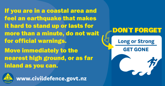
The Civil Defence earthquake-tsunami mantra, “Long or strong, get gone” is not argued with here as potentially life-saving general education. But Christchurch’s experience of the 14.11.16 Waiau quake was ‘moderately long but not strong’ so it was not valid cause for fearful running from local shores or for official alarm-sounding. The alarm was therefore a misguided political act: to satisfy public expectations (of an alarm) incorrectly set. Let us work together now to repair this widely cast misconception of risk and relevant response.

nzmcdem-tsu

[1] Generosity of strangers wins out for Christchurch family burgled after quake http://www.stuff.co.nz/the-press/news/86419856/Generosity-of-strangers-wins-out-for-Christchurch-family-burgled-after-quake + Robbed Christchurch family to share proceeds with other quake victims
http://www.stuff.co.nz/national/nz-earthquake/86494324/Robbed-Christchurch-family-to-share-proceeds-with-other-quake-victims + More than 1000 donors give $40,000 to family burgled after tsunami evacuation http://www.stuff.co.nz/national/crime/86473880/more-than-1000-donors-give-40000-to-family-burgled-after-tsunami-evacuation + ‘Vultures’ stole Christchurch father’s van as he prepared to evacuate family after quakes http://www.stuff.co.nz/the-press/news/86529225/vultures-stole-christchurch-fathers-van-as-he-prepared-to-evacuate-family-after-quakes + Thieves still at large after Christchurch earthquake evacuee homes burgled http://www.stuff.co.nz/the-press/news/86571543/thieves-still-at-large-after-christchurch-earthquake-evacuee-homes-burgled

[2] Tweet: “MCDEM ‏@NZcivildefence Nov 13 [UTC] People on the east coast (including the Chatham Islands) close to the epicentre can expect waves of 3-5 metres. Move to high ground #eqnz”
Earthquake: Deaths, major damage after severe 7.5 quake hits Hanmer Springs, tsunami warning issued “One person died at a property at Mt Lyford, north of Christchurch. The low-lying seaside suburb of Sumner was deserted after residents evacuated, and schools closed for the day. Lyttelton tunnel has been closed until further notice. A New Brighton family who evacuated their home after the quake returned to find their house ransacked by burglars. Matt Mill said they family-of-four had left their home about 2am, after the tsunami risk was broadcast. They returned to their Bower Ave home about 6.30am to find their home damaged, not from the shaking, nor any tsunami, but by burglars who took advantage of a suburb empty of people. Mill said the burglars stole televisions, sports gear and distressingly, a transmitter for his daughter’s hearing aid. His work truck was also stolen. Linwood resident Alice Coats said the tsunami sirens have been going went off intermittently for a couple of hours. The quake felt like a long wave, Coats said. ‘So, we all knew it was a big one.’ As soon as the tsunami warning came in, it was a little more frightening, so she jumped into her car with her flatmate, and went to the airport. Coats said the vagueness of the Civil Defence warnings were frustrating. Tsunami sirens started sounding along Christchurch’s coastline at 2.14am. A significant amount of traffic moved away from New Brighton and other coastal suburbs towards central Christchurch and the Port Hills. Police and Civil Defence have closed the tunnel (State Highway 74), which links Christchurch with the seaside suburb of Lyttelton. The tunnel has been closed temporarily for checks following previous large earthquakes. In the CBD, hotels and occupied buildings were evacuated.” http://www.stuff.co.nz/national/86416268/Earthquake-Deaths-major-damage-after-severe-7-5-quake-hits-Hanmer-Springs-tsunami-warning-issued 14 November 2016 +
Earthquake: Tsunamis hit, warnings downgraded “Several evacuation centres had been set up in the Waimakariri district, north of Christchurch. Welfare centres had been set up at the Woodend Community Centre, Rangiora Baptist Church, Oxford School Hall, and the Kaiapoi Rugby Club. Linwood College has been set up as a evacuation point for people who have left their home in Christchurch.. People living on low-lying ground within one kilometre of the Christchurch coastline had earlier been advised to evacuate inland or to higher ground as a precaution. Tsunami sirens activated at 2.14am in Christchurch’s coastal suburbs, more than an hour after the first tsunami warnings were issued by Civil Defence. The sirens, located from Brooklands to Taylors Mistake, were meant to sound for about 10 minutes to alert residents they could need to evacuate. A significant amount of traffic could be seen heading away from New Brighton and other coastal suburbs towards central Christchurch and the Port Hills. Early on Monday morning police were driving around the New Brighton area with flashing lights on” http://www.stuff.co.nz/national/nz-earthquake/86416653/cheviot-quake-tsunami-warnings-issued (oh-so-wrong?) MCDEM graphic:

Ministry graphic 141116

NZ Ministry of Civil Defence & Emergency Management graphic 141116 – ref. http://twitter.com/NZcivildefence

Coastal Christchurch residents criticise delay in tsunami warning system “A delay activating tsunami warning sirens could have been life-threatening to those living in Christchurch beach suburbs, residents say. Some are demanding answers as to why sirens did not sound until about 2am, two hours after the magnitude-7.5 earthquake struck and an hour after the national civil defence website instructed coastal residents to move to higher ground immediately. ‘Something needs to be done,’ New Brighton resident Shanna Howden said. If there had been a large wave, Howden questioned whether people could have escaped in time. Heavy traffic and bad roads meant it took 45 minutes for them to get out of New Brighton. ‘There must be a way to put something in place to make it a smoother process,’ she said. Tsunami warnings come from the Ministry of Civil Defence and Emergency Management (MCDEM) in Wellington but local authorities are responsible for civil defence emergency management in their own areas. MCDEM posted its first tsunami warning on its website at 1am. The warning was repeated at 1.30am and not lifted until 3.39am. In Christchurch, the tsunami sirens began at 2am and sounded well beyond dawn. However, messages sent by the ministry to the duty officer at the Christchurch City Council and the Canterbury civil defence emergency management group were less clear. Christchurch mayor Lianne Dalziel said she was more interested in learning from the experience than casting blame. ‘I don’t know what went wrong but it’s important we fix this.’ Canterbury civil defence emergency group controller Neville Reilly said the council’s duty officer had relied on the group’s advice. The group’s decision to wait a couple of hours before firing the sirens was done in consultation with a tsunami scientist but without the knowledge that MCDEM was already instructing evacuation on its website. ‘It would have been nice if there wasn’t the confusion coming from emails which were different from the website,’ he said. ‘The worst thing you want to do is cry wolf although safety is paramount. There’s no black and white.’ MCDEM was unable to respond on Monday.” http://www.stuff.co.nz/national/nz-earthquake/86439726/coastal-christchurch-residents-criticise-delay-in-tsunami-warning-system 14 November 2016
Christchurch Star https://issuu.com/the.star/docs/116322cs 17 November 2016 (censored?)
Civil Defence overhaul ‘inevitable’ after tsunami warning confusion: Govt 17 November 2016 http://www.stuff.co.nz/national/86441740/civil-defence-overhaul-inevitable-after-tsunami-warning-confusion-govt
GNS: Tsunami caught us by surprise http://www.radionz.co.nz/news/kaikoura-earthquake/318506/gns-tsunami-caught-us-by-surprise 20 November 2016 + Govt to push for tsumani text message system http://www.radionz.co.nz/news/national/318473/govt-to-push-for-tsumani-text-message-system
Civil Defence’s earthquake response to be reviewed http://www.radionz.co.nz/news/kaikoura-earthquake/318584/civil-defence’s-earthquake-response-to-be-reviewed 21 November 2016
Minister criticises GeoNet’s funding call http://www.radionz.co.nz/news/kaikoura-earthquake/318618/minister-criticises-geonet’s-funding-call 22 November 2016
Review of tsunami alerts likely after Kaikoura earthquake “All in all the response to the early morning Kaikoura earthquake seems to have been a bit of a shambles. Frightening for some and a non-event for others.. warning came out from National Civil Defence at 1.20am. Problems had hit the MCDEM website just after 1am with people advised to follow updates on their Facebook and Twitter instead.” http://www.stuff.co.nz/national/nz-earthquake/86742260/review-of-tsunami-alerts-likely-after-kaikoura-earthquake 24 November 2016 Comment:
“Straw Man – please decommission the Christchurch ones too. They caused unnecessary panic and are not even required. Many hours to evacuate in the case of a large tsunami, and not required for local quakes – there is no sub-duction zone off the ChCh coast. And yes, im aware of the 0.5m tsunami from the Kaikora EQ. It was not worth evacuating thousands of people. There was more risk of death or injury resulting from panicking drivers doing dumb things. Also, Pegasus bay does not funnel the swell into a confined space such as little pidgeon bay either. Start with a little education a[nd] ditch this ridiculous culture of fear that we have developed.”

etc

Watch 15 Years Of Earthquakes Rock The Planet
http://www.huffingtonpost.com/entry/earthquake-animation-noaa-pacific-tsunami_us_58420f7ce4b0c68e0480f908? 2 December 2016

9 December 2016
Huge earthquake hits off Solomons, sparks tsunami warning for New Zealand “The earthquake triggered possible tsunami threats across the Pacific. Waves between one metre and 3m were possible along some coasts of the Solomon Islands, with waves from 30cm to 1m possible in Papua New Guinea and Vanuatu, the US Pacific Tsunami Warning Center predicted. A tsunami watch for New Zealand had been issued, but since cancelled by Civil Defence” http://www.stuff.co.nz/world/south-pacific/87378899/Huge-earthquake-hits-off-Solomons-sparks-tsunami-warning-for-New-ZealandLive: Huge earthquake strikes Solomon Islands http://www.stuff.co.nz/world/south-pacific/87379714/Live-Huge-earthquake-strikes-Solomon-IslandsInitial reports suggest ‘3000 people affected’ by earthquake off Solomon Islands “A tsunami watch for New Zealand had been issued, but since cancelled by Civil Defence. Civil Defence continued to advise people to stay out of the water owing to the threat of unusual currents, but said there was no threat to beaches and land. Earlier, Civil Defence controller Sarah Stewart-Black had told RNZ this was ‘not the same situation as after the Kaikoura earthquake’. The US Pacific Tsunami Warning Center said tsunami waves were forecast to be less than 30cm for New Zealand. They could take 4-5 hours to arrive, Civil Defence said. Waves between one metre and 3m were possible along some coasts of the Solomon Islands, with waves from 30cm to 1m possible in Papua New Guinea and Vanuatu, the US authority predicted” http://www.stuff.co.nz/world/south-pacific/87378899/81-magnitude-earthquake-hits-solomons–usgs + Magnitude 6.5 earthquake strikes off coast of Northern California “no tsunami warning, advisory or threat in effect following the earthquake”
http://www.stuff.co.nz/world/americas/87378423/Magnitude-6-5-earthquake-strikes-off-coast-of-Northern-California

16 December 2016
Selwyn Tsunami evacuation plan
http://www.star.kiwi/2016/12/selwyn-tsunami-evacuation-areas/

20 December 2016
Tsunami evacuation plan kept under wraps “New Brighton residents are furious a tsunami evacuation plan for the area, which could have prevented the traffic chaos, was kept under wraps”
http://www.star.kiwi/2016/12/tsunami-evacuation-plan-kept-under-wraps/

21 December 2016
Coping with an increased risk of quakes “are we in the midst of a period of heightened risk?” asserts random dispersion, no pattern to recent large earthquakes: “The 7.8 Kaikoura quake was one of four earthquakes greater than Magnitude 7 in the last 7 years, and one of only five tremors of that magnitude or larger ever recorded in New Zealand. A similar period of increased activity was seen between 1929 and 1942 when New Zealand experienced a third of all earthquakes of magnitude 7 or larger recorded in the last 160 years..” http://www.radionz.co.nz/national/programmes/ninetonoon/audio/201828532/coping-with-an-increased-risk-of-quakes

25 December 2016
M 7.6 – ISLA CHILOE, LOS LAGOS, CHILE – 2016-12-25 14:22:26 UTC
http://www.emsc-csem.org/Earthquake/earthquake.php?id=555101
http://www.prh.noaa.gov/hnl/tsunami_msgs/HEBTIBHWX.201612251632

26 December 2016
Book details Wheatsheaf flood after earthquake 1868 & 1960
http://www.star.kiwi/2016/12/book-details-wheatsheaf-flood-after-earthquake/

9 January 2017
Tsunami evacuation spurs action “Civil Defence will be boosted in Little River and Birdlings Flat after residents living near the sea had nowhere to evacuate to after the 7.8 magnitude earthquake on November 14”
http://www.star.kiwi/2017/01/tsunami-evacuation-spurs-action/

11 January 2017
Earthquake rattles Wellington and the upper South Island “hit at 1.19pm on Wednesday, jolting office workers across the capital” http://www.stuff.co.nz/national/nz-earthquake/88313350/Earthquake-rattles-Wellington-and-the-upper-South-Island

12 January 2017
Water in Marlborough aquifers rises after 7.8-magnitude earthquake “gaps between the gravel that formed the aquifers had shrunk, causing wells to spill over.. too early to say whether the 7.8-magnitude quake had caused any permanent damage to the underground water network” http://www.stuff.co.nz/environment/88274851/water-in-marlborough-aquifers-rises-after-78magnitude-earthquake

[post under edit – return to read more later – thanks for viewing]

Changes to follow tsunami confusion in Christchurch 7 April 2017
http://www.stuff.co.nz/the-press/news/91330663/changes-to-follow-tsunami-confusion-in-christchurch

Tsunami evacuations: What went wrong? 7 April 2017
http://www.star.kiwi/2017/04/tsunami-evacuations-what-went-wrong/

Plan to improve tsunami response released “staff, police and Mayor Lianne Dalziel were confused about conflicting messages between national and local Civil Defence” 12 August 2017
http://www.star.kiwi/2017/08/plan-to-improve-tsunami-response/

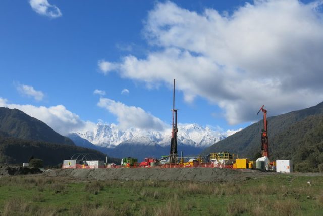
The real and major risk for mid-Canterbury is not coastal – Project AF8: http://projectaf8.co.nz/ – Alpine Fault Magnitude 8

GNS Science head office, like most New Zealand government, resides in Wellington region. There, existential angst competes heavily with Auckland for economic weight and centre of gravity. So Wellington treats the South Island as a private back yard – to be seen, not heard, exploited for all it is worth and insistently ignored and mis-spoken for. ‘It is all about us’, believes the capital, almost always. This hard-to-dislodge perspective explains constant nonsense from official sources over the 14-Nov-2016 magnitude-7.8 earthquake, particularly where it actually took place (and what it did). You would think GNS could not read a map or never travelled a secondary highway, to have located this earthquake as “Culverden”. They have a convention of approximating, to name larger centres that people may have heard of, only. This generalising is unhelpful. Locating the historically-large earthquake accurately is key to understanding it and its implications.

This was a “Wairau” earthquake, as the epicentre map shows – so why aren’t the authorities saying that? Why has this earthquake become about “Wellington” and “Kaikoura” exceptionally? Yes, people have sadly died or become most isolated in the latter town, and have our condolences and full support through that, with buildings lost at both places. But this is governance by spin: intentional confusion to deflect risk – to benefit who, we may ask? Tsunami alarm and quake interpretation questions abound – what is really happening? Where is it happening? Public discourse to be urgently joined. Lives depend on getting this very public knowledge correct.

Canterbury magnitude 5 to 7.8 EQs 13-21 Nov2016

Canterbury magnitude 5 to 7.8 earthquake and aftershocks, 13-21 November 2016 – http://quakesearch.geonet.org.nz

For comparison, Marlborough magnitude 5 to 6 earthquakes, 13-18 November 2016

For comparison, Marlborough magnitude 5 to 6 aftershocks, 13-21 November 2016 – much fewer and smaller

Canterbury 7.8-magnitude earthquake epicentre 141116

Canterbury 7.8-magnitude earthquake epicentre 14Nov2016 http://www.geonet.org.nz/quakes/region/newzealand/2016p858000

Journalists often muddy the water – Cheviot earthquake: Tracing the source of the 7.5 magnitude quake “It appeared to have been a complex earthquake, and scientists were looking into whether it ruptured two separate fault planes, or whether it could be considered just a single rupture. The epicentre of the quake was close to the Hope Fault. The Kaikoura area, where the Hope Fault went offshore, was strongly affected. Despite that, the pattern of events did not necessarily suggest a Hope Fault event, [GNS Science duty seismologist Dr Anna] Kaiser said. The Hope Fault was one of the major faults through Marlborough and North Canterbury that marked the boundary between the Pacific and Australian Plates. Those faults merged near Otira to form the Alpine Fault, which ran along the western edge of the Southern Alps. Looking back over hundreds of thousands of years, the Hope Fault was considered to have one of the highest slip rates among those faults. It was an important structure in accommodating plate movement in that part of the country, Kaiser said. ‘This earthquake occurred right along that line of very active deformation.’ The Marlborough fault system was a kind of transition zone between the Alpine Fault and the subduction interface between the tectonic plates under the North Island. ‘So far, it doesn’t look to be the Hope Fault, rather (and perhaps more concerning) it seems to have ruptured across the Hope Fault,’ USGS seismologist Professor Kevin Furlong said. ‘Most/many aftershocks extend to Cook Strait, implying that the rupture may have extended quite a bit to the north. One concern is whether this has involved any of the subduction plate boundary that starts up at Kaikoura and extends along the [east coast of the] North island. At a minimum, it may have changed the stress conditions on the main megathrust interface – we are exploring that possibility right now'” – deftly shifting the focus to Wellington.
http://www.stuff.co.nz/national/86416880/cheviot-earthquake-tracing-the-source-of-the-quake 14 November 2016
Research https://www.gns.cri.nz/Home/News-and-Events/Media-Releases/Rutherford-Award 11 November 2016

Naming the river floodplains involved is extremely important as these often follow fault lines, in north Canterbury and Marlborough especially – a crucial point for understanding the moving landscape: what is moving, why and when. The Wairau event aftershock trace mostly identifies the Hope Fault, joining directly as it does the massive offshore-Kaikoura Hikurangi Trough (to the Alpine Fault). It is ultimately movement in this huge connected structure that we see affecting land. Seismic force and aftershocks moving in the direction of Wellington should not be confused with the substantive event, but they have been, influential as they are.

Canterbury aftershocks, 14-21 November 2016

Canterbury aftershocks, 14-21 November 2016 – http://quakesearch.geonet.org.nz/

Canterbury aftershocks, 14-21 November 2016

Canterbury aftershocks, 14-21 November 2016 – http://www.christchurchquakemap.co.nz/week

Canterbury aftershocks, 14-21 November 2016 - far view

Canterbury aftershocks, 14-21 November 2016 – http://www.christchurchquakemap.co.nz/week – far view

The zoom out illustrates two things: the offshore trench-fault that runs through land north of Kaikoura as the Hope Fault; that aftershocks are now reaching and accumulating stress along this at the Alpine Fault to the west.

GNS add to confusion – M7.8 Kaikoura quake the biggest since the Dusky Sound jolt in 2009 – 15/11/2016 “Named the Kaikoura earthquake, scientists are describing it as a complex rupture sequence that produced ground-shaking that lasted for about two minutes and was felt throughout the country. It was centered east of Hanmer Springs at a depth of 15km” https://www.gns.cri.nz/Home/News-and-Events/Media-Releases/M7.8-Kaikoura-quake 14 November 2016 – are they afraid of naming Waiau (and Hope)?

The focus is kept upon effects in the Wellington area – Seismologists record 2 metre shift south of Marlborough “The largest aftershocks were close to the Hope Fault, the line running across the centre of the map. The earth moved two metres to the north in Marlborough during Monday morning’s major earthquake, according to data from GNS Science.. the ground moved horizontally 2 metres to the north and vertically down a metre”

www.USGS.gov ground force map for 141116

http://www.USGS.gov ground force map for 141116

http://www.stuff.co.nz/national/nz-earthquake/86429681/seismologists-record-2-metre-shift-south-of-marlborough 14 November 2016 – local info presented may always be the best.

Sensational coverage becomes the fact: ‘Absolutely mind blowing’: Aerial photos ‘show seabed lift’ north of Kaikoura https://nz.news.yahoo.com/a/33218262/absolutely-mind-blowing-aerial-photos-show-seabed-lift-north-of-kaikoura/#page1 + Wellington Earthquake: If it struck at a different time, it could have been “much worse” http://www.stuff.co.nz/national/nz-earthquake/86453972/earthquake-if-it-struck-at-a-different-time-it-could-have-been-much-worse 15 November 2016

New Zealand’s Tectonic Dragon Awakens “beneath its verdant carpet, New Zealand is still under active construction. It occupies one of the most complex geologic venues on the globe, at the messy boundary of two tectonic plates.. violent, episodic upheavals that shake the seemingly tranquil hills” http://www.newyorker.com/tech/elements/new-zealands-tectonic-dragon-awakens 15 November 2016

Christchurch councils sends staff, resources to quake-hit Kaikoura https://ccc.govt.nz/the-council/newsline/show/1169 15 November 2016

GeoNet Kaikoura earthquake update: Magnitude revised http://info.geonet.org.nz/display/home/2016/11/16/Kaikoura+earthquake+update%3A+Magnitude+revised 16 November 2016 + ref. http://earthquake.usgs.gov/earthquakes/
M7.8 – 53km NNE of Amberley, New Zealand
2016-11-13 11:02:56 UTC 42.757°S 173.077°E 23.0 km depth
http://earthquake.usgs.gov/earthquakes/eventpage/us1000778i#executive +
Magnitude Mw 7.9
Region SOUTH ISLAND OF NEW ZEALAND
Date time 2016-11-13 11:02:58.4 UTC
Location 42.69 S ; 172.97 E
Depth 10 km
http://www.emsc-csem.org/Earthquake/earthquake.php?id=545040 7.9
http://www.emsc-csem.org/Earthquake/earthquake.php?id=545057 6.4
http://www.emsc-csem.org/Earthquake/earthquake.php?id=545073 6.1
http://www.emsc-csem.org/Earthquake/earthquake.php?id=545103 6.2
+ http://earthquake.usgs.gov/earthquakes/map/ (current)

While At quake’s epicentre, residents of Waiau watch helicopters destined for elsewhere “Waiau, population 280, is slowly returning to normality following the 7.8-magnitude earthquake that struck five kilometres away.. The town’s water supply has been restored but a separate feed to all rural properties was badly damaged and still broken. [Hamish] Dobbie said the council was working “really hard” to assist farmers who were running low on stock water. He hoped to have the water flowing in about a week. It has been a bitter pill to swallow for the community already struggling through a drought – a disaster within a disaster. Farmers near Waiau waved desperately at helicopters headed for Kaikoura, hoping they would stop.. It was hard not to feel forgotten as helicopters headed for Kaikoura, considering that Waiau was at the centre of it all. ‘I feel Waiau was a bit left out,” [Brenda] Smith said. ‘Even when it was first reported it was so many [kilometres] from Culverden, so many [kilometres] from Hanmer. I get it, we’re all hurting and Kaikoura is isolated … but yeah.'” http://www.stuff.co.nz/national/nz-earthquake/86594300/waiau-farmers-face-weeks-wait-for-water + Civil Defence overhaul ‘inevitable’ after tsunami warning confusion: Govt http://www.stuff.co.nz/national/86441740/civil-defence-overhaul-inevitable-after-tsunami-warning-confusion-govt + Mayor thanks those involved in evacuation effort https://ccc.govt.nz/the-council/newsline/show/1186 17 November 2016

Quake sparked more movements in Marlborough faults than first thought http://www.radionz.co.nz/news/national/318248/quake-sparked-more-movements-in-marlborough-faults-than-first-thought 17 November 2016

“Scientists know a tide gauge at Kaikoura rose 90cm during Monday’s magnitude-7.8 earthquake, but that’s one of the few pieces of detailed data so far about how much the level of the coastline has risen. There is also information about land movement from a network of continuous GPS stations run by GeoNet and Linz showing a rise of around a metre at Cape Campbell, at the southern end of Clifford Bay. Data from the stations also show Cape Campbell moved horizontally northeast by 2-3 metres. ..Many anecdotal reports suggest a two-metre rise at the coast, and there’s even one report of a reef rising six metres”
http://www.stuff.co.nz/national/86565581/finding-out-how-much-the-earth-moved-during-massive-earthquake 18 November 2016

Quake action formed Hanmer Springs but latest quake passed it by “The Hanmer Fault runs right through the township and is the noticeable rise you go up as you head north towards the pools. On the other side of the basin lies the Hope Fault, one of the major seismic features of the region which starts at the Alpine Fault near Inchbonnie on the West Coast and slices its way across North Canterbury before heading offshore just north of Kaikoura. It’s this eastern part of the Hope Fault that some scientists now believe could be at risk of rupturing if enough stress has been transferred on to it from Monday’s large quake.. GeoNet director Dr Ken Gledhill said the quake rupture took the path of least resistance northeastwards up the coast from close to Waiau where it began. ‘It’s kind of strange, it’s like the epicentre in this case is almost a meaningless concept.’ It’s where the action started but it must have started weakly and then slowly built up steam. So Hanmer just happened to be relatively close to where the epicentre, but not the real action, was. The real burst of energy that contributed to most of the magnitude was between Kaikoura and Cape Campbell. It raced up towards Cape Campbell and then it basically stopped.’ Fortunately, Cook Strait, with its offset faults, had acted like a barrier and halted the quake in its tracks, Gledhill said. It was the sudden deceleration which raised the coastal strip by up to 1 metre and shunted that part of the South Island 2m closer to Wellington, rather like a car braking sharply to a stop and the passengers being thrown suddenly up and forward. If you could create a big-enough map of the northern South Island and southern North Island you would be able to see how the islands have stretched, shrunk and otherwise changed shape since 12.02am on Monday. The quake moved Kaikoura about 1m further northeast and upwards 70 cm, and Hanmer Springs jumped east about 50 cm. Wellington and the Kapiti Coast are now 2 to 6cm further north, Christchurch and Banks Peninsula have shifted 2cm south and some parts of the West Coast are now 10cm closer to Canterbury than they were” http://www.stuff.co.nz/national/nz-earthquake/86554866/quake-action-formed-hanmer-springs-but-latest-quake-passed-it-by 18 November 2016

NIWA diverts ship to earthquake areas https://niwa.co.nz/news/niwa-diverts-ship-to-earthquake-areas 18 November 2016

CCC Coastal residents urged to have evacuation plan
https://ccc.govt.nz/the-council/newsline/show/1190

GNS Kaikoura shoreline movement, 14 Nov 2016

GNS Kaikoura shoreline movement, 14 Nov 2016

‘Startling’ rise of 5.5 metres in piece of coastline during Kaikoura earthquake confirms quake energy has spanned the Hope Fault – the Kekerengu Fault has just moved about 10 metres horizontally, or about half of its 20-25m known movement per 1,000 years. That much sudden, imminent movement is scarily awesome. Note the Hope Fault is near where shoreline rise has been the greatest, at 3-3.5 metres. http://www.stuff.co.nz/national/86703833/startling-rise-of-55-metres-in-piece-of-coastline-during-kaikoura-earthquake 21 November 2016

Greedy, short-sighted economic actors are multipliers of natural risk. Korean charter flights pulled post earthquake – “The tourism industry and government agencies were also deliberately calling it the ‘Kaikoura earthquake’ because referring to north Canterbury gave the impression that Christchurch had been affected, when it had not”
http://www.stuff.co.nz/business/86604299/korean-charter-flights-pulled-post-earthquake 18 November 2016

We must remember, and anticipate, the main event.

And the Wellington earthquake – in the South Island – origins.

This 7.8 was exactly where I forecast and warned of, as next in the Canterbury earthquake sequence we are – if lucky, or god will it – living through.

More information: https://www.gns.cri.nz/Home/Our-Science/Natural-Hazards/Recent-Events/Kaikoura-Earthquake

RadioNZ
There was never a risk of a tsunami, says seismologist “We are way over-playing the size and the role of tsunamis. And this is happening in a lot of other places too, because unfortunately we are in a period of science where, to get funding, you have to scare the hell out of the public.” http://www.radionz.co.nz/news/national/318338/there-was-never-a-risk-of-a-tsunami,-says-seismologist 18 November 2016
Stories from the quakes Insight http://www.radionz.co.nz/national/programmes/insight/audio/201824385/insight-earthquake-surviving-7-point-8 19 November 2016
GNS: Tsunami caught us by surprise http://www.radionz.co.nz/news/kaikoura-earthquake/318506/gns-tsunami-caught-us-by-surprise +
Govt to push for tsumani text message system http://www.radionz.co.nz/news/national/318473/govt-to-push-for-tsumani-text-message-system 20 November 2016
Civil Defence’s earthquake response to be reviewed http://www.radionz.co.nz/news/kaikoura-earthquake/318584/civil-defence’s-earthquake-response-to-be-reviewed +
Crayfish and pāua fisheries shut down on quake-hit coast http://www.radionz.co.nz/news/kaikoura-earthquake/318599/’high-and-dry,-and-now-unfortunately-rotting’ +
Quake-hit Kaikōura still isolated by road http://www.radionz.co.nz/news/kaikoura-earthquake/318538/quake-hit-kaikoura-still-isolated-by-road 21 November 2016
Minister criticises GeoNet’s funding call http://www.radionz.co.nz/news/kaikoura-earthquake/318618/minister-criticises-geonet’s-funding-call 22 November 2016

21 November 2016
Morning, Nine to Noon on http://www.radionz.co.nz News, Dr Kelvin Berryman for GNS Science discusses 14.11.2016 mag-7.8 quake fault research results and questions at variance from USGS findings (no link readily available)

This evening’s television illustrated the overwhelming interest we all have in our own local geological hazards: TV1 Seven Sharp asked ‘Is the capital in the right place?’ (lost link?); while TV3 Story looked at new research modelling of an Auckland tsunami.

22 November 2016
Scientists detect huge fault rupture offshore from Kaikoura
https://niwa.co.nz/news/scientists-detect-huge-fault-rupture-offshore-from-kaikoura
Huge fault rupture stretches 34km offshore from Kaikoura http://www.stuff.co.nz/sunday-star-times/latest-edition/latest-news/86752499/Huge-fault-rupture-stretches-34km-offshore-from-Kaikoura

The best clear explanation, through animations, of how the 7.8-magnitude earthquake propagated and exactly which faults where did move the earth, though again generalising the start as “near Culverden”:
Watching the M7.8 Kaikoura Quake Dominos Fall in Real Time

GNS M7.8 Kaikoura Quake Dominos video 2

GNS M7.8 Kaikoura Quake Dominos video 2

http://info.geonet.org.nz/display/quake/2016/11/23/Watching+the+M7.8+Kaikoura+Quake+Dominos+Fall+in+Real+Time

Tremors rattle Hawke’s Bay as ‘silent earthquake’ shunts East Coast after 7.8 quake http://www.stuff.co.nz/national/86715367/Tremors-rattle-Hawkes-Bay-as-silent-earthquake-shunts-East-Coast-after-7-8-quake

Magnitude-5.7 big aftershock that GNS generalises unhelpfully again as “Culverden” area, when it has badly affected Scargill township where a whole new quake sequence is located in their Hurunui River tributary valley. Far too vague! http://www.radionz.co.nz/news/national/318713/aftershock-damages-north-canterbury-homes
http://www.stuff.co.nz/national/86758316/Earthquake-Aftershocks-rumble-through-night-after-5-7-shake
This is what preceded the Scargill mag-5.7, by 1 minute and 23 seconds, a local foreshock of 4.8:

GNS screenshot 2016-11-22 Scargill 4.8-magnitude foreshock aftershock

GNS screenshot 2016-11-22 Scargill 4.8-magnitude foreshock aftershock

http://www.geonet.org.nz/quakes/region/newzealand/2016p881666 83 seconds before
http://www.geonet.org.nz/quakes/region/newzealand/2016p881669 magnitude-5.7 Scargill quake

23 November 2016
The Future of New Zealand’s Coastlines
“The massive uplift after the 7.8 magnitude quake has changed Kaikoura’s coastline significantly. With a new reef forming as the land moved up, by as much as six metres along the fault plain. But do we know what the future of New Zealand’s coastline will look like? Just-published tectonic research gives some insight into what sea levels could be in the future. And the satellitle observations show parts of New Zealand, are sinking at faster rates than others, and will be subjected to higher levels of future sea level rise. Co-author of the research is Professor Tim Stern, of Victoria University’s School of Geography, Environment and Earth Sciences.” – RadioNZ Afternoons 231116

Prof Tim Stern research RadioNZ 231116

Prof Tim Stern research RadioNZ 231116

http://www.radionz.co.nz/national/programmes/afternoons/audio/201825015/the-future-of-new-zealand’s-coastlines

24 November 2016
Geonet ‘puzzled’ by aftershock sequence following the Kaikoura quake http://www.stuff.co.nz/national/86813422/geonet-puzzled-by-aftershock-sequence-following-the-kaikoura-quake
West Coast Civil Defence retracts ‘large aftershock’ warning http://www.newshub.co.nz/nznews/west-coast-warned-to-prepare-for-possible-massive-aftershock-2016112418
https://www.westlanddc.govt.nz/update-west-coast-civil-defence
http://www.wcrc.govt.nz/our-services/civil-defence-emergency-management/Pages/
Rotorua Museum closed over quake-damage concerns http://www.radionz.co.nz/news/kaikoura-earthquake/318833/rotorua-museum-closed-over-quake-damage-concerns

25 November 2016
West Coast Civil Defence aftershock warning ‘irresponsible’ – Mayor http://www.newshub.co.nz/nznews/west-coast-civil-defence-aftershock-warning-irresponsible—mayor-2016112510
Large aftershocks a possibility, but there are no ‘urgent warnings’ http://www.stuff.co.nz/national/nz-earthquake/86852615/large-aftershocks-a-possibility-but-there-are-no-urgent-warnings + Earthquake: Large aftershock urgent warning criticised “West Coast Civil Defence regional manager Chris Raine.. ‘an area in the Arthurs Pass just to the west of the divide is generating small earthquakes with several in the last few days that are being felt in Westland’.. [then CD chief] Stuart-Black said ‘Right from day one I’ve been saying that there is a likelihood that we would experience another large aftershock which could be as big as what we experienced just after midnight on 14th but could in fact be potentially larger’ http://www.stuff.co.nz/national/nz-earthquake/86863920/earthquake-large-aftershock-urgent-warning-criticised
So no news is good news? – http://www.civildefence.govt.nz/resources/declared-states-of-emergency/ – where are the official media releases from MCDEM? See https://www.facebook.com/NzGetThru/posts/1237250506334040 etc + https://www.facebook.com/CanterburyEM/
CCC – “The local state of emergency that has been in place in Canterbury for the past week has been extended until November 29” – https://ccc.govt.nz/the-council/newsline/show/1187 + “Self evacuate – don’t wait for the tsunami sirens – if it’s long or strong, get gone” – https://ccc.govt.nz/services/civil-defence/what-to-do-in-an-emergency/tsunami/evacuating/
GeoNet M7.8 Kaikoura Quake: Future Scenarios and Aftershock Forecasts Update 25 Nov 2016 15.00
“Scenario Three: Extremely unlikely (<1% within the next 30 days)
A much less likely scenario than the previous two scenarios is that recent earthquake activity will trigger an earthquake larger than the M7.8 mainshock. This includes the possibility for an earthquake of greater than M8.0, which could be on the 'plate interface' (where the Pacific Plate meets the Australian Plate). Although it is still very unlikely, the chances of this occurring have increased since before the M7.8 earthquake." http://info.geonet.org.nz/display/quake/2016/11/14/M7.8+Kaikoura+Quake%3A+Future+Scenarios+and+Aftershock+Forecasts + Stress and the earthquakes http://info.geonet.org.nz/pages/viewpage.action?pageId=20545958

26 November 2016
Central New Zealand shaken awake by magnitude 4.6 Cook Strait earthquake http://www.stuff.co.nz/national/86900233/Central-New-Zealand-shaken-awake-by-magnitude-4-6-earthquake
Updated: Gisborne and Hawke’s Bay slow-slip event now extends to include Kapiti and Manawatu regions following M7.8 Kaikoura Quake http://info.geonet.org.nz/display/quake/2016/11/21/Updated%3A+Gisborne+and+Hawke%27s+Bay+slow-slip+event+now+extends+to+include+Kapiti+and+Manawatu+regions+following+M7.8+Kaikoura+Quake

GNS slow-slip movements 26Nov2016

GNS slow-slip movements 26Nov2016

27 November 2016
‘Strong’ magnitude 4.8 quake rattles central New Zealand https://www.tvnz.co.nz/one-news/new-zealand/strong-magnitude-4-8-quake-rattles-central-new-zealand

28 November 2016
Three sharp earthquakes rattle central NZ, jolts continue overnight http://www.stuff.co.nz/national/nz-earthquake/86926530/Three-sharp-earthquakes-rattle-central-NZ-jolts-continue-overnight
Rotorua woken by 30m geyser eruption http://www.newshub.co.nz/nznews/rotorua-woken-by-30m-geyser-eruption-2016112810
‘The village is erupting!’ Water shot 30m into the air on Lake Rotorua, giving locals a fright https://www.tvnz.co.nz/one-news/new-zealand/village-erupting-water-shot-30m-into-air-lake-rotorua-giving-locals-fright
Rotorua geyser erupts like a shaken bottle of fizzy drink http://www.radionz.co.nz/news/national/319092/geyser-erupts-like-a-shaken-bottle-of-fizzy-drink + Geyser eruption sends water 30m into the air http://www.radionz.co.nz/national/programmes/checkpoint/audio/201825617/geyser-eruption-sends-water-30m-into-the-air
Geyser eruptions in Rotorua coincide with earthquake activity http://www.stuff.co.nz/national/86935777/Geyser-eruptions-in-Rotorua-coincide-with-earthquake-activity
Kaikoura quake could be behind ‘silent earthquakes’ http://www.radionz.co.nz/news/national/319093/kaikoura-quake-could-be-behind-‘silent-earthquakes&#8217;
Slow-slip earthquakes detected in Kapiti and Manawatu, joining Gisborne and Hawke’s Bay http://www.stuff.co.nz/national/86927682/Slow-slip-earthquakes-detected-in-Kapiti-and-Manawatu-joining-Gisborne-and-Hawkes-Bay
Watch: Incredible new images from space show how Kaikoura’s earth jolted apart https://www.tvnz.co.nz/one-news/new-zealand/watch-incredible-new-images-space-show-kaikouras-earth-jolted-apart?auto=5225981168001

29 November 2016
‘Unusual’ geothermal activity at Lake Rotorua – GNS
http://www.newshub.co.nz/nznews/unusual-geothermal-activity-at-lake-rotorua-2016112823
Are earthquakes and geyser eruptions related? ‘No, Taupo and Tarawera eruptions have a roughly 1,000 year return period, Auckland every 1-2,000 years..’
http://www.newshub.co.nz/tvshows/paulhenry/are-earthquakes-and-geyser-eruptions-related-2016112913
Scientists’ research trench slips nine metres in Kaikoura Earthquake http://www.stuff.co.nz/science/86972668/scientists-research-trench-slips-nine-metres-in-kaikoura-earthquake

30 November 2016
Another geyser erupts in Rotorua
http://www.newshub.co.nz/nznews/another-geyser-erupts-in-rotorua-2016113015
Weather might have caused second eruption in Rotorua http://www.radionz.co.nz/news/national/319291/weather-might-have-caused-second-eruption-in-rotorua

Become better prepared – https://happens.nz

USGS 141116 mag-7.8 shakemap - Waiau

USGS 141116 mag-7.8 shakemap – Waiau – http://earthquake.usgs.gov/earthquakes/eventpage/us1000778i#map

This USGS shake-intensity map locates: a) the Pacific plate and Australian plate tectonic boundary; b) Wairau River as central to the mag-7.8 EQ fault action – confirmed (therefore USGS have this epicentre listed wrongly?)

Synchronicity with Alpine Fault movement is precise – “at least three past large earthquakes had occurred in the last 1250 years. These initial results confirmed that the Kekerengu Fault was capable of producing large earthquakes frequently (on average, about every 300 or 400 hundred years)” – how long delayed is the M7.8 Waiau flow-on effect, to an Alpine M8-9, being the only question. As in weeks, months, years or decades? … Further large stress input is not needed. – Kekerengu Fault has a Word to its Geologists http://info.geonet.org.nz/display/quake/2016/11/28/Kekerengu+Fault+has+a+Word+to+its+Geologists

1 December 2016
“Kēkerengū Fault.. in the last 1200 years.. this fault has ruptured three times – and now it’s the fourth time.. between 30 and 50 percent chance of having a great earthquake on the Alpine Fault in the next 50 years”
Fault unlocks new geological data
http://www.radionz.co.nz/news/national/319319/fault-unlocks-new-geological-data
Warnings sounded over NZ’s Transport resilience http://www.radionz.co.nz/national/programmes/ninetonoon/audio/201826002/warnings-sounded-over-nz’s-transport-resilience
Giant underwater landslide in the Kaikōura Canyon http://www.radionz.co.nz/national/programmes/ourchangingworld/audio/201825860/giant-underwater-landslide-in-the-kaik-ura-canyon
Slow slips could raise quake risk: GeoNet http://www.newshub.co.nz/nznews/slow-slips-could-raise-quake-risk-geonet-2016120117
“GNS volcanologist Brad Scott says the geyser was more likely due to weather than to seismic activity” Geyser erupts for second time in Lake Rotorua http://www.radionz.co.nz/national/programmes/morningreport/audio/201825984/geyser-erupts-for-secnd-time-in-lake-rotorua

2 December 2016
Lake Rotorua eruptions ‘not related’ to M7.8, say GNS.. despite its very long reach? :
Earthquake leaves Rotorua Museum closed ‘until further notice
http://www.newshub.co.nz/nznews/earthquake-leaves-rotorua-museum-closed-until-further-notice-2016120214

September 2015, one year ago: Rotorua geyser bursts into life after 35 years http://www.radionz.co.nz/national/programmes/checkpoint/audio/201769992/rotorua-geyser-bursts-into-life-after-35-years + in sequence before that:
Seismic studies shed light on natural disaster risk “the build-up to an eruption from Auckland’s volcanos would be more accelerated than those for volcanos elsewhere” http://www.radionz.co.nz/news/national/59423/seismic-studies-shed-light-on-natural-disaster-risk 13 October 2010 [then 4.9.2010, 22.2.2011 etc Canterbury quakes..]
New lakes formed by Mt Tongariro’s eruption http://www.radionz.co.nz/news/national/112694/new-lakes-formed-by-mt-tongariro’s-eruption 8 August 2012
New crater blasted on White Island http://www.radionz.co.nz/news/regional/302697/new-crater-blasted-on-white-island 30 April 2016
Mt Ruapehu still shaking http://www.radionz.co.nz/news/national/303667/mt-ruapehu-still-shaking 12 May 2016
Scientists prepare for Lake Taupo eruption http://www.radionz.co.nz/news/regional/305214/scientists-prepare-for-lake-taupo-eruption 30 May 2016
+ Preceding the 14.11.2016 mag-7.8 was Hydrothermal activity in Lake Rotorua “A collaboration between the New Zealand Defence Force and GNS Science has picked up hydrothermal activity in Lake Rotorua.. ‘This work is the first step in a series of surveys that we hope will ultimately determine how much heat is being discharged through the lake floor from an underlying magma source, with the results feeding into our long-term hazards assessment of the area.’ The six-week survey ends next week. It covered about 40 percent of the lake floor.” http://www.radionz.co.nz/news/national/317947/hydrothermal-activity-in-lake-rotorua 12 November 2016

4 December 2016
Kaikōura’s new coast shown by NASA photos http://www.radionz.co.nz/news/national/319560/kaikoura’s-new-coast-shown-by-nasa-photos

7 December 2016
Nine faults ruptured in Kaikoura quake “but the Hope Fault barely moved.. there could be three segments to the Hope Fault, which moved about 10cm at Half Moon Bay.. GNS was in the process of building a map of the faults” http://www.radionz.co.nz/news/national/319798/nine-faults-ruptured-in-kaikoura-quake
10 faults known to have ruptured in Kaikoura quake, more likely “The quake started with the rupture of the Humps Fault Zone, near Culverden, [Dr Nicola Litchfield, head of the GNS Science active landscapes department].. said. That seemed to have triggered the next fault along, which had triggered the next one and so on all the way to the Needles Fault – the offshore continuation of the Kekerengu Fault. ‘The movement in each of those [faults] was big enough it triggered the next to go in the same earthquake,’ she said. The faults that went must have been ready to go. The large Hope Fault hadn’t ruptured. “Basically it jumped over the Hope Fault and didn’t rupture that except for a tiny bit at the coast,” Litchfield said. ‘In this area there are a lot of faults. The thing is before this earthquake we didn’t think so many were going to rupture in one earthquake. I guess that’s the big surprise.’ It was unlikely the combination of faults in the Kaikoura earthquake would be repeated. The Kekerengu Fault went every 300-400 years. In contrast, it wasn’t known how often the faults at the south of the rupture zone went, but it was thought to be thousands, or tens of thousands of years between ruptures.”
http://www.stuff.co.nz/science/87292211/10-faults-known-to-have-ruptured-in-kaikoura-quake-more-likely

9 December 2016
Central NZ tsunami risk may be higher due to undiscovered offshore faults “GNS Science geophysicist Dr William Power said the 14 November tremor provided an ‘interesting puzzle’ in terms of where the tsunami was generated.. the tsunami might have reached 4 metres in some areas of the Kaikoura coast. However, the fact the quake struck close to low tide and that the land was uplifted at the same time reduced the extent of inundation. ‘A better understanding of the fault movements offshore in the Kaikoura earthquake will help us better evaluate the tsunami risks in central New Zealand.'”
http://www.stuff.co.nz/national/nz-earthquake/87301480/central-nz-tsunami-risk-may-be-higher-due-to-undiscovered-offshore-faults

15 December 2016
Restrictions on building along Alpine Fault in Franz Josef scrapped
http://www.stuff.co.nz/national/87604696/restrictions-on-building-along-alpine-fault-in-franz-josef-scrapped

16 December 2016
Scientists find evidence the Earth’s crust ripped apart to create a 7km deep abyss off Banda, Indonesia http://www.stuff.co.nz/science/87647721/scientists-find-evidence-the-earths-crust-ripped-apart-to-create-a-7km-deep-abyss

[post under edit – return to read more later – thanks for viewing]

M7.8 Kaikoura quake the biggest since the Dusky Sound jolt in 2009 – 15/11/2016
https://www.gns.cri.nz/Home/News-and-Events/Media-Releases/M7.8-Kaikoura-quake

Canterbury Earthquake Research Programme 2012-15 “In Budget 2011, Government made available to the Platform $12M GST ex for studies that addressed the impacts of the Canterbury earthquakes and lessons that could be applied to other centres” – So why stop there? …
https://www.naturalhazards.org.nz/NHRP/Publications/Establishment-Strategy/Canterbury-EQ-Programme

NZ moving to ‘period of more earthquakes’ 15 November 2016
http://www.radionz.co.nz/news/national/318095/nz-moving-to-‘period-of-more-earthquakes&#8217;

The Mountains Moved 00.02 14.11.2016
https://assets.stuff.co.nz/interactives/special-features/the-mountains-moved/index.html

Quake claims top $900m “New Zealand businesses have lodged more than $900 million in insurance claims since the Kaikōura earthquake”
http://www.radionz.co.nz/news/business/323574/quake-claims-top-$900m

Did November’s 7.8 shake create a ‘quake lake’ in the Tararuas? 20 March 2017
http://www.stuff.co.nz/environment/90608086/Did-Novembers-7-8-shake-create-a-quake-lake-in-the-Tararuas

Large earthquake risk remains high “15 percent likelihood of a magnitude 6.0 or higher earthquake striking New Zealand in the next month” 20 March 2017
http://www.radionz.co.nz/news/national/327036/large-earthquake-risk-remains-high

Quake-hit residents fear insurance woes 24 March 2017
http://www.radionz.co.nz/news/national/327322/quake-hit-residents-fear-insurance-woes

Major earthquake could split Wellington region into ‘seven islands’ 24 March 2017
http://www.stuff.co.nz/national/nz-earthquake/90790889/Major-earthquake-could-split-Wellington-region-into-seven-islands

Kaikoura earthquake moved the South Island, new research shows 24 March 2017
http://www.stuff.co.nz/science/90769048/kaikoura-earthquake-moved-the-south-island-new-research-shows

Kaikōura quake moved South Island 5 metres 24 March 2017
http://www.radionz.co.nz/news/national/327328/kaikoura-quake-moved-south-island-5-metres

Extreme heat detected beneath the Southern Alps “New Zealand scientists drilling into the Alpine Fault on the West Coast have found much higher temperatures than expected – which as well as being scientifically exciting could also be commercially very significant for New Zealand. They’ve drilled nearly 900 metres into the Alpine Fault at Whataroa – finding geothermal conditions comparable with Taupo, but there are no volcanoes in Westland. Kathryn Ryan talks to Victoria University’s John Townend” RNZ 18 May 2017
http://www.radionz.co.nz/national/programmes/ninetonoon/audio/201844259/extreme-heat-detected-beneath-the-southern-alps

Whataroa Valley research site, Victoria University

Whataroa Valley research site at Alpine Fault – Victoria University supplied pic, May 2017


+ The sleeping dragon: Researchers find blazing heat beneath the Southern Alps The Press http://www.stuff.co.nz/environment/92669729/the-sleeping-dragon-researchers-find-blazing-heat-beneath-the-southern-alps

NZ recent Quakes - GNS 120512

NZ recent Quakes – GNS 120512

Now that is one ugly mess of subduction movement the length of Aotearoa!

Source: GeoNet.org.nz Recent New Zealand Earthquakes.

So what’s up?

A good way to keep aware – of anything these day – is Facebook. There you can read how last night I gave warning that today’s magnitude 5.5 and 3.9 quakes were on the way. To find out more, friend facebook.com/rik.tindall.

Looking forward to seeing you there 🙂

The North Island has risks even bigger than the South.

Kia kaha. Kia toa. Kia manawanui. Kia ora.

Tuatapere mag 5.5, Cashmere 3.9 - GIM 120512

Tuatapere mag 5.5, Cashmere 3.9 – GIM 120512


Source: quakes.globalincidentmap.com

NZ deep south mag 5.5 quake - NSN 120512

NZ deep south mag 5.5 quake – NSN 120512


NZ Cashmere mag 3.9 quake - NSN 120512

NZ Cashmere mag 3.9 quake – NSN 120512

Source: geonet.org.nz/earthquake/drums

The give-away seismicity that enabled correct forecast of these magnitude 5.5 and ‘4’ approx events:

Mount Oxford jitters - GNS Canterbury Seismograph Drums 110512

Mount Oxford jitters – GNS Canterbury Seismograph Drums 110512


Source: geonet.org.nz/canterbury-quakes/drums/.
The magnitude 5.5 and 3.9 quakes as recorded in Canterbury:
Tuatapere mag 5.5, Cashmere 3.9 quakes - GNS Canterbury seismic Drums 120512

Tuatapere mag 5.5, Cashmere 3.9 quakes – GNS Canterbury seismic Drums 120512

And next there was the Tue, May 15 2012 1:27 pm Magnitude 4.5, Depth 11 km, 10 km north-east of Christchurch, confirming absolutely that correct indicators for upcoming Christchurch aftershocks have been discovered, in the September 4th 2010 earthquake wake.

A week later, again via Facebook, a forecast “4 towards 5?” was spot-on-time: Sun, May 20 2012 5:06 pm Magnitude 4.8, Depth 8 km, 20 km east of Christchurch, following a 9:35am 4.1.

magnitude 4.8 quake off Southshore - GNS 200512

magnitude 4.8 quake off Southshore – GNS 200512


Christchurch magnitude 4.1, 4.8 quakes - GNS Canterbury seismograph drums 200512

Christchurch magnitude 4.1, 4.8 quakes – GNS Canterbury seismograph drums 200512

Picking up community debate, for better civic information and responses:

Sustainable Canterbury, Mauriroa Waitaha: 23 December 2011 earthquake aftermath #Parklands

Parklands liquefaction Hurst Place 130611 - Parklands Red-zone Action Group

Parklands liquefaction Hurst Place 130611 - Parklands Red-zone Action Group

More info: Search “December 23 quakes” stuff.co.nz

350 Otautahi – Sustainable Canterbury mauriroawaitaha.wordpress.com/climate-change mitigation action – 24-09-2011 commuter rail workshop – 3pm-5pm at WEA, 59 Gloucester Street, Christchurch.

~ a 350-Otautahi 2009 team update workshop:
How to effect change in local government in support of cyclists and emission reductions more substantially.

~ Is the smart “350” cause/brand being dumbed down and diluted into a minority matter of consumer choice? Come help build real lasting change.

~ “350” parts per million of atmospheric carbon is the goal – to stabilise Earth climate – and how we get there demands innovation. “Moving Planet” mobilisation is one means, but are there others? Workshop on empowerment vs major emissions sources, 3pm @WEA 24.09.2011.

~ Consumers, you are victims, not the cause – tax/costs up, quality of life down – TO ACTION!

~ Another magnitude 4+ aftershock earthqauke has heralded Moving-Planet day here in Otautahi: stop them?

~ Come help build a Sustainable Canterbury: Moving-Planet.org/events/NZ/Christchurch

Cashmere 7.01am mag 4.0 quake - GNS GeoNet 240911

Cashmere 7.01am mag 4.0 quake - GNS GeoNet 240911

Tidal marine hazard warning for north-east New Zealand coast – Reinga to East Cape – Stay out of the water and off the beach-line. Be Prepared for stronger than usual currents. Act with caution if boating. 7.03am Kermadec Islands magnitude 7.6 earthquake – moderate sea effect – see GeoNet record. Ref. New Zealand Ministry of Civil Defence and Emergency Management MCDEM.

Kermadecs magnitude 7.6 quake - GNS seismometer drums - 070711

Kermadecs magnitude 7.6 quake - GNS seismometer drums - 070711

Kermadecs 7.8 poster - USGS 20071209 - low res

Kermadecs 7.8 poster - USGS 20071209 - low res


See today’s USGS record and the Poster of the Kermadec-Tonga Trench Earthquake of 09 December 2007 – Magnitude 7.8.

At 5:26 pm 2011/07/06 Tsunami-Warn.com wrote to me for an exchange of web-links, which I am very happy to transact. At the time it was not clear which page I should post this Auckland company link onto. Now it stands as 13.4 hours’ early warning for today’s 7:03am, near-local seismic event. Check out the impressive Tsunami-Warn service, a “global early warning and alert system [by] SMS text message” – read latest notice.

Kermadecs magnitude 7.6 quake - USGS 070711

Kermadecs magnitude 7.6 quake - USGS 070711


This momentary alarm follows recent escalation of Fiji area 5+ quakes, that was already amidst a period of heightened seismic activity on the north and east Australian Plate. New Zealand geology is ultimately affected by this type of movement, as I began warning eleven days ago: 5.7 south-west Tonga Trench ridge quake shakes NZ. Then two days ago, it was already looking like a ‘more noticable’ /serious? seismic brewing, which GNS Science advise us not to see: Taupo 6.5 quake not good news 4 ChristChurch or NZ. Three days ago, I showed precisely where to watch for any imminent local bad shakes again: Next ChristChurch 6+ quake (which is not starting to trend below the critical ten gigajoule daily Quake Energy release line again yet)

On Cashmere hill, the first high-frequency vibration burst came through from the Kermadecs at 7:45am.

More community discussion: Tamzin Kay South Pacific Quake & Tsunami July 7 2011 for AstroBlog.

N.B. fellow Kiwis – today’s Magnitude 4.8 – KERMADEC ISLANDS REGION 2011 July 06 21:25:04 UTC 9:25am aftershock does not even make it onto GeoNet’s radar! Nor this, a Raoull Island seismograph screenshot, taken 2 July and perhaps showing a clear foreshock to the 7.6 main shock, that had otherwise escaped all the published seismic records (and forecasting):

Raoul Island seismograph drum - GNS 020711

Raoul Island seismograph drum - GNS 020711

The Raoul Island 7.6 quake and aftershock pattern:
Raoul Island seismograph - GNS 070711b

Raoul Island seismograph - GNS 070711b

But here is the double shocker, the effect of the Kermadec magnitude 7.6 quake upon the other side of Antarctica, south of Cape Horn – Palmer Station:

Kermadec 7.6 - PalmerStation 070711

Kermadec 7.6 - PalmerStation 070711


And what is the extra trace movement you can see here got going early, ahead of the large one. about 4:25am NZST for almost an hour, that has no obvious other global seismic record?
Then a newer shot, capturing also the Kermadec 6.0 aftershock to the 7.6:
Palmer Station seismometer, Kermadec 6.0 - 070711

Palmer Station seismometer, Kermadec 6.0 - 070711

Let this be our triple alert, the effect of the Kermadec magnitude 7.6 quake upon Mount Erebus, NZ Ross Dependency, Antarctica:

Taupo mag 6.5 quake - Mount Erebus 060711

Kermadec 7.6 - Mount Erebus 070711

Significant aftershocks ~ THE EARTH IS STILL MOVING on the Kermadec Trench …

Kermadecs 7.6 quake - GIM 070711

Kermadecs 7.6 quake - GIM 070711

I tend to believe this duplicate Kermadec 7.6 depth record, starting this full event account that shows very strong link to west-coast California and Alaska USA (as figured two weeks ago), from the Live Earthquakes Map (magnitude + depth; newest at top):
(series is ever-continued… New data archive page follows on: Kermadec collision cont’d 11/07/11)
Saturday July 9 2011, 01:53:54 UTC Kermadec Islands region 4.7 19.0
Saturday July 9 2011, 00:53:21 UTC Kermadec Islands region 5.2 56.9
Friday July 8 2011, 23:54:14 UTC Kermadec Islands region 4.9 53.8
Friday July 8 2011, 23:31:24 UTC Fiji region 5.1 520.7
Friday July 8 2011, 20:54:06 UTC Fiji region 4.7 577.1
Friday July 8 2011, 16:47:22 UTC Kermadec Islands region 4.8 46.4
Friday July 8 2011, 05:53:03 UTC central Mid-Atlantic Ridge 5.3 10.0
Friday July 8 2011, 05:12:07 UTC Kermadec Islands region 5.2 20.1
Friday July 8 2011, 04:49:22 UTC Fiji region 4.6 628.9
Friday July 8 2011, 03:40:24 UTC Kermadec Islands region 5.3 22.2
Thursday July 7 2011, 23:27:54 UTC Canada -0.3 178.0
Thursday July 7 2011, 23:27:15 UTC Kermadec Islands region 5.2 69.2
Thursday July 7 2011, 22:46:37 UTC Canada 3.1 76.0
Thursday July 7 2011, 21:03:34 UTC Kermadec Islands region 5.1 1.0
Thursday July 7 2011, 19:08:36 UTC Fiji region 5.6 561.3
Thursday July 7 2011, 18:38:23 UTC south of Panama 4.5 10.1
Thursday July 7 2011, 18:35:42 UTC eastern Honshu, Japan 5.6 45.0
Thursday July 7 2011, 14:53:53 UTC south of the Kermadec Islands 5.3 40.3
Thursday July 7 2011, 13:47:01 UTC south of the Kermadec Islands 5.0 29.4

Thursday July 7 2011, 13:07:23 UTC Kermadec Islands, New Zealand 5.3
(trimmed out from here up, retaining items of interest)
Thursday July 7 2011, 09:29:58 UTC Kermadec Islands region 5.5 22.0
Thursday July 7 2011, 09:10:52 UTC Kermadec Islands region 6.0 19.9

Thursday July 7 2011, 08:29:43 UTC Central California 2.1 2.5
Thursday July 7 2011, 08:17:30 UTC Central Alaska 1.5 84.4
Thursday July 7 2011, 08:00:54 UTC Southern California 1.1 14.1
Thursday July 7 2011, 07:46:08 UTC Central Alaska 1.2 0.9
Thursday July 7 2011, 07:20:09 UTC Central California 1.6 3.6
Thursday July 7 2011, 07:10:20 UTC Moro Gulf, Mindanao, Philippines 4.8 561.1
Thursday July 7 2011, 06:43:42 UTC Southern California 1.0 16.3
Thursday July 7 2011, 06:36:21 UTC Southern Alaska 2.6 91.8
Thursday July 7 2011, 06:05:21 UTC Kermadec Islands region 4.7 19.6
Thursday July 7 2011, 05:10:08 UTC near the east coast of Honshu, Japan 4.9 30.4
Thursday July 7 2011, 05:03:55 UTC Southern California 2.0 14.5
Thursday July 7 2011, 04:40:17 UTC Kermadec Islands region 5.5 19.4
Thursday July 7 2011, 04:38:54 UTC Southern Alaska 1.9 37.0
Thursday July 7 2011, 04:20:03 UTC Kermadec Islands region 4.8 20.0
Thursday July 7 2011, 04:16:37 UTC Southern Alaska 1.7 3.1
Thursday July 7 2011, 04:12:08 UTC Central Alaska 1.9 59.7
Thursday July 7 2011, 04:02:05 UTC near the east coast of Honshu, Japan 4.9 33.9
Thursday July 7 2011, 03:49:18 UTC Washington 1.8 17.7
Thursday July 7 2011, 03:41:39 UTC Kermadec Islands region 4.9 20.0
Thursday July 7 2011, 03:20:16 UTC Central Alaska 2.0 7.3
Thursday July 7 2011, 02:12:24 UTC Virgin Islands region 2.9 36.1
Thursday July 7 2011, 02:10:21 UTC Kermadec Islands region 5.0 19.5
Thursday July 7 2011, 01:26:38 UTC Kermadec Islands region 5.1 19.7

Thursday July 7 2011, 01:23:05 UTC northern Alaska 1.2 11.6
Thursday July 7 2011, 01:16:00 UTC Kermadec Islands region 4.8 20.4
Thursday July 7 2011, 01:06:35 UTC Nevada 2.0 0.0
Thursday July 7 2011, 00:33:37 UTC Kermadec Islands region 5.2 26.4
Thursday July 7 2011, 00:26:44 UTC Southern Alaska 3.1 131.4
Wednesday July 6 2011, 23:13:35 UTC Central California 1.4 10.3
Wednesday July 6 2011, 23:03:32 UTC Kermadec Islands region 4.9 25.0
Wednesday July 6 2011, 22:52:25 UTC Alaska Peninsula 2.2 2.8
Wednesday July 6 2011, 22:50:24 UTC Southern California 1.4 18.8
Wednesday July 6 2011, 22:50:05 UTC Kenai Peninsula, Alaska 1.7 40.7
Wednesday July 6 2011, 22:31:27 UTC Kermadec Islands region 4.9 27.6
Wednesday July 6 2011, 21:49:08 UTC Central Alaska 2.0 74.7
Wednesday July 6 2011, 21:36:37 UTC Southern Alaska 2.1 6.6
Wednesday July 6 2011, 21:28:06 UTC Northern California 1.2 2.4
Wednesday July 6 2011, 21:26:13 UTC Northern California 2.0 2.0
Wednesday July 6 2011, 21:25:04 UTC Kermadec Islands region 4.8 18.9
Wednesday July 6 2011, 21:07:08 UTC Central California 2.0 7.2
Wednesday July 6 2011, 21:04:03 UTC Kermadec Islands region 5.3 16.8
Wednesday July 6 2011, 20:35:39 UTC Kermadec Islands region 5.6 10.0

Wednesday July 6 2011, 19:53:05 UTC Northern California 2.6 1.8
Wednesday July 6 2011, 19:24:55 UTC Southern California 2.4 21.0
Wednesday July 6 2011, 19:15:47 UTC Northern California 3.8 34.2
Wednesday July 6 2011, 19:03:16 UTC Kermadec Islands region 7.6 20.0
Wednesday July 6 2011, 19:03:16 UTC Kermadec Islands region 7.8 48.0

worlds collide? - Canada magnitude "-0.3" - GIM 090711

Worlds collide? - Canada 'Magnitude -0.3' - GIM 090711

Palmer Station Antarctica, below Cape Horn, shaking from two sides and ringing like a bell now – Pacific Kermadec 5.3, Mid-Atlantic Ridge 5.3, Kermadec 5.2:

Mid-Atlantic and Kermadec 5+ shocks - Palmer Station 090711

Mid-Atlantic and Kermadec 5+ shocks - Palmer Station 090711

Raoul Island / Kermadec Trench still very unsettled two days after magnitude 7.6 quake:

Raoul Island seismograph - GNS 090711

Raoul Island seismograph - GNS 090711

NOTE
Iceland volcano: eruption ‘could just be rehearsal’ for worse ash chaos if Katla blows “the magna chambers of a volcano that has some 10 times the power of Eyjafjallajökull are long ‘overdue’ an eruption after an unprecedented 92 years of inactivity..” telegraph.co.uk Saturday 09 July 2011.

…bringing Atlantic events into focus, centred on Palmer Station Antarctica at base here:

Mid-Atlantic Ridge magnitude 5.3 - GIM 090711

Mid-Atlantic Ridge magnitude 5.3 - GIM 090711


Mid-Atlantic Ridge magnitude 5.3 - USGS 090711

Mid-Atlantic Ridge magnitude 5.3 - USGS 090711 - Iceland watch

In the southern hemisphere, we are well into another week of heightened seismic activity; or so it seems from the many medium-sized (5+) earthquakes occurring here. There is an eerie subsurface resonance on two sides of the South Pole, with the recent Chilean volcanic eruption probably venting some displaced energy from March 11th’s Sendai 9.0, and definite ripples on the south-western Pacific. “The last eruption of Puyehue volcano was in 1960 following a 9.5 earthquake. An eruption began at Puyehue-Cordón Caulle Volcano on 24th May 1960. The eruption was probably precipitated by the great earthquake in Chile (magnitude 9.5) which occurred on 22nd May 1960. The eruption consisted of an explosive subplinian phase and the formation of a mushroom-like column 8 km high.” Current visual reference: Chile’s Puyehue Volcano Erupts.

Don’t believe it? – Check the sources: usgs.gov/earthquakes/recenteqsww & quakes.globalincidentmap.com.

Southern Mid-Atlantic Ridge 5.3 USGS 070611

Southern Mid-Atlantic Ridge 5.3 USGS 070611

After some Sandwich Islands earthquakes, the southern Mid-Atlantic Ridge has just had a 5.3. This zone presents a mirror echo of southern Australia and New Zealand quakes of late, the biggest a 6.3 (a 6.5 on the Australian scale):

Earthquakes@Geoscience Australia - Macquarie Island 6.5 050611

Earthquakes@Geoscience Australia - Macquarie Island 6.5 050611

Source: Earthquakes@Geoscience Australia ga.gov.au/earthquakes

“Read ’em and weep”, sayeth Ruaumoko below.

~ Kia ora

Update: And now Easter Island has chimed in, with a magnitude 4.9:

Easter Island 4.9 USGS 070611

Easter Island 4.9 USGS 070611

Puyehue - Reuters 050611

Mount Puyehue in Chile erupts - first time since 1960 - Reuters 050611

Puyehue Volcano in Chile : Real life Mordor Egyptian Chronicles

Mid-Atlantic Ridge 5.3 - quakes.globalincidentmap.com 070611

Mid-Atlantic Ridge 5.3 and Easter Island 4.9 - quakes.globalincidentmap.com 070611

~ Now there’s a very scary line-up indeed – the Earth is peeling like an orange? …

It won’t be anthropogenic global warming that ends human evolution, directly; it will be the toxic atmosphere spewed up by the new age of volcanism that global warming unleashes, alongside emmissions pollution and climate change.

The Earth has been there before, and this is the flipside of global warming – the natural switch for rapid cooling, by global ash-cloud coverage. Next comes The Snowball Earth “when the whole planet appears to have [been] gripped by colossal ice ages” (geology.About.com /controversies) after drastic reduction of oxygen-dependent life, like mammals especially livestock and us.

The plant kingdom can then recover the environmental balance that we previously enjoyed. (Ref. Lovelock and “Gaia” theory).

Here is a consequent forecast/prediction/prophecy that you can bank on: Mount Erebus and its neighbours will erupt increasingly: “The glacier-covered volcano was erupting when first sighted by Captain James Ross in 1841. Continuous lava-lake activity with minor explosions, punctuated by occasional larger strombolian explosions that eject bombs onto the crater rim, has been documented since 1972, but has probably been occurring for much of the volcano’s recent history” Global Volcanism Program

List of volcanoes in Antarctica Wikipedia: Mount Erebus “is part of the Pacific Ring of Fire, which includes over 160 active volcanoes”
Mount Erebus Volcano Observatory MEVO erebus.nmt.edu Live seismometers etc Science+++
Mount Erebus – Antarctic Volcano antarcticconnection.com Science+++
Antarctica Casey Geoscience Australia seismometer + Palmer Station US National Science Foundation seismometer USGS

Surprise! There’s an active volcano under Antarctic ice wattsupwiththat.com January 2008
Under-Ice Volcano Eruption Spewed Ash Over Antarctica “more than 2,000 years ago” news.NationalGeographic.com January 2008
Buried Volcano Discovered in Antarctica “Under the frozen continent’s western-most ice sheet, the volcano erupted about 2,300 years ago yet remains active.. Brooding giant. Although ice buried the unnamed volcano, molten rock is still churning below.. discovery might explain the speeding up of historically slow-moving glaciers in the region.. hidden volcano doesn’t explain widespread thinning of Antarctic glaciers.. ‘This wider change most probably has its origin in warming ocean waters,’.. which most scientists attribute to global warming resulting from human activity, such as the use of fossil fuels..” LiveScience.com January 2008
Scientists Find Active Volcano in Antarctica “For Antarctica, ‘This is the first time we have seen a volcano beneath the ice sheet punch a hole through the ice sheet,’.. Heat from a volcano could still be melting ice and contributing to the thinning and speeding up of the Pine Island Glacier, which passes nearby, but Dr. Vaughan doubted that it could be affecting other glaciers in West Antarctica, which have also thinned in recent years. Most glaciologists.. say that warmer ocean water is the primary cause. Volcanically, Antarctica is a fairly quiet place. But sometime around 325 B.C., the researchers said, a hidden and still active volcano erupted, puncturing several hundred yards of ice above it” NYTimes.com January 2008
Underwater Antarctic volcano found “Research ship documents apparently fresh lava flow ..no previous scientific record of active volcanoes in the region where the new peak was discovered. The volcano is located on the continental shelf, in the vicinity of a deep trough carved out by glaciers passing across the seafloor” msnbc.msn.com Science updated May 2004
Antarctic volcano not melting ice “..Erebus was erupting when members of Capt. James Ross’ 1841 expedition became the first humans to see it. In fact, the eruption at that time was the largest ever seen. Ross named the volcano for his ship, the Erebus. He named another Ross Island volcano Mt. Terror after his other ship. To the ancient Greeks, Erebus was the dark region beneath the earth that spirits had to pass through to get to the realm of Hades below..” USAtoday.com/weather/antarc January 2001 + NOVA program, “Warnings from the Ice” PBS radio April 1998

Antarctica Erupts! “On Mount Erebus, the churning magma is exposed at the top of the volcano, in a roiling 1,700-degree Fahrenheit lake perhaps miles deep.. it had recently broken a two-year quiet spell. Mount Erebus had started acting up in early 2005, and when scientists arrived it was erupting several times a day, each time ejecting 50 or so lava bombs” SmithsonianMag.com/science-nature December 2006

Mount Erebus Volcano Observatory diagram - CO2 degassing

Mount Erebus Volcano Observatory diagram - CO2 degassing


Smithsonian - volcano steam

Smithsonian - volcano steam

“Antarctica Erupts! Seemingly dreamed up by Dr. Seuss, Mount Erebus’ improbable ice towers form around steaming vents, growing up to 60 feet before collapsing” – Photos: Smithsonian

Ross Island Map - Wikipedia Mount Erebus

Ross Island Map - Wikipedia Mount Erebus

Antarctica location map - Wikipedia Mount Erebus

Antarctica location map - Wikipedia Mount Erebus

Another peel of the orange? - Chiapas 5.4 & Hawaii 3.4 080611

Another peel of the orange? - Chiapas 5.4 & Hawaii 3.4 080611

Chiapas alignment through Easter Island to Macquarie Island

Chiapas alignment through Easter Island to Macquarie Island

Extra: Today’s bigger quakes brought further sign of change.. ..Five Injured in 5.3-Magnitude Earthquake in China’s Xinjiang “A specialist with Xinjiang’s earthquake administration said further earthquakes in the region are unlikely.’Quakes over 5-magnitude have rarely been reported in Toksun County over the past 70 years. Citizens do not need to worry'”

Magnitude 6.0 earthquake Southern Peru depth 101.3 km 03:06:18 UTC Wednesday 8th June 2011 – it took about 10 minutes to reach Palmer Station seismometer in Antarctica..

Peru 6.0 Palmer Station USGS 080611

Peru mag 6.0 Palmer Station USGS 080611


and 12 minutes to reach Erebus MEVO Station seismometer Abbot Peak on the other side Antarctica..
Erebus MEVO - Peru 6.0 20110608

Erebus MEVO - Peru 6.0 20110608


For comparison, here is Abbot Peak’s record of the 5 June 2011 Macquarie Island magnitude 6.3 quake:
Erebus - Macquarie Island 6.5 20110605

Erebus - Macquarie Island 6.5 20110605


Antarctic view - USGS 080611

Antarctic view - Peru 6.0 + Chile shocks / south-west Pacific - USGS 080611


Palmer Station Antarctica 080611

Palmer Station Antarctica 080611

Palmer Station 12 hours later: small local seismicity that does not show up, or relate to any remote event, on the global record. i.e. keep watching Antarctic seismometers to better read Antarctica.

Of course, as with diurnal peaks and troughs of seismic activity, there are seasonal flows and ebbs of earthquakes too – all due to planetary warming (then cooling, in cycles). So we should not expect the heightened Antarctic volcanism until next summer, January to March 2012. Make your bets now. …

12Jun2011 – Unless?!?:

Palmer Station Antarctica 1200611 - unusual movement?

Palmer Station Antarctica 1200611 - unusual movement?

These notes continue on new page Earth vs Capitalism

Following my alert at the start of this week, that preceded GNS Science’s quick explanation of last weekend’s shallow quake swarm beneath Lake Taupo, further Kermadec Islands magnitude 5 earthquakes are passing ‘unnoticed’ in New Zealand seismic records, though not overseas:

020611 magnitude 5.1 Kermadec Islands

020611 magnitude 5.1 Kermadec Islands

020611 Pacific Rim - morning

020611 Pacific Rim - morning

Why is that the case, when again the Kermadec Trench effect can apparently be found on our coastal seismograph records? Here we see the above event at Kaikoura, at the eight-hour mark:

020511 Kaikoura seismometer

020611 Kaikoura seismometer


Time approx 8am NZST; further, long and steady tectonic grinding is evident. (Hawaii had two small quakes.)

And this too is probably today’s Kermadec quake – the odd-looking shape above ’12 hours ago’ – picked up from Christchurch vicinity, which is why I’m documenting concern..

020611 seismometer Banks Peninsula

020611 seismometer Banks Peninsula

With this onshore linked precedent?:
Magnitude 4.4, Wednesday, June 1 2011 at 11:45 am (NZST), 30 km north-east of Opotiki

I urge Kiwi north-east coast readers to keep good watch on quakes.globalincidentmap.com for signs of a Kermadec Islands fore-shock quake swarm, like the magnitude 5 swarm which preceded March 2011’s Sendai offshore magnitude 9.1 earthquake. This may prove to be your best warning, with possible ground-shaking, of devastating north-east coastal tsunami risk. Service is not in place to watch this hazard for you.

~ Kia ora

020611 Pacific Rim - evening

020511 Pacific Rim - evening


Revisiting, the Australian Plate seems to be showing increased activity north of Australia and New Zealand – with a Solomon Islands 5.4 (after yesterday’s offshore Chile 6.2). This may have seismic implications for both countries…

020611 seismometer Northland

020611 seismometer Northland


And something big – over 15 minutes of motion – was picked up around Northland, before mid-day NZST.

Another day later (“I told you so”) 4.6 & 4.9 new Kermadec quakes, and a 6.3 near Honshu, Japan:

Pacific Rim quakes June 3, 2011

Pacific Rim quakes June 3, 2011


..looking like the northern Australian Plate shock sequence is coming our way?..

A better view of the north Australian Plate shock sequence – with Kermadec Trench – from NASA/Australia :

northern Australian Plate shock sequence with Kermadec Trench 030611

northern Australian Plate shock sequence with Kermadec Trench 030611

Australia’s Kermadec region data comes from (?) the US Geological Survey USGS National Earthquake Information Center NEIC World Data Center for Seismology in Denver / World Data Center Strain Database / WDCS-D:

030611 USGS Kermadecs quake cluster magnitude 5.5

030611 USGS Kermadecs quake cluster magnitude 5.5


– an increasingly active period here
030611-USGS-Pacific 11pm

030611 USGS Pacific 11pm

The Kermadec Trench activity impacts around the Bay of Plenty – Urewera – East Cape area, North Island NZ:

030611 NZ recent Quakes - Urewera / East Cape

030611 NZ recent Quakes - Urewera / East Cape

030611 seismograph drums - magnitude 4.4 near Whakatane

030611 seismograph drums - magnitude 4.4 near Whakatane

Urewera seismograph 040611 - magnitude 4.4 quake near Whakatane

Urewera seismograph 040611 - magnitude 4.4 quake near Whakatane

Tsunami alert in Northland a false alarm – really? Or has it picked up on something seismically significant? …

And is all this southward-trending movement of shocks building up sheer force on the Southern Alps? …

030611 Kaikoura seismograph

030611 Kaikoura seismograph

030611 Wanaka seismograph

030611 Wanaka seismograph

030611 Otago seismograph

030611 Otago seismograph

Apocalypse believers shocked after appointed hour passes 22 May 2011 “Marie Exley..’Some people were saying it was going to be an earthquake at that specific time in New Zealand and be a rolling judgment, but God is keeping us in our place and saying you may know the day but you don’t know the hour,’ she said Saturday, speaking from Bozeman, Mont. ‘The day is not over, it’s just the morning, and we have to endure until the end.’ On Sunday, a magnitude-6.1 earthquake struck near a group of South Pacific islands about 600 miles off New Zealand, but there were no reports of damage or a risk of a tsunami. The temblor struck under the Kermadec Islands, which has no permanent population…” usatoday.com/news/religion

7.3 quake strikes outer New Zealand islands 29/9/2008 “A 7.3-magnitude earthquake struck near New Zealand’s remote and largely uninhabited Kermadec Islands early Tuesday, New Zealand’s GNS Science geological agency said. New Zealand’s Ministry of Civil Defense issued no tsunami warning following the quake, while the Pacific Tsunami Warning Center said in a bulletin on its Web site that ‘no destructive widespread tsunami threat exists based on historical earthquake and tsunami data’ for the Kermadec area. Only the Kermadec’s Raoul Island is inhabited, with up to six New Zealand Department of Conservation workers living there at any time. The Hong Kong Observatory said the quake was centered about 630 miles south-southwest of Nuku’alofa, Tonga and was recorded in Hong Kong at 4:19 a.m. Tuesday, New Zealand time. The U.S. Geological Survey put the magnitude of the quake at 7.0 and said its depth was 12.5 miles.” + Strong quake near Tonga prompts tsunami warning 19/3/2009 usatoday.com/news/world

Kermadec Expedition Auckland Museum May 2011 blog & Earthquake: ground report from the Kermadecs “bubbles rising out of the sand in places around here, a sure sign of something happening underground” + Magnitude 6.1 22 May 2011 The Real Signs blog + Kermadec Mission Auckland Herald blog + Greg O’Brien: the Kermadecs “Poet, painter, writer and curator at large who was one of nine artists from the South Pacific region who travelled to the Kermadec Islands, the most remote part of New Zealand. (19′13″)” Kim Hill radionz.co.nz/sat-20110604 podcast Kermadecs “the second-most deep body of water in the world” … [meaning subduction fault-slip could generate enormous tsunami waves?] …

A very apposite comment here – Disaster is very good for National Party business, and undertaking – their best /-: “Disaster Capitalism”

Addressing the National Party regional conference at the weekend, John Key did his usual "shucks, nothing to worry about routine" again. Just like his budget predictions, everything will work out fine. He cited EQC as an example of a "growth business". "Look at something like EQC, they've gone from having 29 people to something like 1500; that is a growth business.'' That is indeed exponential growth – EQC is now 50 times larger than it was a yea … Read More

via Rebuilding Christchurch

Seismograph-reuters

Seismograph, Reuters image

Viz “the big oneBig quake risk put at 23 per cent
+ Strong chance of another big shake
+ scientists asleep? in New Zealand
+ tsunami alert ~ Christchurch ~ 1.3.11 on prophecy

+ this fully questionable duty of care:

Prime Minister’s son is NZ’s top planker
PM says a safe plank fine by him

New Zealand Prime Minister John Key backs planking craze

New Zealand Prime Minister John Key backs planking craze - with apologies to grieving Australian parents? - SHAME! - Resign!!!

A New Zealand building safety model

A New Zealand building safety model

– illustrating how this country’s current leadership acts out fatal moral slumber

= Be Prepared for every kind of civil emergency: you are on your own.

John Key – abject community neglect – RESIGN!

#newsflash: Police describe prone pair atop Mini Clubman “as thick as two short planks”

Do you remember the hula-hoop, yoyo, etc, etc? Many a teenage craze ago.. (prototypes of today’s larger, typically New Zealand, cow-farming fad).. after a few weeks the ‘cool’ kids start despising the younger ones who are imitating them and making their pastime now seriously uncool, and abandon both. But why wait until then,.. it’s really dumb now! 😉 😀

Finally the city-trade focused Christchurch misleaders start to twig “It’s now thought that we are looking at a longer term seismic series”, but still Mayor Bob Parker [is] upset at quake data headlines – how many more have to die under his and Key’s morally deficient administration?

Re 31 May 2011 quake risk alarm: What the Minister told the Councillors about land retreat #eqnz #chch + Public has ‘right to know data’

June 2011 governance failure: Owner demands answers on why her building failed

~ Kia ora

Rik Tindall

pp Republic of Canterbury

Canterbury Regional Councillor in exile (ECan), Christchurch East
Canterbury Civil Defence and Emergency Management portfolio chair 2007-2010